[Maps] Cary, John. Group of Maps from the New & Correct[Maps] Cary, John. Group of Maps from the New & Correct English Atlas. London, 1787/88. Five pieces, being color engraved maps of Yorkshire (North Riding and East Riding), Nottinghamshire, LincolnshirSee Sold Price
SoldCARY (JOHN), A NEW & CORRECT MAP OF THE NORTH PART OFCARY (JOHN), A NEW & CORRECT MAP OF THE NORTH PART OF SCOTLAND FROM THE BEST AUTHORITIES, engraved map with hand colouring, framed. 41.5cm by 53cmSee Sold Price
SoldCARY (JOHN), A NEW & CORRECT MAP OF THE NORTH PART OFCARY (JOHN), A NEW & CORRECT MAP OF THE NORTH PART OF SCOTLAND FROM THE BEST AUTHORITIES, engraved map with hand colouring, framed. 41.5cm by 53cmSee Sold Price
Cary (John) A Map of GlocestershireCary (John) A Map of Glocestershire,engraved map with hand-colouring, 485 x 425mm., old folds, slight offsetting, c.1800 § Harrison (J.) A New & Correct Map of the Counties of Glocester &aSee Sold Price
SoldBGLOUC Cary (John) A Map of GlocestershireBGLOUC Cary (John) A Map of Glocestershire,engraved map with hand-colouring, 485 x 425mm., old folds, slight offsetting, c.1800 § Harrison (J.) A New & Correct Map of the Counties ofSee Sold Price
SOMERSETSHIRE MAP U.K. JOHN CARY ORIGINAL FRAMEDOriginal Hand Coloured Map taken from Cary's New and Correct English Atlas. Printed for John Cary Engraver & Map seller. Comes with original Atlas text page affixed to back of frame. Measures 16"x14 3See Sold Price
SoldAmerica.- Cary (John) A group of 5 maps of NorthAmerica.- Cary (John) A group of 5 maps of North America from Cary's 'New Universal Atlas', including: A New Map of the United States of America; A New Map of North America from the latest authoritiesSee Sold Price
SoldCary, John 1787-90 Pair of Maps of Staffrodshire, UKHand Colored Copper Engraved Maps Published 1787, Lond for "Cary's New & Correct English Atlas" Together with a smaller Map of Staffordshire Published 1790, London for "Cary's Traveller's Companion" bSee Sold Price
SoldCary’s New and Correct English Atlas. 1787.[Atlas] Cary, John. “New and Correct English Atlas. Being a New set of County Maps from Actual Surveys.” London, John Cary, 1787. First edition. 4to. Modern 3/4 leather over marbled boardsSee Sold Price
SoldGroup of 4 mapsGroup of 4 maps 1). Johann Baptist Homanno- ''Ducatus Brabantiae Nova Tabula''; 2). John Cary- ''A New Map of United Provinces, Comprehending Holland, Zealand, Utrecht, Gelders, Over Yssel, FrieslandSee Sold Price
Sold'A New And Correct Map Of The South Part Of SCOTLAND'A New And Correct Map Of The South Part Of SCOTLAND from the beft Authorities' engraved by John Cary (c. 1754 – 1835) was an British cartographer. Condition Report: Prior to bidding, please consultSee Sold Price
SoldCary (John) Cary's New and Correct English AtlasCary (John) Cary's New and Correct English Atlas,Being A New Set of County Maps From Actual Surveys, engraved title and 47 maps, all in original outline hand-colouring, occasional slight brownSee Sold Price
SoldCary (John) New and Correct Atlas: Being a New SetCary (John) New and Correct Atlas: Being a New Set of County Maps,engraved title and 47 hand-coloured maps, Northamptonshire with notes and additional lines in purple pencil, a couple of otherSee Sold Price
Britain.- Cary (John) - Cary's New and Correct Englishengraved title and dedication leaf, 47 engraved maps hand-coloured in outline, some light spotting and offsetting, mostly to tissue guards, maps generally very clean, modern half sprinkled calf, spineSee Sold Price
SoldCary (John) New and Correct AtlasCary (John) New and Correct Atlas,engraved title and dedication leaf, 47 engraved maps with partial hand-colouring, list of subscribers at end, some light offsetting but maps generally clean (See Sold Price
SoldCary, John.Cary, John. Cary's New and Correct English Atlas, being a New Set of County Maps. London: J. Cary, 1787, 4to, engraved title and dedication, general map and 46 engraved county maps hand-coloured in ouSee Sold Price
SoldBritain.- Cary (John) Cary's New and Correct EnglishBritain.- Cary (John) Cary's New and Correct English Atlas, engraved title and dedication, 47 engraved maps hand-coloured in outline, tissue guards, 6pp. list of subscribers, title left hand margin anSee Sold Price
Britain.- Cary (John) Cary's New and Correct EnglishBritain.- Cary (John) Cary's New and Correct English Atlas, engraved title and 46 maps hand coloured in outline, some light offsetting, contemporary calf wallet, rubbed and scuffed, for J. Cary, 1818;See Sold Price
SoldAtlas.-Cary (John) New and Correct English AtlasAtlas.-Cary (John) New and Correct English Atlas,engraved title and 47 maps, hand-coloured in out-line, a few spots to Leicestershire and occasional finger-marking, otherwise maps generally inSee Sold Price
SoldCARY (John)Cary's New and Correct English Atlas: being a new set of County Maps from Actual Surveys, 1793, 4to, engraved title and 47 engraved maps hand-coloured in outline, tissue guards, some annotations, lengSee Sold Price
SoldBritain.- Cary (John) Cary's New and Correct EnglishBritain.- Cary (John) Cary's New and Correct English Atlas, engraved title, dedication and 47 maps hand-coloured in outline, occasional foxing or offsetting, bookplate, contemporary morocco-backed boaSee Sold Price
SoldCary (John) Cary's New and Correct English AtlasCary (John) Cary's New and Correct English Atlas: Being A New Set of County Maps from Actual Surveys,general map of South Britain and Wales plus 46 County maps, as called for, all with outlineSee Sold Price
SoldCary (John) - Cary's New and Correct English Atlas,engraved title and dedication, 46 engraved maps hand-coloured in outline, most county maps, tissue guards lightly spotted, one with small repaired tear, occasional light soiling but maps generally cleSee Sold Price
SoldCary (John) Cary's New and Correct English AtlasCary (John) Cary's New and Correct English Atlas,Being A New Set of County Maps from Actual Surveys, engraved title, General Map, and 46 single-page county maps, all with outline hand-colourinSee Sold Price
Central Railroad of New Jersey Map of Sandy Hook Route-ca. 1903JM Hobby Supply and Railroad Artifact Auctions4.4(127)See Sold PriceFeb 24, 2024
LATE 17TH C. FRENCH MAP OF THE NEW WORLD BY ALEXIS-HUBERT JAILLOT (1632-1712)Thomaston Place Auction Galleries4.4(393)See Sold PriceFeb 24, 2024
GROUP OF NEW ENGLAND COUNTRY PRIMITIVE TREENWAREJohn McInnis Auctioneers,LLC4.5(505)See Sold PriceFeb 24, 2024
Portfolio of 15 County Maps by Robert Morden (English 1650-1703)Nadeau's Auction Gallery4.7(409)See Sold PriceFeb 24, 2024
Group of Ten Railroad Photographs, Maps, and Prints - New Jersey, Long Island, and New YorkRail & Road Auctions4.6(165)See Sold PriceMar 07, 2024
Keith Haring - Ink on New York Map, Best Buddies, Inscribed, Signed, and DatedSapphire Auction Gallery4(67)See Sold PriceMar 02, 2024
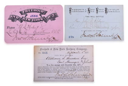
Three Freehold & New York Railway Annual Passes - 1877, 1881, and 1886Rail & Road Auctions4.6(165)See Sold PriceMar 08, 2024
Map: A 19thC engraved map titled Gloucestershire from the Best Authorities, after John Cary. Approx.Claydon Auctioneers Ltd4.3(125)See Sold PriceFeb 26, 2024
Map: A 19thC engraved and hand coloured map of Buckingham titled A New Map of BuckinghamshireClaydon Auctioneers Ltd4.3(125)See Sold PriceFeb 26, 2024
Map: A 19thC engraved map of West Riding, titled A Map of the North Part of the West Riding ofClaydon Auctioneers Ltd4.3(125)See Sold PriceFeb 26, 2024
1738 RUSSIA SIBERIA & GREAT TARTARY Description illustrated ANTIQUE in ENGLISHJasper524.5(9.9k)See Sold PriceFeb 27, 2024
Group of Vintage travel maps and bookletsBaker's Antiques and Auctions3.2(471)See Sold PriceFeb 25, 2024
New and Correct Map of North America With the West India Islands,Jasper524.5(9.9k)See Sold PriceFeb 27, 2024
Antique John Rogers Cast Plaster Statue Rip Van Winkle at HomeRapid Estate Liquidators and Auction Gallery4.5(1.1k)See Sold PriceFeb 24, 2024
Guthrie, William 1812 Antique Map. Spain and PortugalAlbion Auctions4.6(341)See Sold PriceMar 01, 2024
![[Maps] Cary, John. Group of Maps from the New & Correct First Image](https://p1.liveauctioneers.com/928/93171/47564389_1_x.jpg?height=282&quality=95&version=1472660174&width=282)
![[Maps] Cary, John. Group of Maps from the New & Correct (1 of 1)](https://p1.liveauctioneers.com/928/93171/47564389_1_x.jpg?height=282&quality=70&version=1472660174)
![[Maps] Cary, John. Group of Maps from the New & Correct First Image](https://p1.liveauctioneers.com/928/93171/47564389_1_x.jpg?height=282&quality=1&version=1472660174&width=282)