SoldTWO EARLY ENGLISH MAPS. Includes a map of BarkshirTWO EARLY ENGLISH MAPS. Includes a map of Barkshire, drawn by Robert Morden, printed for Abel Swall and Awnsham and John Churchill, ca. 1709, engraved and handcolored (pictured). Later frame, 17h. 18See Sold Price
SoldTWO EARLY MAPS. Includes "An Accurate Map of SoutTWO EARLY MAPS. Includes "An Accurate Map of South America", Emanuel Bowen, 18th century, engraving on laid paper, handcolored, matted and framed, 15"h. 16 1/4"w.; and a map of the military districtsSee Sold Price
SoldLot of 2 Early Engraved MapsLot of two early engraved maps, to include: bird's eye view, "Brugae Flandica Rum Vrbium Decus," city plan of Bruges, Belgium, 9" h x 12" w (view), 17 3/8" h x 20 1/2" w (frame) and Joannes Van KeulenSee Sold Price
Sold2 Early Maps of PennsylvaniaDESCRIPTION: Two early maps of Pennsylvania. Includes: 1) 1805 handcolored engraved map by John Carey in two parts. 17" x 21-1/4". Hinged at center. Small pinhole to York County. Light edge toning. CoSee Sold Price
SoldLot of 2 Early Hand Colored Engraved MapsLot of two early hand colored engraved maps, to include: "Andegaver Sium Ditionis Vera et Integra Descripto," dated 1579, map of Anjou, France, 13 3/4" h x 18 3/8" w (view), 19" h x 23 5/8" w (frame)See Sold Price
SoldTwo Early Framed Engraved MapsA lot of two early hand-colored engraved maps to include a W. J. Bleau map of Amsterdam, ca. 1634-1635, "Sabaudia Ducatus Savoye", together with a John Speed map of Britain, ca. 1611-1614, "DevonshireSee Sold Price
SoldTwo Early English Maps of the United States,Two Early English Maps of the United States, GUTHRIE, William. – DARTON, William. A Map of the United States of America, Agreeable to the Peace of 1783. and GIBSON, John. The British Governments inSee Sold Price
SoldLot of Two Early Maps.Includes 17th century Hand Colored Mariette Map of India and Indes Orientales 18" x 24" with huge margins and a Map of Arabia Deserta. 13 1/2" x 16" Black and White.See Sold Price
SoldEARLY FRAMED ENGLISH MAP GROUP 3 PCSEARLY FRAMED MAP GROUP 3 PCS. Includes: Middlesex - by Thomas Kitchin & Thomas Jeffreys c.1749 hand coloured. Staffordshire - Engraved by J. Roper from a drawing by G. Cole pub. 1808. Bridgnorth - froSee Sold Price
Two map bibliographies by Rodney W. ShirleyTitle: Maps of the British Isles - two map bibliographies by Shirley Author: Shirley, Rodney W. Description: Includes: Early Printed Map of the British Isles, 1477-1650. (4to), cloth, dust jacket. RevSee Sold Price
SoldEARLY ENGLISH MAP OF LONDONEARLY ENGLISH MAP OF LONDON hand-colored, "Bowles's New Two-Sheet Plan of the Cities of London & Westminster; with the Borough of Southwick", 1797, printed for Bowles & Carver, London, title to upperSee Sold Price
SoldGrp: 2 Early Maps of New England de Vaugondy HomaGroup of two early maps of New England or the eastern seaboard of what is now the United States. Includes Robert de Vaugondy (1688–1766), "Partie de L'Amerique Septentrionale, qui comprend le CSee Sold Price
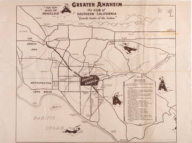
SoldTwo Maps Early 1900s Los Angeles, Sequoia and GeneralTwo maps from the early 1900s, includes 1917 Sequoia and General Grant National Parks, by the Secretary of the Department of the Interior, Franklin K. Lane and Director of the National Park Service, SSee Sold Price
SoldTwo early 19th century maps of MacedoniaHeading: (Macedonia) Author: Title: Two early 19th century maps of Macedonia Place Published: London Publisher: Date Published: 1807-1809 Description: Includes:See Sold Price
SoldGrp: Mixed Atlas PagesLarge group of pages from a variety of early atlases. The majority are from two atlases: Mallet and "Della Geografia di Tolomeo." Maps from Mallet include including maps of Asia, eastern India, China,See Sold Price
2 Maps, incl. Napoleonic Theatre de la Guerre,Two (2) early 19th century maps, incl. French Napoleonic and English. 1st item: Map of Theater of War and French and Allied Saxon Marches in Prussia and Poland during the Campaigns of 1806 and 1807 (CSee Sold Price
19th Century Map Print Collection19th Century Map Print Collection Includes forty-two loose maps cut from German and English books Height: 16.50 inches, Width: 11.00 inches (dimensions of Assyrian map) Category: Decorative Arts > EtcSee Sold Price
Sold19th C English Hunting MapsTWO folding maps from the early 19th century showing the places of meeting for two hunts. On conducted by Lord Gifford and the other by the Marquis of Hasting. Fine, each 8 x 11". Please note that thiSee Sold Price
SoldEarly Map of DenmarkGuiljelimus Blaeu, DANIA REGUM, hand-colored map of Denmark and Scandinavia from "Le Theatre du Monde ou Nouvel Atlas," published 1647. Includes two decorative coats of arms and title cartouche. MatteSee Sold Price
SoldEarly Maps of New YorkMap Book; Early Maps of New York and Julia Newberry's Sketch Book or The Life of Two Future Old Maids by Tracy D. Mygatt. The Map Book was published in 1909 by Townsend MacCoun and includes early mapsSee Sold Price
SoldTwo hand colored two part maps of Rockefellerland toTwo hand colored two part maps of Rockefellerland to include Pocantico Hills New York, Westchester County and Area for Early Action. 45" x 39 1/2" each Provenance: Estate of Peggy & David RockefellerSee Sold Price
SoldLate 17th-Early 18th Century Maps of North America, LotLate 17th-Early 18th Century Maps of North America, Lot of Two Two maps of North America, including: English, late 17th-early 18th century. Robert Morden (British, 1650-1703), America. Title identifieSee Sold Price
SoldTRANQUILLO MOLLO ATLASTRANQUILLO MOLLO ATLAS; Thirty-four maps out of an original fifty-two include America, United Kingdom, Australia, etc., Vienna, late 18th/early 19th c.; Most maps with color; 15'' x 20''See Sold Price
SoldTWO EARLY MAPS. Map of Africa by Johann Matthias HTWO EARLY MAPS. Map of Africa by Johann Matthias Hase (German, 1684-1742), engraving on laid paper with handcoloring, 18th Century, 24"h. 27"w. (framed); and a map of Greece and Crete by Guillaume DelSee Sold Price
Early 1990s Chicago Transit Authority Fiberglass Line MapRail & Road Auctions4.6(165)See Sold PriceMar 08, 2024
An Indiana Jones Adventure Opening Year Field Map.Van Eaton Galleries4.6(99)See Sold PriceMar 02, 2024
GERMAN - TWO EARLY 20th CENTURY 835 SILVER CANDELABRA, MUSUEM QUALITY, EXCELLENT CONDITION !!Jasper524.5(9.9k)See Sold PriceFeb 27, 2024
INDIA WITHIN THE GANGES SUSAN GOLE ILLUSTRATED MAPS EARLY CARTOGRAPHYJasper524.5(9.9k)See Sold PriceFeb 27, 2024
WEST AFRICA Explorers' routes Senegal Ashanti. Mountains of Kong. SDUK 1857 mapJasper524.5(9.9k)See Sold PriceFeb 28, 2024
AFRICA. Map pre-dating much exploration. Mountains of Kong. SDUK 1851 oldJasper524.5(9.9k)See Sold PriceFeb 28, 2024
WEST AFRICA explorers' routes. Beaufort Gray Park Dochard Caillie. SDUK 1874 mapJasper524.5(9.9k)See Sold PriceFeb 28, 2024
WEST AFRICA I Explorers' routes Senegal Ashanti Ivory Gold Coast. SDUK 1851 mapJasper524.5(9.9k)See Sold PriceFeb 28, 2024
WEST AFRICA showing early explorers' routes & Mountains of Kong. SDUK 1844 mapJasper524.5(9.9k)See Sold PriceFeb 28, 2024
PRE COLONIAL WESTERN AFRICA. Shows Mountains of Kong. Tribes. WELLER 1863 mapJasper524.5(9.9k)See Sold PriceFeb 28, 2024