4 maps of British Counties, 1793.[British Counties]. 4 engraved maps of British counties from Lon: John Cary, 1793. Each approx. 8 3/4 x 10 7/8 in. Includes Worcestsershire, Huntingdonshire, Warwickshire, Suffolk, and Bedfordshire. CSee Sold Price
Sold5 British county maps w/ color OL. Lon: Cary, 179[British Counties]. 5 engraved maps of British counties, from Lon: John Cary, 1793. Each approx. 10 7/8 x 8 3/4 in. Includes Derbyshire, Monmouthshire, Westmoreland, North Wales, and Cumberland. ColorSee Sold Price
Dugdale & Archer C1840 Group of 4 British County MapsIncl Lincoln, Leicester, Suffolk, Caermarthenshire. Steel Engraved Maps Published C1835-60 London for "Curiosities of Great Britain. England & Wales Delineated..." by Thomas Dugdale. Centre fold as isSee Sold Price
Dugdale & Archer C1840 Group of 4 British County MapsIncl Lincoln, Leicester, Suffolk, Caermarthenshire. Steel Engraved Maps Published C1835-60 London for "Curiosities of Great Britain. England & Wales Delineated..." by Thomas Dugdale. Centre fold as isSee Sold Price
Dugdale & Archer C1840 Group of 4 British County MapsIncl Lincoln, Leicester, Suffolk, Caermarthenshire. Steel Engraved Maps Published C1835-60 London for "Curiosities of Great Britain. England & Wales Delineated..." by Thomas Dugdale. Centre fold as isSee Sold Price
Lot of 18th c. British Maps.MAP LOT. Lot of three 18th c. British maps: County of Kent, 1765, 6 1/2" x 7 3/4" viewed; J. Gibson, 6 1/4" x 8" viewed; Berk Shire 1765, 6 1/2" x 7 3/4" viewed; Oxford Shire 1765, 8 " x 6 1/2" viewedSee Sold Price
Sold10 Antique British Counties Framed MapsThese 10 framed maps measure 16" x 12 3/4" . The image sight is 11 1/4" x 8 1/8". The maps are or Northumberland, Wiltshire, Cumberland, Yorkshire, Lancashire, Yorkshire, Worcestershire, Cheshire, WesSee Sold Price
Lot of 18th C. MapsMAP LOT. Lot of three 18th C. British maps. Double framed county maps, "Essex" and "Hereford Shire", published Sept 29, 1741, engraved by W.H. Toms, 6" x 5 3/4" viewed; "Survey of the road from ExeterSee Sold Price
Third Battle of Ypres 1917 MapThird Battle of Ypres - Summer and Autumn 1917 World War I One. Linen backed. Map 4 - Ordnance Survey - Large Map with Scale Publisher British Dated: 1919<See Sold Price
SoldMorden, ''Devonshire,'' c.1695-1722 map[British Counties]. Robert Morden. Devonshire. Amst: Abel Swale/John Churchil, c.1695-1722. 14 1/4 x 16 1/4 inches. Hand-colored outline, color to cartouche and scale.See Sold Price
SoldFramed map, John Farey Sr. British 1766-1826,Framed map, John Farey Sr. British 1766-1826, Derbyshire & parts of seven adjacent counties, condition is good, frame is 12 3/4" x 16 3/4" no ref.#See Sold Price
SoldA Topographical Map of the North Part of New YorkWilliam Faden (1750 - 1836). London: Faden, 1793. 19 3/4 x 13 inches. This map records activity in 1776 when the British, led by General Howe, attacked New York City, defended by General Washington. DSee Sold Price
SoldMorden (Robert) - A group of English county maps,including Lancaster, The Smaller Islands in the British Ocean, Barkshire, Britannia Saxonica, and others, 21 engraved maps with 13 duplicates in addition,4 hand-coloured, occasional marginal wormholesSee Sold Price
SoldWalker (John & Charles) British AtlasWalker (John & Charles) British Atlas,engraved title and 47 maps of England & Wales, individual English counties, including the 3 separate Ridings of Yorkshire, and the 4 quarters of Wales, coSee Sold Price
Sold1793 Sampler : 'Eliz. Chambers Moulton 1793...', A silk1793 Sampler : 'Eliz. Chambers Moulton 1793...', A silk on linen map, Counties of England and Wales, includes Rutlandshire, Huntindonshire, West More Land, Humber etc. and British Ocean, St. Georges CSee Sold Price
SoldWilliam Faden 1793 Map of Eastern United StatesThe United States of North American: with the British Territories and Those of Spain, according to the Treaty of 1784, Engraved by Wm Faden 1793. 25-3/4"h x 38"wSee Sold Price
Thomas Moule Map of CambridgeshireCambridgeshire. Thomas Moule (1784-1851). Handcolored steel engraving. From The English Counties Delineated, 1842. 10 3/4 x 8 1/4 inches sheetSee Sold Price
Smith: Antique Map of Cambridge UK, 1808Title/Content of Map: 1808 Smith Map of Cambridge UK -- A New Map of the County of Cambridge Divided into Hundreds Date Printed: 1808, London Cartographer: C Smith Size: 19.5 x 17.4 in. This is a verySee Sold Price
SoldTwo British Prints(18th century) Map of Middlesex County, England, by T. Kitchin, circa 1786, handcolored engraving on laid paper, 7-3/4 x 8 in.; Prince Charles of Lorraine, mezzotint on laid paper, 12-1/4 x 9-1/8 in.,See Sold Price
Views from Webber's Views in South SeasPlate 6, Waheiadooa, Chief of Oheitepeha...John Webber (1751-1793). from Views in the South Seas... London: Boydell & Co., 1808 [but 1820]. 21 x 16 1/4 inches sheetSee Sold Price
Views from Webber's Views in South SeasPlate 5, A view of Oheitepeha Bay. John Webber (1751-1793). from Views in the South Seas...London: Boydell & Co., 1808 [but 1820]. 21 x 16 1/4 inches sheetSee Sold Price
Views from Webber's Views in South SeasPlate 14, A View in the Island of Pulo Condore. John Webber (1751-1793). from Views in the South Seas... London: Boydell & Co., 1808 [but 1820]. 21 x 16 1/4 inches sheetSee Sold Price
Views from Webber's Views in South SeasPlate 9, The Resolution beating through the ice...John Webber (1751-1793). from Views in the South Seas... London: Boydell & Co., 1808 [but 1820]. 21 x 16 1/4 inches sheetSee Sold Price
Views from Webber's Views in South SeasPlate 8, A Toopapaoo of a Chief with a Priest....John Webber (1751-1793). from Views in the South Seas... London: Boydell & Co., 1808 [but 1820]. 21 x 16 1/4 inches sheetSee Sold Price
OFFER VAN ABRAHAM Book Of Genesis in Engravings c1700 Amsterdam Very rare!Luis Porretta Fine Arts4.3(10)See Sold PriceMar 02, 2024
DUNLEVIE c1856 Map Counties Of Gaspe & Bonaventure Quebec Canada SCARCE! #2Luis Porretta Fine Arts4.3(10)See Sold PriceMar 02, 2024
DUNLEVIE c1856 Map Counties Of Gaspe & Bonaventure Quebec Canada SCARCE! #1Luis Porretta Fine Arts4.3(10)See Sold PriceMar 02, 2024
Archaeological Books - Morgan - Romano-British Mosaic PavementsTimeLine Auctions Ltd.4.6(182)See Sold PriceMar 06, 2024
General Books - Nicolson - The Counties of Britain - A Tudor Atlas by John SpeedTimeLine Auctions Ltd.4.6(182)See Sold PriceMar 08, 2024
General Books - Four Maps of Great Britain Designed by Matthew Paris About A.D. 1250TimeLine Auctions Ltd.4.6(182)See Sold PriceMar 08, 2024
General Books - Victoria County History of Kent - Vol ITimeLine Auctions Ltd.4.6(182)See Sold PriceMar 08, 2024
Portfolio of 15 County Maps by Robert Morden (English 1650-1703)Nadeau's Auction Gallery4.7(405)See Sold PriceFeb 24, 2024
Map: A 17thC engraved map of the British Isles titled A Generall Mapp of the Isles of GreatClaydon Auctioneers Ltd4.3(125)See Sold PriceFeb 26, 2024
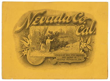
VARIOUS ARTISTS [BRITISH TRAVEL GUIDES]. Group of 6 map booklets and flyers. 1930s.Swann Auction Galleries4.4(69)See Sold PriceFeb 29, 2024
Fielding (Henry) The Works, with An Essay on His Life and Genius by Arthur Murphy, 10 vol., newForum Auctions4.3(53)See Sold PriceFeb 29, 2024
Framed Collection Engravings & A Map From The Excursions In The County Of Sussex Published In 1822Rapid Estate Liquidators and Auction Gallery4.5(1.1k)See Sold PriceMar 01, 2024


![VARIOUS ARTISTS [BRITISH TRAVEL GUIDES]. Group of 6 map booklets and flyers. 1930s. (1 of 2)](https://p1.liveauctioneers.com/199/319703/171640571_1_x.jpg?height=282&quality=70&version=1707943705)