SoldMiniature map of California 1859Heading: Author: Barber, E.L. Title: Miniature Map of California... Copyright secured 1859 and Published by E.L. Barber, Sacramento City Cal. Place Published: Sacramento Publisher: Date PublishSee Sold Price
SoldWells, Edvardus. Americae Septentrionalis Tabula.Wells, Edvardus. Americae Septentrionalis Tabula. Oxford, 1726. Mapa, 8.5x15.5 cm. Miniature map showing California as an island.See Sold Price
SoldMiniature world map with California an islandHeading: Author: Jansson, Jan Title: Typus Orbis Terrarum Place Published: Amsterdam Publisher: Date Published: 1628-[1630?] Description: Copper-engraved double-hemisphereSee Sold Price
Miniature world map with California an islandHeading: Author: Jansson, Jan Title: Typus Orbis Terrarum Place Published: Amsterdam Publisher: Date Published: 1628-[1630?] Description: Copper-engraved double-hemisphereSee Sold Price
Miniature map of Central CaliforniaHeading: (California) Author: Title: Miniature Map of Central California Place Published: Los Angeles Publisher:Hicks & Borgnis Date Published: c.1925 Description: Map prinSee Sold Price
Miniature map of Central CaliforniaHeading: (California) Author: Title: Miniature Map of Central California Place Published: Los Angeles Publisher:Hicks & Borgnis Date Published: c.1925 Description: Map prinSee Sold Price
SoldMORDEN, ROBERT. A New Map of ye World.MORDEN, ROBERT. A New Map of ye World. Miniature engraved double-hemisphere world map showing California as an island and with allegories of the four seasons represented in the corner spandrels. 6x7&#See Sold Price
SoldMallet's North America California an islandTitle: Amerique Septentrionale Author: Mallet, Alain Manesson Description: Copper-engraved map, later hand-coloring. 15x11.5 cm. (6x4½").Charming miniature map of the continent with the island of CalSee Sold Price
Mallet's North America California an islandTitle: Amerique Septentrionale Author: Mallet, Alain Manesson Description: Copper-engraved map, later hand-coloring. 15x11.5 cm. (6x4½").Charming miniature map of the continent with the island of CalSee Sold Price
SoldGold rush era uncommon California, 1859 by ColtonTitle: Gold rush era uncommon California, 1859 by Colton Date/Period: 1859 Materials: Hand colored lithographic printing Size: 15 x 12'' 1859. By G. W. Colton & R. S. Fisher. Published in ‘ColtoSee Sold Price
SoldMALLET, ALAIN MANESSON. Nouveau Mexique et Californie.MALLET, ALAIN MANESSON. Nouveau Mexique et Californie. Miniature engraved map of the North American southwest with California prominently shown as an island. 8x6 inches sheet size, wide margins; smallSee Sold Price
Solddu Val: Antique Map of California as an Island, 1670Title: Nouveau Mexique. Wonderful 1670 miniature of California as an Island Map maker: Pierre Du Val, Le Monde ou la Geographie Universelle Place and Year: Paris, 1670 Dimensions: 3.9 x 4.7 in; 9.8 xSee Sold Price
SoldRARE Hand colored map by Charles DeSilver c. 1859RARE original hand colored map of California and the territories of Oregon, Washington, Utah and New Mexico, by Charles DeSilver, in frame, circa 1859, image measuring 16.75" xSee Sold Price
SoldSan Diego Folding Trade Card Shows San Diego Bay fromTrade card from D.C. Collier & Co., Real Estate & Investments, San Diego, California. On the front is a nice view of San Diego Bay from Point Loma and on the back is a miniature relief map of San DiegSee Sold Price
Sold1859 account of Gold Rush California and Pacific travelHeading: (California Gold Rush, Hawaii, Pacific) Author: Warren, T. Robinson Title: Dust and Foam; or, Three Oceans and Two Continents; Being Ten Years' Wanderings in Mexico, South America, Sandwich ISee Sold Price
SoldRare map of San Francisco, 1864Heading: (California - San Francisco) Author: Title: Miniature Copy of the Assessment Roll Map of San Francisco. Donated by Charles R. Story - Tax Collector. September 18th, 1864 Place Published: SanSee Sold Price
SoldMap of San Francisco Bay, 1859Title: 1859 Map of San Francisco Bay Cartographer: US Coast Survey/ A. Bache Published: 1859, Washington DC Measurements: 23.2 x 39.2 in. Entrance to San Francisco Bay California. From a TrigonometricSee Sold Price
SoldCoast Survey map of San Francisco 1859Title: City of San Francisco and its Vicinity California Author: U.S. Coast Survey Description: Lithographed map. 60x88 cm. (23½x34½").Oriented to the west. This is a new plan (superseding the 1853See Sold Price
United States of North America, Pacific States by Joseph Wilson Lowry 1859 mapTitle: United States of North America, Pacific States by Joseph Wilson Lowry 1859 map Description: The United States of North America, Pacific States [including California, Oregon, Washington, Utah, aSee Sold Price
1859. Mexico by ColtonTitle: 1859. Mexico by Colton Date/Period: 1859 Materials: Hand colored steering engraved Size: 17 1/2 x 14 1/2” Mexico. With a united Baja California. A single state of Yucatán. The stateSee Sold Price
SoldNorth America Monk's Wall Map 1859Published by Jacob Monk in 1859 in Baltimore. It is in fair to good condition for age. From Col. Elisha Camp's Federal Home in Sackets Harbor, NY.See Sold Price
Sold1703 Scherer - World Map [California as an Island]Title: World Map [without title] "Map maker: Heinrich Scherer, Atlas Marianus" "Place and Year: Munich, 1703" "Dimensions: 23.6 x 35.5 cm (9.3 x 14 in)" "Technique: Copperplate engraving" "Coloring: USee Sold Price
SoldHoltrop: Antique Miniature Map of the U.S, 1788Map: De Vereenigde Staten van Noord America Cartographer: Holtrop Place & Date: Amsterdam / 1788 Size: 4 1/2" x 3 3/4" Condition: outline color; overall age toning A delightful miniature map of the neSee Sold Price
Bertius: Antique Miniature Map of Mexico, 1606Title: Descriptio Novae Hispaniae / Mexicana. Early 17th century miniature map of Mexico Map maker: P. Bertius & B. Langenes, Cornelis Claes Place and Year: Amsterdam, 1606 Dimensions: 8.5 x 12.2 cm (See Sold Price
EARLY 18TH C. DUTCH CHART OF PACIFIC OCEAN BY FREDERIK DE WIT (1629-1706) WITH CALIFORNIA AS ANThomaston Place Auction Galleries4.4(386)See Sold PriceFeb 24, 2024
An "Official Disneyland Road Map" Richfield Brochure.Van Eaton Galleries4.6(99)See Sold PriceMar 02, 2024
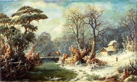
John Zang (NY,CA,GA,1859-?) oil painting antiqueBroward Auction Gallery4.8(277)See Sold PriceMay 05, 2024
Strickler, Rare - San Francisco, CaliforniaTrillium Antique Prints & Rare Books4.5(30)See Sold PriceFeb 24, 2024
Francis McNally - Antique Map of California & MinnesotaProverde Auctions4.3(3)See Sold PriceFeb 28, 2024


![1703 Scherer - World Map [California as an Island] (1 of 2)](https://p1.liveauctioneers.com/5584/112867/57947644_1_x.jpg?height=282&quality=70&version=1511920104)