(4) 17th c. English maps, framedFour 17th century English maps, includes: (1) "Carrnarvon both Syre & Shire Towns and Citic Bangor", (1) "Worcester Shire & Worcester", (1) "Province of Connaugh" and (1) "City of Galwaye & Countie ofSee Sold Price
(4) 17th c. English maps, framedFour 17th century English maps, includes: (1) "Carrnarvon both Syre & Shire Towns and Citic Bangor", (1) "Worcester Shire & Worcester", (1) "Province of Connaugh" and (1) "City of Galwaye & Countie ofSee Sold Price
(4) 17th c. English maps, framedFour 17th century English maps, includes: (1) "Carrnarvon both Syre & Shire Towns and Citic Bangor", (1) "Worcester Shire & Worcester", (1) "Province of Connaugh" and (1) "City of Galwaye & Countie ofSee Sold Price
Sold(4) 17thC - 18thC FRAMED ENGLISH WILLS WITH WAXSEALS ; FROM 1683 , 1718 & 1773 - LARGEST IS 25" x 17"See Sold Price
Sold17TH C ENGLISH FRAMED INDENTUREA manuscript on vellum of a deed for land, with seals affixed to the bottom. English, dated 1691. Dimensions of frame: 50 x 46.5 cm (19 3/4 x 18 1/4 in.) Condition Report Condition report available upSee Sold Price
Sold2 - 17THC. FRAMED MAPS OF BERMUDA, ONE BY W. BLAEU 1640 & 1 BY JANSSONIUS JOANNES (19" X 23 3/4")2 - 17THC. FRAMED MAPS OF BERMUDA, ONE BY W. BLAEU 1640 & 1 BY JANSSONIUS JOANNES (19" X 23 3/4")See Sold Price
Sold"Patrimonio di S. Pietro Sabino et Ducato di Castr"Patrimonio di S. Pietro Sabino et Ducato di Castro," 17th c., hand colored map, framed, H.- 14 1/4 in., W.- 18 3/8 in.See Sold Price
SoldSix Antique English Maps and PlansSix Antique English Maps and Plans , incl. four John Ogilby road maps, 17th c. (13 3/4 in. x 17 in.); and two plates of London showing Christopher Wren and John Evelyn's designs for the rebuilding ofSee Sold Price
SoldILLUMINATIONS, ETC.Two, together with pastel on paper signed Augusta and a reproduction 17th/18th c. New York City map (all framed); Largest: 18 1/2" x 1 3/4" (irregular) (sheet)See Sold Price
Sold17th C. Map of Guernsey, Jersey Islandsframed, not examined out of frame. Frame size: 18" high, 21 3/4" wide. Stains, toning. Provenance: Property of a Madison, CT Collector. Provenance: Purchased at New Haven Colony Historical Society AucSee Sold Price
Mid 17th C Map BavariaWilliam Janszoon Blaeu (1571-1638), "Palatinus Bavariae" (mid 17th C Map of Bavaria), hand colored, image 14-1/2" x 19-3/4", overall 21-1/4" x 26-1/2", framed and mattedSee Sold Price
Sold17th c. Map of CreteFramed 17th c. steel engraved & colored 15" x 19" double folio map, "Creta Iovis Magni Medio jacet insula ponto", by Abraham Ortelius, depicting the islands of Crete, 24" x 27 1/4" overall size framedSee Sold Price
SoldAn Early Virginia Map,from an E 17th C map by Capt. John Smith, having "The Virginian Sea", "Chesapeack Bay", etc. with folds as a pull-out from a book. Matted and framed under glass, visible image 13 1/4" high, 16 1/4" wiSee Sold Price
SoldFramed MARTIN LISTER Shell EngravingFramed MARTIN LISTER Shell Engraving: English 17thC Listed Artist. From Book Plate. Professionally Mounted and Framed with Museum Quality Glass. 3" X 4" Image Framed to 10 1/2" X 11 1/2". (60-100)See Sold Price
Sold17th C. Partial Map of Europe by H. van LoonH. van Loon, circa 1685, framed map of Turkey, "Arabia", and "Persia", 18 3/4" x 25" sight, 20 1/4" x 26 1/2" framed.See Sold Price
17th/18th c Map of Rome by Christoph Weigelins17th/18th c Map of Rome by Christoph Weigelins, hand tinted print, labeled in latin, matted and framed. Appx 12 1/2" x 17 1/4" viewed, frame 19" x 24". Good condition with some discoloration in the upSee Sold Price
17th c. Hand Colored Nassovia Comitatus MapFramed 17th c. hand colored 15 1/4" x 19 1/4" "Nassovia Comitatus" German region map, overall size framed is 23 1/2" x 26 3/4". CONDITION: Toning, center fold line with tearing.See Sold Price
SoldReproduction 17th c. Celestial Hemisphere MapFramed Reproduction 17th c. steel engraved & hand-colored 17 12" x 20 3/4" map, "Hemisphae Alis Coeli; Sphaeri Grarri Bore Et Terrae Caseno Phia" published in 1660 by Joannes Janssonius, depicting theSee Sold Price
SoldJohannes Van Keulen, Map of Brazilia, Late 17th CJohannes Van Keulen, Map of Brazilia, Late 17th C, (Dutch, 1654-1715), Map of Brazilia, Late 17th C, showing the coastline, matted and framed. Frame size 26 3/4 in. x 30 1/2 in. By sight: H. 19 3/4 inSee Sold Price
Johannes Van Keulen, Map of Guiana, Late 17th CJohannes Van Keulen, Map of Guiana, Late 17th C, (Dutch, 1654-1715), Map of Guiana, Late 17th Century, showing the coastline, matted and framed. Frame size 27 in. x 30 3/4 in. By sight: H. 20 in. x W.See Sold Price
SoldEnglish School, "The Nativity," 17th c., engraving,English School, "The Nativity," 17th c., engraving, framed, H.- 9 1/4 in., W.- 6 1/4 in.See Sold Price
Johannes Van Keulen, Map of Guiana, Late 17th CProperty of a Private Collection, Savannah, GA (Dutch, 1654-1715), Map of Guiana, Late 17th Century, showing the coastline, matted and framed. Frame size 27 in. x 30 3/4 in. By sight: H. 20 in. x W. 2See Sold Price
Johannes Van Keulen, Map of Brazilia, Late 17th CProperty of a Private Collection, Savannah, GA (Dutch, 1654-1715), Map of Brazilia, Late 17th C, showing the coastline, matted and framed. Frame size 26 3/4 in. x 30 1/2 in. By sight: H. 19 3/4 in. xSee Sold Price
Johannes Van Keulen, Map of Guiana, Late 17th CProperty of a Private Collection, Savannah, GA (Dutch, 1654-1715), Map of Guiana, Late 17th Century, showing the coastline, matted and framed. Frame size 27 in. x 30 3/4 in. By sight: H. 20 in. x W. 2See Sold Price
17TH C. ENGLISH CHART OF THE THAMES BY CAPT. GREENVILLE COLLINS, 1693-4, FRAMEDThomaston Place Auction Galleries4.4(386)See Sold PriceFeb 24, 2024
17TH C. ANTIQUE MAP SIEGE OF LA ROCHELLE, FRANCE, FRAMEDThomaston Place Auction Galleries4.4(386)See Sold PriceFeb 24, 2024
17TH C. MAP OF THE BERKSHIRES BY JOHN SPEED, FRAMEDThomaston Place Auction Galleries4.4(386)See Sold PriceFeb 24, 2024
17TH C. ENGLISH LINEAR MAP BY OGILBY, FRAMEDThomaston Place Auction Galleries4.4(386)See Sold PriceFeb 24, 2024
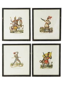
Rare 19thc German Handcolored Costume Plates, 17thc NobilityConnoisseur Auctions4(333)See Sold PriceMar 02, 2024
A.J. Bailey English Estate c.1902-Present Sterling Silver Salad Serving Set 2pcMynt Auctions4.6(680)See Sold PriceFeb 23, 2024
English Onslow by C J Vander Sterling Silver Salad Fork 6 3/4" FlatwareMynt Auctions4.6(680)See Sold PriceFeb 24, 2024
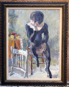
Norman C. Black (1920-1999) Antique Indian Surrealist Landscape Framed Original Oil PaintingCurated Gallery Auctions4.6(120)See Sold PriceFeb 25, 2024
19th C. English Architectural Interior WatercolorEpic Auctions and Estate Sales4.6(204)See Sold PriceMar 02, 2024
Map: A 17thC engraved map of the British Isles titled A Generall Mapp of the Isles of GreatClaydon Auctioneers Ltd4.3(125)See Sold PriceFeb 26, 2024
Map: A 17thC engraved and hand coloured map of Bedfordshire after Robert Morden. Approx. 12 1/2" xClaydon Auctioneers Ltd4.3(125)See Sold PriceFeb 26, 2024
English Gadroon by Gorham Sterling Silver Candelabra 3-Light -1 c.1940Mynt Auctions4.6(680)See Sold PriceFeb 26, 2024
19C ENGLISH O/C PAINTING OF SEATED WOMAN BY K.DAVIS LISTED ARTISTBidhaus4.3(747)See Sold PriceFeb 26, 2024
English Onslow by C J Vander Sterling Silver Cream Soup Spoon 6 3/4" SilverwareMynt Auctions4.6(680)See Sold PriceFeb 27, 2024
C. Saunders F. Shepherd English Estate Sterling Silver Coronation Spoon VermeilMynt Auctions4.6(680)See Sold PriceFeb 29, 2024
English Estate Sterling Silver and Glass Bottle London c.1914 4" TallMynt Auctions4.6(680)See Sold PriceFeb 29, 2024
Beaded by LP & Co English Silver and Copper Candlestick Pair c.1930Bidhaus4.3(747)See Sold PriceMar 02, 2024
Philip Gilbert Hamerton Cottages in a Valley etching signedKCM Galleries4.7(164)See Sold PriceFeb 25, 2024
THE WHOLE CHRONICLE OF POLYBIUS ANCIENT IN ENGLISH, 1756NY Elizabeth 4.3(84)See Sold PriceMar 03, 2024
ANTIQUE 19TH C OIL PAINTING OF TWO PUGS AND A CATAntique Arena Inc.4.5(852)See Sold PriceMar 09, 2024
VICTORIAN NEEDLEPOINT FIRE SCREENA.H. Wilkens Auctions & Appraisals4.7(388)See Sold PriceFeb 28, 2024