SoldDury (Andrew) A New General & Universal AtlasDury (Andrew) A New General & Universal Atlas, 39 engraved maps on 45 plates, 6 folding, all outlined in colour, some offsetting, contemporary calf, rubbed, rebacked and recornered, oblong 8voSee Sold Price
SoldDury (Andrew) A New General & Universal AtlasDury (Andrew) A New General & Universal Atlas,engraved title, dedication and contents leaf, 39 engraved maps on 45 plates, 6 folding, all outlined in colour, title browned, 3 fly-leaves cut awSee Sold Price
SoldENGRAVED & COLORED 1761 POCKET ATLAS.Dury, Andrew. A New, General, and Universal Atlas, Containing Forty five Maps by Andrew Dury, Engraved by Mr. Kitchin, & others. [London:] Printed for & sold by A. Dury at the Indian Queen … & Robt.See Sold Price
SoldMitchell's New General Atlas & Universal AtlasTwo "A New Universal Atlas... Empires, Kingdoms, States & Republics of the World... . ", Philadelphia, S. Augustus Mitchell, 1848; together with: "Mitchell's New General Atlas, ...", Philadelphia, s.See Sold Price
SoldMitchells New Universal Atlas, 1857Mitchells New Universal Atlas, 1857MITCHELL, S. AUGUSTUS. A New Universal Atlas--Containing Maps of the Various Empires, Kingdoms, States, and Republics of the World. Philadelphia: Charles Desilver, 1See Sold Price
A George III steel engraved map and other mapsA George III steel engraved map 'Atlantic Islands' (Cape Verdis, Canaries, Azores and Madeira) by T Clerk for Thomson's New General Atlas 50 x 60 cm, mounted framed and glazed to/w a French map enSee Sold Price
Sold2 Prints: General Andrew Jackson, Thinking Of Home[War of 1812/Civil War] 2 Items. ++ General Andrew Jackson. New Orleans Jany. 8th. 1815. Margin at lower left: “Painted by John Vanderlyn.” Lower right: “Engraved by A. B. Durand.” Center of lSee Sold Price
SoldMitchell's General World Atlas 1856, colored mapsTitle: A New Universal Atlas Containing Maps of the various Empires, Kingdoms, States and Republics of the World with a special Map of each of the United States, plans of Cities &c. Comprehended in seSee Sold Price
Sold(2) ENGRAVED MAPS ASIA & WORLD MERCATOR PROJECTION(lot of 2) Framed engravings on paper, maps, including: (1) "General Chart on Mercator's Projection," engraved for Payn's [Payne's] "Universal Geography," published by Low & Willis, New York, sight: 7See Sold Price
SoldMitchell's New General Atlas. 1863. 84 maps/insets[Atlas]. MITCHELL’S NEW GENERAL ATLAS, Containing Maps ot the the Various Countries of the World, Plans of Cities, Etc… Phila: S. Augustus Mitchell, 1863. 4to. Orig quarter leather and cloth. WornSee Sold Price
SoldMITCHELL'S NEW GENERAL ATLAS, PUBLISHED BYAUGUSTUS MITCHELL, JR., PHILADELPHIA, 1869, CLOTH BOUND WITH GILT LETTERING. THE ATLAS CONTAINS 96 MAPS OF VARIOUS COUNTRIES INCLUDING U.S. CITY MAPS. OVERALL CONDITION IS VERY GOOD WITH MINOR FOXINGSee Sold Price
SoldMitchell's New General Atlas 1873Mitchell's New General Atlas (of the World), 1873, S. Augustus Mitchell. Has wear around the cover edges and to the spine and the front cover is loose, as well as the first few pages, but the Atlas paSee Sold Price
SoldAtlantic Islands. The New General Atlas. John Thomson.Maker: Thomson, John. Origin: Edinburgh, Thomson, 1817. Medium: Original engraving hand-colored at publication. Sheet size: 21 x 26 in. No Reserve: This lot starts at $1 and has no reserve as a courteSee Sold Price
SoldA NEW UNIVERSAL ATLAS... Phila: DeSilver, 1856.[Atlas] A NEW UNIVERSAL ATLAS Containing Maps of the various Empires, Kingdoms, States and Republics of the World… Phil: Charles DeSilver, 1856. [DeSilver entered a contract to take over publicationSee Sold Price
SoldMitchells New General Atlas 1862Mitchell's new general atlas, containing maps of the various countries of the world, plans of citiew, etc. Published by S. Augustus Mitchell, Jr. 1862; 16x13 inches.See Sold Price
SoldMITCHELLS NEW GENERAL ATLASDATED 1863. BINDING IS ROUGH, STRUNG TOGETHER. INK SMEARS AND SPOTS. ALSO WITH BRITISH MAP AND SOUTH AFRICASee Sold Price
SoldMitchel, Samuel Augustus "A New Universal Atlas"Mitchel, Samuel Augustus "A New Universal Atlas", (Baltimore, Cushings & Bailey 1859); folio; quarter-gilt pebbled sheep over gilt embossed cloth (front panel detached); Final edition of Michell's renSee Sold Price
SoldA NEW UNIVERSAL ATLAS... Phila: 1854.[Atlas]. A NEW UNIVERSAL ATLAS Containing Maps of the various Empires, Kingdoms, States and Republics of the World With a special Map of each of the United States, plans of the Cities, &c. ComprehendeSee Sold Price
SoldMitchell's New General Atlas. 1883.[Atlas] Mitchell, S. Augustus. "Mitchell's New General Atlas containing Maps of the Various Countries of the World, Plans of Cities, Etc.” Philadelphia, Bradley & Company, 1883. 15 1/2” x 13”. CSee Sold Price
SoldMITCHELL’S NEW GENERAL ATLAS. 1863. 84 maps/insets[Atlas]. MITCHELL’S NEW GENERAL ATLAS, Containing Maps of the Various Coutnries of the World, Plans of Cities, Etc… Phila: S. Augustus Mitchell, 1863. Folio. 84 maps & insets (As numbered. MitchelSee Sold Price
SoldCary (John) - New Universal Atlas,engraved title and 55 double or folding map sheets, numbered 1 to 60, bound with 6 additional maps by James Wyld , comprising Upper Canada, Lower Canada, Sketch of the Niagara River (mounted on versoSee Sold Price
SoldHenry Schenck Tanner's New Universal Atlas contHenry Schenck Tanner's New Universal Atlas containing Maps of the Various Empires, Kingdoms, States, and Republics of the World, pub. 1844, Carey & Hart, Philadelphia, containing 117 hand colored mapsSee Sold Price
SoldMitchell’s New General Atlas.[Maps] Mitchell’s New General Atlas. Philadelphia: S. Augustus Mitchell, Jr., 1861. Publisher’s three-quarter leather over gilt-stamped cloth boards. Seventy-four hand-colored maps and plaSee Sold Price
Lot of 21 New and Used Atlas Turnouts-HO ScaleJM Hobby Supply and Railroad Artifact Auctions4.4(127)See Sold PriceFeb 25, 2024
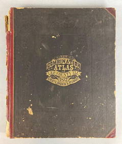
1872 New Combination Atlas of Lee County Illinois BookMatthew Bullock Auctioneers4.7(1.8k)See Sold PriceFeb 24, 2024
Arrowsmith & Lewis - Map of PolynesiaTrillium Antique Prints & Rare Books4.5(32)See Sold PriceFeb 24, 2024
Arrowsmith & Lewis - Map of North AmericaTrillium Antique Prints & Rare Books4.5(32)See Sold PriceFeb 24, 2024
Arrowsmith & Lewis - Map of the World on Mercator's ProjectionTrillium Antique Prints & Rare Books4.5(32)See Sold PriceFeb 24, 2024
Arrowsmith & Lewis - Map of LouisianaTrillium Antique Prints & Rare Books4.5(32)See Sold PriceFeb 24, 2024
Arrowsmith & Lewis - Map of the United StatesTrillium Antique Prints & Rare Books4.5(32)See Sold PriceFeb 24, 2024
Putnam - First Map of the State of Ohio by Rufus PutnamTrillium Antique Prints & Rare Books4.5(32)See Sold PriceFeb 24, 2024
Mitchell - Map of the City of Washington (Washington, DC)Trillium Antique Prints & Rare Books4.5(32)See Sold PriceFeb 24, 2024
Carey, pub. 1796 - Map of GeorgiaTrillium Antique Prints & Rare Books4.5(32)See Sold PriceFeb 24, 2024
Carey, pub. 1796 - Map of The State of South CarolinaTrillium Antique Prints & Rare Books4.5(32)See Sold PriceFeb 24, 2024
Carey, pub. 1796 - Map of KentuckyTrillium Antique Prints & Rare Books4.5(32)See Sold PriceFeb 24, 2024
Carey, pub. 1796 - Map of the Tennassee State formerly part of North Carolina (Tennessee)Trillium Antique Prints & Rare Books4.5(32)See Sold PriceFeb 24, 2024
West Indies Islands. Guadaloupe. | Mariegalante &C. | Antigua.Jasper524.5(9.9k)See Sold PriceFeb 27, 2024
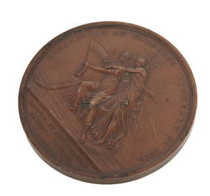
Moritz Fuerst (American/Slovakia, 1782-1840), Patinated Bronze Congressional Medallion, 1815, H.- 5Crescent City Auction Gallery4.3(231)See Sold PriceMar 08, 2024
Robert H Labberton - Map of The Territory of the Present United States - The territory of theProverde Auctions4.3(3)See Sold PriceFeb 28, 2024