SoldLOT (4) ENGRAVED MAPS INCLUDING ENVIRONS OF JERUSALEM,LOT (4) ENGRAVED MAPS INCLUDING ENVIRONS OF JERUSALEM, ROBINSON & SMITH, 1841, 13 3/4 X 18"; SYRIA R.B. DAVIES, 19TH CENTURY, 10 1/2 X 8 1/2"; THE ROMAN ROADS OF BRITAIN, THOMAS LEMAN, 1817, 18 3/8 XSee Sold Price
SoldLOT ASSORTED ENGRAVED MAPS, CALIFORNIA, OREGON ANDLOT ASSORTED ENGRAVED MAPS, CALIFORNIA, OREGON AND ALASKA COASTAL REGIONS, 19/20TH CENTURY. VARIOUS SIZESSee Sold Price
SoldLOT (34) ASSORTED ENGRAVED MAPSLOT (34) ASSORTED ENGRAVED MAPS (HISTORY OF MAN, FRENCH 18TH CENTURY). APPROXIMATELY 10 1/2 X 16"See Sold Price
SoldLOT (6) ASSORTED ENGRAVED MILITARY MAPS INCLUDING FT.LOT (6) ASSORTED ENGRAVED MILITARY MAPS INCLUDING FT. ST. PHILIP AND ENVIRONS, 18TH CENTURY, 14 1/2 X 9"; (3) BATTLE PLANS INCLUDING DEFRIBOURG, 1644; DETURCKEIM, 1674; D'ENSHEIM, 1674; ALL 10 X 15";See Sold Price
SoldVintage Maps of Pennsylvania Counties of Westmoreland(lot of 4) Copper Engraved Maps including, "Atlas of Pennsylvania Counties of Westmoreland and Fayette," "Latrobe," "Ligonier," and "Donegal," some with scale insets, overall (framed/each): 17.5"h x 1See Sold Price
SoldMaps 1813-1904 Mixed Lot of 4. Ireland, Canada, AfricaLot of 4 Engraved and Lithographed Maps. Incl Wellington Channel (Canada) Belfast/Cork Town Plans, Parliamentry Map of Ireland and an Untitled Map of Africa. Examples by Bruce, Fullarton and BartholomSee Sold Price
Sold4 Engraved & Colored England Maps Ca 1810-20sLot of 4 engraved and hand-colored maps of England / English Counties, first quarter of the 19th century, 8 3/4" X 10 3/4" - 1) Hommouthshire with inset scenes of Town Hall Monmouth, Chepstow Castle aSee Sold Price
SoldEgypt & Arabia 19th Cent. Lot of 5 MapsLot of 4 19th Cent Lithographed and Engraved Maps. Examples by SDUK, Weller/Weekly Dispatch, William Collins, and Johnston. Together with a large 20th Cent. Admiralty Chart of the Red Sea, published 1See Sold Price
SoldLOT (4) ASSORTED VINTAGE WRISTWATCHESLOT (4) ASSORTED VINTAGE WRISTWATCHES INCLUDING ASPREY/BREGUET SILVER, 15-JEWEL TANK (NO CRYSTAL); OMEGA STAINLESS MILITARY STYLE, ENGRAVED "OSS FRANCE 1944", 31MM; UNIVERSAL GENEVE STAINLESS UNISONICSee Sold Price
SoldLot of 4 Assorted Pieces of Jewelry w/ Necklace & BeadsLot of 4 assorted pieces of jewelry with necklace and beads. This set includes a necklace, bracelet, broach, and strand of beads. The bracelet has a beautiful locket with a woman in profile engraved oSee Sold Price
SoldBecker, F. C1838 Lot of 4 Maps of the UK & IrelandSteel Engraved Maps with outline hand color Published C1838, London for "A Complete and Universal English Dictionary" by the Rev. James Barclay et al. Maps by F. Becker and others. Paper Size: 10.5 xSee Sold Price
SoldEncyclo. Metropolitana 1825-42 Lot of 4. Tides, WavesPlus Magnetic Variation and Dip Chart. Copper Engraved Maps Published 1817-45, London for "Encyclopaedia Metropolitana" by Samuel Taylor Coleridge el al. Paper Size: 16.5 x 10.5 inch (42x 27cm) A fewSee Sold Price
SoldHall, Sidney 1852 Lot of 4 Maps - ContinentsIncl Asia, Africa, Europe and South America. Steel Engraved Map Published 1852, London for "A Grammar of General Geography" by the Rev. Goldsmith. Engraved by Sidney Hall. Folds as issued. Paper Size:See Sold Price
SoldGreece 1824 Lot of 4 Maps by Barthelemy"Plan de l'Academie" "Plan d'Une Palestre Grecque" "Plan d'Une Maison Grecque" and "Essai sur les Environs de Delphes" Copper Engraved Maps Published 1824, Paris for "Voyage du Jeune Anacharsis en GreSee Sold Price
SoldBecker, F. C1838 Lot of 4 European MapsIncl France, Italy, Europe and Spain/Portugal. Steel Engraved Maps with outline hand color Published C1838, London for "A Complete and Universal English Dictionary" by the Rev. James Barclay et al. MaSee Sold Price
SoldCornwell & Dower 1849 Lot of 4 Asian Maps"Chinese Empire and Japan" "Further India, Birman Empire etc" "Hindostan" and "Asia Physical Map" Steel Engraved Map Published 1849, London for "A School Atlas" by James Cornwell. Maps by John Dower.See Sold Price
SoldHall, Sidney C1850 Mixed Lot of 4 MapsIncl Australia/New Zealand, British Isles, Central Europe, and Canaan/Palestine. Steel Engraved Maps Published C1850, London for "A Grammar of General Geography..." by the Rev. J. Goldsmith & Edward HSee Sold Price
SoldEngravings, European, Goodall, Sands, Turbull(Lot of 4) Unframed 18th and 19th century European engravings including: a copper engraved map of ancient Rome; ''Manchester, from Kersal Moor,'' by E. Goodall; ''Yale College'' by J. Sands; and ''NewSee Sold Price
SoldAssorted Lg Lot Vintage Map Bookplates. 4 AustralAssorted Lg Lot Vintage Map Bookplates. 4 Australia & Pacific Maps, 5 Amer. city plans mid 19th century incl. New Orleans & Philadelphia. Lg lot of American cities.-- Dimensions: ---See Sold Price
Essex Antique County Map By Thomas Moule, C 1840Essex Antique Hand-coloured County Map By Thomas Moule, C 1840. Size: Approx 12.0 x 17.0cm, 4.75 x 6.75 inches. Antique engraved map. Hand colour Please note that this lot has a confidential reserve.See Sold Price
SoldVuillemin, A 1848 Group of 4 Decorative French MapsLozere, Lot, Loirret, and Lot et Garonne. Steel Engraved Maps Published 1848, Paris for "La France et ses colonies" by Alexandre Vuillemin & Migeon. Paper Size: 13 x 10 inch (33 x 25cm) Good ConditionSee Sold Price
SoldCornwell & Dower 1849 Lot of 6 European MapsIncl Germany, Austria, Europe, Spain/Portugal, Prussia, and France. Steel Engraved Maps Published 1849, London for "A School Atlas" by James Cornwell. Maps by John Dower. Paper Size: 6.5 x 4 inch (16See Sold Price
SoldLOT (5) ENGRAVED MAPS INCLUDING MARTINIQUE, FROM PETITLOT (5) ENGRAVED MAPS INCLUDING MARTINIQUE, FROM PETIT ATLAS NATIONAL, 19TH CENTURY, 10 X 8"; WINDWARD ISLANDS (ST. LUCIA, ST. VINCENT AND BARBADOS), T. KITCHIN, 18TH CENTURY, 10 1/4 X 8"; ANTILLES ORSee Sold Price
SoldASSORTED ENGRAVED / INTAGLIO GLASS TOOTHPICK HOLDERS,ASSORTED ENGRAVED / INTAGLIO GLASS TOOTHPICK HOLDERS, LOT OF 16, colorless, various foliate patterns, including five pedestaled examples. 20th century. 2 1/4" to 3 1/4" H.One pedestaled example with pSee Sold Price
4 Sea Shell & Sea Glass Picture FramesThe Benefit Shop Foundation Inc.4.3(2.9k)See Sold PriceFeb 28, 2024
Map: An 18thC engraved and hand coloured map of Buckinghamshire after Robert Morden. Approx. 8 1/4"Claydon Auctioneers Ltd4.3(125)See Sold PriceFeb 26, 2024
Map: A 19thC engraved and hand coloured map of South America. Published by the Society for theClaydon Auctioneers Ltd4.3(125)See Sold PriceFeb 26, 2024
Map: A 19thC engraved and hand coloured map of St. Petersburg / Sanktpeterburga by W. B. Clarke.Claydon Auctioneers Ltd4.3(125)See Sold PriceFeb 26, 2024
Map: An engraved and hand coloured map titled The Countie of Nottingham described The Shire TownesClaydon Auctioneers Ltd4.3(125)See Sold PriceFeb 26, 2024
Map: A 17thC engraved map of the British Isles titled A Generall Mapp of the Isles of GreatClaydon Auctioneers Ltd4.3(125)See Sold PriceFeb 26, 2024
Map: A 17thC engraved and hand coloured map of Bedfordshire after Robert Morden. Approx. 12 1/2" xClaydon Auctioneers Ltd4.3(125)See Sold PriceFeb 26, 2024
Map: An 18thC engraved and hand coloured map of North America and South America, titled DeClaydon Auctioneers Ltd4.3(125)See Sold PriceFeb 26, 2024
Map: A 19thC engraved and hand coloured map of Buckingham titled A New Map of BuckinghamshireClaydon Auctioneers Ltd4.3(125)See Sold PriceFeb 26, 2024
Map: An 18thC engraved map titled A New and Improved Map of Oxfordshire.. after Thomas Kitchin.Claydon Auctioneers Ltd4.3(125)See Sold PriceFeb 26, 2024
Map: A 19thC engraved map of West Riding, titled A Map of the North Part of the West Riding ofClaydon Auctioneers Ltd4.3(125)See Sold PriceFeb 26, 2024
1738 BIBLE in DUTCH ILLUSTRATED w/ MAPS MASSIVE FOLIO in DUTCH antique BIBLIAJasper524.5(9.9k)See Sold PriceFeb 27, 2024
1711 GREEK BIBLE ILLUSTRATED w/ MAPS VELLUM BOUND antique NEW TESTAMENTJasper524.5(9.9k)See Sold PriceFeb 27, 2024
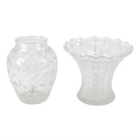
Lot of 4 Assorted Glass Minimalist Bowls, Vases, Henry DeanPUBLIC SALE4.7(226)See Sold PriceMar 02, 2024
Assorted glass to include a Clyne Farquharson for John Walsh Walsh vaseFellows4.3(159)See Sold PriceMar 05, 2024
Set of 4 Maps - Netherlands - Seven United Provinces - Germany - Sweden, Denmark, Norway, FinlandProverde Auctions4.3(3)See Sold PriceFeb 28, 2024
Lot of 4 Assorted Vintage Antique China Dishes - Floral PatternsRapid Estate Liquidators and Auction Gallery4.5(1.1k)See Sold PriceMar 01, 2024
Lot of 4 Assorted Vintage Antique China Dishes - Floral Rose PatternsRapid Estate Liquidators and Auction Gallery4.5(1.1k)See Sold PriceMar 01, 2024
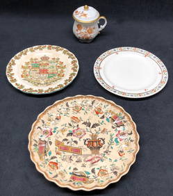
Lot of 4 Assorted Vintage Antique Chinoiseries Blue & White Transferware China DishesRapid Estate Liquidators and Auction Gallery4.5(1.1k)See Sold PriceMar 01, 2024
Lot of 4 Assorted Vintage Antique China DishesRapid Estate Liquidators and Auction Gallery4.5(1.1k)See Sold PriceMar 01, 2024
Lot of 4 Assorted Sterling Silver Bracelets.Direct Auction Galleries 4.7(337)See Sold PriceFeb 24, 2024
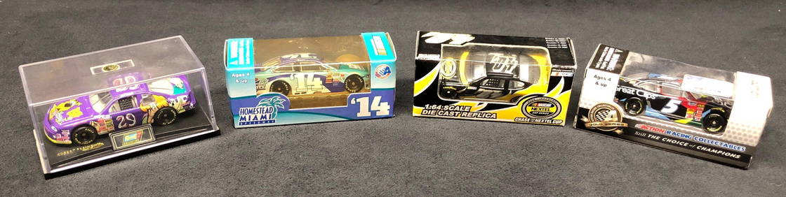
Lot of 4 Assorted Nascar 1:64 Replica Stock Cars - Revell & Action Racing CollectablesRapid Estate Liquidators and Auction Gallery4.5(1.1k)See Sold PriceMar 02, 2024