[Map] d'Anville, Canada and New England, 1776S. d'Anville - "Partie Orientale du Canada, avec la Nouvelle Angleterre, l'Acade, et la Terre Neuve" (Venice: Santini, 1776) engraving with light colored outlining, 19 1/4 X 23 1/4 in., plus margins.See Sold Price
Santini / d'Anville: Antique Map of Canada, New EnglandTitle/Content of Map: 'Partie Orientale du Canada avec la Nouvelle Angleterre, l'Acadie, et la Terre-Neuve. Par le S. d'Anville. À Venise par P. Santini 1776 [Eastern Canada with New England, Acadia,See Sold Price
Santini/d'Anville: Antique Map of "New France", 1784TITLE/CONTENT OF MAP: 'Partie Orientale du Canada avec la Nouvelle Angleterre, l'Acadie, et la Terre-Neuve. Par le S. d'Anville. À Venise par P. Santini 1776 [Eastern Canada with New England, Acadia,See Sold Price
"Partie Orientale du Canada" New England & MaritimesTITLE/CONTENT OF MAP: 'Partie Orientale du Canada avec la Nouvelle Angleterre, l'Acadie, et la Terre-Neuve. Par le S. d'Anville. À Venise par P. Santini 1776 [Eastern Canada with New England, Acadia,See Sold Price
Sold"Partie Orientale du Canada" New England & MaritimesTITLE/CONTENT OF MAP: 'Partie Orientale du Canada avec la Nouvelle Angleterre, l'Acadie, et la Terre-Neuve. Par le S. d'Anville. À Venise par P. Santini 1776 [Eastern Canada with New England, Acadia,See Sold Price
SoldMap of New England and New FranceJean Baptiste Bourguignon d'Anville, (1697-1782), published 1755, in four parts, all retaining their original uncut margins (rare), black and white engravings, entitled [Canada Louisiane etSee Sold Price
Untitled. [New England, Acadia, Quebec, St. LawrenceTitle/Content of Map: Untitled. [New England, Acadia, Quebec, St. Lawrence River, Etc.] Cartographer: ANVILLE, J. B. B. D' Height (inches): 18.75 Width (inches): 22.5Year: 1748 Eastern Canada & New EnSee Sold Price
SoldT.C. Lotter, Map of New England, 1776'A Map of the most Inhabited part of New England containing the Provinces of Massachusetts Bay and New Hampshire, with the Colonies of Connecticut and Rhode Island, Divided into Counties and TownshipsSee Sold Price
SoldTobias Lotter Map of New England 1776Tobias Conrad Lotter (1717-1777), "A Map of the Most Inhabited part of New England, containing the Provinces of Massachusets Bay and New Hampshire, with the Colonies of Conecticut and Rhode Island, DiSee Sold Price
SoldALEXANDER, SIR WILLIAM (PURCHAS)ALEXANDER, SIR WILLIAM (PURCHAS)Untitled map of Eastern Canada, Newfoundland & New England, 1624/1625, engraving, 10-1/2 x 14 in. (sight), map including the names of the twenty patentees who made up tSee Sold Price
1746 Map of New England Canada Gentleman's Magazine1746 Volume, featuring large folding "New Chart of the Coast of New England Nova Scotia, New France or Canada", of Gentleman's Magazine for the year 1746 containing all twelve issues and Supplement. ESee Sold Price
SoldNew England New York Railroad MapRailroad, Steam Boat & Stage Route of New England, New York, Canada, Antique Map by Shearman & Smith, 1852. 22 3/4" x 28".See Sold Price
SoldSmith's Rail Road, Steam Boat & Stage Route Map...[New York/New England] J. Calvin Smith. SMITH’S RAIL ROAD, STEAM BOAT & STAGE ROUTE MAP OF NEW ENGLAND, NEW-YORK AND CANADA. Pocket map. Front cover title: SHERMAN & SMITH’S ILLUSTRATED RAILROAD SSee Sold Price
SoldGroup of Five Maps Drawn by Vaugondy.Robert de Vaugondy. Group of Five Maps Drawn by Vaugondy. London: ca. 1764. Includes: A New Map of Canada, Also the North Parts of New England and New York; An Accurate Map of North America (engravedSee Sold Price
SoldRobert de Vaugondy. A New Map of CanadaRobert de Vaugondy (Gilles & Didier) After. A New Map of Canada, Also the North Parts of New England and New York, with Nova Scotia and Newfound Land,with inset map of the Great Lakes, froSee Sold Price
SoldLotter's version of Jeffery's New England 1776Title: A Map of the Most Inhabited Part of New England, Containing the Provinces of Massachusetts Bay and New Hampshire, with the Colonies of Connecticut and Rhode Island, Divided into Counties and ToSee Sold Price
SoldMAP - Carte Generale du Canada. 1776.MAP - ANVILLE, Jean Baptiste Bourguignon d'. Carte Generale du Canada, de la Louisiane, de la Floride, de la Caroline, de la Virginie, de la Nouvelle Angleterre, etc.Venice: P. Santini, 1776.See Sold Price
SoldMap of Canada's Ascot Gold FieldsHeading: (Canada & New England) Author: Colton, G.W. & C.B. Title: The Ascot Gold Fields, Lower Canada Place Published: New York Publisher: Date Published: 1865 Description:See Sold Price
Lotter's version of Jeffery's New England 1776Title: A Map of the Most Inhabited Part of New England, Containing the Provinces of Massachusets Bay and New Hampshire, with the Colonies of Conecticut and Rhode Island, Divided into Counties and TownSee Sold Price
Ortelius, Abraham. Tartariae sive Magni Chami RegniOrtelius, Abraham Tartariae sive Magni Chami Regni 1584 Copperplate engraving; area coloured Printed area: 47 x 35.1 cm; 19.3 x 13.8 in Depicted are the eastern regions of Canada, New England, and theSee Sold Price
Sold(CANADA.) Jefferys, Thomas. A New Map of Nova Scotia(CANADA.) Jefferys, Thomas. A New Map of Nova Scotia and Cape Britain with the Adjacent Parts of New England and Canada. Double-page engraved map of Nova Scotia, modern-day New Brunswick, the Saint LaSee Sold Price
SoldRailroad Public Travel Folders & Booklets (15)Some interesting public travel information including a 1889 Boston & Maine "Here and There in New England & Canada", with 2 fold out maps. Mt Tom, B&M, "Charles to the Hudson" has Fitchburg Division sSee Sold Price
SoldCanada.- Colonial New England.- Owen (W.) A Map of NewNO RESERVE Canada.- Colonial New England.- Owen (W.) A Map of New England & ye Country Adjacent, Extending Northward to Quebec & Westward to Niagara, on Lake Ontario, map covering New England includinSee Sold Price
SoldBellin/Jefferys: Antique Map of Canada & Islands, 1746Map: A new chart of the coast of New England, Nova Scotia, New France or Canada, with the islands of Newfoundl’d. Cape Breton, St. John’s &c. Publication Date: 1746 Authors: Gentleman’s MagazineSee Sold Price
LATE 18TH C. VERY LARGE CHART OF NORTHEAST CANADA BY DES BARRES (1721-1824), 1780, FRAMEDThomaston Place Auction Galleries4.4(386)See Sold PriceFeb 24, 2024
LARGE LATE 17TH C. DUTCH CHART OF CANADA, GREAT LAKES, NEW FRANCE, LABRADOR, HUDSON BAY, BY PIERREThomaston Place Auction Galleries4.4(386)See Sold PriceFeb 24, 2024
1849 THE NEW-ENGLAND MERCANTILE UNIONNorth American Artifact Auctions4.6(182)See Sold PriceApr 20, 2024
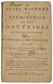
[MAP]. [ALBRIZZI, Giambatista, 1698-1777]. Carta Geografica...Potter & Potter Auctions4.6(539)See Sold PriceMar 07, 2024
[BASEBALL]. Group of Four Postcards Featuring Ballparks, in...Potter & Potter Auctions4.6(539)See Sold PriceMar 07, 2024
Robert de Vaugondy - Map of Canada - Mer de l' Ouest or Sea of the West and a Northwest PassageProverde Auctions4.3(3)See Sold PriceFeb 28, 2024
Herman Moll A New Map of Ye North Parts of AmericaWillow Auction House4.5(283)See Sold PriceMar 14, 2024


![[Map] d'Anville, Canada and New England, 1776 First Image](https://p1.liveauctioneers.com/523/81971/42494506_1_x.jpg?height=282&quality=95&version=1447274451&width=282)
![[Map] d'Anville, Canada and New England, 1776 (1 of 2)](https://p1.liveauctioneers.com/523/81971/42494506_1_x.jpg?height=282&quality=70&version=1447274451)
![[Map] d'Anville, Canada and New England, 1776 First Image](https://p1.liveauctioneers.com/523/81971/42494506_1_x.jpg?height=282&quality=1&version=1447274451&width=282)


![[MAP]. [ALBRIZZI, Giambatista, 1698-1777]. Carta Geografica... (1 of 1)](https://p1.liveauctioneers.com/928/318880/171361280_1_x.jpg?height=282&quality=70&version=1707501302)
![[BASEBALL]. Group of Four Postcards Featuring Ballparks, in... (1 of 2)](https://p1.liveauctioneers.com/928/318880/171361369_1_x.jpg?height=282&quality=70&version=1707501302)