MATTHEWS c1856 Map Of Upper Canada Ontario Indian Land Agency Divisions Scarce!Luis Porretta Fine Arts4.3(10)See Sold PriceMar 02, 2024
DEVINE c1856 Dr Salters Map Of Lake Huron Ontario Indian Lands etc. No. 7 ScarceLuis Porretta Fine Arts4.3(10)See Sold PriceMar 02, 2024
DUNLEVIE c1856 Map Counties Of Gaspe & Bonaventure Quebec Canada SCARCE! #1Luis Porretta Fine Arts4.3(10)See Sold PriceMar 02, 2024
DUNLEVIE c1856 Map Counties Of Gaspe & Bonaventure Quebec Canada SCARCE! #2Luis Porretta Fine Arts4.3(10)See Sold PriceMar 02, 2024
Map UNITED COUNTIES LEEDS & GRENVILLE by Walling 1861 Rare Canada Map 5ft x 5ftLuis Porretta Fine Arts4.3(10)See Sold PriceMar 02, 2024
Ambroise TARDIEU c1822 Map Venice Napoleon Italian Campaign 17" x 11"Luis Porretta Fine Arts4.3(10)See Sold PriceMar 02, 2024
SoldMap of Chile Patagonia Uruguay Paraguay. 1830.Victor Lavasseur. Map of Chile Patagonia Uruguay Paraguay. 1830.Print of hand colored steel engraving titled Chili Patagonie La Plata Uraguay Paraguay“.Author Victor Lavasseur.Engraved by unknown.FrSee Sold Price
Big Map Chile Paraguay Uruguay Patagonia hand colouredReserve Reduced! Title/Content of Map: Big Map Chile Paraguay Uruguay Patagonia hand coloured 1870 Vuillemin Bellier Copper etching Date Printed: 1870 Cartographer: Alexandre Vuillemin, P. Bellier MatSee Sold Price
SoldChile Paraguay Uruguay La Plata Patagonia 1870CHILI PLATA ET PATAGONIE Beautiful big hand coloured map of 1870 circa featuring Chile, Paraguay, Uruguay and Patagonia. Date: 1870 circa Author: Alexandre Vuillemin, P. Bellier Technique: Copper etchSee Sold Price
Patagonia By. H. MollTitle: Patagonia By. H. Moll Date/Period: 1729-1736 Materials: Copperplate engraved. Size: 13x9”. Patagonia. Chile, Argentina, Paraguay, Uruguay. By. H. Moll. From. Atlas minor. Published. London. RSee Sold Price
Patagonia (Chile & Argentina) with Paraguay & UruguayTitle: Patagonia (Chile & Argentina) with Paraguay & Uruguay Date/Period: 1729-1736 Materials: Copperplate engraved. Size: 13x9”. By. H. Moll. From. Atlas minor. Published. London. Reserve: $125.00See Sold Price
Patagonia (Chile & Argentina) with Paraguay & UruguayTitle: Patagonia (Chile & Argentina) with Paraguay & Uruguay Description: By. H. Moll. From. Atlas minor. Published. London. Date/ Period: 1729-1736 Materials: Copperplate engraved. Dimensions: 13x9��See Sold Price
Patagonia (Chile & Argentina) with Paraguay & UruguayTitle: Patagonia (Chile & Argentina) with Paraguay & Uruguay Date/Period: 1729-1736 Materials: Copperplate engraved. Dimensions: 13x9”. By. H. Moll. From. Atlas minor. Published. London. Reserve: $2See Sold Price
Patagonia (Chile & Argentina) with Paraguay & UruguayTitle: Patagonia (Chile & Argentina) with Paraguay & Uruguay Date/Period: 1729-1736 Materials: Copperplate engraved. Size: 13x9”. By. H. Moll. From. Atlas minor. Published. London. Reserve: $185.00See Sold Price
Patagonia (Chile & Argentina) with Paraguay & UruguayTitle: Patagonia (Chile & Argentina) with Paraguay & Uruguay Description: By. H. Moll. Published. London. Date/Period: 1729-1736 Materials:Copperplate engraved Dimensions:13x9” Reserve: $275.00 ShipSee Sold Price
Patagonia (Chile & Argentina) with Paraguay & UruguayTitle: Patagonia (Chile & Argentina) with Paraguay & Uruguay Date/Period: 1729-1736 Materials: Copperplate engraved. Dimensions: 13x9”. By. H. Moll. From. Atlas minor. Published. London. Reserve: $2See Sold Price
Patagonia (Chile & Argentina) with Paraguay & UruguayTitle: Patagonia (Chile & Argentina) with Paraguay & Uruguay Date/Period: 1729-1736 Materials: Copperplate engraved. Size: 13x9”. By. H. Moll. From. Atlas minor. Published. London. Reserve: $115.00See Sold Price
SoldEARLY MAP OF PATAGONIA AND THE STRAIT OF MAGELLANEarly hand-colored, copperplate-engraved map, 20 3/4' x 25 1/2', a depiction of southern South America, including modern Uruguay, Paraguay, Argentina and Chile. The map was created by French cartograpSee Sold Price
1859 Argentina, Chile, Paraguay & Uruguay by ColtonTitle: 1859 Argentina, Chile, Paraguay & Uruguay by Colton Date/Period: 1859 Materials: Hand colored steering engraved Size: 17 1/2 x 14 1/2” Argentina, Chile, (both don’t control PatagoniSee Sold Price
Mitchell: Map of Brazil Chile Uruguay Paraguay BoliviaTitle/Content of Map: Brazil, Chile, Uruguay, Paraguay and Bolivia Date Printed: 1869 Cartographer: Augustus S. Mitchell Material/Medium: Paper Size: 15 1/4" x 12" Hand colored steel engraved Map. PubSee Sold Price
SoldMap Chile Paraguay Uruguay 1860REPUBLIQUES DES PROVINCES UNIES (OU LA PALATA) DU CHILI DU PARAGUAY ET DE L’URUGUAY Beautiful coloured map of 1860 circa featuring Chile, Paraguay and Uruguay. Decorated frame. Date: 1860 circaSee Sold Price
Argentina, Chile, Paraguay & Uruguay by ColtonTitle/Content of Map: Argentina, Chile, Paraguay & Uruguay by Colton Date: 1861 Cartographer: J.H. Colton Material/Medium: Paper Size: 15" x 17" Provenance: New York From Colton's General Atlas. HandSee Sold Price
1867 Mitchell: Brazil, Bolivia, Paraguay, Uruguay,Reserve Reduced! Title/Content of Map: 1867 Mitchell: Brazil, Bolivia, Paraguay, Uruguay, Chile -- Map of Brazil, Bolivia, Paraguay and Uruguay [on sheet with] Map of Chili Date: 1867, Philadelphia CaSee Sold Price
1867 Mitchell: Brazil, Bolivia, Paraguay, Uruguay,Title/Content of Map: 1867 Mitchell: Brazil, Bolivia, Paraguay, Uruguay, Chile -- Map of Brazil, Bolivia, Paraguay and Uruguay [on sheet with] Map of Chili Date: 1867, Philadelphia Cartographer: S MitSee Sold Price
Mitchell: Map of Brazil Bolivia Paraguay Uruguay, 18671867 Mitchell: Brazil, Bolivia, Paraguay, Uruguay, Chile -- Map of Brazil, Bolivia, Paraguay and Uruguay [on sheet with] Map of Chili. A brightly colored fantastic map of central portion of South AmerSee Sold Price
Argentina, Chile, Paraguay & UruguayTitle/Content of Map: Argentina, Chile, Paraguay & Uruguay Date Printed: 1861 Cartographer: J.H. Colton Material/Medium: Paper Size: 15" x 17" Provenance: New York Published in New York in 'Colton's ASee Sold Price
Mitchell: Antique Map of Brazil, Chile, etc., 1867Title/Content of Map: 1867 Mitchell: Brazil, Bolivia, Paraguay, Uruguay, Chile -- Map of Brazil, Bolivia, Paraguay and Uruguay [on sheet with] Map of Chili Date Printed: 1867, Philadelphia CartographeSee Sold Price
1867 Mitchell: Brazil, Bolivia, Paraguay, Uruguay,Title/Content of Map: 1867 Mitchell: Brazil, Bolivia, Paraguay, Uruguay, Chile -- Map of Brazil, Bolivia, Paraguay and Uruguay [on sheet with] Map of Chili Cartographer: S Mitchell Year/Place: 1867, PSee Sold Price
1867 Mitchell: Brazil, Bolivia, Paraguay, Uruguay,Title/Content of Map: 1867 Mitchell: Brazil, Bolivia, Paraguay, Uruguay, Chile -- Map of Brazil, Bolivia, Paraguay and Uruguay [on sheet with] Map of Chili Date Printed: 1867, Philadelphia CartographeSee Sold Price
1867 Mitchell: Brazil, Bolivia, Paraguay, Uruguay ChileTitle/Content of Map: 1867 Mitchell: Brazil, Bolivia, Paraguay, Uruguay, Chile -- Map of Brazil, Bolivia, Paraguay and Uruguay [on sheet with] Map of Chili Date Printed: 1867, Philadelphia CartographeSee Sold Price
LATE 17TH C. FRENCH MAP OF THE NEW WORLD BY ALEXIS-HUBERT JAILLOT (1632-1712)Thomaston Place Auction Galleries4.4(386)See Sold PriceFeb 24, 2024
18TH C. ANTIQUE MAP: FRENCH & INDIAN WAR, FRAMEDThomaston Place Auction Galleries4.4(386)See Sold PriceFeb 24, 2024
Keith Haring - Ink on New York Map, Best Buddies, Inscribed, Signed, and DatedSapphire Auction Gallery4(67)See Sold PriceMar 02, 2024
Rand McNally Railroad Map Cabinet w/ 21 Railroad MapsRail & Road Auctions4.6(165)See Sold PriceMar 08, 2024
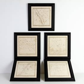
Set of Five Astronomical Zodiac Maps of the Stars by Baldwin & Gradock 1830Passion For Antiques3.9(23)See Sold PriceFeb 25, 2024
South American Argentina or Uruguay Prehispanic Engraved Stone.Succetti Gallery4.6(80)See Sold PriceFeb 25, 2024
Putnam - First Map of the State of Ohio by Rufus PutnamTrillium Antique Prints & Rare Books4.5(30)See Sold PriceFeb 24, 2024
1760 MAP CARTE PARTICULIERE DE L'ISLE DE JUAN FERNANDES antique Robinson CrusoeJasper524.5(9.8k)See Sold PriceFeb 27, 2024
1822 MAP of CHILI GEOGRAPHICAL STATISTICAL HISTORICAL antique 17.5x 22" CHILEJasper524.5(9.8k)See Sold PriceFeb 27, 2024
ANCIENT NORTH AFRICA. Greek colonies. "La Libye, L'Egypte…". TARDIEU 1830 mapJasper524.5(9.8k)See Sold PriceFeb 28, 2024
ARTIST: LAINE VAIGUR / 5 Banderas Ecuador Paraguay Peru Uruguay Venezuela POSTERChurchill Galleries3.7(213)See Sold PriceFeb 26, 2024
Rare 19thc Colton Map, Argentine Republic, Chile, Uruguay, PataguayConnoisseur Auctions4(333)See Sold PriceMar 16, 2024