SoldCelarius chart with California and islandHeading: Author: Cellarius, Andreas Title: Typus Aspectuum, Oppositionum et con Iunctionum etz in Planetis Place Published: [Amsterdam] Publisher:Peter Schenk & Gerhard Valk Date Published:See Sold Price
Anson World Chart California an island 1748Title: A Chart Shewing the Track of the Centurion round the World Author: Anson, George Description: Copper-engraved map. 23x41 cm. (9x16").Illustrates George Anson's circumnavigation. Insular CaliforSee Sold Price
SoldAnson World Chart California an island 1748Title: A Chart Shewing the Track of the Centurion round the World Author: Anson, George Description: Copper-engraved map. 23x41 cm. (9x16").Illustrates George Anson's circumnavigation. Insular CaliforSee Sold Price
SoldDe Wit chart of Pacific California an islandTitle: Magnum Mare del Zur cum Insula California. De Groote Zuyd-Zee en 't Eylandt California Author: De Wit, Frederick Description: Copper-engraved chart, hand-colored in outline, colored pictorial cSee Sold Price
SoldDe Wit chart of Pacific California an islandTitle: Magnum Mare del Zur cum Insula California. De Groote Zuyd-Zee en 't Eylandt California Author: De Wit, Frederick Description: Copper-engraved chart, hand-colored in outline, colored pictorial cSee Sold Price
SoldDe Wit chart of Pacific California an islandTitle: Magnum Mare del Zur cum Insula California. De Groote Zuyd-Zee en 't Eylandt California Author: De Wit, Frederick Description: Copper-engraved chart, hand-colored, colored pictorial cartouche. 5See Sold Price
SoldRenard's chart of Pacific California an islandTitle: Magnum Mare del Zur cum Insula California. De Groote Zuyd-Zee en 't Eylandt California Author: Renard, Louis Description: Copper-engraved chart, hand-colored, uncolored pictorial cartouche. 50xSee Sold Price
Sold1700 Pacific sea chart with Island of California andTitle: Mer de Sud ou Pacifique contenant l'Isle de Californe. Map maker: Pierre Mortier Place and Year: Amsterdam, 1700 Dimensions: 60 x 74.5 cm (23.6 x 29.3 in) Technique: Copperplate engraving ColorSee Sold Price
SoldEngraved Hand-Colored Map of PacificEngraved hand colored map, "Magnum Mare del Zur cum Insula California" by Frederick de wit, chart of the Pacific with California as an island, title cartouche with portrait of Magellan and winged cherSee Sold Price
SoldMagnum Mare del Zur cum InsulaCalifornia by Frederick de Wit (1630-1706), Amsterdam, 1675, copper-engraved mariner's chart, hand-colored in outline, showing California as an island, Tooley #40, with a colorful pictorial cartoucheSee Sold Price
Sold19th century California chart.Chart in sketch form showing the "Progress of the Survey" dated 1877 by the US Coast Surveyors of the southern coast of California including Santa Barbara Channel, Coronado, Catalina Island, Santa RosSee Sold Price
SoldCoast Survey chart of Anacapa IslandHeading: (California - Anacapa Island) Author: U.S. Coast Survey Title: Preliminary Survey of Anacapa Island and East End of Santa Cruz Island, California Place Published: Washington, D.C. Publisher:See Sold Price
Coast Survey chart of Anacapa IslandTitle: Preliminary Survey of Anacapa Island and East End of Santa Cruz Island, California Author: U.S. Coast Survey Description: Engraved chart. 23.5x65.5 cm. (9¼x25¾").Chart of the islands of the SSee Sold Price
Southern California Bight islands San Diego LA ADMIRALTY chart 1885 (1955) mapTitle: Southern California Bight islands San Diego LA ADMIRALTY chart 1885 (1955) map Description: North America - West Coast - California - San Diego Bay to Conception Point including Santa Cruz andSee Sold Price
Sold1861 Chart of the Petaluma and Napa Creeks1861 chart of the Petaluma and Napa Creeks in California. Chart shows the creeks in detail and surrounding areas including the road to Sonoma and Mare Island. Black frame. 31 x 41. Condition: very gooSee Sold Price
SoldCatalina Harbor from U.S. Coast Survey 1852Title: Reconnaissance of Catalina Harbor and the Anchorage on the N.E. Side of the Island, California Author: U.S. Coast Survey Description: Engraved chart, modern hand-coloring. 38x27 cm. (15x10½").See Sold Price
1861 Chart of the Petaluma and Napa CreeksCHART. 1861 chart of the Petaluma and Napa Creeks in California. Chart shows the creeks in detail and surrounding areas including the road to Sonoma and Mare Island. Black frame. 32" x 22" viewed plusSee Sold Price
Pacific Ocean.- Australasia.- Americas.- Jansson (Jan)Pacific Ocean.- Australasia.- Americas.- Jansson (Jan) Mar del Zur Hispanis Mare Pacificum, the first chart of the Pacific Ocean to show California as an Island, including the western coastlines of thSee Sold Price
SoldRare Mexican map showing California not an islandHeading: Author: Castillo, Domingo del. Title: [Nautical chart of the Pacific coast of Mexico, Baja California, and the Gulf of California] Place Published: Mexico Publisher:[Impr. del Superior GobieSee Sold Price
SoldLarge Chart of Hawaii & California CoastTitle: Chart of the Sandwich Islands [on sheet with] the Coast of California on an Enlarged Scale Author: Wilson, Charles Description: Engraved chart. 78.5x62.5 cm. (31x23¾").Large chart, with the HaSee Sold Price
Soldc. 1650 Map: Mar del Zur Hispanis Mare PacificumHistoric Maps c. 1650 Hand-Colored Map "Mar del Zur Hispanis Mare Pacificum" by Joannes Jansson with California as an Island Earliest Pacific Sea Chart of the to Appear in a Dutch Atlas c. 1650, Hand-See Sold Price
1675 - 1715 Magnum Mare del Zur Insula California...This is a stunning sea chart covering the Pacific Ocean from 45 degrees S. Latitude to 50 degrees N. Latitude. Featured in the top right portion of the map is the island of California as copied from PSee Sold Price
1675 - 1715 Magnum Mare del Zur Insula California...This is a stunning sea chart covering the Pacific Ocean from 45 degrees S. Latitude to 50 degrees N. Latitude. Featured in the top right portion of the map is the island of California as copied from PSee Sold Price
SoldCompte de la PerousePart of the Pacific Ocean between California and the Philippine Islands - 37 cm x 51 cm (14.5 x 20 in) Copper engraving in its original black and white state. Upper chart shows the route of the SpanisSee Sold Price
Emily Selinger (MA,CA,NC,RI,1848-1927) watercolor painting antiqueBroward Auction Gallery4.7(292)See Sold PriceMar 10, 2024
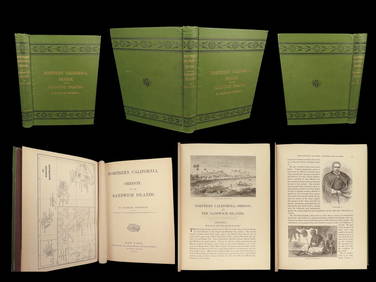
1874 HAWAII 1ed Northern California Oregon Pacific Island Travel Puget RedwoodsSchilb Antiquarian Rare Books4.8(428)See Sold PriceMar 10, 2024
LATE 17TH C. FRENCH MAP OF THE NEW WORLD BY ALEXIS-HUBERT JAILLOT (1632-1712)Thomaston Place Auction Galleries4.4(393)See Sold PriceFeb 24, 2024
EARLY 18TH C. DUTCH CHART OF PACIFIC OCEAN BY FREDERIK DE WIT (1629-1706) WITH CALIFORNIA AS ANThomaston Place Auction Galleries4.4(393)See Sold PriceFeb 24, 2024
CHART "LONG ISLAND SOUND FROM NEW YORK TO MONTOCK POINT ..." New York, 1830 21" x 77" sight. FramedEldred's4.7(419)See Sold PriceFeb 27, 2024
1939 Folies Bergere Programme California Auditorium - Treasure Island, San FranciscoNorth American Artifact Auctions4.7(198)See Sold PriceApr 20, 2024
1764 Bellin Map of Lesser Antilles Northern Portion -- Petites Antilles ou Isles du Vent 3e. Partie.Jasper524.5(9.9k)See Sold PriceFeb 27, 2024
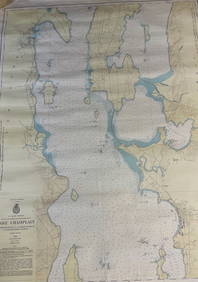
CHART: U.S LAKE SURVEYS/ LAKE CHAMPLAIN/ CUMBERLAND HEAD, NY and SAVAGE ISLAND, VT. TO FOUR BROTHERSChurchill Galleries3.7(217)See Sold PriceFeb 26, 2024