MAP - PIETER SCHENK / VALK / JANSSEN Hand Colored superb Map Central Italy c1702Luis Porretta Fine Arts4.3(10)See Sold PriceMar 02, 2024
CHARLES ROLLIN c1828 Ceasar Hand Colored Africa Military MapLuis Porretta Fine Arts4.3(10)See Sold PriceMar 02, 2024
MAP - Dufour, A. H. ( Malte / Brun ) :MAP - ESPAGNE PARTIE SUD DIVISEE EN PROVINCES ANCIENNES ( MAPLuis Porretta Fine Arts4.3(10)See Sold PriceMar 02, 2024
RIGOBERT BONNE c1787 Original Colored Map Germany & Region 15" x 12"Luis Porretta Fine Arts4.3(10)See Sold PriceMar 02, 2024
AMBROISE TARDIEU c1822 Napoleonic War Map GermanyLuis Porretta Fine Arts4.3(10)See Sold PriceMar 02, 2024
MAP - AMBROISE TARDIEU c1822 Napoleonic Miltary Map GermanyLuis Porretta Fine Arts4.3(10)See Sold PriceMar 02, 2024
1822 Rare Map by Ambroise Tardieu Napoleon Caldiero Battle of Vento 17" x 11Luis Porretta Fine Arts4.3(10)See Sold PriceMar 02, 2024
PIETER SCHENK / VALK / JANSSEN Hand Colored Map of Rhodes Greece ca1702 vgcLuis Porretta Fine Arts4.3(10)See Sold PriceMar 02, 2024
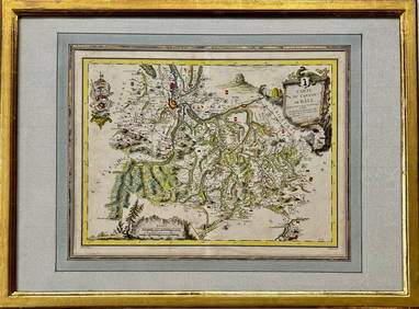
Map: Carte du Canton de Bale, Jacques Clermont, Paris, 1788Kensington Estate Auction4.6(216)See Sold PriceFeb 26, 2024
Map of Persian Empire. Print in 1850.Print of steel engraving titled „Carte de L Empire des Perses.Author A. Houze.Engraved by unknown.From the „Atlas Universel Historique et Geographique by A. Houze, Paris. 1850.The Persian Empire iSee Sold Price
Map of Eastern Roman Empire. Print in 1850.Map of Eastern Roman Empire in 410 - 553. Print in 1850.Print of steel engraving titled „LEmpire Romain dOrient a lavenement de Justinien 1 er et le Roy de4s Ostrocoths a la mort de Theodoric 410 aSee Sold Price
Map of French Empire. Europe. 1871.Map of French Empire divided into 130 departments. Europe. 1871.Print from steel engraving titled „Empire Francais divise en 130 departements“.Author/compiler - MM. Drioux et Ch. Leroy.Engraver unSee Sold Price
Map of French Empire in 1813. Europe. 1854.Print of hand colored steel engraving titled „Carte de L’ Empire Francais en 1813”.Drawn by L. Dussieux. Engraved by Marlier.From „Atlas General De Geographie physique, politique et historiqueSee Sold Price
Map of Byzantine Empire and Italy in 1200 - 1400.Map of Byzantine Empire and Italy in 1200 - 1400. Print in 1850.Print of steel engraving titled „LEmpire DOrient et ses Demembrements Apres la prise de Constantinople Par les Croises Francais. IItalSee Sold Price
SoldMap of Ottoman Empire and Italy in 1400 - 1500.Map of Ottoman Empire and Italy in 1400 - 1500. Print in 1850.Print of steel engraving titled „L‘Empire Ottoman apres la prise de Constantinople L‘Italie a l‘epoque de l‘asservissement des VSee Sold Price
Map of Greece Empire and Italy in 1300 - 1400.Map of Greece Empire and Italy in 1300 - 1400. Print in 1850.Print of steel engraving titled „LEmpire Grec apres les conque de Bajazet L Italie a l epoque du Grand Schisme D Occident 1300 - 1400.AutSee Sold Price
SoldMap of Ancient Greece and Italy in 900 - 1002.Map of Ancient Greece and Italy in 900 - 1002. Print in 1850.Print of steel engraving titled „L‘Empire Grec, L‘ Italy 900 - 1002“.Author A. Houze.Engraved by unknown.From the „Atlas UniverseSee Sold Price
The Ottoman Empire, Greece and Italy in 1500 - 1700.The Ottoman Empire, Greece and Italy in 1500 - 1700. Print in 1850.Print of steel engraving titled „L Empire Ottoman La Grece et L Italie de 1500 a 1700.Author A. Houze.Engraved by unknown.From theSee Sold Price
Map of France in 1350 - 1364. Print in 1850.Print of steel engraving titled „La France apres le traite de Bretigne 1350 a 1364“.Author A. Houze.Engraved by unknown.From the „Atlas Universel Historique et Geographique“ by A. Houze, ParisSee Sold Price
SoldFrench Lithographic Map of 1807 EuropeFrench lithographic map of 1807 Europe, coat of arms and title to the upper left corner reads in French ‘Carte politburo et itineraire de L’Europe et du L’Empire Francais en 1807’, legend to lSee Sold Price
SoldV. Levasseur: Map of Asia, 1850Map: Asie Maker: V. Levasseur Date: 1850 Origin Paris Date: 11 x 16.5 inches A highly decorative nineteenth century map of Asia, dominated by Russian, Chinese Empires and British India and French IndoSee Sold Price
SoldMap of Empire of Charlemagne. Europe. 1854.Print of hand colored steel engraving titled „Carte du Partage de L’Empire de Charlemagne“.Drawn by L. Dussieux.Engraved by unknown.From „Atlas General De Geographie physique, politique et hisSee Sold Price
SoldA Set of Five French Empire Prints, Height 12 1/2A Set of Five French Empire Prints, depicting interiors and furniture details. Height 12 1/2 x width 17 1/2 inches.See Sold Price
SoldPR FRENCH EMPIRE COSTUME PRINTPAIR OF FRENCH EMPIRE COSTUME PRINTS. Perhaps 19th c. Black crayon lithograph with color. Nos. 315 and 316 of a costume folio: they show Costume de Bal and Jeune Femme en Neglige. Size framed: 14 1/2'See Sold Price
SoldAntique Hand Colored French Empire Fashion PrintsPair Antique Hand Colored French Empire Fashion Prints. Professionally framed and matted. French descriptions on backs of each. Each measures 18.5 x 14 inches.See Sold Price
SoldFrench Bronze CandelabraFrench, Empire, circa 1850 Bronze 22" H x 9" W Five arms set on tripod feetSee Sold Price
SoldPair of Antique Hand-Colored French Fashion PrintsPair of Antique Hand-Colored French Empire Fashion Prints; professionally framed & matted. Having a description in French on the back of each one. Measure 18.5 x 14 inches.See Sold Price
SoldPair of Antique Hand-Colored French Fashion PrintsPair of Antique Hand-Colored French Empire Fashion Prints; professionally framed & matted. Having a description in French on the back of each one. Measure 18.5 x 14 inches.See Sold Price
SoldFRAMED 1850 PRINT MAP OF THE UNITED STATESFramed 1850 map of the United States by John Tallis & Company London and New York. Frame measures 18.5 by 14.5 by 1 inches, map measures 14 by 10.5 inches. Some wear to frame, overall in very good conSee Sold Price
FRENCH EMPIRE CLOCK, CA. 1850FRENCH EMPIRE CLOCK, CA. 1850: Bell strike, key wind, movement, unsigned, with a floral bouquet pendulum. White marble case with gilt swag floral garlands nicely balanced and composed with a delicateSee Sold Price
SoldCa. 1850 French Empire 10 arm figural chandelierCa. 1850 French Empire bronze and tole 10 arm figural chandelier with swan arms and lady centerSee Sold Price
SoldFRENCH ZOOLOGY PRINT CIRCA 1850Zoology print, "Castor du Canada", N. Rémond Imprimerie, framed, French, circa 1850, 10 x 6 1/2 inches.See Sold Price
SoldAntique French Map Print of the Antilles IslandsAn antique French map print of the Antilles Islands, size as framed 22 x 17See Sold Price
CLAUDE EDMOND DELBOS (1878-1949) Engraving Meadow Landscape ca1929Luis Porretta Fine Arts4.3(10)See Sold PriceMar 02, 2024
CLAUDE EDMOND DELBOS (1879-1949) Engraving Tree LandscapeLuis Porretta Fine Arts4.3(10)See Sold PriceMar 02, 2024
Mitchell - Map of the City of Washington (Washington, DC)Trillium Antique Prints & Rare Books4.5(30)See Sold PriceFeb 24, 2024
New and Correct Map of North America With the West India Islands,Jasper524.5(9.8k)See Sold PriceFeb 27, 2024
UPPER/HAUTE VOLTA. Burkina Faso. French West Africa. Ouagadougou plan 1929 mapJasper524.5(9.8k)See Sold PriceFeb 28, 2024
Colonial Africa. British German French Spanish Portuguese Italian TIMES 1900 mapJasper524.5(9.8k)See Sold PriceFeb 28, 2024
COLONIES FRANÇAISES en AFRIQUE. Africa Sénégal Madagascar. LEVASSEUR c1850 mapJasper524.5(9.8k)See Sold PriceFeb 28, 2024
Colonial Africa North-West. British French. Nigeria Sahara. THE TIMES 1895 mapJasper524.5(9.8k)See Sold PriceFeb 28, 2024
Colonial Central Africa. Belgian Congo. French Equatorial Africa. TIMES 1922 mapJasper524.5(9.8k)See Sold PriceFeb 28, 2024
COLONIAL AFRICA. British French German Italian Portugal Spain.STANFORD 1906 mapJasper524.5(9.8k)See Sold PriceFeb 28, 2024
Carte de L'Algérie et de la Régence de Tunis' ANDRIVEAU-GOUJON Algeria 1850 mapJasper524.5(9.8k)See Sold PriceFeb 28, 2024
UPPER/HAUTE VOLTA. Burkina Faso. French West Africa. Ouagadougou plan 1931 mapJasper524.5(9.8k)See Sold PriceFeb 28, 2024
West Africa. Sahara caravan routes. Tribes Kingdoms Empires. LIZARS 1842 mapJasper524.5(9.8k)See Sold PriceFeb 28, 2024
Colonial Africa. British German French Spanish Portuguese Italian TIMES 1895 mapJasper524.5(9.8k)See Sold PriceFeb 28, 2024
EARLY COLONIAL WEST AFRICA. Empires of Sokoto Gando Mas.Tribes.Fellatah 1886 mapJasper524.5(9.8k)See Sold PriceFeb 28, 2024
Colonial Africa North-West. British French. Nigeria Sahara. THE TIMES 1900 mapJasper524.5(9.8k)See Sold PriceFeb 28, 2024
L'Afrique Françoise ou du Senegal'. French West Africa. DE L’ISLE 1727 mapJasper524.5(9.8k)See Sold PriceFeb 28, 2024
French Elegance: Lithographic Fashion Print from the 1900s - Magazine CoverProverde Auctions4.3(3)See Sold PriceFeb 28, 2024
James Cook - Map of the Friendly Isles - Tonga IslandsProverde Auctions4.3(3)See Sold PriceFeb 28, 2024