SoldNORTH AFRICAN MAP 1830 J. PERTHESNORTH AFRICAN MAP - J. PERTHES 1830 - Printed and hand tinted; "Mittle Und Nord-Africa und Arabien" Westliches Blatt; matted and framed; minor foxing; visual: 13" x 15", G.See Sold Price
Sold1830 Mittel und Nord-Africa und Arabien1830 Mittel und Nord-Africa und Arabien, from Stieler's Hand Atlas #45a & 45b, Gotha bie J Perthes, 2 hand colored single sheet maps of North Africa & Arabia, 14" x 17 1/2"See Sold Price
Victor Lavasseur. Map of Algeria. 1830.Print of hand colored steel engraving titled Algerie“.Author Victor Lavasseur.Engraved by unknown.From Atlas classique universel de Geographie anciene et moderne“ by Victor Levasseur. Paris. 1830.See Sold Price
Victor Lavasseur. Map of Barbarity. 1830.Print of hand colored steel engraving titled Barbarie“.Author Victor Lavasseur.Engraved by unknown.From Atlas classique universel de Geographie anciene et moderne“ by Victor Levasseur. Paris. 1830See Sold Price
Victor Lavasseur. Map of ancient Africa. 1830.Print of hand colored steel engraving titled Melanesie“.Author Victor Lavasseur.Engraved by unknown.From Atlas classique universel de Geographie anciene et moderne“ by Victor Levasseur. Paris. 183See Sold Price
SoldJohn Grigg: Map of North America, 1830Map: North America Maker: John Grigg, Malte-brun, Conrad/ J. H. Young Date: 1830 Size: Quarto, 9.8 inches high x 8 inches wide From Malte-Brun's "A new General atlas, exhibiting the five great divisioSee Sold Price
SoldLattre: Antique Map of the Barbary Coast, 1791Map: Barbary Coast by Lattre Date Printed: 1791 Cartographer: J Lattre Material/Medium: Paper Size: Approx 11 1/2" x 8 1/2" Hand colored copperplate engraving. Published in Petit Atlas Moderne Ou CollSee Sold Price
SoldLattre: Antique Map of Ancient Egypt, 1791Map: Ancient Egypt by Lattre Date Printed: 1791 Cartographer: J Lattre Material/Medium: Paper Size: 8 1/2" x 12" Hand colored copperplate engraving. Published in Petit Atlas Moderne Ou Collection De CSee Sold Price
SoldHENRI LANGEROCK (BELGIAN 1830-1915), GOUACHE VHENRI LANGEROCK (BELGIAN 1830-1915), GOUACHE ON PAPER, NORTH AFRICAN VILLAGE SCENE, SIGNED. SIGHT 9 3/4 X 17 1/2"; FRAMED AND GLAZED-10 3/4 X 18 1/2"See Sold Price
PRINTED COTTON MAP OF NORTH AMERICA, C.1830PRINTED COTTON MAP OF NORTH AMERICA, C.1830. FRAMED 29 X 35" (MOUNTED)See Sold Price
SoldBuxton (Edward North) Two African TripsBuxton (Edward North) Two African Trips,first edition, plates, folding map in pocket at end, bookplate on front free endpaper, original pictorial buckram, uncut, soiled, 1902 § House (Edward JSee Sold Price
HENRI LANGEROCK (BELGIAN 1830-1915), GOUACHEHENRI LANGEROCK (BELGIAN 1830-1915), GOUACHE ON PAPER, NORTH AFRICAN VILLAGE SCENE, SIGNED. SIGHT 9 3/4 X 17 1/2"; FRAMED AND GLAZED-10 3/4 X 18 1/2"See Sold Price
1851 Tallis Antique Map of North AfricaTitle/Content of Map: 1851 Tallis Map of North Africa -- Northern Africa Date Printed: 1851, London Cartographer: J Tallis Size: 10 x 12.4 in. A very nice map of North Africa, including Tunisia, AlgerSee Sold Price
1792 Elwe Map of Northwest Africa -- Carte de laTitle: 1792 Elwe Map of Northwest Africa -- Carte de la Barbarie le la Nigritie et de la Guinee Date: 1792, Amsterdam Cartographer: J Elwe Size: 19.2 X 22.1 in. Additional Information: This an impressSee Sold Price
SoldGroup of African maps(Lot of 3) Maps of Africa, including Afrika, Gotha: Justus Perthes 1874, Stieler's Hand-Atlas, No.68, a Modern Africa, J. Wilkes, August 13th, 1796, hand colored, and Africa, Harrison, circa 1800, witSee Sold Price
SoldGroup of African maps(Lot of 3) Maps of Africa, including Afrika, Gotha: Justus Perthes 1874, Stieler's Hand-Atlas, No.68, a Modern Africa, J. Wilkes, August 13th, 1796, hand colored, and Africa, Harrison, circa 1800, witSee Sold Price
Bellin: Antique Map ot North Western Africa, 1740Title/Content of Map: North Western Africa by Bellin Date Printed: 1740-70's Cartographer: J.N. Bellin & J.F. La Harpe Material/Medium: Paper Size: 14" x 9" Copperplate engraved. Published in Paris. FSee Sold Price
Colton: Antique Map of North Eastern Africa, 1861Title/Content of Map: Northern and Eastern Africa by Colton Date Printed: 1861 Cartographer: J.H. Colton Material/Medium: Paper Size: 14" x 17" Hand colored steel engraved Map. Published in New York iSee Sold Price
Cie Gle Transatlantique North African Route Map,Cie Gle Transatlantique North African Route Map, original map poster printed by Blondel La Rougery 1950 - 64 x 99 cmSee Sold Price
Cie Gle Transatlantique North African Route Map,Cie Gle Transatlantique North African Route Map, original map poster printed by Blondel La Rougery 1950 - 64 x 99 cmSee Sold Price
Stieler Adolf. Hand-Atlas - 88 maps Gotha, J. PerthesTitle: Stieler Adolf. Hand-Atlas - 88 maps Gotha, J. Perthes 1876 Date: 1876 Medium: paper Dimensions: 18.9 x 15.8 cm Description: Stieler Adolf. Hand-Atlas über alle Theile der Erde nach dem neuesteSee Sold Price
SoldE. 19TH C. OTTOMAN SILVER INLAID FLINTLOCK PISTOLNorth African / Ottoman, circa 1830 / 1840. Silver filigree inlaid flintlock pistol with spring bayonet havi Provenance: Acquired from Hermann Historica on May 15-19th, 2019, lot 1663, for 1900 euro.See Sold Price
SoldGrp: 12 Regional Maps of AfricaGroup of twelve 18th and 19th c. regional maps of Africa. Includes two maps of the North African coast; one map of Madagascar; one page with seven inset maps of the major islands of Africa; one map ofSee Sold Price
Sold131: Jean Louis Ernst Meissonier French, 1815-1893 A NOJean Louis Ernst Meissonier French, 1815-1893 A NORTH AFRICAN WARRIOR Signed J.L.E. Meissonier (ll) Oil on panel 16 1/2 x 8 1/2 inches (42.0 x 21.5 cm.)See Sold Price
CHARLES ROLLIN c1828 Ceasar Hand Colored Africa Military MapLuis Porretta Fine Arts4.3(10)See Sold PriceMar 02, 2024
1919 The Story of The Great War by Official Sources Volumes 1,2,3,8.North American Artifact Auctions4.6(182)See Sold PriceApr 20, 2024
1764 Bellin Map of Western Guadeloupe in the Lesser Antilles -- Partie Occidentale de l'Isle de laJasper524.5(9.8k)See Sold PriceFeb 27, 2024
1764 Bellin Chart of Three South Haitian Bays -- Carte des Bayes du Mesle des Flamands et deJasper524.5(9.8k)See Sold PriceFeb 27, 2024
1764 Bellin Map of Port Antonio, Jamaica -- Plan des Havres de Port Antonio et de Saint FrancoisJasper524.5(9.8k)See Sold PriceFeb 27, 2024
Mexico, Central America and West Indies Physical PoliticalJasper524.5(9.8k)See Sold PriceFeb 27, 2024
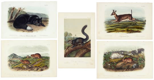
First 50 plates from Audubon's Quad Quarto (all in Vol. I)PBA Galleries4.7(381)See Sold PriceMar 07, 2024
Nearly complete set of plates from Vol. III Quad QuartoPBA Galleries4.7(381)See Sold PriceMar 07, 2024
NORTHERN AFRICA. Morocco Tunisia Algeria. Caravan routes. RAPKIN/TALLIS 1851 mapJasper524.5(9.8k)See Sold PriceFeb 28, 2024
NORTH AFRICA. 'Biledulgerid', a former North African country. MALLET 1683 mapJasper524.5(9.8k)See Sold PriceFeb 28, 2024
African Reptiles & Birds. Horned viper Grey crowned crane Flamingo Penguin 1748Jasper524.5(9.8k)See Sold PriceFeb 28, 2024
ANCIENT NORTH AFRICA. Greek colonies. "La Libye, L'Egypte…". TARDIEU 1830 mapJasper524.5(9.8k)See Sold PriceFeb 28, 2024
NORTH AFRICAN FLAGS. Tripoli Tunis Algiers. Libya Tunisia Algeria. HOUNSELL 1873Jasper524.5(9.8k)See Sold PriceFeb 28, 2024
NORTHERN AFRICA. Morocco Tunisia Algeria. Caravan routes.TALLIS/RAPKIN 1851 mapJasper524.5(9.8k)See Sold PriceFeb 28, 2024
NORTHERN AFRICA. Morocco Tunisia Algeria. Caravan routes. RAPKIN/TALLIS 1851 mapJasper524.5(9.8k)See Sold PriceFeb 28, 2024
Carl J. Sundevall (1801 - 1875) Set of 4 Bird Prints - Dove - Woodpecker - DuckProverde Auctions4.3(3)See Sold PriceFeb 28, 2024