SoldWest Indies.- - A small mixed group of maps,comprising A New and Accurate Map of the Island of Antigua or Antego, by Emanuel Bowen; Map of the Island of Tobago, by Bryan Edwards; The Island of St Christophers alias St. Kits, by Herman Moll; PiaSee Sold Price
West Indies.- - A small mixed group of maps,comprising A New and Accurate Map of the Island of Antigua or Antego, by Emanuel Bowen; Map of the Island of Tobago, by Bryan Edwards; The Island of St Christophers alias St. Kits, by Herman Moll; PiaSee Sold Price
West Indies.- - A small mixed group of maps,comprising Jamaica from the Latest Surveys, by Thomas Jefferys; A New and Accurate Map of the Island of Antiguaor Antego, by Emanuel Bowen; Map of the Island of Tobago, by Bryan Edwards; The Island ofSee Sold Price
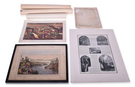
SoldWest Indies.- [Caribbean Islands]Arrowsmith (John) [Caribbean Islands],including the Windward and Leeward Islands, and Jamaica, by John Arrowsmith, and 2 of Antigua published by W. Phillips, mixed group of c.15 engraved maps,See Sold Price
SoldAmericas.- A mixed group of national and regionalAmericas.- A mixed group of national and regional maps and plansIncluding North American states, central America and the West Indies, Peru and Bolivia, engraved and lithograph maps some with oSee Sold Price
Sold(WEST INDIES.) Group of 20 engraved maps of th(WEST INDIES.) Group of 20 engraved maps of the West Indies or portions thereof, extracted from various British magazines, generally small sizes, but several larger, generally ample margins; conditionSee Sold Price
Sold(WEST INDIES.) Group of approximately 30 engra(WEST INDIES.) Group of approximately 30 engraved maps of the West Indies or parts thereof, on various size sheets small to large, variable margins; a few with color; condition varies greatly, the betSee Sold Price
SoldEurope.- a small mixed group of mapsEurope.- a small mixed group of maps,including 5 maps of Spain and Portugal, and maps of Greece, Sicily, and Corsica, by or after Vandermaelen, Tardieu, Alt, and others, engravings, some hand-See Sold Price
SoldA Small, Mixed Group Of Maps Of EuropeA Small, Mixed Group Of Maps Of Europe, including France (16), Russia (12), Spain (8), Sweden and Norway (8), and others, with several small world hemispheres (7), mostly lithographs, a few eSee Sold Price
Soldworld.- a small mixed group of mapsWorld.- a small mixed group of maps,including the British Isles, by Sebastian Munster, hand-coloured woodcut map, 80 x 130mm., mounted close, framed and glazed, c.1545 or later; 2 woodblock maSee Sold Price
Sold-. Sanson (Guillaume) - small mixed group of maps ofincluding the rare map Asia Minor in Epitomen Contracta, from Hellespont to Syria, including Cyprus and the Black Sea, decorative title cartouche above, architectural dedication vignette lower right,See Sold Price
SoldA small, mixed group of maps of IrelandIreland.- A small, mixed group of maps of Ireland, comprising 3 of Ireland, 2 of Howth Harbour, 1 of the road from Howth Harbour to Dublin, a road map of county Clare, Galway, Roscommon and MaSee Sold Price
Sold0 A small mixed group of maps0 A small mixed group of maps,including 2 from Thompson's New General Atlas, Austrian Dominions, and Corea and Japan, a Cary map of France, an 18th century map of Holland by Jean Lattré, and aSee Sold Price
A small, mixed group of maps of New ZealandA small, mixed group of maps of New Zealand,lithographs, from 200 x 180mm. to 490 x 600mm., various conditions, various publishers, including the House of Commons, the Journal Of The Royal GeSee Sold Price
SoldA small, mixed group of mapsA small, mixed group of maps,with regional and national maps of South America, Russia, and Africa, engraved maps, v.s., from 170 x 240mm to 350 x 540mm, occasional browning, spotting, surfaceSee Sold Price
SoldA small, mixed group of Maps Of ScandinaviaA small, mixed group of Maps Of Scandinavia, including a family tree of the Royal House of Denmark, and another of the Royal House of Sweden, engravings and lithographs, several hand-colouredSee Sold Price
SoldA small, mixed group of maps of RussiaRussia.- A small, mixed group of maps of Russia, including regional maps, several of Russia in Europe, one of the Kamtchatka Peninsula, and a Sketch map of the Districts of St Petersburg, andSee Sold Price
SoldA small, mixed group of maps of OceaniaOceania.- A small, mixed group of maps of Oceania, including New South Wales with an inset plan of Sydney, several of Polynesia and the Pacific Islands, by or for De La Rochette, Edward WellerSee Sold Price
A small, mixed, group of maps of EgyptEgypt.- a small, mixed, group of maps of Egypt,including Professor Long's map for the S.D.U.K., 3 maps of Egypt and Middle East after D'Anville for Rollin's Antient History, and 3 others, engrSee Sold Price
SoldA Small, Mixed Group of MapsSchenk (Petrus) Portugalliae et Algarve, Portugal with decorative title cartouche, engraved map with hand-colouring, 580 x 490mm., central horizontal fold, a small map of central Europe attachSee Sold Price
SoldSwitzerland.- - A small, mixed, group of maps and3 folding general maps, Carte de la Suisse, by Rodolphe Gross, 1852, Road Map of Switzerland, by Mullhaupt, 1856, and Keller's Second Road Map of Switzerland, 1859, engraved maps, the first named prinSee Sold Price
SoldA small, mixed, group of maps of Cumbria, WestmorA small, mixed, group of maps of Cumbria, Westmorland, Durham and Northumberland,including the Saxton/Kip maps of Cumbria and Westmorlandiæ, Drayton's Poly-Olbion map of Northumberland/The BiSee Sold Price
SoldA small, mixed group of mapsA small, mixed group of British Isles maps, including Barkshire, Buckinghamshire, Brittania Romana, and others, by various authors, including J. Speed, H. Moll, and others, engravings, v.s. fSee Sold Price
SoldA small, mixed group of mapsBritish Isles.- A small, mixed group of maps, of Europe, the Middle East, India, Russia, Brazil and the world, engravings, from 180 x 110 to 200 x 510mm., various conditions, mostly 19th centuSee Sold Price
Ancient Roman Imperial Coins - Unresearched - Mixed AE3/4 Coin Group [250+]TimeLine Auctions Ltd.4.5(183)See Sold PriceMar 09, 2024
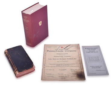
Mixed Group of Railroad Paper - 1895 Telegraph Registers, Art Prints, Profile Blueprint, Way-Bills,Rail & Road Auctions4.6(165)See Sold PriceMar 07, 2024
Assortment of Railroad Paper - Rule Books, Stationary, Ink Blotter, Map, Timetables, and MoreRail & Road Auctions4.6(165)See Sold PriceMar 07, 2024
Four Pennsylvania Railroad Paper Items - 1906 CT 1000 Manual, 1913 Percentages, 1949 CentennialRail & Road Auctions4.6(165)See Sold PriceMar 07, 2024
Group of Ten Railroad Photographs, Maps, and Prints - New Jersey, Long Island, and New YorkRail & Road Auctions4.6(165)See Sold PriceMar 07, 2024
Winifred Mason Modernist Metal Face BroochThe Benefit Shop Foundation Inc.4.3(2.9k)See Sold PriceMar 06, 2024
Carey, pub. 1796 - Map of KentuckyTrillium Antique Prints & Rare Books4.5(30)See Sold PriceFeb 24, 2024
Carey, pub. 1796 - Map of the Tennassee State formerly part of North Carolina (Tennessee)Trillium Antique Prints & Rare Books4.5(30)See Sold PriceFeb 24, 2024
Map of Part of the West Indies, Etc., Showing the Exact Position Of The U.S. War Steamer SanJasper524.5(9.8k)See Sold PriceFeb 27, 2024
West Indies. Rand, McNally & Co.'S Indexed Atlas Map of the West Indies.Jasper524.5(9.8k)See Sold PriceFeb 27, 2024
Geographical, Statistical, and Historical Map of the West Indies.Jasper524.5(9.8k)See Sold PriceFeb 27, 2024
OLD MAP of the West Indies/ Carta Esperica/ 1804Churchill Galleries3.7(213)See Sold PriceFeb 26, 2024
Cooke, George 1801 Antique Map. West Indies CaribbeanAlbion Auctions4.6(336)See Sold PriceMar 01, 2024
Mixed Group of Small Steiff - Mouse, Hedgehog, Pig and MoreAmanda Auction Gallery, LLC4.4(13)See Sold PriceMar 03, 2024
Framed Tropical West Indies Map PrintRapid Estate Liquidators and Auction Gallery4.5(1.1k)See Sold PriceFeb 26, 2024
A group of Southwest stone necklaces including Federico JimenezJohn Moran Auctioneers, Inc.4.7(453)See Sold PriceMar 12, 2024


![West Indies.- [Caribbean Islands] (1 of 1)](https://p1.liveauctioneers.com/410/16866/5605128_1_x.jpg?height=282&quality=70&version=1220278581)


![Ancient Roman Imperial Coins - Unresearched - Mixed AE3/4 Coin Group [250+] (1 of 1)](https://p1.liveauctioneers.com/1191/317894/170617375_1_x.jpg?height=282&quality=70&version=1706620797)