18th Century Hand-Colored Map - Cony, a Ftrong City ofVintage 18th Century Hand-Colored Map of Cony, a Ftrong City of Piedmont in the States of Savoy. Explaination key reads: The Castle, Bastions, Ravelins, Horn Work, Government Palace, Town House, PalacSee Sold Price
18th Century Hand-Colored Map - Cony, a Ftrong City ofVintage 18th Century Hand-Colored Map of Cony, a Ftrong City of Piedmont in the States of Savoy. Explaination key reads: The Castle, Bastions, Ravelins, Horn Work, Government Palace, Town House, PalacSee Sold Price
18th Century Hand-Colored Map - Cony, a Ftrong City ofVintage 18th Century Hand-Colored Map of Cony, a Ftrong City of Piedmont in the States of Savoy. Explaination key reads: The Castle, Bastions, Ravelins, Horn Work, Government Palace, Town House, PalacSee Sold Price
18th Century Hand-Colored Map - Cony, a Ftrong City ofVintage 18th Century Hand-Colored Map of Cony, a Ftrong City of Piedmont in the States of Savoy. Explaination key reads: The Castle, Bastions, Ravelins, Horn Work, Government Palace, Town House, PalacSee Sold Price
18th Century Hand-Colored Map - Cony, a Ftrong City ofVintage 18th Century Hand-Colored Map of Cony, a Ftrong City of Piedmont in the States of Savoy. Explaination key reads: The Castle, Bastions, Ravelins, Horn Work, Government Palace, Town House, PalacSee Sold Price
18th Century Hand-Colored Map - Cony, a Ftrong City ofVintage 18th Century Hand-Colored Map of Cony, a Ftrong City of Piedmont in the States of Savoy. Explaination key reads: The Castle, Bastions, Ravelins, Horn Work, Government Palace, Town House, PalacSee Sold Price
18th Century Hand-Colored Map - Cony, a Ftrong City ofVintage 18th Century Hand-Colored Map of Cony, a Ftrong City of Piedmont in the States of Savoy. Explaination key reads: The Castle, Bastions, Ravelins, Horn Work, Government Palace, Town House, PalacSee Sold Price
18th Century Hand-Colored Map - Cony, a Ftrong City ofVintage 18th Century Hand-Colored Map of Cony, a Ftrong City of Piedmont in the States of Savoy. Explaination key reads: The Castle, Bastions, Ravelins, Horn Work, Government Palace, Town House, PalacSee Sold Price
Sold1744 DATED MAP OF ST. PETERSBURG RUSSIAAN 18TH CENTURY HAND COLORED ENGRAVED MAP OF ST. PETERSBURG, TOBIAS CONRAD LOTTER (GERMAN 1717-1777), DATED 1744. Showing an overview of the city, and with legend in Latin and German. The upper left cSee Sold Price
Sold17th - 18th century Dutch city map of Delft. Hand17th - 18th century Dutch city map of Delft. Hand colored. Engraving on paper. Dimensions: H 44 x W 55 cm. In good condition.See Sold Price
SoldAN 18TH CENTURY HAND COLORED ENGRAVING, Louis XVAN 18TH CENTURY HAND COLORED ENGRAVING, Louis XVI Period. Attributed to Francois Antoine Filbert (1718-1780). A map of Lyon, France "the Capital city of the Province and the Governor General of the PrSee Sold Price
SoldMap of City and Harbour of MacauA Plan of the City and Harbour of Macao" engraved by B. Baker, Islington 27" x 20 1/2" (sight) hand-colored engraved map 18th century framed- 32 1/2" x 40See Sold Price
Sold2 Maps of US - 18th century1st item: AMERIQUE SEPTENTRION LE DIVISEE EN SES PRINCIPAUX ETATS; A PARIS CHEZ DELAMARCHE GEO. 1783. French engraved and handcolored map of North America, with major American cities noted. 7 3/4" x 1See Sold Price
5 - 17/18 C Etchings: Maps, Cities, Isfahan, ect.5 - 17th/18th Century Etchings of Maps, Cities, Battles: an Italian hand-colored folio map with center fold of the Island of Sardinia, "Isola Di Sardegna", A detailed view of Naghsh-e Jahan Square inSee Sold Price
SoldMAP OF BAVARIAMAP OF BAVARIA Fine antique hand-colored map, 19" x 21" (sight), likely dating from the late 18th-early19th century, showing the German province of Bavaria, from the cities of Wuzberg near upper leftSee Sold Price
SoldVarle Map of Philadelphia, 1796To the Citizens of Philadelphia this Plan of the City and its Environs... Charles P. Varle (18th century), Engraved by Robert Scot. Hand-colored engraving. Philadelphia: Varle, 1796. First State, SnydSee Sold Price
SoldLot of Three Maps1 by Isaac Basire, Plan of the City of Barcelona. Engraving. Framed.18th Century. Approx 14" H x 19" W w/o frame, 2" H x 26" W framed. Some creasing. 1 by Meilen, Map of Cadiz. Hand colored engraving.See Sold Price
Sold18th century Hand Tinted Map of StockholmCirca 1780. A Plan of the City of Stockholm. Engraved by Thomas Kitchen. Very nicely hand colored and well framed and matted. Sight size: H12" W10 3/4" Sold from the collection of a Southern lady.See Sold Price
18th Century Durnford Engraving of Havana CubaA View of the City of the Havana taken from the Road near Colonel Howe's Battery, published in 1765 by Thomas Jefferys, London. Engraved from a drawing by Elias Dunford. Expertly hand colored showingSee Sold Price
18th Century Durnford Engraving of Havana CubaA View of the Franciscan Church & Convent in the City of the Havana, published in 1765 by Thomas Jefferys, London. Engraved from a drawing by Elias Dunford. Expertly hand colored showing a church andSee Sold Price
18th Century Durnford Engraving of Havana CubaA View of the Harbour & City of the Havana taken from the Hill near the Road, published in 1765 by Thomas Jefferys, London. Engraved from a drawing by Elias Dunford. Expertly hand colored showing locaSee Sold Price
Sold18th Century Hand Colored Map18th Century Hand Colored Map, " Hertfordia Comitantys, Vernacule HertFordshire" - 14 3/4" x 19"See Sold Price
Sold18th Century Hand Colored Map, "Magellanica",Patagonia, image area 16" X 21" plus mat and frame.See Sold Price
Sold18th century hand colored map, titled "A New andAccurate Map of the Colony of Massachusetts Bay in North America from a Late Survey". Published in London, 1780, by John Hinton. Sight size 10 3/8" x 12 7/8". In a modern burlwood frame with multi-laySee Sold Price
Large collection of hand colored plates depicting costumes and fashion from various cultures aroundTremont Auctions4.6(293)See Sold PriceFeb 25, 2024
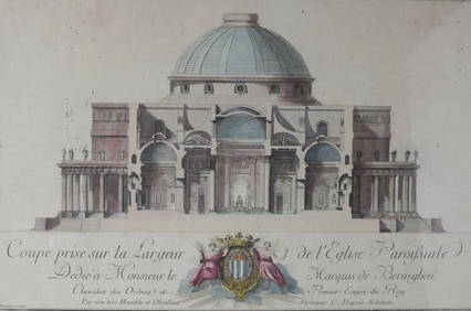
Charles Dupuis French 18th century, Pair Hand Colored Engravings, ArchitecturalGlobal Auctions Company4.3(36)See Sold PriceMar 03, 2024
An early Dutch hand colored engraving map by Georg Balthasar Probst (1732-1801)Ostantix Auctions4.4(10)See Sold PriceFeb 27, 2024
Hand Colored Map of the city of Amsterdam 1720Global Auctions Company4.3(36)See Sold PriceMar 03, 2024
17th Century Hand Colored Engraved Map of GermanyGlobal Auctions Company4.3(36)See Sold PriceMar 03, 2024
18th Century Hess Germany Hand colored Engraved MapGlobal Auctions Company4.3(36)See Sold PriceMar 03, 2024
[MAPS]. DUFOUR, Auguste-Henri (1795-1865). Bound Volume of ...Potter & Potter Auctions4.6(539)See Sold PriceMar 07, 2024
Johann Homann Hand-Colored Map Engraving, c. 1730Auctions at Showplace4.5(726)See Sold PriceMar 17, 2024
Willem Blaeu, Etc. 17th C. Antiquarian Maps, 2Auctions at Showplace4.5(726)See Sold PriceMar 17, 2024
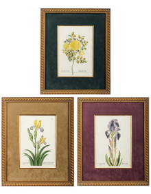
Georg Wolfgang Knorr (German, 1705-1761), Three Antique Hand Colored Botanical Engravings ofHoch LTD.4.5(73)See Sold PriceFeb 25, 2024
Mitchell - Map of the City of Washington (Washington, DC)Trillium Antique Prints & Rare Books4.5(30)See Sold PriceFeb 24, 2024
Pair of Hand Colored Heraldic EngravingsBroken Arch Auction Gallery NCFL#93994.6(294)See Sold PriceMar 04, 2024
La Nubia ed Abissinia. Red Sea Ethiopia Sudan Eritrea Arabia. ZATTA 1785 mapJasper524.5(9.8k)See Sold PriceFeb 28, 2024
Two Hand-Colored 19th Century Maps of New Orleans and Louisiana, Larger- H.- 12 1/2 in., W.- 15 1/2Crescent City Auction Gallery4.3(229)See Sold PriceMar 08, 2024
18th Century Hand Colored Engraving. "Minnebroeders Klooster"Clark's Auction Company4.6(433)See Sold PriceMar 03, 2024
Rare 19thc Colton Map, Argentine Republic, Chile, Uruguay, PataguayConnoisseur Auctions4(333)See Sold PriceMar 16, 2024
John Hinton "The Tamarind" Hand-Colored EngravingAuctions at Showplace4.5(726)See Sold PriceApr 16, 2024
Galliae Regionis Nova Descriptio Hand Colored Map of France on Laid Paper, Ca. 16th Century, H 10" WDuMouchelles4.6(825)See Sold PriceMar 15, 2024


![[MAPS]. DUFOUR, Auguste-Henri (1795-1865). Bound Volume of ... (1 of 2)](https://p1.liveauctioneers.com/928/318880/171361279_1_x.jpg?height=282&quality=70&version=1707501302)