SoldGrouping of 3 Early Hand Colored Engraved MapsGrouping of three early hand colored engraved maps, to include: Abraham Ortelius (Belgian 1528-1598), "Insularum Aliquot Maris Mediterranes Descripto," islands of Sicily, Malta, Sardinia, Cerfu, Elba,See Sold Price
SoldLot of 2 Early Hand Colored Engraved MapsLot of two early hand colored engraved maps, to include: "Andegaver Sium Ditionis Vera et Integra Descripto," dated 1579, map of Anjou, France, 13 3/4" h x 18 3/8" w (view), 19" h x 23 5/8" w (frame)See Sold Price
Three Framed Early Hand-colored Engraved Maps DepThree Framed Early Hand-colored Engraved Maps Depicting Great Britain, Annandiae Praefectura, sight size 18 1/2 x 22 3/4; Huntington Shire, sight size 19 x 23 1/4; and Nithia Vicecomitatvs,See Sold Price
SoldSchenk, map of Transylvania, c.1700s[Transylvania]. Pieter Schenk. Nova Et Accurata Transylvaniae Descriptio. c.1690s - early 1700s. Double-page engraved map. 15 3/8 x 19 3/4 in. Early hand-colored outline, both cartouches colored.See Sold Price
Braun (Georg and Franz Hogenberg). EngravingBraun (Georg and Franz Hogenberg). Early Hand-Colored Engraved Town Plan Of Alexandria . From Civitates Orbis Terrarum. [Cologne], [1572 or later]. Measures 15-3/4" H x 20" W (sight), frame measures 2See Sold Price
SoldBraun (Georg and Franz Hogenberg). Early Hand-ColoredBraun (Georg and Franz Hogenberg). Early Hand-Colored Engraved Town Plan Of Alexandria . From Civitates Orbis Terrarum. [Cologne], [1572 or later]. Toning from age, creases, tears. Measures 15-3/4" xSee Sold Price
SoldMap grouping by Jodocus HondiusGrouping of 4-small maps by Jodocus Hondius including; map of the world, Africa, Sicily and Crete. Maps are hand-colored and measure 3.5" x 5" and are framed. c.late 16th early 17th century. $300-400See Sold Price
SoldLOT (3) HANDCOLORED ENGRAVED MAPSLOT (3) HANDCOLORED ENGRAVED MAPS INCLUDING BOHEMIA AND MORAVIA (1801), TURKEY/EUROPE, (1801) AND ENGLAND (1811), JOHN CAREY. PLATES 20 1/2 X 23"See Sold Price
SoldEarly MapsLot (3) early hand colored maps. Includes "PORTUS PULCHRI..", (10" x 11 3/4"), "CARTE DE L 'ISLE DE / LA JAMAIQUE....1758", (10" x 14"), and "CARTAGENA in Terra firma", (10" x 11 3/4").See Sold Price
SoldTwo Early Framed Engraved MapsA lot of two early hand-colored engraved maps to include a W. J. Bleau map of Amsterdam, ca. 1634-1635, "Sabaudia Ducatus Savoye", together with a John Speed map of Britain, ca. 1611-1614, "DevonshireSee Sold Price
Sold3 pieces. Hand-Colored Engraved Maps - America: J3 pieces. Hand-Colored Engraved Maps - America: Janvier, Robert. L'Amerique Divisee par Grandes Etats." Paris, 1783. 12 3/8 x 17 7/8 inches; 314 x 454 mm, full margins. Light to moderate foxing. Orig.See Sold Price
Sold2 Early French Hand Colored Engraved Maps2 Early French Hand Colored Engraved Maps. 1) Canada IIe. Feuille, Plate No. XXXV, B 32. Detailed map of eastern Canada, US and Louisiana territory, c.1776; has a vertical crease through the center. SSee Sold Price
SoldMaps, Africa, Americas, and Jesus Christ..(lot of 3) Hand-colored copper engraved maps, "Carte de l'Afrique," 1827 and "Carte des deux Ameriques," 1829, for Herisson Geographe, published in Paris chez Jean, rue St. Jean de Beauvais No. 10, anSee Sold Price
SoldJohnson: Antique Map of Globular World, 1868Title/Content of Map: Globular World Date Printed: 1868 Cartographer: A.J. Johnson Material/Medium: Paper Size: 18" x 23 3/4" Hand colored engraved Map. From Johnson's Illustrated Family Atlas of theSee Sold Price
SoldMitchell: Antique Map of Kentucky & Tennesse, 1869Title/Content of Map: Kentucky & Tennesse by Mitchell Date Printed: 1869 Cartographer: Augustus S. Mitchell Material/Medium: Paper Size: 15 1/3" x 12 1/3" Hand colored steel engraved Map. Published inSee Sold Price
SoldIssak Tirion (Dutch, 1705-1765) MapIssak Tirion (Dutch, 1705-1765), "Grondvlakte van Nieuw Orleans, de Hoosdstad van Louisiana...", Amsterdam, 1767, 3 hand-colored copper-engraved maps on one sheet, 13 in. x 17 5/8 in., unframed. (3 pcSee Sold Price
Sold(NEW YORK.) Group of 3 hand-colored engraved pocket(NEW YORK.) Group of 3 hand-colored engraved pocket maps. Vp, vd Burr, D.H. State of New York. 13x15½ inches overall; a few closed splits along fold lines; publisher's cloth case with gilt moroccSee Sold Price
Sold3 ANTIQUE HAND COLORED COPPER ENGRAVED MAPSA collection of three antique hand colored copper engraved maps. Ht: 20.75" Wd: 25.75" (largest, framed)See Sold Price
Lot of 17 Early 19th C. Hand Colored Engraved MapsLot of seventeen early 19th century hand colored engraved maps, to include: Asia, Daenenmark, Das Konigreich Polen, Ungarn, Schweden und Norwegen, Denmark, Portugal, and various counties of England, aSee Sold Price
Sold3 Hand-Colored Engraved New England Maps3 hand-colored engraved New England maps including the states of Rhode Island, Vermont and New Hampshire. "Lon E. from Philada" on lower margin of all three. All most likely engraved by Joseph T. ScotSee Sold Price
SoldLOT (3) INCLUDING HAND COLORED COPPER ENGRAVED MAPLOT (3) INCLUDING HAND COLORED COPPER ENGRAVED MAP, JOHN SPEEDE, A COAT OF ARMS AND A MAP OF WESTPHALIA, 17/18TH CENTURYSee Sold Price
SoldMitchell: Antique Map of Pacific Ocean Islands, 1869Title/Content of Map: Pacific Ocean Islands with Australia Date Printed: 1869 Cartographer: Augustus S. Mitchell Material/Medium: Paper Size: 15 1/3" x 12" Hand colored engraved Map. Published in PhilSee Sold Price
SoldMitchell: Antique Map of Philadelphia, 1869Title/Content of Map: Philadelphia by Mitchell Date Printed: 1869 Cartographer: Augustus S. Mitchell Material/Medium: Paper Size: 15 1/3" x 12 1/3" Condition: Excellent Hand colored engraved Map. PublSee Sold Price
SoldAntique French Map of St. AugustineAntique French Map of St. Augustine, "Plan de la Ville et Port de St. Augustin", late 18th/early 19th c., hand-colored engraved map, sight 8 1/2 in. x 12 in., framed. Provenance: Estate of Faith K. TiSee Sold Price
VENET / DEBUCOURT (1755-1832) Set 3 x Aquatint Engraved Hunting Scenes 23" x 16"Luis Porretta Fine Arts4.3(10)See Sold PriceMar 02, 2024
An early Dutch hand colored engraving map by Georg Balthasar Probst (1732-1801)Ostantix Auctions4.4(11)See Sold PriceFeb 27, 2024
17th Century Hand Colored Engraved Map of GermanyGlobal Auctions Company4.3(36)See Sold PriceMar 03, 2024
18th Century Hess Germany Hand colored Engraved MapGlobal Auctions Company4.3(36)See Sold PriceMar 03, 2024
Hand Colored Engraved Map of Europe, Jean Baptiste Bourguignon Anville 1754Global Auctions Company4.3(36)See Sold PriceMar 03, 2024
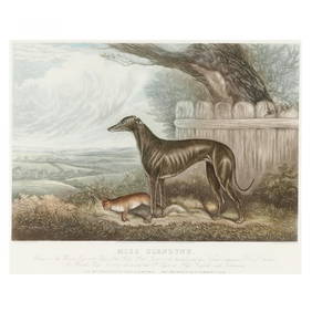
after Sydney R. Wombill (English, Late 19th/Early 20th century), Miss GlendyneLeland Little4.5(701)See Sold PriceFeb 29, 2024