SoldPair of 1869 New York City Political MapsTwo maps of New York City. One of Wards & Senate districts circa 1869 and the other showing political divisions & subdivisions. Frames: 40" x 10 7/8" image sight: 38" x 8.75"See Sold Price
SoldDripps' Pocket Map of New York City, 1869Dripps' Pocket Map of New York City, 1869, "Map of the City of New York", published by M. Dripps, 103 Fulton Str., N.Y., 1869, enclosed in cloth covered boards, shows Central Park, Blackwell's IslandSee Sold Price
SoldPair of Antique Framed Hand-Colored NYC MapsPair of antique framed hand-colored New York City maps. From a Greenwich, CT collector, very good antique condition.See Sold Price
SoldMitchell: Antique Map of New York City, 1869Title/Content of Map: New York City by Mitchell Date Printed: 1869 Cartographer: Augustus S. Mitchell Material/Medium: Paper Size: 23" x 15" Condition: Excellent Hand colored engraved Map. Published iSee Sold Price
SoldAntique Map Lithographs New York City, World MapPair Antique Hand Colored Map Lithographs of New York City, and a World Map. Unframed 18 inches x 23 inchesSee Sold Price
Rare Antique Classroom Pull Down Map RackLate 19th -Early 20th Century.Denoyer - Geppert Co. Chicago.1) Third and Last Algonkin Period Map.2)New Netherland Map.3)Political and Conservation Map.4)Formation Of The State(New York) Map.5)City GoSee Sold Price
Bishop: Antique City Plan of Brooklyn, 1869Map: 1869 Bishop Map of Brooklyn -- Map of the City of Brooklyn Cartographer: A Brown for W G Bishop Year / Place: 1869, New York City Dimensions: 17.5 x 22.6 in. Condition: Very good. Slight toning,See Sold Price
Bishop: Map of Brooklyn, 1869Map: 1869 Bishop Map of Brooklyn -- Map of the City of Brooklyn Cartographer: A Brown for W G Bishop Year / Place: 1869, New York City Map Dimensions: 17.5 x 22.6 in. Condition: Very good. Slight toniSee Sold Price
SoldBishop: Antique Map of Brooklyn, 1869Map: 1869 Bishop Map of Brooklyn -- Map of the City of Brooklyn Cartographer: A Brown for W G Bishop Year / Place: 1869, New York City Map Dimensions: 17.5 x 22.6 in. Condition: Very good. Slight toniSee Sold Price
SoldThree 19th Century Maps of New YorkGroup Lot of 3 New York Maps 1. Map of the City of New York, 1852. D. T. Valentine (1801 - 1869). New York: Hayward, 1852. Lithograph. Dimensions. 2. Plan of the City of New-York, drawn by Major HollaSee Sold Price
SoldS. H. Elliot "The Attractions of New Haven Connecticut"Samuel Hayes Elliot (1809-1869), "The Attractions of New Haven, Connecticut; A Guide to the City with Map and Illustrations," New York: N. Tibbals & Co., 1869. With map of the city of New HaSee Sold Price
SoldHardy: Map of New York City, 1870Map: 1870 Hardy Map of New York City -- Map of the City of New York, Showing its Political Divisions and Subdivisions November 1870 Cartographer: J. Hardy Year / Place: 1870 New York City Map DimensioSee Sold Price
1870 Hardy Map of New York City1870 Hardy Map of New York City -- Map of the City of New York, Showing its Political Divisions and Subdivisions November 1870. J. Hardy, 1870 New York City, This large colorful map of New York City��See Sold Price
SoldMap of the Country Thirty Three Miles Around the CityG.W. & C.B. Colton & Co. lithograph. New York: G.W. & C.B. Colton & Co., 1869. 24 7/8 x 23 3/4 inches, 34 1/4 x 34 1/8 inches framed. An unusual circular representation of New York City and its enviroSee Sold Price
1855 New-York City & County Map with Vicinity entireBy: Charles MagnusDate: 1855 (published) New York, NYDimensions: 19.5 x 32.5 inches ( 49.5 x 82.5 cm)A scarce city map of New York and the surrounding boroughs produced at the middle of the 19th centuSee Sold Price
SoldTheodore Roosevelt NEW YORK 1891 First Printing GiltTheodore Roosevelt NEW YORK 1891 First Printing Gilt Fold‐Out Maps Color Map Historic Towns Series New York City History Settlement New Amsterdam Colonial Period Revolution War Population CoSee Sold Price
SoldManual of the Corporation of New York 1869Title: Manual of the Corporation of the City of New York Author: Shannon, Joseph Description: xvi. 896 pp. Profusely illustrated with engraved portraits, folding maps, lithograph views, etc. (8vo) 8�See Sold Price
SoldGrimm Map of New YorkA plan of the city and environs of New York : as they were in the years 1742-1743 and 1744... D. T. Valentine (1801 - 1869), After David Grimm. From the Manual of Corporation of the City of New York,See Sold Price
SoldJames Hardie THE DESCRIPTION OF THE CITY OF NEW-YORKJames Hardie THE DESCRIPTION OF THE CITY OF NEW-YORK 1827 Leatherbound Hand-Colored Fold-Out Map S Marks Discovery of America Dutch Colony Negro Plot Sir Charles Hardie Evacuation British Census PubliSee Sold Price
Sold* [ARCTIC EXPLORATION]. A group of 5 works, comprising:* [ARCTIC EXPLORATION]. A group of 5 works, comprising: FIALA, Anthony (1869-1950). Fighting the Polar Ice. New York: Doubleday, Page, 1907. 8vo. Folding color map, numerous plates (most in color). SeSee Sold Price
SoldThomas Jefferson Notes on Virginia 1801 Map 3rd EdNotes of the State of Virginia with appendix by Thomas Jefferson, 3rd American Edition New York, printed by M.L. & W.A. Davis for Furman & Loudon, opposite the City Hall 1801, with map of Virginia. PrSee Sold Price
Sold1853 1ed New York City MAPS American INDIANS Revolutionary WAR Valentine1853 1ed New York City MAPS American INDIANS Revolutionary WAR Valentine David Valentines “History of the City of New York” is a rare and complete history of New York from the earliest timSee Sold Price
Sold1865 Colton New York City Map1865 Colton New York City Map -- New York City Brooklyn, Jersey City, Hoboken, Etc. C. B. Colton 1865 New York 24 x 17 in. This nice map of New York City, including Manhattan, Brooklyn, Jersey City anSee Sold Price
Sold(3) OLD NEW YORK CITY MAPS, VALENTINE'S MANUALIncluding "Old New York, The Bouwery," 1862. Dimensions: (Largest) H 16.75'" x W 20.5" Conditions: Removed from books, folds, edge damages, toning.See Sold Price
Erie Railway Tourist Book/Magazine-1874JM Hobby Supply and Railroad Artifact Auctions4.4(126)See Sold PriceFeb 24, 2024
Louis XVI Style Mounted Marble Covered Urns, PairAuctions at Showplace4.5(726)See Sold PriceMar 03, 2024
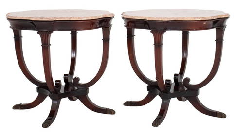
Victorian Style Belgian Marble Top Tables, PairAuctions at Showplace4.5(726)See Sold PriceMar 03, 2024
George Hayward - Map of the City of New York 1854Dane Fine Art Auctions4.4(494)See Sold PriceMar 07, 2024
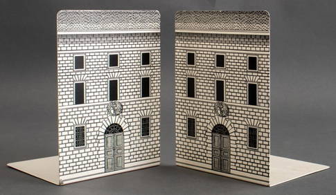
Pair of The Gateway to a Continent Books - Grand Central Zone and 1939 World's FairRail & Road Auctions4.6(165)See Sold PriceMar 07, 2024
1855 Map of New York & Erie Railroad and 1917 Trespassing On Railway Property Is A MisdemeanorRail & Road Auctions4.6(165)See Sold PriceMar 07, 2024
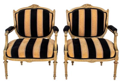
Verzelloni "Zoe" Yellow Fabric Armchairs, PairAuctions at Showplace4.5(726)See Sold PriceMar 17, 2024
Franz Hagenauer Brass Schnauzer Bookends, PairAuctions at Showplace4.5(726)See Sold PriceMar 17, 2024
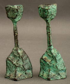
Graff, Washbourne and Dunn, Candlesticks, pairToomey & Co. Auctioneers4.7(390)See Sold PriceFeb 29, 2024
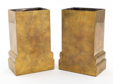
Josef Hoffmann Wiener Werkstatte Brass Vases, PairAuctions at Showplace4.5(726)See Sold PriceApr 07, 2024
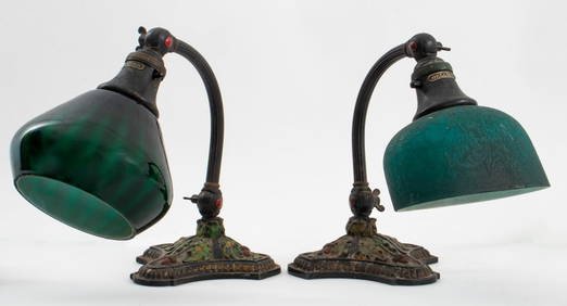
H.G. McFaddin Bellova Acorn and Oak Lamps, PairAuctions at Showplace4.5(726)See Sold PriceApr 07, 2024
Black and white map of part of New York City (mostly Manhattan)Proverde Auctions4.3(3)See Sold PriceFeb 28, 2024
Laminated Unique Media New York City MapRapid Estate Liquidators and Auction Gallery4.5(1.1k)See Sold PriceFeb 29, 2024


![* [ARCTIC EXPLORATION]. A group of 5 works, comprising: (1 of 1)](https://p1.liveauctioneers.com/197/136865/69466281_1_x.jpg?height=282&quality=70&version=1550699608)