Sold2 Maps of Europe, EngravingsLot of two hand colored maps of Europe, engraved, each 16 5/8" h x 23" w (view), 18 5/8" h x 25" w (frame). Provenance: MA estate.See Sold Price
2 Maps of Europe, EngravingsLot of two hand colored maps of Europe, engraved, each 16 5/8" h x 23" w (view), 18 5/8" h x 25" w (frame). Provenance: MA estate.See Sold Price
Sold3 Items: 2 maps (Senex, Bleau) + 1 navy battle.[Europe] 3 Engravings. ++ PICARDIA REGIO BELGICA, Auctore Joanne Surhonio. “Amsterdami/ Bleau.” Probably from “Nieuwe Atlas,” [c. 1642-43.] Hand-colored outline, scale, shield, and cartouche.See Sold Price
Sold10 engravings, mostly maps: Britain, Europe.[Britain/Europe] 10 engravings. 9 have full or outline hand coloring. ++ 2 Maps on 1 sheet: A New Map Of...….Northamptonshire…, ...Cambridgeshire…, ...Drawn From The Latest Authorities. Lon: AleSee Sold Price
Sold2) STIELER & MITCHELL MAPS EUROPE, TURKEY & GREECE(lot of 2) Framed maps, including: (1) engraving with hand coloring on paper, German map of Europe, Turkey, Greece, and the Ionian Islands, from "Stielers Schul-Atlas," published by Justus Perthes, GoSee Sold Price
Sold[Europe/Scythia]. 2 Maps.[Europe/Scythia]. 2 Maps. Each double-page engraving, Latin text on verso. ++ Blaeu [after]. Limovicum [with] Topographia Limaniae. [c1640]. 15 x 20 with wide margins. Toned with minor spotting, uncolSee Sold Price
SoldLot of Two Engraved and Colored MapsLot of two engraved and colored maps, "Provinces Unies Des Pays Bas", 17" h x 21 1/2" w (sight), "Map of Europe" dated 1853, 15 1/4" h x 19 3/4" w (sight), largest frame 22" h x 27" w. Provenance: FroSee Sold Price
SoldEuropaHendrick Hondius (1573–1650). Amsterdam: Hondius, 1631 (30 x 33 1/2 inches). A Splendid Map of Europe from the Golden Age of Dutch CartographySee Sold Price
Isaak Tirion, Dutch (1705-1765) Two (2) Circa 1755 HandIsaak Tirion, Dutch (1705-1765) Two (2) Circa 1755 Hand Colored Copper Engraving Maps, "Scotland" and "Europe, Africa and Asia" (2 works). Signed Within Plate. Toning Otherwise Good Condition. MeasureSee Sold Price
Pieter van der Aa map of Europe Leiden (1659-1733)Pieter van der Aa map of Europe Leiden (1659-1733) "Europa" engraving. (Good condition, trimmed) paper size: H23 1/4" W30 1/2"See Sold Price
AMOS DOOLITTLE ENGRAVING OF EUROPEAMOS DOOLITTLE ENGRAVING OF EUROPE Engraved map of Europe, 9 3/4" x 8 1/2", executed by American engraver AMOS DOOLITTLE (1754-1832), and marked: "Engraved by A. Doolittle N.E.", and also: "PublishedSee Sold Price
Sold(2) HAND-COLORED GERMANIC MAPS, NUREMBERG(lot of 2) Framed hand-colored engravings on paper, maps of Central Europe, including: (1) "Tabula Geographica: Principatus Gotha, Coburg et Altenburg," Johann Baptist Homann (1663-1724), Nuremberg, sSee Sold Price
Ortelius, Map of EuropeEuropae. Abraham Ortelius (1527-1598). Engraving with original hand color in full. Antwerp, 1595. 16 1/2 x 21 inches sheet. This important map of Europe derives in large part from Mercator’s work; RSee Sold Price
SoldNine Antique Maps of EuropeNine Antique Maps of Europe , 17th c., by Mercator and Jansson, hand-colored engravings, sheets 19 1/2 in. x 23 in Provenance: Property deaccessioned from the Louisiana State Museum, proceeds to be usSee Sold Price
De Jode Map of EuropeDe Jode, Gerard (1509-1591). Nova Totius Europae Tabula... Engraved map. Antwerp c. 1578, from Speculum Orbis Terrae. 16 3/4" x 22 1/2" sheet, 28 1/2" x 33 3/4" framed.See Sold Price
De Jode Map of Europe*** START PRICE IS THE RESERVE *** [Europe] DE JODE, Gerard (1509-1591). Nova Totius Europae Tabula... Engraved Map. Antwerp, c. 1578 from Speculum Orbis Terrae. 16 3/4" x 22 1/2" sheet, 28 1/2" x 33See Sold Price
MAPS, Central Europe, SansonCentral Europe. N. Sanson/Mariette, [Lot of 2] Partie Septentrionale du Royme de Hongrie Tiree de Divers Autheurs [and] Partie Meridionale de Rme. de Hongrie Tiree de Divers Autheurs, 1664 (dated). HaSee Sold Price
SoldMap of Europe by Allen Bell, 1837Original engraving of Europe by Allen Bell & Company, London 1837. Dimensions: 18 1/2” x 14”See Sold Price
SoldEurope Antique MapEurope. Map by Victor Levasseur. From Atlas National Illustree. Paris: mid 19th Century. Engraving, outline color. Pictorial borders. 14 1/4" x 20 1/2".See Sold Price
SoldEuropae (from Novus Atlas)Henricus Hondius. copperplate engraving with very fine original handcoloring. Amsterdam, 1631. 18 1/4 x 22 1/4 inches, 29 1/2 x 33 3/4 inches framed. A Splendid Map of Europe from the Golden Age of DuSee Sold Price
Sold4 Maps: Luxemburg, etc. 2 hand colored. Ca. 18th[EUROPE]. 4 Maps. Good - very good condition, defects noted below. All but one is double-page engravings (3 hand-colored). ++ Danckerts. Ducatus Lutzenburgi Nova et Accurata Tabula cum Adjacentibus PrSee Sold Price
Dudley Map of Northern EuropeCarta Particolare della costa di nuoua Zembla. Robert Dudley (1574-1649). Copperplate engraving. Florence, 1648. 21 x 31 1/2 inches sheetSee Sold Price
Early Map Russia In EuropeEarly Map of Russia in Europe Up to Arctic Circle Maker: Samuel Walker - Boston Dated: Circa 1830's - 40's Type: Engraving DSee Sold Price
MAPS, Russia in Europe, DelisleRussia in Europe. Delisle/Covens & Mortier, [On 2 Sheets] Carte de Moscovie Dressee par Guillaume de l'Isle de l'Academie Royale des Sciences a son Excellence Monseigneur Andre Artemonides de Matueof�See Sold Price
MARTINET / DE VRIES Catechism of Nature 4 Vol. Set c1788 Engravings Rare!Luis Porretta Fine Arts4.3(10)See Sold PriceMar 02, 2024
JOHANNES GRABE c1707 Hebrew Septuagint Alexandrian Codis 2 x VolumesLuis Porretta Fine Arts4.3(10)See Sold PriceMar 02, 2024
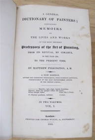
MATTHEW PILKINGTON General Dictionary Painters 2 Vol Set 1824 Calf BindingLuis Porretta Fine Arts4.3(10)See Sold PriceMar 02, 2024
DUNLEVIE c1856 Map Counties Of Gaspe & Bonaventure Quebec Canada SCARCE! #2Luis Porretta Fine Arts4.3(10)See Sold PriceMar 02, 2024
The First World War A Photographic History 1933. 1st EditionNorth American Artifact Auctions4.6(182)See Sold PriceApr 20, 2024
Willem Blaeu, Etc. 17th C. Antiquarian Maps, 2Auctions at Showplace4.5(726)See Sold PriceMar 17, 2024
Hand Colored Engraved Map of Europe, Jean Baptiste Bourguignon Anville 1754Global Auctions Company4.3(36)See Sold PriceMar 03, 2024
Two (2) Antique 18th C. Copper Engraved Framed Maps - America & EuropeMagnusson Art Group4.5(46)See Sold PriceMar 14, 2024
1816 MAP SOUTHERN PART OF RUSSIA or MUSCOVY in EUROPE copper engraving ANTIQUEJasper524.5(9.8k)See Sold PriceFeb 27, 2024
1816 MAP NORTHERN PART OF RUSSIA or MUSCOVY in EUROPE copper engraving ANTIQUEJasper524.5(9.8k)See Sold PriceFeb 27, 2024
Medicine.- Kennedy (James) The History of the Contagious Cholera, first edition, 1831 & others (11)Forum Auctions4.3(52)See Sold PriceFeb 29, 2024


![[Europe/Scythia]. 2 Maps. (1 of 2)](https://p1.liveauctioneers.com/179/1435/617489_1_x.jpg?height=282&quality=70)