Britannia Map, Robert de Vaugondy, 1750Framed hand-colored map of Britannia, by Nicolao Sanson and Robert de Vaugondy, dated 1750. Latin: Britannicae, Insula. Measures 20.75" x 22.5". Framed and matted measurement 30.25" x 31.5".See Sold Price
SoldAmerique Septentrionale.Amerique Septentrionale. Hand-colored engraved map by Robert de Vaugondy, 1750 18.75" x 23" Frame: 29" x 33.75"See Sold Price
Sold3 Maps: Robert de Vaugondy, [ca. 1750's].[Europe/Italy/Scandanavia]. 3 Maps by Robert de Vaugondy, [ca. 1750’s]. Upper & lower margins narrow (approximating 1 map's lower plate mark, but other plate marks are unaffected). Very good. ++ LESSee Sold Price
SoldMap of Spain, Robert de VaugondyHispania Antiqua map of Spain. Robert de Vaugondy, 1750. [Sight: 19 1/4" x 22 1/2"; Frame: 25 1/2" H x 29" W]. Frame missing glass. Creases and water damage.See Sold Price
SoldMap of Spain, Robert de VaugondyHispania Antiqua map of Spain. Robert de Vaugondy, 1750. [Sight: 19 1/4" x 22 1/2"; Frame: 25 1/2" H x 29" W]. Frame missing glass. Creases and water damage.See Sold Price
Royaume de Danemarck… Denmark & Southern Sweden. ROBERT DE VAUGONDY 1750 mapTITLE OF MAP (NOT PRINTED ON THE PAGE):'Royaume de Danemarck, qui comprend le Nort-Jutland divisé en fes quatre Dioceses, le Sud-Jutland divisé en ses deux Duchés, de Sleswick et de HolSee Sold Price
Map of Asia. Robert de Vaugondy. Paris, c. 1750.Map of Asia. Asie par le Sr. Robert de Vaugondy avec Privileg. By Robert de Vaugondy. C. 1750. "No. 1" in the upper right corner. 15.5x15.5 cm. French. Very fine condition. Thin, quality paper. NarrowSee Sold Price
SoldTWIN HEMISPHERE MAP OF THE WORLD 1750Twin hemisphere map of the world by Robert de Vaugondy, 1750. 6.25 x 11.5 inches, plus matting.See Sold Price
SoldMap- Robert de Vaugondy (1723-1786). "AmeriqueMap- Robert de Vaugondy (1723-1786). "Amerique Septentrionale," 1750, hand colored, with a cartouche of Tropical plants, natives and wildlife surrounding the title, shrink wrapped, H.- 21 3/8 in., W.-See Sold Price
1750 Robert de Vaugondy Map of Majority of RussianTitle: 1750 Robert de Vaugondy Map of Majority of Russian Empire -- Partie Occidentale de l'Empire de Russie, ou se Trouve Distinguee la Russie Europeenne… Cartographer: D Robert de Vaugondy Year /See Sold Price
Amérique Méridionale. South America. ROBERT DE VAUGONDY 1750 old antique mapTITLE OF MAP (NOT PRINTED ON THE PAGE):'Amérique Méridionale, dressée, sur les Mémoires les plus récents et assujétie aux observations astronomique. Par le Sr. Robert deSee Sold Price
1750 Robert de Vaugondy Map of Majority of RussianTitle: 1750 Robert de Vaugondy Map of Majority of Russian Empire -- Partie Occidentale de l'Empire de Russie, ou se Trouve Distinguee la Russie Europeenne… Cartographer: D Robert de Vaugondy Year /See Sold Price
LARGE 18TH C MAP OF RUSSIAA FINE 18TH CENTURY MAP OF RUSSIA, 1750, ROBERT DE VAUGONDY. Partie Occidentale DE L'EMPIRE DE RUSSIE A finely engraved map with large title cartouche upper left dated 1750, original hand-colorinSee Sold Price
SoldMap, Robert de VaugondyRobert de Vaugondy (French, 1688-1766), "Royaume d'Irlande divise en ses quatre Provinces," 1750, hand-colored engraving, sight (image): 19.5"h x 21.5"w, overall (with frame): 27"h x 29"w. Provenance:See Sold Price
Sold18th Century Map of Great Britain"[Brittanicae, Insulae in quibis Albion Seu Brittania Major, et Ivernia Seu Brittania Minor…,]" by Nicholas Sanson, engraved by Robert De Vaugondy, 1750, copper engraving hand colored in outline, "6See Sold Price
Sold4 Dbl-page Maps: 2 Israel + ARRAGONIA REGNUM + 1 other.[Israel/Mideast/France] 4 Maps. Double-page. ++ LA JUDEE OU TERRE SAINTE. Robert [de Vaugondy], 1750. Large inset: Carte de la Terre de Canaan. Orig hand-colored outline, scale uncolored. 19” x 23��See Sold Price
2 Maps incl: LA JUDEE OU TERRE SAINTE. 1750.[Middle East/Israel] 2 Maps. ++ LA JUDEE OU TERRE SAINTE, divisee en ses douze Tribus. Robert [de Vaugondy], 1750. Large inset: Carte de la Terre de Canaan. Orig hand-colored outline, scale uncolored.See Sold Price
Robert de Vaugondy: Map of Poland With Privilege 1750Original title: Pologne par le Sr. Robert de Vaugondy. Avec Privilege 1750 Cartographer: Gilles Robert de Vaugondy 6 x 6.5 inches. Hand colored. Dated 1750 on the title, this version was published inSee Sold Price
Sold4 Maps: 1760 N. Am.; Botanic Geo.; Eur.; OK Terr.Four Antique Maps; a French 1760 Map of North American ''AMÉRIQUE SEPTENTRIONALE...1750'' Paris: S. Robert De Vaugondy, c. 1750 (1st edition, dated in the cartouche; "Outlines of Botanical Geography"See Sold Price
Robert de Vaugondy: Map of Poland With Privilege 1750Original title: Pologne par le Sr. Robert de Vaugondy. Avec Privilege 1750 Cartographer: Gilles Robert de Vaugondy 6 x 6.5 inches. Hand colored. Dated 1750 on the title, this version was published inSee Sold Price
Sold.Royaumes D'Espagne et De Portugal,, MapFine 18th Century Map.Royaumes D'Espagne et De Portugal, Sir Robert de Vaugondy c. 1750.Copperplate engraving with hand coloring. Sight 19 1/2" x 23 1/2", framed.See Sold Price
SoldMap by Robert de Vaugondy Britainafter Robert de Vaugondy- ''Britannicae Insulae''- hand-colored engraving, 1750, paper age toned, edges rough, stains in margins. 19 x 21''See Sold Price
SoldMap, Gilles Robert de VaugondyGilles Robert de Vaugondy (French, 1688-1766), "L'Empire du Japon, Divise en Sept Principales Parties," 1750, hand-colored engraving, image (sight): 18.75"h x 21"w, overall (with mat/unframed): 26.75"See Sold Price
Sold(MAP) VAUGONDY, ROBERT DE. Amerique Septentrionale.(MAP) VAUGONDY, ROBERT DE Amerique Septentrionale, dressee sur les Relations plus modernes des Voyageurs et Navigateurs' North America Didier Robert de Vaugondy. (Paris), 1750. Hand-colored engraved mSee Sold Price
Portfolio of 15 County Maps by Robert Morden (English 1650-1703)Nadeau's Auction Gallery4.7(405)See Sold PriceFeb 24, 2024
20TH C. TV & FILM ACTORS & ACTRESSES AUTOGRAPHED PHOTOSOmnia Auctions4.7(324)See Sold PriceFeb 26, 2024
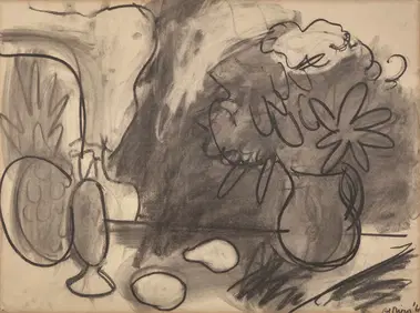
Robert De Niro, Sr. (American, 1922-1993) - Still Life with PitcherFreeman's | Hindman4.5(158)See Sold PriceFeb 28, 2024
THE GODFATHER PART II (1974) - Vito Corleone's (Robert De Niro) Photo-Matched Pea CoatPropstore4.2(6)See Sold PriceMar 12, 2024
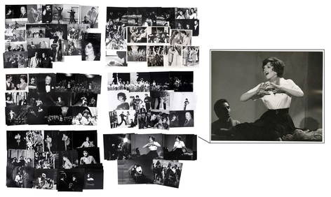
NEW YORK, NEW YORK (1977) - Collection of 151 Production PhotographsPropstore4.2(6)See Sold PriceMar 13, 2024
Buffon, Vaugody & Bell 1785 America - Map of the New ContinentAlbion Auctions4.6(341)See Sold PriceMar 01, 2024
Buffon, Vaugody & Bell 1785 Map of the Old Continent. Africa, AsiaAlbion Auctions4.6(341)See Sold PriceMar 01, 2024
Robert Benard (1734 - 1777) - Set of 9 Copperplate Engravings - Greek and Roman architecture - ViewProverde Auctions4.3(3)See Sold PriceFeb 28, 2024
Robert Benard (1734 - 1777) - Set of 9 Copperplate Engravings - Architecture, Masonry, Quarry withProverde Auctions4.3(3)See Sold PriceFeb 28, 2024
Robert Benard (1734 - 1777) - Set of 9 Chemical Engravings - Alchemical symbols - Utensils forProverde Auctions4.3(3)See Sold PriceFeb 28, 2024
Robert de Vaugondy - Map of Canada - Mer de l' Ouest or Sea of the West and a Northwest PassageProverde Auctions4.3(3)See Sold PriceFeb 28, 2024


![3 Maps: Robert de Vaugondy, [ca. 1750's]. (1 of 10)](https://p1.liveauctioneers.com/179/54294/26374862_1_x.jpg?height=282&quality=70&version=1398371595)