Sold''Dolph's Street, Road, and Land Ownership Map of''Dolph's Street, Road, and Land Ownership Map of Nassau County, Long Island, New York'', Dolph & Stewart publishers, New York City, 1939, titled ''Atlas of Nassau County, Long Island, N.Y.'' to coverSee Sold Price
Sold(NEW YORK – LONG ISLAND.) Lombardo, Frank T.;(NEW YORK – LONG ISLAND.) Lombardo, Frank T.; for Dolph, F.B. Dolph's Street, Road and Land Ownership Map of Nassau County Long Island, New York. 8 double-page chromolithographed contiguous mapsSee Sold Price
SoldFive Australian Colonial Maps,including town plan of Liverpool, 1847 State of Blighs Terrace, Subdivision of Lots 26 & 27 Point Piper Estate, Plan of Land Ownership along Edgecliff Rd and 1895 Plan showing alternate roads MacquariSee Sold Price
SoldTwo Australian Colonial Hand Drawn Maps,one of Double Bay and Rose Bay displaying land ownership and map displaying the homes "Wyndella", Cadarga and Maesgwyn (2)See Sold Price
Agri-Land: Property Ownership Maps, 5 CA countiesHeading: (California Property Ownership Maps) Author: Title: Agri-Land: Property Ownership Maps, Plat Book & Guide - for five different counties, in 5 volumes Place Published: Publisher:Echoe Map PuSee Sold Price
Agri-Land: Property Ownership Maps, 5 CA countiesHeading: (California Property Ownership Maps) Author: Title: Agri-Land: Property Ownership Maps, Plat Book & Guide - for five different counties, in 5 volumes Place Published: Publisher:Echoe Map PuSee Sold Price
Agri-Land: Property Ownership Maps, 5 CA countiesTitle: Agri-Land: Property Ownership Maps, Plat Book & Guide - for five different counties, in 5 volumes Author: ** Description: 5 volumes, including: Monterey County. 119 pp. 1982. * Napa County. 37See Sold Price
Agri-Land: Property Ownership Maps, 5 CA countiesTitle: Agri-Land: Property Ownership Maps, Plat Book & Guide - for five different counties, in 5 volumes Author: ** Description: 5 volumes, including: Monterey County. 119 pp. 1982. * Napa County. 37See Sold Price
SoldThree 1940's Santa Cruz Road, Street & Telephone Maps3 1940's City of Santa Cruz road/ Street/ telephone maps in plastic case folder. One labeled 1942. Approximately 36.5 x 24.5 in. Telephone map is of Cooper St. California Pacific Title Co.See Sold Price
SoldWork on Paper, Napa County Map of Land OwnershipNapa County Map of Land Ownership, 1857, ink and watercolor on paper, signed by "Y.J DeWoody" Napa County Surveyor, notes ownership of land in Yount Township, overall (with frame): 13"h x 15"wSee Sold Price
c1690 John Ogilby Part Two Road London to Lands End Mapc1690 John Ogilby Part Two Road London to Lands End Map A rare hand-coloured travellerÂ’s map showing the second half of the road from London to Lands End, from John OgilbyÂ’s Britannia Altas ofSee Sold Price
1675 John Ogilby Road from London to Lands End Map1675 John Ogilby Road from London to Lands End Map An unusual hand-coloured traveller’s map, charting the ‘Road from London to the Lands End’, from John Ogilby’s Britannia Atlas of 167See Sold Price
Gregory's Road Map of N.S.WTitle: Gregory's Road Map of N.S.W Date: c1938 Cartographer: BARRASS, CLIVE Publisher: GREGORY PUBLISHING COMPANY Size: 28.25Height - 37.5Width Huge uncolored road and street map of New South Wales. WSee Sold Price
SoldA quantity of assorted Oxford postcards, together withA quantity of assorted Oxford postcards, together with a 1921 ordnance survey map of Oxford, a coloured street plan of Oxford, a contoured road map of Oxford, and Wembley Exhibition Edition of Bacon'sSee Sold Price
SoldA quantity of assorted Oxford postcards, together withA quantity of assorted Oxford postcards, together with a 1921 ordnance survey map of Oxford, a coloured street plan of Oxford, a contoured road map of Oxford, and Wembley Exhibition Edition of Bacon'sSee Sold Price
Rand, McNally & Co. (Publishers) Lands OriginallyRand, McNally & Co. (Publishers) Lands Originally Granted to the Houston & Texas Central,pamphlet on land ownership in Texas, with engraved folding map attached to inside of back cover, 360 xSee Sold Price
Aldersgate Ward & St Martins le Grand Liberty. London.TITLE/CONTENT OF MAP: 'Aldersgate Ward and St Martins le Grand Liberty' The map covers Goswell Road/Aldersgate Street/St Martin's-le-Grand from the Barbican south to St Paul's. Little Britain is markeSee Sold Price
SoldA quantity of assorted Oxford postcards, together withA quantity of assorted Oxford postcards, together with a 1921 ordnance survey map of Oxford, a coloured street plan of Oxford, a contoured road map of Oxford, and Wembley Exhibition Edition of Bacon'sSee Sold Price
Aldersgate Ward & St Martins le Grand Liberty. London.TITLE/CONTENT OF MAP: 'Aldersgate Ward and St Martins le Grand Liberty' The map covers Goswell Road/Aldersgate Street/St Martin's-le-Grand from the Barbican south to St Paul's. Little Britain is markeSee Sold Price
Stow/Strype: Antique Map of Aldersgate Ward & StTITLE/CONTENT OF MAP: 'Aldersgate Ward and St Martins le Grand Liberty' The map covers Goswell Road/Aldersgate Street/St Martin's-le-Grand from the Barbican south to St Paul's. Little Britain is markeSee Sold Price
Sold2-pg. Plan of Boston, Mitchell 1872Reserve Reduced! Impressive layout of Boston, hand colored by wards. Highly detailed large format map shows railroad lines, roads, streets, wharfs, bridges, buildings, rivers and other landmarks. ExteSee Sold Price
Sold[MAPS] Sands & McDougall Map of Melbourne and SuburbsSands & McDougall New Revised Map of Melbourne and Suburbs: Extended Map of All Metropolitan Roads, Streets, Railways, Tramways and Postal Districts Melbourne: Sands & McDougall, No date [1960s].113.5See Sold Price
Foldable Map of Oranienburg with Roads and StreetsFoldable map of the municipality of Oranienburg, known for the infamous concentration camp established by the Nazis near this city, with roads, buildings and streets. It's printed by the Transport CluSee Sold Price
Sold32 vintage car related manuals, books, brochures32 vintage car related manuals, books, brochures including 1950's Ford times; Anti-friction bearing data; how to tune your Datsun; Mixers road guide and street maps; 1921 Automobile green book vol. 1;See Sold Price
1892 Adams and Bowles New Road Map of the State of New YorkJM Hobby Supply and Railroad Artifact Auctions4.4(127)See Sold PriceFeb 24, 2024
FLYING A TOURING SERVICE U.S. ROAD MAPS TIN WALL DISPLAY.Dan Morphy Auctions4.2(1.3k)See Sold PriceFeb 25, 2024
EARLY 18TH C. DUTCH CHART OF PACIFIC OCEAN BY FREDERIK DE WIT (1629-1706) WITH CALIFORNIA AS ANThomaston Place Auction Galleries4.4(393)See Sold PriceFeb 24, 2024
17TH C. ENGLISH LINEAR MAP BY OGILBY, FRAMEDThomaston Place Auction Galleries4.4(393)See Sold PriceFeb 24, 2024
Westland Oil Company North Dakota Road MapCheck the Oil Promotions, LLC4.6(327)See Sold PriceFeb 25, 2024
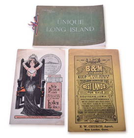
Three Peices of 1800s / Early 1900s Railroad Ephemera Pieces - Boston and Maine, Boston & NorthernRail & Road Auctions4.6(165)See Sold PriceMar 08, 2024
Keith Haring Artwork Signed on a Shell Oil New York Road Map 18 in. x 24 in.Donny Malone Auctions4.4(1.8k)See Sold PriceMar 04, 2024
Alfred Salzman, Etc. JNF Tin Tzedakah Boxes, 3Auctions at Showplace4.6(740)See Sold PriceApr 07, 2024


![[MAPS] Sands & McDougall Map of Melbourne and Suburbs (1 of 3)](https://p1.liveauctioneers.com/8597/296734/157735916_1_x.jpg?height=282&quality=70&version=1690170365)