SoldC. F. Weiland map- Iberian PeninsulaCartographer: Carl Ferdinand Weiland Title: Spanien und Portugal entworfen und gezeichnet Subject: Iberian Peninsula, Portugal, Spain Published: Weimar: Geographisches Institut Date: 1838 Description:See Sold Price
SoldC. F. Weiland map of Italy, MaltaCartographer: Carl Ferdinand Weiland Title: Italien entworfen und gezeichnet Subject: Italy, Malta Published: Weimar: Geographisches Institut Date: 1839 Description: Map showing the sovereign states oSee Sold Price
SoldC. F. Weiland map of Denmark and IcelandCartographer: Carl Ferdinand Weiland Title: Daenemark mit seinen Aebenlandern in Europa Subject: Denmark, Iceland Published: Weimar: Geographisches Institut Date: 1849 Description: Map of Denmark withSee Sold Price
SoldC. F. Weiland map of Asia MinorCartographer: Carl Ferdinand Weiland Title: Das Osmanische Asien Subject: Asia Minor, Middle East, Ottoman Empire, Turkey Published: Weimar: Geographisches Institut Date: 1828 Description: Map showingSee Sold Price
Sold1821 C F WEILAND GERMAN MAP OF EUROPE1821 C F Weiland German Map of Europe Designed and drawn C. F. Weiland.See Sold Price
Iberian Peninsula Map by Abraham OrteliusIberian Peninsula Map by Abraham Ortelius c.1600, having the title in the bottom right corner and outside border of directional numbers Height: 28.50 inches, Width: 33.00 inches (framed) Category: BooSee Sold Price
Weiland Lithograph Map of North AmeircaNord America. C. F. Weiland (1782 - 1847). Lithograph. Weimar, 1837. 27 3/4 x 22 3/4 inches sheet. Scarce map of North America, on the eve of Texas Independence. The map is remarkably detailed, especiSee Sold Price
Early 18th C. Map of Spain and Portugal, J. HomannAn Early 18th Century Map of Spain and Portugal, the hand colored map of the Iberian Peninsula by the noted German cartographer Johann Baptiste Homann (1664-1724) entitled "Regnorum Hispaniae et PortuSee Sold Price
SoldCARL FERDINAND WEILAND (GERMAN, 1782-1847) MAP OF NORTHCARL FERDINAND WEILAND (GERMAN, 1782-1847) MAP OF NORTH AMERICA lithograph on paper, "Nord America entworfen and gezeichnet von C. F. Weiland", published 1826 in Weimer. Matted and housed under glassSee Sold Price
SoldTWO 16TH C. MAPS, 1 INDIA & PAKISTAN & 1 IBERIAGroup of two hand colored Lorenz Fries (German 1485-1532), early 1500s etching on paper maps comprising, one of India, Afghanistan and Pakistan and one of the Iberian Peninsula, unframed. Provenance:See Sold Price
SoldTwo European 1830s Folio Mapshand-colored engravings, unframed, the first being DIE VEREINIGTEN STAATEN VON NORD AMERICA, by C. F. Weiland, Weimar, 1831, with Washington, D.C. inset (20.75 x 25.75 in.); the second is MAPPE-MONDE,See Sold Price
SoldAllard Engraved Map of Iberian PeninsulaCorona Portugalliae cum ei affinibus Regnis Hispanicis...Carel Allard (1648-c. 1709). Engraved map with fine original hand color in full. Amsterdam: Frederick De Wit, c. 1705. In 4 parts, 21 1/8 x 24See Sold Price
SoldPtolemaic map of Iberian PeninsulaHeading: Author: Ptolemy/Mercator Title: Tab. II. Europae, Hispaniam ac Lusitaniam Complectens Place Published: [Amsterdam] Publisher: Date Published: [c.1730] Description:See Sold Price
SoldMunster: Antique Map of the Iberian Peninsula, 1550Title: Tabula Europae II, Lovely mid-16th century woodblock map of the Iberian Peninsula Map maker: Sebastian Münster, Cosmographiae Universalis... Place and Year: Basel, c. 1550 Dimensions: 35.3 x 2See Sold Price
SoldAN ANTIQUE IBERIAN PENINSULA MAP, "Regnorum CastellæAN ANTIQUE IBERIAN PENINSULA MAP, "Regnorum Castellæ Veteris, Legionis, Galæciæ, Principatuum Biscaiæ Astariarum, Accuratissima Descriptio Per F. de Wit, Amsterdam," CIRCA 1690, hand colored ink eSee Sold Price
HEINRICH SCHERER "Map of the Iberian Peninsula"HISPANIAE ET LUSITANIAE complura pia loca INMACULATAE VIRGINI DICATA Eiusdemq [ue] Beneficiis inclyta. 1699. Munich, J. C. Bencard, (1702) Map of Spain and Portugal by Jesuit H. Scherer for his "AtlasSee Sold Price
AN ANTIQUE IBERIAN PENINSULA MAP, "Regnorum CastellæAN ANTIQUE IBERIAN PENINSULA MAP, "Regnorum Castellæ Veteris, Legionis, Galæciæ, Principatuum Biscaiæ Astariarum, Accuratissima Descriptio Per F. de Wit, Amsterdam," CIRCA 1690, hand colored ink eSee Sold Price
Pr Large Maps Italy Malta etc By Weiland 1820Weiland, C. F. SUDLICHES ITALIEN KONIGEICHI BEIDER SICILIEN NEBST DE INSELN MALTA, GOZO U COMINO. ( LARGE MAP DATED 1820 OF SOUTHERN ITALY, SICILY, MALTA, GOZO AND COMINO ) 26" x 21". Published in GerSee Sold Price
SoldWEILAND, C. F. Sudliche und Noerdliche Halbkugel der ErWEILAND, C. F. Sudliche und Noerdliche Halbkugel der Erde nach den neuesten Entdeckungen. Weimar: Geographische Institut, 1812. Engraved double-hemisphere map, hand-colored. Northern and Southern hemiSee Sold Price
SoldHomann, Johann Baptist. Regnorum Hispaniae et Portug.Homann, Johann Baptist Regnorum Hispaniae et Portug C. 1720 Copperplate engraving; outline coloured Printed area: 57.7 x 48.7 cm; 22.7 x 19.2 in A map of the Iberian Peninsula which also features theSee Sold Price
Sold-. Scott (F. H.) A Map of the Peninsula of India C-. Scott (F. H.) A Map of the Peninsula of India Comprising the Whole of the Madras Presidency and Portions of theAdjacent Territories of Bengal and Bombay, engraved map, outline colouring, diSee Sold Price
Schenk, P. Novissima Hispaniae et PortugalliaeSchenk, Petrus Novissima et Accuratissima Regnorum Hispaniae et Portugalliae C. 1734 Copperplate engraving; area coloured Printed area: 58 x 48.5 cm; 22.8 x 19.1 in The Iberian Peninsula with Spain anSee Sold Price
SoldNova Persiae Armeniae Natoliae et ArabiaeFrederick de Wit (c. 1630-1706). Engraved Map with hand color in full. Amsterdam: F. De Wit, [c. 1710]. (20 ¾ x 24 ¾ inches sheet. The detail in the Arabian peninsula is based on Sanson’s map of 1See Sold Price
Sold1710 Map, de Witt, Nova Persia, Armenia & ArabiaFrederick de Wit (c. 1630-1706). Engraved Map with hand color in full. Amsterdam: F. De Wit, [c. 1710]. Overall framed size is 32 1/2" x 29 1/2". The detail in the Arabian peninsula is based on SansonSee Sold Price
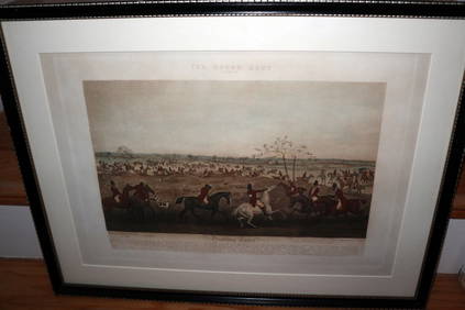
HENRY ALKEN / LEWIS Original 1835 Hand Colored Engraving Quorn Hunt DrawingLuis Porretta Fine Arts4.3(10)See Sold PriceMar 02, 2024
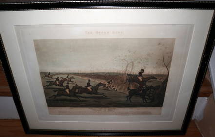
HENRY ALKEN / LEWIS Original 1835 Hand Colored Engraving Quron Hunt Snob Is BeatLuis Porretta Fine Arts4.3(10)See Sold PriceMar 02, 2024
D'Entrecasteaux - Australia: Coasts of Van Diemen's Land (New Holland). 9Trillium Antique Prints & Rare Books4.5(33)See Sold PriceFeb 24, 2024
D'Entrecasteaux - Tasmania, Australia: Map of the Northern Portion of Recherche Bay. 5Trillium Antique Prints & Rare Books4.5(33)See Sold PriceFeb 24, 2024
D'Entrecasteaux - Australia: Chart of Van Diemen's Land (New Holland). 3Trillium Antique Prints & Rare Books4.5(33)See Sold PriceFeb 24, 2024
D'Entrecasteaux - Map of Australia (New Holland), New Zealand, and southern Asia and surroundingTrillium Antique Prints & Rare Books4.5(33)See Sold PriceFeb 24, 2024
Donovan's The Natural History of British Shells - 5 Volumes in 3 Books with 180 EngravingsTrillium Antique Prints & Rare Books4.5(33)See Sold PriceFeb 24, 2024
Railways & Transport.- [Prospectus] The Dorking, Brighton, and Arundel Atmospheric Railway, byForum Auctions4.4(54)See Sold PriceFeb 29, 2024
3 Vintage The World Lithographs, By JanssonThe Benefit Shop Foundation Inc.4.3(3k)See Sold PriceMar 13, 2024


![Railways & Transport.- [Prospectus] The Dorking, Brighton, and Arundel Atmospheric Railway, by (1 of 1)](https://p1.liveauctioneers.com/5458/319736/171654703_1_x.jpg?height=282&quality=70&version=1708010439)