SoldMitchell's New General Atlas, Containing Maps Of TheMitchell's New General Atlas, Containing Maps Of The Various Countries Of The World, Plans Of Cities, Etc., Embraced In Fifty-Three Quarto Maps, Forming A Series of Eighty-Four Maps And Plans, TogetheSee Sold Price
SoldMitchell's New General Atlas, Containing Maps ofAuthor: Mitchell, [Samuel Augustus] With approximately 80 hand-colored maps and plans plus several insets (28 are double-page) and 1 double-page railroad map of the United States; all on approximatelySee Sold Price
SoldMitchell's New General Atlas, Containing Maps ofAuthor: Mitchell, S[amuel] Augustus With 76 total hand-colored maps and plans including insets (4 are double-page); all on 43 map-sheets. 15½x13, original half sheep and brown cloth, front cover lettSee Sold Price
Mitchell's New General Atlas containing maps of the various countries of the world, plans of cities,Publication Date: 1877 Title: Mitchell's New General Atlas containing maps of the various countries of the world, plans of cities, etc., embraced in seventy-nine quarto maps. Primary Authors: SAMUEL ASee Sold Price
Mitchell's New General Atlas containing maps of theTitle:Mitchell's New General Atlas containing maps of the various countries of the world, plans of cities, etc., embraced in seventy-nine quarto maps. Author: SAMUEL AUGUSTUS MITCHELL, JR Publisher/MaSee Sold Price
Mitchell's New General Atlas, Containing Maps of theTitle: Mitchell's New General Atlas, Containing Maps of the Various Countries of the World Publication Date: 1879 Primary Authors: MITCHELL, SAMUEL AUGUSTUS (JR.) Publisher: S. AUGUSTUS MITCHELL (JR.)See Sold Price
Mitchell's New General Atlas, Containing Maps of thePublication Date: 1879 Title: Mitchell's New General Atlas, Containing Maps of the Various Countries of the World Primary Authors: MITCHELL, SAMUEL AUGUSTUS (JR.) Publisher: S. AUGUSTUS MITCHELL (JR.)See Sold Price
SoldMitchell's New General Atlas, Containing Maps Of TheMitchell's New General Atlas, Containing Maps Of The Various Countries Of The World, Plans Of Cities, Etc., Embraced In Ninety-Three Quarto Maps, Forming A Series of One Hundred and Forty-Seven Maps ASee Sold Price
SoldMitchell's New General Atlas, Containing Maps of[4], 83, 22, [8] pp. With 53 hand-colored maps and plans (4 are double-page), plus several inset maps, all on 49 map-sheets. (Folio) 15½x12½, original quarter sheep and brown cloth, gilt-lettered frSee Sold Price
SoldMitchell's New General Atlas, Containing Maps ofWith 65 hand-colored maps (plus insets) on 56 map-sheets, 9 of which are double-page; also, a hand-colored Time Table page. 15½x12½, recent half dark calf and marbled boards, new endpapers. Most ofSee Sold Price
SoldMitchell's New General Atlas. 1863. 84 maps/insets[Atlas]. MITCHELL’S NEW GENERAL ATLAS, Containing Maps ot the the Various Countries of the World, Plans of Cities, Etc… Phila: S. Augustus Mitchell, 1863. 4to. Orig quarter leather and cloth. WornSee Sold Price
SoldPair Antique 19th Century Atlases, Bound MapsPair Antique 19th Century Atlases. ‘Mitchell’s New General Atlas Containing Maps of Various Countries of the World, Plans of Cities, Etc.’ published by S. Augustus Mitchell, Jr. c 1860. ‘AtlasSee Sold Price
SoldPair Antique 19th Century Atlases, Bound MapsPair Antique 19th Century Atlases. ‘Mitchell’s New General Atlas Containing Maps of Various Countries of the World, Plans of Cities, Etc.’ published by S. Augustus Mitchell, Jr. c 1860. ‘AtlasSee Sold Price
SoldMitchells New General Atlas 1862Mitchell's new general atlas, containing maps of the various countries of the world, plans of citiew, etc. Published by S. Augustus Mitchell, Jr. 1862; 16x13 inches.See Sold Price
SoldMitchell's New General Atlas. 1883.[Atlas] Mitchell, S. Augustus. "Mitchell's New General Atlas containing Maps of the Various Countries of the World, Plans of Cities, Etc.” Philadelphia, Bradley & Company, 1883. 15 1/2” x 13”. CSee Sold Price
SoldMITCHELL’S NEW GENERAL ATLAS. 1863. 84 maps/insets[Atlas]. MITCHELL’S NEW GENERAL ATLAS, Containing Maps of the Various Coutnries of the World, Plans of Cities, Etc… Phila: S. Augustus Mitchell, 1863. Folio. 84 maps & insets (As numbered. MitchelSee Sold Price
SoldMitchell’s New General Atlas, 1868.[Atlas]. Mitchell’s New General Atlas, Containing Maps of the Various Countries of the World, Plans of Cities, Etc… Phila: S. Augustus Mitchell, 1868. Complete with 96 maps/insets on 65 pages. (InSee Sold Price
SoldFRAMED 1860 COUNTY MAP OF TEXASFramed copy of "County Map of Texas with inset of Galveston Bay & Vicinity", c. 1860, believed to be from "Mitchell's New General Atlas, containing Maps of the Various Countries of the World, Plans ofSee Sold Price
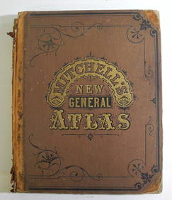
Sold[ATLASES].* [ATLASES]. Four editions of Mitchell's New General Atlas, Containing Maps of the Various Countries of the World, Plans of Cities, Etc. Philadelphia: S. Augustus Mitchell, Jr., 1861 - 1864 - 1878 - 1See Sold Price
SoldMAPS: 1867 Mitchell's New General AtlasMAPS: 1867 Mitchell's New General Atlas, Mitchell's New General Atlas, Containing Maps of the Various Countries of the World, Plans of Cities, Etc., Embraced by Fifty-Eight Quarto Maps, forming a seriSee Sold Price
SoldMitchell's New General Atlas 1860 U.S. mapsHeading: Author: Mitchell, Samuel Augustus Title: Mitchell's New General Atlas, Containing Maps of the Various Countries of the World, Plans of Cities, Etc.... Place Published: Philadelphia PublisherSee Sold Price
SoldMitchell's New General Atlas, 1872Heading: Author: Mitchell, Samuel Augustus Title: Mitchell's New General Atlas, Containing Maps of the Various Countries of the World, Plans of Cities, Etc... Place Published: Philadelphia Publisher:See Sold Price
SoldMitchell's New General Atlas 1863Heading: Author: Mitchell, Samuel Augustus Title: Mitchell's New General Atlas, Containing Maps of the Various Countries of the World, Plans of Cities, Etc.... Place Published: Philadelphia PublisherSee Sold Price
SoldMitchell's New General Atlas 1875Heading: Author: Mitchell, Samuel Augustus Title: Mitchell's New General Atlas, Containing Maps of the Various Countries of the World, Plans of Cities, Etc., Embraced in Seventy-Nine Quarto Maps... PSee Sold Price
1849 Mitchell School ATLAS 24 MAPS America Holy Land France Africa Egypt AsiaSchilb Antiquarian Rare Books4.8(428)See Sold PriceMar 31, 2024
Rand McNally & Co's New Ideal State and County Survey and Atlas 1911North American Artifact Auctions4.7(198)See Sold PriceApr 20, 2024
1849 THE NEW-ENGLAND MERCANTILE UNIONNorth American Artifact Auctions4.7(198)See Sold PriceApr 20, 2024
HAMMOND'S READY REFERENCE HISTORICAL ATLAS 1920North American Artifact Auctions4.7(198)See Sold PriceApr 20, 2024
Arrowsmith & Lewis - Map of PolynesiaTrillium Antique Prints & Rare Books4.5(32)See Sold PriceFeb 24, 2024
Arrowsmith & Lewis - Map of North AmericaTrillium Antique Prints & Rare Books4.5(32)See Sold PriceFeb 24, 2024
Arrowsmith & Lewis - Map of the World on Mercator's ProjectionTrillium Antique Prints & Rare Books4.5(32)See Sold PriceFeb 24, 2024
Arrowsmith & Lewis - Map of LouisianaTrillium Antique Prints & Rare Books4.5(32)See Sold PriceFeb 24, 2024
Arrowsmith & Lewis - Map of the United StatesTrillium Antique Prints & Rare Books4.5(32)See Sold PriceFeb 24, 2024
Mitchell - Map of the City of Washington (Washington, DC)Trillium Antique Prints & Rare Books4.5(32)See Sold PriceFeb 24, 2024
1816 MAP SOUTHERN PART OF RUSSIA or MUSCOVY in EUROPE copper engraving ANTIQUEJasper524.5(9.9k)See Sold PriceFeb 27, 2024
1816 MAP NORTHERN PART OF RUSSIA or MUSCOVY in EUROPE copper engraving ANTIQUEJasper524.5(9.9k)See Sold PriceFeb 27, 2024
West Indies Islands. Guadaloupe. | Mariegalante &C. | Antigua.Jasper524.5(9.9k)See Sold PriceFeb 27, 2024
Robert H Labberton - Map of The Territory of the Present United States - The territory of theProverde Auctions4.3(3)See Sold PriceFeb 28, 2024


![[ATLASES]. (1 of 1)](https://p1.liveauctioneers.com/197/119933/61100820_1_x.jpg?height=282&quality=70&version=1522758048)


