SoldStanford's new map of the United States and NorthStanford's new map of the United States and North America London: Edward Stanford, May 13, 1861Scale: 400 British milesNote: 1860 census; Indian tribes includes boundary of seceding states.Dimensions:See Sold Price
SoldConfederate States case map, Edward StanfordDesc: Stanford's New Hand Map of the United States of North America; boundaries of seceded states delineated with original hand coloring; six sequential images mounted to canvas backing and folded toSee Sold Price
SoldStanford's new large print map of the United States ofStanford's new large print map of the United States of North America London:1863. Showing boundary of seceded states.Scale of British miles 400Dimenstions 24" X 29 3/4"Inv.129See Sold Price
Sold(North America, United States), MITCHELL'S NEW NAT(North America, United States), MITCHELL'S NEW NATIONAL MAP, UNITED STATES, NORTH AMERICAN BRITISH PROVINCES, Philadelphia, 1861, wall map with colored state borders, with rollers, 62 x 60 in., (creasSee Sold Price
New Map of United States of North America, 1805Map: A New Map of Part of the United States of North America, exhibiting the Western Territory, Kentucky, Pennsylvania, Maryland, Virginia &c., also the lakes Superior, Michigan, Huron, Ontario & ErieSee Sold Price
SoldSAMUEL DUNN HAND COLORED PRINTED MAPSAMUEL DUNN, HAND COLORED PRINTED MAP, IMAGE: H 19", W 12 1/2", "A NEW MAP OF THE UNITED STATES OF NORTH AMERICA":"--- with the British Dominions on the continent"; printed for Robert Sayer; framed.See Sold Price
SoldSAMUEL DUNN (BRITISH, D. 1794) MAP OF THE UNITED STATESSAMUEL DUNN (BRITISH, D. 1794) MAP OF THE UNITED STATES, hand-colored engraving on paper, titled "A New Map of the United States of North America with the British Dominions on that Continent & c." FouSee Sold Price
SoldHanging Wall Map of North America-19th centuryWall map titled "Mitchells' New National Map Exhibiting the United States with North American British Provinces, Sandwich Islands, Mexico and Central America, Together with Cuba and the other West IndSee Sold Price
SoldStanford's 1889 Map of the United StatesHeading: Author: Stanford, Edward Title: Map of the United States of North America Place Published: London Publisher:Edward Stanford Geographer to His Majesty the King Date Published: 1889See Sold Price
Mitchell's New National Map Exhibiting the United States with the North AmericanDescription: Description: MAP Year - 1857. : Mitchell's New National Map Exhibiting the United States with the North American British Provinces, Sandwich Islands, Mexico and Central American, TogetherSee Sold Price
SoldAN 1811 UNITED STATES MAP BY JOHN CARYA New Map of Part of the United States of North America Exhibiting the Western Territory, Kentucky, Pennsylvania, Maryland, Virginia & c. also the Lakes Superior Michigan Huron Ontario & Erie with UppSee Sold Price
Sold1812 John Cary Map ofTitled "A New Map of Part of the United States of North America", published by J. Cary, London, 1812. There are a few small pinholes, and one small hole in the bottom center along the center fold.See Sold Price
Cary: Antique Map of New England, 1811An original hand colored engraved 1811 map titled ""A New Map of Part of the United States of North America Containing New York, Vermont, New Hampshire, Massachusets, Connecticut, Rhode Island, PennsySee Sold Price
Sold1856 MITCHELL'S WALL MAP OF NORTH AMERICAFull title being: “Mitchell’s New National Map, Exhibiting the United States with the North American British Provinces Sandwich Islands, Mexico and Central America, Cuba, West India Islands.” PuSee Sold Price
SoldCary Map of Florida, Georgia, North Carolina, SouthCary, John (British, 1754-1835). A New Map of Part of the United States of North America, Containing the Carolinas and Georgia, also the Floridas and Part of the Bahama Islands. London: 1806. EngravedSee Sold Price
SoldCary's Map of the Southern United States, 1806A New Map of Part of the United States of North America Containing the Carolinas and Georgia, Also the Floridas and Part of the Bahama Islands, etc. by John Cary, 1806, a partially hand-coSee Sold Price
SoldCary: US Western Territory/Great Lakes Region Map, 1805Map: A New Map of Part of the United States of North America, exhibiting the Western Territory, Kentucky, Pennsylvania, Maryland, Virginia &c., also the lakes Superior, Michigan, Huron, Ontario & ErieSee Sold Price
SoldJohn Cary (British, 1754-1835)John Cary (British, 1754-1835), "A New Map of Part of The United States of North America Containing the Carolinas and Georgia, also The Floridas and Part of The Bahama Islands & C.", London, 1806, hanSee Sold Price
SoldCary Map of the Western Territory, Kentucky,Cary, John (British, 1754-1835). A New Map of Part of the United States of North America, Exhibiting the Western Territory, Kentucky, Pennsylvania, Maryland, Virginia &c. Also, the Lakes Superior, MicSee Sold Price
SoldA New Map... Western Territory, Kentucky...[United States/Old Northwest]. A New Map Of Part Of The United States Of North America, Exhibiting the Western Territory, Kentucky, Pennsylvania, Maryland, Virginia, &c. Also the Lakes Superior, MichiSee Sold Price
Sold1806 John Carey Map of North AmericaDESCRIPTION: 1806 John Carey A New Map of Part of the United States of North America in two parts. Handcolored engraving on wove paper. MEASUREMENTS: 20-7/8" x 25" CONDITION: Hinged at center. Two minSee Sold Price
Sold1805 REGIONAL NORTH AMERICA HAND-COLORED MAP FEAT1805 REGIONAL NORTH AMERICA HAND-COLORED MAP FEATURING VIRGINIA, "A New Map of Part of the United States of North America, Exhibiting The Western Territory, Kentucky, Pennsylvania, Maryland, Virginia,See Sold Price
19th century map of the southeast,A New Map of Part of the United States of North America, containing the Carolinas and Georgia. Also the Floridas and part of the Bahama islands, &c., by John Cary, published in [Cary's New Universal ASee Sold Price
SoldJOHN CARY, HAND COLORED MAP, 1806, PART OF USAJOHN CARY, HAND COLORED MAP, 1806, "A NEW MAP OF PART OF THE UNITED STATES OF NORTH AMERICA":17 7/8" x 20 1/4", unframed. Ex. Collection Nancy and the late G. Mennen Williams.See Sold Price
American Express/New York Central Railroad Map of the United States-1934JM Hobby Supply and Railroad Artifact Auctions4.4(126)See Sold PriceFeb 24, 2024
1886 A Larger History of the United States 1st EditionNorth American Artifact Auctions4.6(182)See Sold PriceApr 20, 2024
A "Red Book" of the Greatest War of History 1914North American Artifact Auctions4.6(182)See Sold PriceApr 20, 2024
Over There: The United States in the Great War, 1917-18 1st EditionNorth American Artifact Auctions4.6(182)See Sold PriceApr 20, 2024
These United States 1968 Folio Size HardbackNorth American Artifact Auctions4.6(182)See Sold PriceApr 20, 2024
Arrowsmith & Lewis - Map of the United StatesTrillium Antique Prints & Rare Books4.5(30)See Sold PriceFeb 24, 2024
Mitchell - Map of the City of Washington (Washington, DC)Trillium Antique Prints & Rare Books4.5(30)See Sold PriceFeb 24, 2024
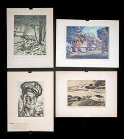
1930s American Etchings, Original Ltd. Editions (4)Artemis Fine Arts4.8(1.4k)See Sold PriceFeb 26, 2024
Blackie (Pub) 1882 Folio Map. West USA - Pacific StatesAlbion Auctions4.6(336)See Sold PriceMar 01, 2024
Blackie (Pub) 1882 Folio Map. United States of North AmericaAlbion Auctions4.6(336)See Sold PriceMar 01, 2024
Robert H Labberton - Map of The Territory of the Present United States - The territory of theProverde Auctions4.3(3)See Sold PriceFeb 28, 2024
Map of United States of North America, 1785Antiques Online Auctions4.6(407)See Sold PriceMar 14, 2024