Map of Territory of Idaho comp. by Charles Roeser.Territory of Idaho comp. by Charles Roeser. Washington, DC: and NY: Julius Bien, 1876Dimensions: 17 3/4" X 10"Inv.171See Sold Price
Map of Territory of Idaho comp. by Charles Roeser.Territory of Idaho comp. by Charles Roeser. Washington, DC: and NY: Julius Bien, 1876Dimensions: 17 3/4" X 10"Inv.171See Sold Price
SoldMap of Territory of Idaho by Charles Roeser 1876Territory of Idaho comp. by Charles Roeser. Washington, DC: and NY: Julius Bien, 1876Dimensions: 17 3/4" X 10"Inv.53See Sold Price
SoldMap of Washington Territory west of Cascade Mountains,Map of Washington Territory west of Cascade Mountains, comp. by Charles A. White. NY: 1870Statue miles 4 to One (1) inch.Dimensions: 30 1/2" X 20 1/2" and 30 1/4" X 15" in Two (2) sections (maps)Inv.3See Sold Price
SoldMap of Idaho Territory 1879Title: Territory of Idaho Author: U.S. State Surveys Description: Color lithographed map. Compiled by C. Roeser from the official records of the General Land Office. Lithographed by Julius Bien. 83x54See Sold Price
[MAP]. ANDERSON. Territory of Idaho236. [MAP]. ANDERSON, W[illiam] F., C[harles] D[rayton] Gibbes, et al (cartographers & surveyors), Warren Holt (publisher), & Edward Bosqui (lithographer). Territory of Idaho South of Salmon RSee Sold Price
Map of Territory of IdahoMap of Territory of Idaho Color Map Dated: 19th century Dimensions: 10 x 6 1/2" Condition Report Good. Text on verso. Subject References: <See Sold Price
SoldMap of Territory of IdahoMap of Territory of Idaho Color Map Dated: 19th century Dimensions: 10 x 6 1/2" Condition Report Good. Text on verso. Subject ReferenceSee Sold Price
Map of Territory of IdahoMap of Territory of Idaho Color Map Dated: 19th century Dimensions: 10 x 6 1/2" Condition Report Good. Text on verso. Subject References: <See Sold Price
Map of Territory of IdahoMap of Territory of Idaho Color Map Dated: 19th century Dimensions: 10 x 6 1/2" Condition Report Good. Text on verso. Subject ReferenceSee Sold Price
SoldPost Route Map Idaho, Montana & WyomingMarked in ink, Inspector's Office on the label, reading "Post Route Map of the Territory of Idaho, Montana and Wyoming. Linen backed, 19th Century Map of these early territories. 31x42"See Sold Price
Sold1863 Johnson’s Nebraska, Dakota, Colorado, Idaho Map1864 Johnson’s Nebraska, Dakota, Colorado, Idaho, Kansas. Johnson & Ward. Johnson and Ward's rare 1863 map of the territories of Idaho, Dakota, Nebraska, Colorado and Kansas. Extends west as far asSee Sold Price
1863 Johnson’s Neb., Dak., Col., Ida., Kans.Johnson and Ward's rare 1863 map of the territories of Idaho, Dakota, Nebraska, Colorado and Kansas. Extends west as far as the Great Salt Lake and east to Lake Superior. Depicts this area during inteSee Sold Price
Sold1863 Johnson’s Neb., Dak., Col., Ida., Kans.Johnson and Ward's rare 1863 map of the territories of Idaho, Dakota, Nebraska, Colorado and Kansas. Extends west as far as the Great Salt Lake and east to Lake Superior. Depicts this area during inteSee Sold Price
Scarce 1863 Western States, Johnson & WardLovely example of Johnson and Ward's scarce 1863 map of the territories of Idaho, Dakota, Nebraska, Colorado and Kansas. Extends west as far as the Great Salt Lake and east to Lake Superior. Shows thiSee Sold Price
Scarce 1864 map of western territoriesScarce Johnson 1864 map of the western territories when Idaho was a large area consisting of present-day Idaho, Wyoming and Montana. Colorado had recently been created in 1861 making this one of the eSee Sold Price
SoldRARE 1863-64 Map of the United StatesThis is a RARE hand tinted map of the United States, Canada, Mexico and Central America circa 1863. The map shows the large Idaho Territory that included the lands of Montana. This configuration of boSee Sold Price
Sold1890's Hand Tinted Northwest Territory MapFeatured in this lot we have a hand tinted Northwest US territory maps originating from the 1890's. The map details the Northwest territories including Wyoming, Idaho, and Montana. The map shows mountSee Sold Price
Texas & western states, 1864 scarce publication by SchonbergTitle: Texas & western states, 1864 scarce publication by Schonberg Date/Period: 1864 Materials: Hand colored steel plate engraved. Size: 14 x 12'' Important map. Shows a massive Idaho territory. 1864See Sold Price
Sold1870's Northwest Territory Hand Tinted MapAvailable in this lot we have a hand tinted map of the Northwest Territories originating from the 1870's. The map details the Northwest territories including Washington, Oregon, Idaho, and most of MonSee Sold Price
Geological Map - Portions of Wyoming, Idaho & Utah 1879Geological map of portions of Wyoming, Idaho and Utah, comp. by A.C. Peale. Washington D.C. 1879Five miles to One (1) inch.Dimensions: 20 1/2" X 36 1/4" Inv.51See Sold Price
Scarce map NW corner of America, 1875Original full hand color map of Washington, Oregon and Idaho. One of the few maps to spell out “Territory of Washington” and “Territory of Idaho” on the map. Scarce map of these states showingSee Sold Price
Geological Map of portions of Wyoming, Idaho and Utah,Geological map of portions of Wyoming, Idaho and Utah, comp. by A.C. Peale. Washington D.C. 1879Five miles to One (1) inch.Dimensions: 20 1/2" X 36 1/4" Inv.164See Sold Price
Geological Map of portions of Wyoming, Idaho and Utah,Geological map of portions of Wyoming, Idaho and Utah, comp. by A.C. Peale. Washington D.C. 1879Five miles to One (1) inch.Dimensions: 20 1/2" X 36 1/4" Inv.164See Sold Price
19 century Ormolu Commemorative mantle clock Charles V of FranceSan Diego Art Auction4.3(9)See Sold PriceFeb 24, 2024
Northern Pacific RR Washington and Northern Idaho Map Folder-1941JM Hobby Supply and Railroad Artifact Auctions4.4(127)See Sold PriceFeb 24, 2024
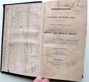
Charles Butler Ancient & Modern Music 1824 1st Edition Scarce MusicLuis Porretta Fine Arts4.3(10)See Sold PriceMar 02, 2024
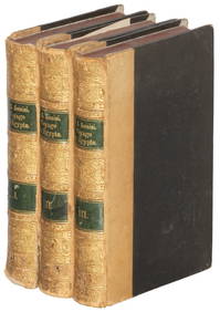
1885 CIVIL WAR 1ed Famous Memoirs US Grant Sheridan Sherman 6v RARE LOT MapsSchilb Antiquarian Rare Books4.8(428)See Sold PriceMar 10, 2024
CHARLES ROLLIN c1828 Ceasar Hand Colored Africa Military MapLuis Porretta Fine Arts4.3(10)See Sold PriceMar 02, 2024
Collection of Allied Military Silk Printed Maps, WWII Era and LaterMaterial Culture4.6(778)See Sold PriceFeb 29, 2024
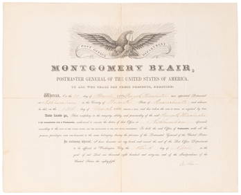
SOMERSET, Lord Charles (1767-1831) and BLAIR, Montgomery (1...Potter & Potter Auctions4.6(545)See Sold PriceMar 07, 2024
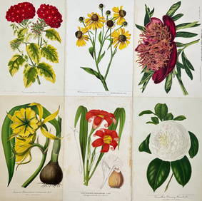
Charles Antoine Lemaire (1800 - 1871) - Set of 4 Botanical Prints - Rose - Camellia Duchesse deProverde Auctions4.3(3)See Sold PriceFeb 28, 2024
Charles Antoine Lemaire (1800 - 1871) - Set of 6 Botanical Prints - Ismene amancaes - Camellia FannyProverde Auctions4.3(3)See Sold PriceFeb 28, 2024
Charles Antoine Lemaire (1800 - 1871) - Set of 8 Botanical Prints - Alstraemeria Argento - CayaponiaProverde Auctions4.3(3)See Sold PriceFeb 28, 2024
Francis McNally - Antique Map of Washington, Oregon, Idaho, Nevada, Utah & ArizonaProverde Auctions4.3(3)See Sold PriceFeb 28, 2024
The Kingdom of Dalmatia Territories Map, 1700Antiques Online Auctions4.6(415)See Sold PriceMar 14, 2024
Herman Moll A New Map of Ye North Parts of AmericaWillow Auction House4.5(289)See Sold PriceMar 14, 2024


![[MAP]. ANDERSON. Territory of Idaho (1 of 10)](https://p1.liveauctioneers.com/514/38480/16487076_1_x.jpg?height=282&quality=70&version=1363614971)