SoldThree hand colored Montgomery county township maps,Three hand colored Montgomery county township maps, which include the townships of Upper & Lower Providence with COA, part of Norristown and Palm Station, Upper Hanover and Pennsburg with COASee Sold Price
SoldThree matted hand colored township maps,Three matted hand colored township maps, late 19th C., two combination atlas maps of Montgomery County, which includes Upper Hanover Palm Station with COA, New Hanover, Zieglersville, Limerick SquareSee Sold Price
Sold(Hand-Colored Lithographic Map.) "Plan1 piece. (Hand-Colored Lithographic Map.) "Plan of Chelten Hills, Cheltenham Township, Montgomery County, Penn." Philadelphia, 1854. Surveyed by Sidney & Neff. 25 x 25 inches, linen-backed; some stainSee Sold Price
SoldSIDNEY & NEFF. Plan of Chelten Hills Cheltenham TSIDNEY & NEFF. Plan of Chelten Hills Cheltenham Township Montgomery County, Penna.Philadelphia: Friend & Aub, 1854. Lithographed map, dissected into 36 sections and linen-backed, hand-coloredSee Sold Price
Nevada & Utah 1880Title: Nevada & Utah 1880 Date Printed: 1880 Material/Medium: paper Size: folio, 23x 15 inches Additional Info: Hand colored county & township map of Utah & Nevada by Mitchell. Map measures 23" x 15",See Sold Price
Nevada & Utah 1880Title/Content of Map: Nevada & Utah 1880 Date Printed: 1880 Material/Medium: paper Size: folio, 23x 15 inches Additional Info: Hand colored county & township map of Utah & Nevada by Mitchell. Map measSee Sold Price
Nevada & Utah 1880Title: Nevada & Utah 1880 Date Printed: 1880 Cartographer: Materials: paper Dimensions: folio, 23x 15 inches Additional Info: Hand colored county & township map of Utah & Nevada by Mitchell. Map measuSee Sold Price
Nevada & Utah 1880Title/Content of Map: Nevada & Utah 1880 Date Printed: 1880 Material/Medium: paper Size: folio, 23x 15 inches Hand colored county & township map of Utah & Nevada by Mitchell. Map measures 23" x 15", fSee Sold Price
Nevada & Utah 1880Title/Content of Map: Nevada & Utah 1880 Date Printed: 1880 Material/Medium: paper Size: folio, 23x 15 inches Hand colored county & township map of Utah & Nevada by Mitchell. Map measures 23" x 15", fSee Sold Price
Nevada & Utah 1880Title/Content of Map: Nevada & Utah 1880 Date Printed: 1880 Material/Medium: paper Size: folio, 23x 15 inches Additional Info: Hand colored county & township map of Utah & Nevada by Mitchell. Map measSee Sold Price
Nevada & Utah 1880Title/Content of Map: Nevada & Utah 1880 Date Printed: 1880 Material/Medium: paper Size: folio, 23x 15 inches Additional Info: Hand colored county & township map of Utah & Nevada by Mitchell. Map measSee Sold Price
Counties and Townships of Nevada & Utah, 1880Title/Content of Map: Counties and Townships of Nevada & Utah Date Printed: 1880 Material/Medium: paper Size: folio, 23x15 inches Hand colored county & township map of Utah & Nevada by Mitchell. Map mSee Sold Price
Nevada & Utah 1880Title/Content of Map: Nevada & Utah 1880 Date Printed: 1880 Material/Medium: paper Size: folio, 23x 15 inches Hand colored county & township map of Utah & Nevada by Mitchell. Map measures 23" x 15", fSee Sold Price
SoldThree hand colored maps of Dutchess County areaThree hand colored maps of Dutchess County area including a Beers map of Unionvale, and 2 of Dutchess itself. All circa 1860-70.See Sold Price
SoldThree Hand Colored Pocket MapsComprising Pennsylvania and New Jersey by H.S Tanner Philadelphia 1827, Tourist Map of New York State by William Williams 1828 and Township Map of the State of New York published by JH Colton New YorkSee Sold Price
SoldFolding map of Washington State 1889Title: New Sectional, Township & County Map of Washington Author: Gill, J.K. Description: Folding lithographed map, hand-colored. 54x70 cm. (21x27½"), folding into original cloth covers.LithographedSee Sold Price
SoldHand-Colored ANTIQUE LINEN-BACKED WALL MAP OFDetails: This lot consists of the antique wall map shown in the corresponding images.This map of Montgomery County, New York, was drawn from actual surveys done by Samuel Geil and B.J. Hunter. It wasSee Sold Price
SoldThree framed Beers atlas local Dutchess County handThree framed Beers atlas local Dutchess County hand colored maps including Rhinebeck, Rhinecliff, and Red Hook. Published in 1867. Provenance: Private donation to the Northern Dutchess Hospital in RhiSee Sold Price
SoldENGLISH MAPS. SAXTON, CHRISTOPHER. c. 1540-c. 1610. Three English county maps.ENGLISH MAPS. SAXTON, CHRISTOPHER. c. 1540-c. 1610. Three English county maps. Engraved maps, hand colored, matted and framed, comprising: Mongomery comitatus qui olim pars Ordovicum; Cardigan comitatSee Sold Price
SoldSectional Township and County Map of Washington.[Maps] Sectional Township and County Map of Washington. Portland: J.K. Gill & Co., 1889. Brown cloth boards with blind-stamped title and decorations. Hand-colored lithographed foldout map (23 x 27RSee Sold Price
SoldThree Virginia Maps, Unframed165. Three Virginia Maps, Unframed: 1855 Handcolored Wood Engraved Map, 1 1/2 x 9". 1866 Miniature Hand Colored Map with West Virginia, 3 x 5 1/4. 11" X 14" Rand McNally Colored County Map of VirginiaSee Sold Price
SoldAntique Hand Colored Maps of Fairfield County CTAntique Hand Colored Maps of Fairfield County CT. This lot includes three 19th century hand colored maps from the "Atlas of Fairfield County CT" by F.W. Beers. Includes one map of Bethel, one map of DSee Sold Price
SoldAntique Hand Colored Maps of Westchester County NYAntique Hand Colored Maps of Westchester County NY. This lot includes three 19th century hand colored maps from the "Atlas of Westchester County, NY" by G.W. Bromley & Co. Includes one map of the VillSee Sold Price
SoldAntique Hand Colored Maps of Westchester County NYAntique Hand Colored Maps of Westchester County NY. This lot includes three 19th century hand colored maps from the "Atlas of Westchester County NY" by G.W. Bromley and Co. Includes one map of HastingSee Sold Price
Rand McNally Township County and Railroad Map of Indiana-1880JM Hobby Supply and Railroad Artifact Auctions4.4(126)See Sold PriceFeb 24, 2024
WILLEM JANSZOON BLAEU (NETHERLANDS, 1571-1638) MAP OF UMBRIAThomaston Place Auction Galleries4.4(386)See Sold PriceFeb 24, 2024
MARTIN VILLALBA Three Baristas Limited Ed 11/50 Engraving Hand ColoredLuis Porretta Fine Arts4.3(10)See Sold PriceMar 02, 2024
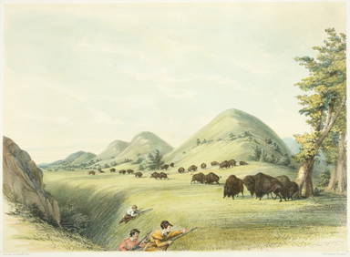
VENET / DEBUCOURT (1755-1832) Set 3 x Aquatint Engraved Hunting Scenes 23" x 16"Luis Porretta Fine Arts4.3(10)See Sold PriceMar 02, 2024
PIETER SCHENK / VALK / JANSSEN Hand Colored Map of Rhodes Greece ca1702 vgcLuis Porretta Fine Arts4.3(10)See Sold PriceMar 02, 2024
THOMAS MOULE 1837 Colored Map of Warwickshire Framed vgcLuis Porretta Fine Arts4.3(10)See Sold PriceMar 02, 2024
[CHICAGO]. Rare Pre-Fire Illinois Map: “Blanchard’s Map of ...Potter & Potter Auctions4.6(538)See Sold PriceMar 07, 2024
Johann Homann Hand-Colored Map Engraving, c. 1730Auctions at Showplace4.5(723)See Sold PriceMar 17, 2024
Pascal's Collection de fleurs... - Volume with 48 Originally Hand-colored LithographsTrillium Antique Prints & Rare Books4.5(28)See Sold PriceFeb 24, 2024
THREE HAND COLORED AND ADORNED PRINTS.Amelia Jeffers, Auctioneers & Appraisers4.6(97)See Sold PriceMar 08, 2024


![[CHICAGO]. Rare Pre-Fire Illinois Map: “Blanchard’s Map of ... (1 of 2)](https://p1.liveauctioneers.com/928/318880/171361260_1_x.jpg?height=282&quality=70&version=1707501302)