SoldThomas Kitchin (1718-1784). 'A New Improved Map ofThomas Kitchin (1718-1784). 'A New Improved Map of Oxfordshire from the best intelligences' and dedicated to the Duke of Marlborough. 72x53cmSee Sold Price
SoldAfter Thomas Kitchin (1718-1784) British. "A New Map ofAfter Thomas Kitchin (1718-1784) British. "A New Map of the County of Surrey", Map, 7.75" x 10".See Sold Price
SoldAn 18th century map engraving after Thomas KitchinAn 18th century map engraving after Thomas Kitchin (1718-84) 'A New Improved Map of Hampshire.....Divided into its Hundreds', 53 x 70 cm, framed and glazedSee Sold Price
SoldTHOMAS KITCHIN (ENGLAND 1718-1784), "A NEW AND ACCURATETHOMAS KITCHIN (ENGLAND 1718-1784), "A NEW AND ACCURATE MAP OF THE BRITISH DOMINIONS IN AMERICA, ACCORDING TO THE TREATY OF 1763; DIVIDED INTO THE SEVERAL PROVINCES AND JURISDICTIONS", C.1765. SIGHT 2See Sold Price
SoldA New Map of the Philippine Islands, Drawn from theArtist: Thomas Kitchin Birth Year: (1718 - 1784) Title: A New Map of the Philippine Islands, Drawn from the Best Authorities Signed & Dated: Ca. 1765 Medium: hand-colored copperplate engraving MeasureSee Sold Price
SoldFour Antique Southern MapsFour Antique Southern Maps , comprising "A New Map of the Mississippi River from the Sea to Bayagoulas" by Thomas Kitchin (English, 1718-1784), published by "London Magazine", 1761, 7 in. x 9 in.; "ASee Sold Price
SoldTHOMAS KITCHIN (ENGLISH 1718-1784) ENGRAVED MAP OFTHOMAS KITCHIN (ENGLISH 1718-1784) ENGRAVED MAP OF MEXICO AND NEW SPAIN FROM ROBERTSON HISTORY OF AMERICA 1778. SIGHT 11 X 14 3/4"; FRAMED AND GLAZED 16 1/2 X 20 1/4"See Sold Price
SoldThomas Kitchin, Maryland and Scotland maps(Scottish, 1718-1784)., "Map of Maryland with the Delaware counties and the southern part of New Jersey," hand colored map, circa 1750, 7 x 9 in. , framed and "Scotland," circa 1760, 7 1/2 x 9 in. , fSee Sold Price
SoldThomas Kitchin, A New Improved Map of Hartfordshire,Thomas Kitchin, A New Improved Map of Hartfordshire, hand coloured engraved map, 54 x 67cmSee Sold Price
Thomas Kitchin (1718-1784) Map of the United StatesProfessionally framed and matted. United States of America. Thomas Kitchin (1718-1784) Map of the United States in North America; with the British, French, and Spanish Dominions adjoining, accorSee Sold Price
SoldThomas Kitchin (1718-1774), "A New Map of the UnitedThomas Kitchin (1718-1774), "A New Map of the United States of N. America," c. 1782, H. - 14 5/8 in., W. - 18 1/4 in.See Sold Price
SoldThomas Kitchin (1718-1774), "A New Map of the UnitedThomas Kitchin (1718-1774), "A New Map of the United States of the United States of America," c. 1782, presented in a carved giltwood frame, H. - 14 1/2 in., W. - 17 3/8 in.See Sold Price
SoldThomas Kitchin, NorthumberlandThomas Kitchin, A New and Improved Map of Northumberland, 18th century coloured engraving, 70 x 53cmSee Sold Price
SoldThomas Kitchin (1718-1784), "Plan of New Orleans," 20thThomas Kitchin (1718-1784), "Plan of New Orleans," 20th c., after the 18th c. original, H.- 9 1/4 in., W.- 12 1/2 in.See Sold Price
SoldThomas Kitchin (1718-1784), "Plan of New Orleans,"Thomas Kitchin (1718-1784), "Plan of New Orleans," 20th c., after the 18th c. original, H.- 9 1/4 in., W.- 12 1/2 inSee Sold Price
SoldKitchin - Virginia from the Best AuthoritiesThomas Kitchin (1719-1784), A New Map of Virginia from the Best Authorities, 1761 from the London Magazine after the Fry-Jefferson map of 1753, black and white line engraving, 7-3/8 x 9-1/4 in. (platSee Sold Price
SoldKitchin (Thomas) A New Improved Map of NorthumberlKitchin (Thomas) A New Improved Map of Northumberland,engraved county map with large cartouche, dedication, and descriptive text, coloured by hand, dissected and mounted on damask, in originalSee Sold Price
Kitchin (Thomas) Improved Map of HampshireKitchin (Thomas) A New Improved Map of Hampshire,engraved map partly hand-coloured in outline, dissected and linen-backed, 504 x 710 mm., n.d. [c.1760].See Sold Price
SoldThomas Kitchin, (English, 1719-1784)Thomas Kitchin, (English, 1719-1784), "A New and General Map / of the Southern Dominions Belonging to / the United States of America, / viz North Carolina, South Carolina, / and Georgia: / with the BoSee Sold Price
Kitchin Map of Europe, 1780Kitchin, Thomas (1719-1784). New and Accurate Map of Europe. Engraved map. Robert Sayer, 1780. 41 ¼" x 41" sheet. "Divided into its empires, kingdoms, states and republics, &c. Drawn by the Sieur RSee Sold Price
SoldGrp: 5 Maps of Brazil Blaeu Bellin KitchinGroup of five 17th to 19th c. maps of South America and the Caribbean. Thomas Kitchin (1719-1784) map of the Caribbean, "A New Map of the Caribbee Islands in America 1761" London, 1761; Jacques-NicolaSee Sold Price
SoldGrp: 5 Maps of Brazil Blaeu Bellin KitchinGroup of five 17th to 19th c. maps of South America and the Caribbean. Thomas Kitchin (1719-1784) map of the Caribbean, "A New Map of the Caribbee Islands in America 1761" London, 1761; Jacques-NicolaSee Sold Price
SoldJohn Blair (1722-1782) British. "Palestinae, Seu TerraeJohn Blair (1722-1782) British. "Palestinae, Seu Terrae Promissionis in duo de cim Tribus Partitae Facies Antiqua", Map, Engraved by Thomas Kitchin (1718-1784) British, 16.5" x 22.5".See Sold Price
SoldAn 18thC hand coloured map of Sussex engraved by ThomasAn 18thC hand coloured map of Sussex engraved by Thomas Kitchin (1718-1784) and published in Henry Boswell's atlas Antiquities of England & Wales. Approx. 5 1/2" x 8 3/4"See Sold Price
Arrowsmith & Lewis - Map of PolynesiaTrillium Antique Prints & Rare Books4.5(32)See Sold PriceFeb 24, 2024
Arrowsmith & Lewis - Map of North AmericaTrillium Antique Prints & Rare Books4.5(32)See Sold PriceFeb 24, 2024
Arrowsmith & Lewis - Map of the World on Mercator's ProjectionTrillium Antique Prints & Rare Books4.5(32)See Sold PriceFeb 24, 2024
Arrowsmith & Lewis - Map of LouisianaTrillium Antique Prints & Rare Books4.5(32)See Sold PriceFeb 24, 2024
Arrowsmith & Lewis - Map of the United StatesTrillium Antique Prints & Rare Books4.5(32)See Sold PriceFeb 24, 2024
Map: An 18thC engraved map titled A New and Improved Map of Oxfordshire.. after Thomas Kitchin.Claydon Auctioneers Ltd4.3(125)See Sold PriceFeb 26, 2024
Guthrie, William 1812 Antique Map. Spain and PortugalAlbion Auctions4.6(341)See Sold PriceMar 01, 2024
Robert Benard (1734 - 1777) - Set of 9 Copperplate Engravings - Architecture, Masonry, Quarry withProverde Auctions4.3(3)See Sold PriceFeb 28, 2024
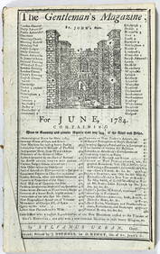
June 1784 Tells of a Balloon Launch Page 433, 434Grant Zahajko Auctions, LLC4.7(1k)See Sold PriceMar 06, 2024