SoldGrenfell Newfoundland Large Woven MapGrenfell Newfoundland Large Woven Map Including whales, boats and compass. Label, "Grenfell Labrador Industries, Hand-made in Newfoundland & Labrador." 42" H x 32" WSee Sold Price
SoldGRENFELL PICTORIAL HOOKED LARGE-SIZE MAT / RUGGRENFELL PICTORIAL HOOKED LARGE-SIZE MAT / RUG, dyed silk or rayon stocking material, DESCRIPTION UPDATE 6/17/13 depicting a map of Newfoundland featuring a spouting whale, several sailing vessels, seSee Sold Price
SoldGrenfell Newfoundland Woven MatGrenfell Newfoundland Woven Mat Seals and hunters. Labeled, "Grenfell Labrador Industries, Handmade in Newfoundland & Labrador." 22 1/2" H x 26 1/2" WSee Sold Price
SoldGrenfell Newfoundland Woven Matt of Man and DogGrenfell Newfoundland Woven Matt of Man and Dog Nighttime winter scene of man and dog trekking home. Label, " Grenfell Labrador Industries, Handmade in Newfoundland & Labrador." 21 1/2" H x 26 1/4" WSee Sold Price
SoldGrenfell Newfoundland Woven Polar Bear MatGrenfell Newfoundland Woven Polar Bear Mat Polar bear on the ice at sunset. Labeled, "Grenfell Labrador Industries, Hand-made in Newfoundland & Labrador." 27 1/4" H x 39" WSee Sold Price
SoldGrenfell Newfoundland Woven MatGrenfell Newfoundland Woven Mat Mother and child. Label reads, "Grenfell Labrador Industries, Handmade in Newfoundland & Labrador." 9 1/2" H x 7 1/2" WSee Sold Price
SoldGrenfell Newfoundland Woven Puffin MatGrenfell Newfoundland Woven Puffin Mat Puffin has animal fur on body. Label, "Grenfell Labrador, Handmade in Newfoundland & Labrador." 11 1/2" H x 17" WSee Sold Price
1901 - Newfoundland - XTRA Large Map1901 - Newfoundland - XTRA Large Map **|**|** This is a beautiful, 114 year old map of Newfoundland - published in the USA by George F. Cram. The map is much larger than most atlas maps of the same erSee Sold Price
Large Map of Newfoundland [Canada]Map of Newfoundland Canada With map of New Brunswick and Nova Scotia [and] Ontario on versos Cartographer: George Franklin Cram Dated: Circa 1900 Type:See Sold Price
Canada 1894 Large Map of Newfoundland by StanfordLarge Lithograph Map Published 1894, London for "Stanford's London Atlas of Universal Geography" by Edward Stanford. Paper Size: 29.5 x 22 inch (75 x 56cm) A few closed tears, minor wrinkle present.See Sold Price
Large Map of Newfoundland [Canada]Map of Newfoundland Canada With map of New Brunswick and Nova Scotia [and] Ontario on versos Cartographer: George Franklin Cram Dated: Circa 1900 Type:See Sold Price
Large Map of Newfoundland [Canada]Map of Newfoundland Canada With map of New Brunswick and Nova Scotia [and] Ontario on versos Cartographer: George Franklin Cram Dated: Circa 1900 TypeSee Sold Price
Canada 1894 Large Map of Newfoundland by StanfordLarge Lithograph Map Published 1894, London for "Stanford's London Atlas of Universal Geography" by Edward Stanford. Paper Size: 29.5 x 22 inch (75 x 56cm) A few closed tears, minor wrinkle present.See Sold Price
Canada 1894 Large Map of Newfoundland by StanfordLarge Lithograph Map Published 1894, London for "Stanford's London Atlas of Universal Geography" by Edward Stanford. Paper Size: 29.5 x 22 inch (75 x 56cm) A few closed tears, minor wrinkle present.See Sold Price
Canada 1894 Large Map of Newfoundland by StanfordLarge Lithograph Map Published 1894, London for "Stanford's London Atlas of Universal Geography" by Edward Stanford. Paper Size: 29.5 x 22 inch (75 x 56cm) A few closed tears, minor wrinkle present.See Sold Price
Large Map of Newfoundland [Canada]Map of Newfoundland Canada With map of New Brunswick and Nova Scotia [and] Ontario on versos Cartographer: George Franklin Cram Dated: Circa 1900 TypeSee Sold Price
Canada 1894 Large Map of Newfoundland by StanfordLarge Lithograph Map Published 1894, London for "Stanford's London Atlas of Universal Geography" by Edward Stanford. Paper Size: 29.5 x 22 inch (75 x 56cm) A few closed tears, minor wrinkle present.See Sold Price
Miniature Grenfell Map of NewfoundlandItem: Miniature Grenfell mat depicting the map of Newfoundland. The colors are spectactular, shows no fading and has the original label on the reverse side. Date: Circa 1920's. Dimensions: 7 1/4” xSee Sold Price
SoldA VINTAGE HOOKED RUG BY GRENFELL LABRADOR INDUSTRA hooked mat with a map of Newfoundland by Grenfell Labrador Industries. The map features stylized images of seals, whales, and ships. Circa 1930 Dimensions: 22 x 18 in.See Sold Price
Sold[Map, Large] Gulf and River St. Lawrence…"Chart of the Gulf and River St. Lawrence. Including the coast from Breton Island to Cape Cod, and the Island and Banks of Newfoundland." London: James Imray, 1853. Large map, measured from neat-linesSee Sold Price
Grenfell Mission Map of NewfoundlandItem: Grenfell Mission mat depicting the map of Newfoundland. Date: Circa 1920's-1930's. Size: 15.5 x 12.5 inches The map includes a compass rose, the North wind blowing, a spouting whale, a sail boatSee Sold Price
SoldGrenfell Labrador Industries Map Hook Rug MatGrenfell Mission, Newfoundland & Labrador, Canada. Small textile map of Newfoundland with motifs such as a ship and whale in the water, wind personified, and a compass along the lower left. Label whicSee Sold Price
SoldMid 20th C. Grenfell Mat MapCirca 1930's/40's Grenfell mat map of Newfoundland, dyed silk and rayon hosiery on burlap, map includes spouting whale and other details, 15"h x 12 3/4"w (sight), 21 3/4"h x 19 1/2"w (frame), in pinkSee Sold Price
SoldHomann (Heirs of) - Partie Orientale de la Nouvelleafter Bellin, from Hudson Bay and Lake Ontario to Newfoundland, large decorative title cartouche lower right, engraved map, 450 x 560mm., central vertical fold, Nuremberg, 1755 § Holland (Samuel)See Sold Price
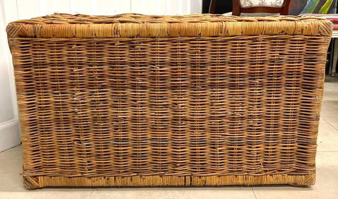
Large Woven Antique 19th Century Gathering Basket w/ Carved HandlesHoller and Hammer4.5(47)See Sold PriceFeb 24, 2024
1736 LARGE MAP OF SILESIA POLAND OPPAVIENSIS antique 25 by 34 3/4"Jasper524.5(9.8k)See Sold PriceFeb 27, 2024
1736 LARGE MAP OF SILESIA POLAND KARNOVIENSIS antique 25 x 4 3/4" Duchy of KrnovJasper524.5(9.8k)See Sold PriceFeb 27, 2024
Stanford, Edward 1901 Large Map. Burma and Adjacent CountriesAlbion Auctions4.6(336)See Sold PriceMar 01, 2024
Stanford, Edward 1901 Large Map. Sea of Marmara. TurkeyAlbion Auctions4.6(336)See Sold PriceMar 01, 2024
Stanford, Edward 1901 Large Map. Geological Map of the British IslesAlbion Auctions4.6(336)See Sold PriceMar 01, 2024
Stanford, Edward 1901 Large Map. Hydrographical Map of the British IslesAlbion Auctions4.6(336)See Sold PriceMar 01, 2024
Stanford, Edward 1901 Large Map. Stereographical Map of The British IslesAlbion Auctions4.6(336)See Sold PriceMar 01, 2024
Perry, Matthew C. 1856 Large Map. Shah Bay, Lew Chew I. JapanAlbion Auctions4.6(336)See Sold PriceMar 01, 2024
1913-1936 Newfoundland Large Cent George V Avg CircGolden Air Auctions4.4(257)See Sold PriceFeb 26, 2024


![Large Map of Newfoundland [Canada] (1 of 2)](https://p1.liveauctioneers.com/5614/261620/136319767_1_x.jpg?height=282&quality=70&version=1663186266)

![Large Map of Newfoundland [Canada] (1 of 2)](https://p1.liveauctioneers.com/5614/197749/99927639_1_x.jpg?height=282&quality=70&version=1616015306)
![Large Map of Newfoundland [Canada] (1 of 2)](https://p1.liveauctioneers.com/5614/183569/92295170_1_x.jpg?height=282&quality=70&version=1603822607)


![Large Map of Newfoundland [Canada] (1 of 2)](https://p1.liveauctioneers.com/5614/289638/153376142_1_x.jpg?height=282&quality=70&version=1684353133)


![[Map, Large] Gulf and River St. Lawrence… (1 of 8)](https://p1.liveauctioneers.com/3532/146911/74242535_1_x.jpg?height=282&quality=70&version=1564368564)