Sold20th C. U.S. Geological Survey MapsGrouping of 74 early 20th C. U.S. Geological Survey maps of Pennsylvania, New Jersey, New York, Connecticut, Rhode Island, Massachusetts.See Sold Price
SoldSpace Selection of 1960s US Geological Survey MapsSpace Selection of 1960s US Geological Survey Maps of the Moon consisting of 1962 Kepler Region R J Hackman^ 1963 Letronne Region C.H Marshall^ 1965 Aristarchus region H.J Moore^ 1966 Pitatus Region NSee Sold Price
265 Topographical Maps, assorted contour maps, U.265 Topographical Maps, assorted contour maps, U.S. Geological Survey, early 20th century, 16 1/2 x 20 in. each.See Sold Price
SoldNantucket Map, c. 1890Two U.S. geological survey topographical chart maps framed and matted together, showing Nantucket Tuckernuck and Muskeget,c.1890, Overall, 35” x 45”See Sold Price
Map of Public Surveys in California to Accompany ReportReserve Reduced! Title: Map of Public Surveys in California to Accompany Report of Surveyor General Publication Date: 1856 Cartographer: John C. Hays Publisher: U.S. Geological Survey Size (inches): HSee Sold Price
Land Classification Map Part of Southern Colorado 1878Map: Land Classification Map of Part of Southern Colorado Maker: U.S. Geological Survey, George Wheeler Publishing: Washington DC 1878 Size: 15 x 19.3 inches "Atlas sheet No. 62 (C) U.S. Geological suSee Sold Price
Important Late 19th C Wall Map of ConnectcutPowell, J. W. Map of Connecticut/ Prepared by the U.S. Geological Survey in Co-Operation With the State of Connecticut/ U.S.G.S.. J.W. Powell, Director/ State Of Connecticut Commissioners: William H.See Sold Price
SoldLarge colored map of Shasta Co. CA 1912Heading: (California - Shasta County) Author: Wiegel, C. R. Title: Map of the County of Shasta California. Compiled from U.S. geological and U.S. land surveys, official and private surveys, etc. by C.See Sold Price
Antique Map of MIneral Springs of the US, 1892[United States]. [Washington]: U. S. Geological Survey, A. C. Peale, 1892. Coloured map. 16-1/2 x 27 inches, printed in black, pale green and red on cream paper. A little browned in margins and centerSee Sold Price
SoldUS Geological Survey Map of the United StatesVery large book of US maps, from the whole country. All color topographical maps, featuring quadrant sections. This book measures 28"x19", and has railroads indicated on the maps. These maps are detaiSee Sold Price
1958 US Geological Survey Map of Yosemite Valley -- MapTitle/Content of Map: 1958 US Geological Survey Map of Yosemite Valley -- Map of Yosemite Valley, Yosemite National Park, California, Mariposa County Date: 1558, Washington DC Cartographer: US GeologiSee Sold Price
SoldCATALOG OF US GEOLOGICAL SURVEY MAPS OF MAINE"Railroad Station" Binding of (187) Maps of Maine published between roughly 1928-1956, indexed by town at front, in black hinged hardcover with tabulation. 22 1/2" x 19". Generally good condition, somSee Sold Price
CATALOG OF US GEOLOGICAL SURVEY MAPS OF MAINE"Railroad Station" Binding of (187) Maps of Maine published between roughly 1928-1956, indexed by town at front, in black hinged hardcover with tabulation. 22 1/2" x 19". Generally good condition, somSee Sold Price
1958 US Geological Survey Map of Yosemite Valley -- MapTitle/Content of Map: 1958 US Geological Survey Map of Yosemite Valley -- Map of Yosemite Valley, Yosemite National Park, California, Mariposa County Date: 1558, Washington DC Cartographer: US GeologiSee Sold Price
Sold6 US Geological Survey Maps Pisgah ForestCollection of six US Geological Survey topographical maps covering areas of the Tennessee River watershed including; 10 Horse Shoe, NC, 2) Shining Rock, NC, 3) Skyland, NC, 4) Rosman, NC, 5) StandingsSee Sold Price
6 US Geological Survey Maps Pisgah ForestCollection of six US Geological Survey topographical maps covering areas of the Tennessee River watershed including; 10 Horse Shoe, NC, 2) Shining Rock, NC, 3) Skyland, NC, 4) Rosman, NC, 5) StandiSee Sold Price
6 US Geological Survey Maps Pisgah ForestCollection of six US Geological Survey topographical maps covering areas of the Tennesseeï¾ River watershed including; 10 Horse Shoe, NC, 2) Shining Rock, NC, 3) Skyland, NC, 4) Rosman, NC, 5) StanSee Sold Price
Sold1938 U.S. Geological Survey Map of Oahu Hawaii"Geologic and Topographic Map of the Island of Hawaii. Showing well, springs, tunnels, shafts, proposed Kalihi-Waiahole tunnel, specimen localities and structure sections". Inset map of Honolulu, explSee Sold Price
Sold1958 US Geological Survey Map of Yosemite Valley -- MapTitle: 1958 US Geological Survey Map of Yosemite Valley -- Map of Yosemite Valley, Yosemite National Park, California, Mariposa County Cartographer: US Geological Survey Year/Place: 1558, Washington DSee Sold Price
Sold1938 U.S. Geological Survey Map of Oahu Hawaii"Geologic and Topographic Map of the Island of Hawaii. Showing well, springs, tunnels, shafts, proposed Kalihi-Waiahole tunnel, specimen localities and structure sections". Inset map of Honolulu, explSee Sold Price
U.S. GEOLOGICAL SURVEY - MAP OF PORTIONS OF UTAH AND ARU.S. Geological Survey - Map Of Portions Of Utah And Arizona, 1879 - Giclée On Canvas - 25 1/8 X 36 In.See Sold Price
U.s. Geological Survey - Map Of Portions Of Utah AndU.s. Geological Survey - Map Of Portions Of Utah And Arizona, 1879 - 27 7/8 X 40 In. - Giclée On Canvas - Museum Wrapped - Large Piece Of Art - This Piece Is Ready To Hang On Your WallSee Sold Price
U.S. GEOLOGICAL SURVEY - MAP OF PORTIONS OF UTAH ANDU.s. Geological Survey - Map Of Portions Of Utah And Arizona, 1879 - 27 7/8 X 40 In. - Giclée On Canvas - Museum Wrapped - Large Piece Of Art - This Piece Is Ready To Hang On Your WallSee Sold Price
U.S. GEOLOGICAL SURVEY - MAP OF THE BLACK HILLS OFU.s. Geological Survey - Map Of The Black Hills Of Dakota, 1879 - 30 X 24 5/8 In. - Gallery Stretched The Piece Of Art Is Ready To Hang Or Lean Against A Wall, Or Display On An Easel. - A Giclée PrinSee Sold Price
DODIE THAYER (US, 20TH C.) MAJOLICA TUREENThomaston Place Auction Galleries4.4(394)See Sold PriceFeb 25, 2024
Carole Scott (US 20th C) Hand Painted Porcelain Plaque of Birds, SignedTaylor & Harris4.7(163)See Sold PriceMar 10, 2024
Three American Military Style Knives, 20th c., M3- L.- Blade- 6 5/8 in., Overall- 11 1/2 in.;Crescent City Auction Gallery4.3(233)See Sold PriceMar 01, 2024
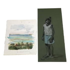
Pair Quince Quaintance (American 20th c ) Signed Beach Themed ArtAbsolute Auction Gallery4.5(58)See Sold PriceFeb 28, 2024
Nottingham.- Ordnance Survey Office (publisher) Collection 8 geological maps on the environs ofForum Auctions4.4(54)See Sold PriceFeb 29, 2024
INDIA WITHIN THE GANGES SUSAN GOLE ILLUSTRATED MAPS EARLY CARTOGRAPHYJasper524.5(9.9k)See Sold PriceFeb 27, 2024
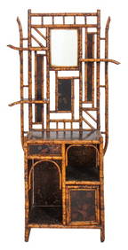
Aesthetic Movement Faux Bamboo Etagere, 20th CAuctions at Showplace4.6(744)See Sold PriceApr 07, 2024
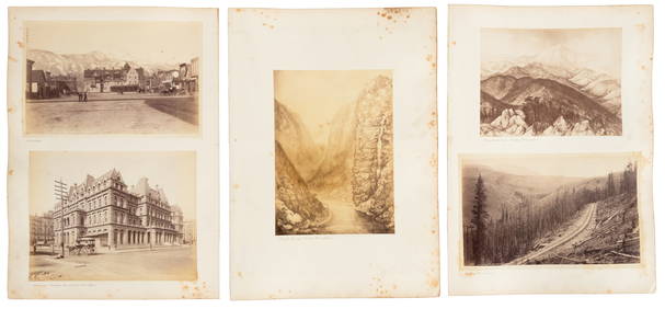
Virginia and West Virginia Topography MapsRapid Estate Liquidators and Auction Gallery4.5(1.1k)See Sold PriceFeb 28, 2024