SoldAfter Jan Jansson 'Hornius map' of the 12 Tribes oAfter Jan Jansson 'Hornius map' of the 12 Tribes of Israel,expanding on the late 16th century cartography of Christian van Adricham, reduced 18th century issue, 6 engraved maps sheets with hanSee Sold Price
SoldJansson & Hornius - Map of the Holy LandJan Jansson [or Johannes Janssonius] (1588 - 1664) and Georgius Hornius [or Georg Horn] (1620 - 1670), Tribuum Ephraim, Beniamin, et Dimidiae Manasse intra Iordanem partes occidentales, et partes septSee Sold Price
Jansson & Hornius - Map of the Holy LandJan Jansson [or Johannes Janssonius] (1588 - 1664) and Georgius Hornius [or Georg Horn] (1620 - 1670), Tribuum Ephraim, Beniamin, et Dimidiae Manasse intra Iordanem partes occidentales, et partes septSee Sold Price
Middle East.- Jansson (Jan)Middle East.- Jansson (Jan) Dimidia Tribus Manasse..; Tribus Ruben..; Pars Maxima Tribus Iuda..; Tribus Aser..; Tribuum Ephraim..; Tribus Simeon.., the 6-sheet 'Hornius Map' depicting the textSee Sold Price
SoldJAN JANSSON & VICOR LEVASSEUR MAPS - TWO WORKS.JAN JANSSON & VICOR LEVASSEUR MAPS - TWO WORKS. Levasseur: Dept. de Maine et Loire, color engraving, circa 1859 (12.50' x 17.4" sight). Jansson: Principatus Anhaldinus et Magdeburgensis ArchiepiscopatSee Sold Price
Exceptionally Large Map - Territories of the Tribes ofMap of Palestine, showing the territories of the Tribes of Israel, by Georg Horn and Jan Jansson, after Christian Kruik van Adrichem ("Situs Terrae Promissionis"). Engravings printed on six sheets, atSee Sold Price
Dutch Jan Jansson 1657 Color Jerusalem Map reproductionFramed, Titled ""View of Jerusalem Down from the East" Image Dimensions: 12" x 15", AL280, K119W, shipping in the USA $40See Sold Price
SoldJansson (Jan) - Mappa Aestivarum Insularum, aliasthe island of Bermuda, north oriented to the upper right, central strapwork title cartouche, compass rose and rhum lines, tables of county 'tribes' below, engraved map with original hand-colouring, 39See Sold Price
SoldJansson (Jan) - Mappa Aestivarum Insularum, aliasthe island of Bermuda, north oriented to the upper right, central strapwork title cartouche, compass rose and rhumb lines, tables of county 'tribes' below, engraved map with original hand-colouring, 3See Sold Price
SoldJansson (Jan) Galliae Veteris TypusJansson (Jan) Galliae Veteris Typus, Roman France, divided into provinces, with various tribes marked, engraved map with original outline hand-colouring, 385 x 490mm., central vertical fold, rSee Sold Price
SoldHoly Land.- Jansson (Jan) [Holy Land] Dimida TribusHoly Land.- Jansson (Jan) and Georgius Hornius. [Holy Land] Dimida Tribus Manasse ... [with] Tribus Ruben, et Gad ... [and] Pars Maxima Tribus Iuda ... [and] Tribuum Ephraim ... [and] Tribus Aser [andSee Sold Price
SoldLarge Wall Map - Living Areas of the Twelve Tribes -Tribus Ruben, et Gad et partes orientales tribuum Beniamin, Ephraim, et dimidiae Manasse intra Iordanem. Map showing the regions of the Twelve Tribes of Israel, by Georg Horn and Jan Jansson, accordinSee Sold Price
SoldJansson map of Paraguay c.1640Title: Paraguay, o Prov. de Rio de la Plata cum Regionibus Adiacentibus Tucuman et Sta. Cruz de la Sierra Author: Jansson, Jan Description: Copper-engraved map, hand-colored. 38x49 cm. (15x19½").AttrSee Sold Price
SoldAveele (Jan vanden) 12 tribes of IsraelAveele (Jan vanden) Perigrinatie ofte Veertigh-Iarige Reyse der Kinderen Israëls,variant of the Holy Land map by Visscher and others, with a more elaborate vignette above, and revised title baSee Sold Price
SoldSouth America.- Jansson (Jan) Paraguay, o Prov. de RioSouth America.- Jansson (Jan) Paraguay, o Prov. de Rio de la Plata cum Regionibus Adiacentibus Tucuman et Sta. Cruz de la Sierra, map of the Paraguay River basin and the Peru-Chilean coast with Lake TSee Sold Price
SoldJansson (Jan) Provincia Connachtiæ, The province oJansson (Jan) Provincia Connachtiæ, The province of Connaugt,north oriented to the right, with strapwork title cartouche lower left, ships and sea monster, engraved map with original hand-coloSee Sold Price
SoldJan Jansson, map of Italy, 17th c.Jan Jansson, map of Italy, 17th c., Joannes Janssonius, Amsterdam, c. 1635, "Italia Nuovamente piu perfetta che mai per inanzi posta in luce, scolpita et con le suoi figure vivamente rappresentate", wSee Sold Price
Jan Jansson: Map of Malay Peninsula, 1617Map: Tabula Asiae XI (Malay Peninsula) Cartographer: Jan Jansson Illustrator: Jan Jansson Date: 1617 Size: 5 x 6.625 inches Hand-colored, authentic antique map based on early version by Ptolemy. NiceSee Sold Price
SoldJan Jansson map of the Caribbean, c.1640Heading: Author: Jansson, Jan Title: Insulae Americanae in Oceano Septentrionali, cum Terris Adiacentibus Place Published: Amsterdam Publisher: Date Published: c,1640 Description:See Sold Price
SoldJan Jansson Map, Nova Anglia Nova Belgium et Virginiauncolored copperplate engraving, Amsterdam, second quarter of the 17th century, from the Theatre du Monde ou Nouvel Atlas showing North America's Atlantic coast from Nova Scotia south to North CarolinSee Sold Price
SoldJAN JANSSON MAP MAKERTitled: "Fezzae et Marocchi Regna Africae Celeberrima" Amsterdam / ca.1660, Map Maker: Jan Jansson Hand Colored Dimensions: H 20" x W 15". Condition: Good, has some tears on the sides and center foldSee Sold Price
Jan Jansson Map, Poli Arctici"Nova et Accurata Poliartici et terrarum..." Amsterdam [Circa 1650]. Copper engraved map with hand-coloring. Art: 16" x 20 3/4". Uneven age-toning, vertical crease at center, and light staining.See Sold Price
SoldJan Jansson map of AfricaCartographer: Jan Jansson Title: Aethiopia Superior vel Interior vulgo Abissinorum sue Presbiteri Ioannis Imperium Subject: Africa Published: Amsterdam Date: c. 1680 Description: Map of central AfricaSee Sold Price
SoldJan Jansson map of Scotland, c.1640Heading: Author: Jansson, Jan Title: Scotia Regnum Place Published: Amsterdam Publisher: Date Published: c.1640 Description: Copper-engraved map, hand-colored. 38.2x50 cm (See Sold Price
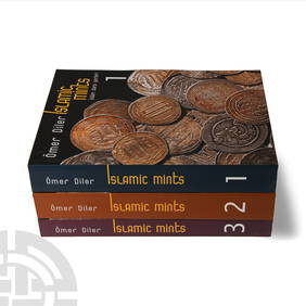
Numismatic Books - Diler - Islamic Mints Volumes 1-3TimeLine Auctions Ltd.4.5(183)See Sold PriceMar 09, 2024
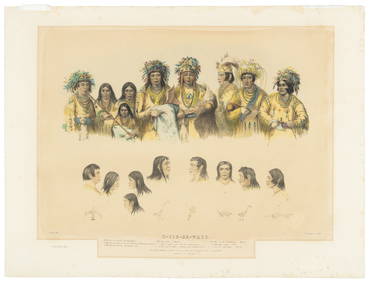
[LITHOGRAPHY]. [NATIVE AMERICANS]. Group of Five Hand-Color...Potter & Potter Auctions4.6(539)See Sold PriceMar 07, 2024
1749-59 21 volumes NETHERLANDS HISTORY ILLUSTRATED antique VELLUM BOUNDJasper524.5(9.8k)See Sold PriceFeb 27, 2024
3 Vintage The World Lithographs, By JanssonThe Benefit Shop Foundation Inc.4.3(2.9k)See Sold PriceMar 13, 2024


![Holy Land.- Jansson (Jan) [Holy Land] Dimida Tribus (1 of 1)](https://p1.liveauctioneers.com/5458/162099/81861694_1_x.jpg?height=282&quality=70&version=1582043994)


![[LITHOGRAPHY]. [NATIVE AMERICANS]. Group of Five Hand-Color... (1 of 5)](https://p1.liveauctioneers.com/928/318880/171361074_1_x.jpg?height=282&quality=70&version=1707501302)