Sold-. Bellin (Jacques Nicolas) Carte Reduite du Golph-. Bellin (Jacques Nicolas) Carte Reduite du Golphe de St. Laurent ...,map showing the Gulf of St Lawrence, with decorative title cartouche upper right, engraving, with manuscript pen and redSee Sold Price
SoldBELLIN, JACQUES NICOLAS. Carte Reduite du GolpBELLIN, JACQUES NICOLAS. Carte Reduite du Golphe de St. Laurent. Double-page engraved map, 560x900 mm, wide margins; dampstaining in the top margin (well outside the platemark and easily matted out),See Sold Price
Bellin, J. N. Costes Orientales de L' AmeriqueBellin, Jacques Nicolas Carte Reduite du Costes Orientales de L'Amerique Septentrionale É 1757 Copperplate engraving; uncoloured Printed area: 62.5 x 49.5 cm; 24.6 x 19.5 in Large and detailed chartSee Sold Price
SoldFrance.- Bay of Biscay.- Bellin (Jacques Nicolas) CarteNO RESERVE France.- Bay of Biscay.- Bellin (Jacques Nicolas) Carte Reduite Du Golphe De Gascogne..., chart of the Bay of Biscay from Bellin's atlas, "Le Neptune Francois ...", showing from Galicia inSee Sold Price
SoldBellin (J.N.) Carte Reduite du Grand BancBellin (Jacques Nicolas) Carte Reduite du Grand Banc et d'une partie de l'Isle de Terre Neuve,coastal chart of southern Newfoundland and the Grand Banks, engraved chart with hand-colouring, 55See Sold Price
France.- Bay of Biscay.- Bellin (Jacques Nicolas) CarteFrance.- Bay of Biscay.- Bellin (Jacques Nicolas) Carte Reduite Du Golphe De Gascogne..., chart of the Bay of Biscay from Bellin's atlas, "Le Neptune Francois ...", showing from Galicia in Spain arounSee Sold Price
SoldBellin (J N) Carte Réduite des Mers du NordBellin (Jacques Nicolas) Carte Réduite des Mers du Nord,the North sea, Labrador, Greenland, Iceland, Scandinavia, the British Isles, and the northern regions of northern Europe, engraved map wSee Sold Price
SoldBellin maps of Straight of Magellan 1753Title: Two maps of the Magellan Straits & Tierra Del Fuego Author: Bellin, Jacques Nicolas Description: Includes: Carte Reduite du Detroit de Magellan Dressee sur les Journaux des Navigateurs... 20x35See Sold Price
SoldBellin (J N) Carte Réduite des Mers du NordBellin (Jacques Nicolas) Carte Réduite des Mers du Nord,North Atlantic showing the coastlines of Labrador, Greenland, Iceland, British Isles and Scandinavia, ornamental title cartouche, engravSee Sold Price
MAP - Gulf of Mexico & Caribbean. BellinGulf of Mexico & Caribbean. Jacques Nicolas Bellin, Carte Reduite du Golphe du Mexique et des Isles de l'Amerique. Dressee au Depost des Cartes et Plans de la Marine pour le Service des Vaisseaux du RSee Sold Price
SoldAustralasia.- South Pacific.- Bellin (Jacques Nicolas)Australasia.- South Pacific.- Bellin (Jacques Nicolas) Carte Reduite de la Mer du Sud pour Servir a l'Histoire Generale des Voyages, map showing Eastern Australia with dotted lines, and joining both TSee Sold Price
Sold[Jacques Nicolas Bellin (1703-1772)]. Carte Reduite Du[Jacques Nicolas Bellin (1703-1772)]. Carte Reduite Du Globe Terrestre. N.p; n.p, ca 1764. Engraved map with hand-coloring in wash and outline, visible area 9 1/4 x 14 in. (236 x 356 mm), matted and fSee Sold Price
SoldBellin (J N) Carte des Détroits de MalacaBellin (Jacques Nicolas) Carte Réduite des Détroits de Malaca, Sincapour, et du Gouveneur,straits of Mallaca with the islands at the mouth, inset coastal profiles, decorative title cartouche,See Sold Price
SoldBELLIN, JACQUES NICOLAS. Carte Reduite des BanBELLIN, JACQUES NICOLAS. Carte Reduite des Bancs et de l'Ile de Terre-Neuve avec les Cotes du Golfe de St. Laurent et de l'Acadie. Large double-page engraved map, 640x940 mm, wide margins; hand-coloreSee Sold Price
SoldPacific Ocean.- Bellin (Jacques Nicolas) Carte ReduitePacific Ocean.- Bellin (Jacques Nicolas) Carte Reduite des Mers Comprises Entre L'Asie et L'Amerique Apelées par les Navigateurs Mer du Sud ou Mer Pacifique, large sea chart of the Pacific Ocean,See Sold Price
SoldBellin (Jacques Nicolas) Essay... GlobeBellin (Jacques Nicolas) Essay D'Une Carte Réduite, Contenant Les Parties Connuees Du Globe Terrestre,world map with decorative title cartouche and compass roses, engraved map with hand-colourSee Sold Price
SoldCarte Reduite du Golphe du Mexique...Carte Reduite du Golphe du Mexique et des Isles de L'Amerique. Jacques-Nicolas Bellin (1703 - 1772). Engraved map on blue paper. Paris: Depot de la Marine, 1774 (Second Edition). 24 1/2 x 32 1/8 incheSee Sold Price
SoldAN ANTIQUE MAP, "Carte Reduite du Golphe du Mexique etAN ANTIQUE MAP, "Carte Reduite du Golphe du Mexique et Des Isles de L'Amerique," PARIS, 1749, hand colored engraving on paper, by Jacques-Nicolas Bellin (1703-1772), Official Hydrographer of Louis XVSee Sold Price
SoldBellin CARTE REDUITE DE L'ISLE DE LA JAMAIQUE 1755-1766Details: BELLIN, Jacques-Nicolas (1703-1772). Carte Reduite de l'Isle de la Jamaique pour servir aux Vaisseaux Français. Paris: Imprimerie du Departement de la Marine, 1753 [but 1755-1766]. EngravedSee Sold Price
SoldMAP - Hispaniola & Bahamas. BellinNorthern Hispaniola & Southern Bahamas. Jacques Nicolas Bellin, Carte Reduite des Debouquemens de St. Domingue Dressee pour le Service des Vaisseaux du Roy..., 1768 (dated). Hand Color. This large-scaSee Sold Price
Sold[Maps] Bellin, Globe Terrestre, 1748Jacques Nicolas Bellin, Essay d'une carte réduite contenant les parties connuees du globe Terrestre. 1748. Incisione in rame. mm 508x700. Titolo e dati editoriali entro cartiglio in basso a siniSee Sold Price
SoldBellin map of Northwest coast 1758Title: Carte Reduite des Parties Septentrionales du Globe, Situees Entre l'Asie et l'Amerique Author: Bellin, Jacques Nicolas Description: Copper-engraved map. 21x35 cm. (8½x14").Unusual chart showinSee Sold Price
MAP, Northwestern Africa, BellinNorthwestern Africa. Jacques Nicolas Bellin, Carte Reduite des Costes Occidentales d'Afrique Seconde Feuille Depuis le Cap Bojador Jusqu'a la Riviere de Sierra Leona Pour le Service des Vaisseaux du RSee Sold Price
SoldMAP - Hispaniola. BellinHispaniola. Jacques Nicolas Bellin, Carte Reduite de l'Isle de Saint Domingue et de ses Debouquements pour Servir aux Vaisseaux du Roy..., 1754 (dated). Hand Color. This gorgeous, large-scale chart coSee Sold Price
Map of St. Kitts and Nevis Depot de la Marine, Paris, 1758Global Auctions Company4.3(36)See Sold PriceMar 03, 2024
Duval - Pair: Map of India & Map of MaldivesTrillium Antique Prints & Rare Books4.5(32)See Sold PriceFeb 24, 2024
1758 MAP PARTIE DE LA MER GLACIALE contenants La Nouvelle Zemble RUSSIA antiqueJasper524.5(9.9k)See Sold PriceFeb 27, 2024
1749 MAP CARTE DE LA TARTARIE ORIENTALE RUSSIA & CHINA antique EASTERN TARTARYJasper524.5(9.9k)See Sold PriceFeb 27, 2024
1764 Bellin Chart of Three South Haitian Bays -- Carte des Bayes du Mesle des Flamands et deJasper524.5(9.9k)See Sold PriceFeb 27, 2024
Partie de la Coste d'Afrique depuis Tanit…' Southern Mauritania BELLIN 1746 mapJasper524.5(9.9k)See Sold PriceFeb 28, 2024
Carte du Golfe de Guinée'. Gulf of Guinea. Nigeria & Cameroon. BELLIN 1747 mapJasper524.5(9.9k)See Sold PriceFeb 28, 2024
Barthelemy, Jean 1790 Map. Greece - Essa sur la Bataille de PlateeAlbion Auctions4.6(341)See Sold PriceMar 01, 2024
Barthelemy, Jean 1790 Map. Greece - Plan de L'AcademieAlbion Auctions4.6(341)See Sold PriceMar 01, 2024
Barthelemy, Jean 1790 Map. Greece - Essai sur les Environs de DelphesAlbion Auctions4.6(341)See Sold PriceMar 01, 2024
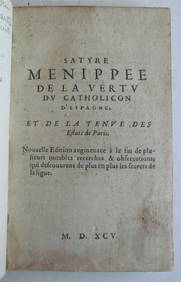
OLD SATIRICAL WORK, 1595 SATYRE MENIPPEE DE LA VERTU DU CATHOLICON D'ESPAGNENY Elizabeth 4.2(86)See Sold PriceMar 03, 2024
Jacques Nicolas Bellin - Antique Map - Vue de la Rade de Tiniam, double antique coast view of theProverde Auctions4.3(3)See Sold PriceFeb 28, 2024
Jacques Nicolas Bellin - View of the entrance to Zihuatanejo Bay - View of the entrance to the portProverde Auctions4.3(3)See Sold PriceFeb 28, 2024


![[Jacques Nicolas Bellin (1703-1772)]. Carte Reduite Du (1 of 1)](https://p1.liveauctioneers.com/197/144217/72930596_1_x.jpg?height=282&quality=70&version=1560547084)


![[Maps] Bellin, Globe Terrestre, 1748 (1 of 3)](https://p1.liveauctioneers.com/1306/149407/75466431_1_x.jpg?height=282&quality=70&version=1567670607)