Sold18th century map by John Overton 'A New Map of th18th century map by John Overton 'A New Map of the Kingdom of England and Principality of Wales' with twenty panels featuring views of city's, British Royal coat of arms above table showing the reignsSee Sold Price
Sold1799 Map ITALY JOHN CARY "A New Map of Piedmont" 18th CA beautifully engraved and colored 18th Century map of Italy. This piece is entitled: "A New Map of Piedmon the Duchies of Savoy and Milan; and the Republic of Genoa; with their Subdivisions." EngraveSee Sold Price
Sold18TH CENTURY MAP OF FRANCE18TH CENTURY MAP OF FRANCE, hand-colored, titled "A NEW MAP OF FRANCE, DIVIDED into DEPARTMENTS, as decreed by the NATIONAL ASSEMBLY, MDCCXC. FROM THE LATEST AUTHORITIES, By JOHN CARY, Engraver. 1799"See Sold Price
SoldGibson (John) Map of GuadaloupeGibson (John) A New And Accurate Map of the Isles of Guadaloupe, Marie-Galante &c., engraved map with full hand-colouring, 125 x 200mm., hinged into decorative mount, mid 18th century.See Sold Price
SoldMap Early 18th Century "A New Map of the World",Most Humbly Inscribed to his Royal Highness George Prince of Wales", by John Senex, c.1721, from the New General Atlas of the World, handcoloured etching, framed, 42cm x 52cmSee Sold Price
Sold18th century map of North Carolina,"A New and Accurate Map of North Carolina in North America", by John Hinton, published in [The Universal Magazine of Knowledge and Pleasure,] London, October 1779, copper engraving on laid paper withSee Sold Price
SoldLate 18th Century Map of North CarolinaLate 18th Century Map of North CarolinaThe State of North Carolina from the best Authorities from the American Atlas (New York: John Reid, 1796), copperplate engraving by Benjamin Turner with hand-colSee Sold Price
SoldA 19th century four fold screen,A 19th century four fold screen, decorated with 18th century maps including two hemi-spherical world maps with small text roundels possibly by Henry Overton or John Senex, each 'orb' about 92cm diametSee Sold Price
Sold1850s Re-creation of 18th Century Map Showing Lower1850s Re-creation of 18th Century Map Showing Lower Manhattan Montresor, John. A Plan of the City of New York & its Environs...To the Hon'ble Tho's. Gage, Esq. Major General and Commander in Chief ofSee Sold Price
SoldAN INTERESTING FRAMED 18TH CENTURY ENGLISH ENGRAVED MAPAN INTERESTING FRAMED 18TH CENTURY ENGLISH ENGRAVED MAP PRINT OF CHINA AFTER BOWAN, entitled ‘A New & Accurate Map of China Drawn From Surveys Made by the Jesuit Missionaries, by Order of the EmperoSee Sold Price
SoldCharles Smith (18th-19th Century) British. "A New MapCharles Smith (18th-19th Century) British. "A New Map of the County of Rutland", 1801, Engraved Map, 17.25" x 19.25".See Sold Price
SoldPhilip Astley Snr (18th-19th Century) British. "A NewPhilip Astley Snr (18th-19th Century) British. "A New Map of Europe", Map, 13" x 18.5".See Sold Price
Sold18th century hand colored map, titled "A New andAccurate Map of the Colony of Massachusetts Bay in North America from a Late Survey". Published in London, 1780, by John Hinton. Sight size 10 3/8" x 12 7/8". In a modern burlwood frame with multi-laySee Sold Price
Sold'Bowles's New Medium Map of Surrey', 18th Century'Bowles's New Medium Map of Surrey', 18th Century Hand-Coloured. 9" x 13", along with Hawkin's 'Mother Ludlam's Hole near Farnham, Surrey', 6" x 9".See Sold Price
SoldJohn Hinton, Maryland map(English, 18th century) "New and Accurate Map of the Province of Maryland in North America" hand colored map, circa 1780, 11 x 13 1/4 in. , framedSee Sold Price
SoldGrp: 9 Maps of New York City 18th-Early 20th c.Group of nine maps of New York City, dating from the 18th to early 20th century. By cartographers including John Montresor (1736-1799). Additionally includes a lovely 1704 map of the city featuring thSee Sold Price
SoldJohn Lord Summers Map of North AmericaFine 18th Century Map.John Lord Summers Map of North America, London c. 1715 by H. Moll.Copperplate engraving with hand coloring. Sight 23" x 38", framed.See Sold Price
SoldTwo 18th C. Maps & Two 18th C. EngravingsLot consists of three 18th century engravings--1st item: Mid 18th century map titled "A New Map of Carolina by Robert Morden"; page taken from a book or publication "A Description of Carolina"; map siSee Sold Price
SoldThree Early Maps of South Carolina/North Carolina1. Mid 18th century map titled "A New Map of Carolina by Robert Morden"; page taken from a book or publication "A Description of Carolina"; map size approximately 5" x 5"; page size 6 3/8"W, 8"H; 2. MSee Sold Price
Sold18th century hand coloured map of Britannia Romana18th century hand coloured map of Britannia Romana and a 18th century map titled a new map of England and Scotland and Ireland.See Sold Price
Sold18th Century Map of New EnglandMap titled "Nova Anglia Septentrionali Americae implantata Anglorumique coloniis florentissima…" by Johann Baptiste Homann ,Nuremberg,1716. Map is framed and matted and measures 18.5" x 23" (sight).See Sold Price
Sold18th Century map of New World, insular California[Americas]. America. Engraved map of North and South America, early full hand-coloring, early 1700s? 6 1/4 x 7 1/2 in. Several locations on map labelled with abbreviations glossed in panels at right.See Sold Price
AN 18TH CENTURY MAP OF NEW ENGLAND AND NAN 18TH CENTURY MAP OF NEW ENGLAND AND NEW YORK AND A 17TH CENTURY GERMAN MAP OF JERUSALEM. The first by F. Lamb, hand colored engraving; the second by Matthew Sutters - 19 1/2 x 22 in., the larger.See Sold Price
SoldSUTTON NICHOLLS (English, 18th century). A New MapSUTTON NICHOLLS (English, 18th century). A New Map of the Most Considerable Plantations of the English in America. Etching with hand-coloring, circa 1714 - 14 x 20 in. PROVENANCE: Darnall's Chance HSee Sold Price
Large lot of assorted prints. 18th-20th century. To include: North American and other maps, CivilTremont Auctions4.5(297)See Sold PriceFeb 25, 2024
An early Dutch hand colored engraving map by Georg Balthasar Probst (1732-1801)Ostantix Auctions4.4(11)See Sold PriceFeb 27, 2024
18th Century Hess Germany Hand colored Engraved MapGlobal Auctions Company4.3(36)See Sold PriceMar 03, 2024
1764 MAP OF COUNTRIES THIRTY MILES ROUND LONDON antique 12.5 by 15"Jasper524.5(9.9k)See Sold PriceFeb 27, 2024
1738 RUSSIA SIBERIA & GREAT TARTARY Description illustrated ANTIQUE in ENGLISHJasper524.5(9.9k)See Sold PriceFeb 27, 2024
La Basse-Guinée… Loango, Congo, AngoIa & Benguela Southern Africa BONNE 1790 mapJasper524.5(9.9k)See Sold PriceFeb 28, 2024
États du Roi de Maroc… d’Alger, Tunis & Tripoli. North Africa. BONNE 1790 mapJasper524.5(9.9k)See Sold PriceFeb 28, 2024
Le Canal de Mosambique, l'Isle de Madagascar… Mozambique. Africa. BONNE 1788 mapJasper524.5(9.9k)See Sold PriceFeb 28, 2024
Royaumes, Etats et Pays de la Haute Guinée. Gulf of Guinea. BONNE 1788 old mapJasper524.5(9.9k)See Sold PriceFeb 28, 2024
La Nubia ed Abissinia. Red Sea Ethiopia Sudan Eritrea Arabia. ZATTA 1785 mapJasper524.5(9.9k)See Sold PriceFeb 28, 2024
Le Royaume d’Adel… Ajan & Zanguebar. Adal Ajuran. Kenya Tanzania. BONNE 1788 mapJasper524.5(9.9k)See Sold PriceFeb 28, 2024
Le Canal de Mosambique, l'Isle de Madagascar… Mozambique. Africa. BONNE 1790 mapJasper524.5(9.9k)See Sold PriceFeb 28, 2024
Partie Occidentale de l’Afrique. West Africa coast Canary islands BONNE 1788 mapJasper524.5(9.9k)See Sold PriceFeb 28, 2024
Le Royaume d’Adel… Ajan & Zanguebar. Adal Ajuran. Kenya Tanzania. BONNE 1790 mapJasper524.5(9.9k)See Sold PriceFeb 28, 2024
États du Roi de Maroc… d’Alger, Tunis & Tripoli. North Africa. BONNE 1788 mapJasper524.5(9.9k)See Sold PriceFeb 28, 2024
La Basse-Guinée… Loango, Congo, AngoIa & Benguela Southern Africa BONNE 1788 mapJasper524.5(9.9k)See Sold PriceFeb 28, 2024
Egypte, Nubie et Abissinie. Egypt, Nubia & Abyssinia. Sudan. BONNE 1788 mapJasper524.5(9.9k)See Sold PriceFeb 28, 2024
Two Hand-Colored 19th Century Maps of New Orleans and Louisiana, Larger- H.- 12 1/2 in., W.- 15 1/2Crescent City Auction Gallery4.3(231)See Sold PriceMar 08, 2024
Late 18th century map of England and Wales sampler and two printsFellows4.3(159)See Sold PriceMar 05, 2024
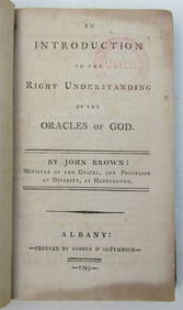
INTRODUCTION TO THE KNOWLEDGE OF GOD'S ORACLES, 1793, OLD ALBANY, NEW YORKNY Elizabeth 4.2(86)See Sold PriceMar 03, 2024