SoldJohn Speed (1552-1629) - Coloured engraving - “Map of HJohn Speed (1552-1629) - Coloured engraving - “Map of Hantshire described and devided”, with plan of the City of Winchester, 15ins x 20ins (text to reverse), in modern gilt frame and glazed ProvenSee Sold Price
SoldJohn Speed (1552-1629), map of Midle-sex (Middlesex),John Speed (1552-1629), map of Midle-sex (Middlesex), described with the most famous cities of London and Westminster, coloured engraving, circa 1600s H.39cm, W.52cm,See Sold Price
SoldJohn Speed (1552-1629) - Coloured engraving - Map of “John Speed (1552-1629) - Coloured engraving - Map of “Britain as it was devided.....”, 15ins x 19.75ins, published by Thomas Bassett & Richard Chiswell, in gilt moulded frame and glazedSee Sold Price
SoldJohn Speed (1552-1629) - Coloured engraving - “Map of TJohn Speed (1552-1629) - Coloured engraving - “Map of The Kingdome of Scotland”, with vignettes of the Royal Family, 15ins x 20ins, published by John Sudbury & George Humbell, 1610 (with printed dSee Sold Price
SoldJohn Speed (1552-1629) - Coloured engraving - 'Map ofJohn Speed (1552-1629) - Coloured engraving - 'Map of Caermarden', 15ins x 20ins, with Latin text to reverse, in modern wood frame and glazed Provenance: Richard A. Nicholson, Antique Maps & Prints, WSee Sold Price
SoldJohn Speed (1552-1629) - Coloured engraving - “Map of TJohn Speed (1552-1629) - Coloured engraving - “Map of The County and City of Lincoln”, 15ins x 20ins, printed by Joe Dococus Hondius 1610, in double sided Hogarth frame and glazedSee Sold Price
SoldJohn Speed (1552-1629) - Coloured engraving - “Map of DJohn Speed (1552-1629) - Coloured engraving - “Map of Derbyshire”, 15ins x 20ins, sold by John Sudbury and G. Humble, in double sided Hogarth frame and glazedSee Sold Price
SoldJohn Speed (1552-1629) - Coloured engraving - "Kent witJohn Speed (1552-1629) - Coloured engraving - "Kent with Her Cities and Earles described and observed" - Map of the County of Kent with plans of Canterbury and Rochester, 15ins x 19.75ins, thought toSee Sold Price
SoldA John Speed, 17th Century Map of Poland,Speed, John (1552-1629). 17th-Century map of Poland, hand-coloured copper engraving, featuring inset city views and figures displaying regional fashions/costumes, published by Bassett & Chiswell, EnglSee Sold Price
Speed, John (1552-1629). A 17th-century map ofSpeed, John (1552-1629). A 17th-century map of Nottinghamshire, hand-coloured copper engraving on laid/chain-lined paper, featuring heraldic shields and inset view of Nottingham, originally removed fSee Sold Price
SoldJohn Speed (1552-1629) - engraving - Map - ''Breknoke,John Speed (1552-1629) - engraving - Map - ''Breknoke, both shyre and towne described'', uncoloured with inset map of the town of Breknoke, Bassett and Chiswell edition, published in London (1676), frSee Sold Price
SoldJohn Speed (1552-1629) - Two coloured engravings -John Speed (1552-1629) - Two coloured engravings - "The Countie of Leinster" and "The Province of Mounster", each 15ins x 20ins, in double sided Hogarth frames and glazed, and Emanuel Bowen (1714-1767See Sold Price
SoldJohn Speed (1552-1629) British 'Oxfordshire', aJohn Speed (1552-1629) British 'Oxfordshire', a hand-coloured engraved map, titled 'Oxfordshire described with ye Citie and the Armes of the Colledges of ty famous University. Ao. 1605.', with an inseSee Sold Price
John Speed (British 1552-1629)/Anglesey, 1610/handJohn Speed (British 1552-1629)/Anglesey, 1610/hand coloured engraved map, 39cm x 51cmSee Sold Price
SoldJohn Speed (1552-1629) British. "The West Ridinge ofJohn Speed (1552-1629) British. "The West Ridinge of Yorkeshyre", Coloured Map, 15" x 20".See Sold Price
SoldJohn Speed (1552-1629) British. "Britain, As it Was,John Speed (1552-1629) British. "Britain, As it Was, Devided in the Tyme of the Englishe Saxons Especially During their Haptarchy [sic]", Coloured Map, showing details on the reverse, 15" x 20".See Sold Price
SoldJohn Speed, A Newe Mape of Tartary, Map in OldJohn Speed (1552-1629) – English cartographer and historian A Newe Mape of Tartary augmented by John Speede Decorative, colored copper engraving map of Asia with the historic territory of the TatarsSee Sold Price
SoldJohn Speed (1552-1629) English 'The Counti ofJohn Speed (1552-1629) English 'The Counti of Warwick...', hand coloured engraved map with maps of Coventry and Warwick and the arms of the Earls of Warwick, 39 cm x 50 cm.See Sold Price
SoldJohn Speed Map of Virginia and MarylandA Map of Virginia and Maryland. John Speed (1552-1629). Copperplate engraving. London: Bassett, 1776. 17 1/4 x 22 inches sheet. Speed’s map of Virginia and Maryland is one of the first to incorporatSee Sold Price
SoldJOHN SPEED (British 1552-1629) A HAND COLOREDJOHN SPEED (British 1552-1629) A HAND COLORED ENGRAVING, "A New and ACCURATE MAP OF THE WORLD," DATED 1651, a twin-hemisphere map of the world entitled ''A New and Accurat Map of The World Drawne accoSee Sold Price
SoldJohn Speed (1552-1629) British. "Denbighshire", Map,John Speed (1552-1629) British. "Denbighshire", Map, later hand coloured, Framed showing the reverse, 16.25" x 20.75".See Sold Price
John Speed (British 1552-1629)/Rutlandshire with OakhamJohn Speed (British 1552-1629)/Rutlandshire with Oakham and Stanford with the arms of the Duke of Rutland/hand coloured engraved map, 38cm x 51cmSee Sold Price
SoldJohn Speed (1552-1629), Map of Africae, hand coloredJohn Speed (1552-1629), Map of Africae, hand colored engraving by London Bassett Chiswell 1676 plate size 14 1/2" x 20"See Sold Price
SoldJohn Speed, (1552-1629) The Four Provinces of IrelaJohn Speed, (1552-1629) The Four Provinces of Ireland and a matching Map of Ireland, 1610 Handcoloured engravings, 38 x 50.5cm (5)See Sold Price
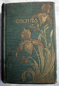
ORCHIDS Culture & Management 1st Edition c1903 ScarceLuis Porretta Fine Arts4.3(10)See Sold PriceMar 02, 2024
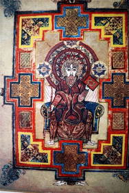
THE BOOK OF KELLS 3 x Limited Edition Serigraph Hand Made Prints Celtic ArtLuis Porretta Fine Arts4.3(10)See Sold PriceMar 02, 2024
17TH C. ANTIQUE MAP SIEGE OF LA ROCHELLE, FRANCE, FRAMEDThomaston Place Auction Galleries4.4(394)See Sold PriceFeb 24, 2024
17TH C. MAP OF THE BERKSHIRES BY JOHN SPEED, FRAMEDThomaston Place Auction Galleries4.4(394)See Sold PriceFeb 24, 2024
17TH C. ENGLISH LINEAR MAP BY OGILBY, FRAMEDThomaston Place Auction Galleries4.4(394)See Sold PriceFeb 24, 2024
MAP OF SALZBURG BY GEORGE BRAUN & FRANS HOGENBURG. 1588Thomaston Place Auction Galleries4.4(394)See Sold PriceFeb 24, 2024
Vintage County Map Of NY State Plate EngravingThe Benefit Shop Foundation Inc.4.3(3k)See Sold PriceFeb 28, 2024
Johann Homann Hand-Colored Map Engraving, c. 1730Auctions at Showplace4.6(744)See Sold PriceMar 17, 2024
Willem Blaeu, Etc. 17th C. Antiquarian Maps, 2Auctions at Showplace4.6(744)See Sold PriceMar 17, 2024
Map: An engraved and hand coloured map titled The Countie of Nottingham described The Shire TownesClaydon Auctioneers Ltd4.3(125)See Sold PriceFeb 26, 2024
John James Audubon (American, 1785-1851), "Song Sparrow," Pl. 25, 1827-1838, Plate- H.- 19 1/2 in.,Crescent City Auction Gallery4.3(233)See Sold PriceMar 08, 2024