Sold1 piece. Hand-Colored Map. Anville, Jean Baptiste1 piece. Hand-Colored Map. Anville, Jean Baptiste Bourguignon d'. Premiere Partie de la Carte d'Asie." Paris, 1751. 29 x 31 inches; 736 x 787 mm. Orig. color. Horizontal crease across center, slightlySee Sold Price
Sold2 pieces. Hand-Colored Engraved Maps. Anville, J2 pieces. Hand-Colored Engraved Maps. Anville, Jean Baptiste Bourguignon d': Hemisphere Occidental ou du Noveau Monde"; "Hemisphere Oriental, ou de l'Ancien Monde." Paris, 1786. World in two hemispherSee Sold Price
SoldBourguignon d'Anville, "Carte de La Louisiane""Carte de La Louisiane," by Jean-Baptiste Bourguignon d'Anville (French, 1697-1782), hand-colored copper engraved map, created 1732, published Paris, 1752, plate 20-3/4" x 23-1/4", sheet 22" x 28-3/4"See Sold Price
SoldANVILLE, JEAN BAPTISTE BOURGUIGNON d'. A ComplANVILLE, JEAN BAPTISTE BOURGUIGNON d'. A Complete Body of Ancient Geography. 13 engraved maps, all but one double-page; all hand-colored in outline. Folio, 545x390 mm, early 1/4 roan, very worn; firstSee Sold Price
SoldAsia Minor and Syria. Jean Baptiste D'Anvillle.Asiae quae Vulgo Minor DIcitur et Syriae. Maker: D'Anville, Jean Baptiste Bourguignon. Origin: Nuremberg, 1783. Medium: Original engraving hand-colored at publication. Sheet size 22 x 28 1/4 in. No ReSee Sold Price
Sold1 piece. Hand-Colored Engraved Map. Blaeu, Willia1 piece. Hand-Colored Engraved Map. Blaeu, William & Jean. Virginiae partis australis et Floridae partis orientalis,... Nova Descriptio." [Amsterdam], [1640]. Second state. 15 x 19 3/4 inches; 381 x 5See Sold Price
SoldD'Anville, Jean Baptiste Bourguignon 1732/1752D'Anville, Jean Baptiste Bourguignon, "Carte de la Louisiane", Paris, 1732/1752, hand-colored, detailed map with earliest occurrence of "Le Baton Rouge", large inset map details "Partie Superieure deSee Sold Price
D'Anville map of ancient world 1763Title: Orbis Veteribus Notus... Author: D'Anville, Jean Baptiste Description: Copper-engraved map, hand-colored in outline. 53.5x76 cm. (21x29¾").The world as known to the ancients, from the BritishSee Sold Price
D'Anville map of ancient world 1763Title: Orbis Veteribus Notus... Author: D'Anville, Jean Baptiste Description: Copper-engraved map, hand-colored in outline. 53.5x76 cm. (21x29¾").The world as known to the ancients, from the BritishSee Sold Price
D'Anville map of ancient world 1763Title: Orbis Veteribus Notus... Author: D'Anville, Jean Baptiste Description: Copper-engraved map, hand-colored in outline. 53.5x76 cm. (21x29¾").The world as known to the ancients, from the BritishSee Sold Price
SoldMap of Turkey, 1794Title: Asiae, quae vulgo Minor Dicitur, et Syriae, Tabula Geographica Author:D'Anville, Jean Baptiste Bourguignon Description:Copper-engraved map, hand-colored in outline. 49.3x59.5 cm. (19¼x23¾").See Sold Price
Sold* ANVILLE, Jean Baptiste Bourguignon d' (1697-1782).* ANVILLE, Jean Baptiste Bourguignon d' (1697-1782). Amérique Septentrionale. Paris, 1746. Engraved map of North America, hand-colored in outline, on 4 sheets joined as 2, overall image 900 x 1730 mmSee Sold Price
SoldJean Baptiste Bourguignon d'Anville (French)Jean Baptiste Bourguignon d'Anville (French, 1697-1782) , "Carte de la Louisiane", Paris, 1752, hand-colored engraved map, with an inset map of the upper Mississippi River Valley, sight 21 in. x 25 1/See Sold Price
SoldDELISLE, GUILLAUME and ANVILLE, JEAN BAPTISTEDELISLE, GUILLAUME and ANVILLE, JEAN BAPTISTE BOURGUINON d'. Carte d'Amerique divisees en ses Principales Parties. Double-page engraved map, 520x610 mm, wide margins; hand-colored in outline; small arSee Sold Price
SoldCarte de La Louisiane by Bourguignon d'Anville"Carte de La Louisiane," by Jean-Baptiste Bourguignon d'Anville (French, 1697-1782) hand-colored copper engraved map, created 1732, published Paris, 1752. Matted, glazed and framed. plate 21" x 36-1/2See Sold Price
SoldCarte de la plus generale et qui comprend la Chine...Carte de la plus generale et qui comprend la Chine, la Tartarie Chinoise, et le Thibet. Jean Baptiste d'Anville. engraved map with original hand-color in full. 1734. 19 1/2 x 28 inches, 27 1/2 x 35 3/See Sold Price
SoldJean Baptiste Bourguignon d'Anville (French, 1697Jean Baptiste Bourguignon d'Anville (French, 1697-1782), "Carte de la Louisiane", hand-colored copper engraved map, on two sheets, created 1732, published 1752, with an inset map of the upper MississiSee Sold Price
SoldANVILLE, JEAN BAPTISTE BOURGUIGNON d'. Carte dANVILLE, JEAN BAPTISTE BOURGUIGNON d'. Carte de la Louisiane. Engraved folding two-sheet map joined, 525x925 mm, ample margins; hand-colored in outline; scattered minor foxing, some browning at sheetSee Sold Price
SoldANVILLE, JEAN BAPTISTE BOURGUIGNON d'. Orbis VANVILLE, JEAN BAPTISTE BOURGUIGNON d'. Orbis Veteribus Notus. Engraved folding map, 555x770 mm, margins trimmed but ample; hand-colored in outline; somewhat toned overall. Paris, 1763 All items are ofSee Sold Price
SoldANVILLE, JEAN BAPTISTE BOURGUIGNON d'. AmeriquANVILLE, JEAN BAPTISTE BOURGUIGNON d'. Amerique Septentrionale. Engraved 4-sheet map, horizontal sections joined, 945x885 mm overall, wide margins; hand-colored in outline; scattered browning. Paris,See Sold Price
SoldANVILLE, Jean Baptiste Bourguignon d' (1697-1782)ANVILLE, Jean Baptiste Bourguignon d' (1697-1782).[ Paris: maps dated 1743-1796]. Folio (550 x 420mm). 36 maps on 55 leaves in accordance with mss index, many double page, hand-colored in oSee Sold Price
SoldJean Baptiste Bourguignon D'Anville, Map, 1764Jean Baptiste Bourguignon D'Anville, "Amerique Septentrionale Publiee Sous les Auspices De Monsiegneur Le Duc d'Orleans Premier Prince du Sang", Paris, 1746, 4 sheet map, unjoined, hand-colored in outSee Sold Price
SoldJean Baptiste Bourguignon D'Anville MapJean Baptiste Bourguignon D'Anville, "Amerique Septentrionale Publiee Sous les Auspices De Monsiegneur Le Duc d'Orleans Premier Prince du Sang", Paris, 1746, 4 sheet map, unjoined, hand-colored in outSee Sold Price
SoldFramed Anville "Amerique Septentrionale" MapFramed Hand Colored Framed Anville "Amerique Septentrionale" Northern Section Map. Jean Baptiste Bourguignon D, 1697-1782. French.See Sold Price
NICOLAES VISSCHER (NETHERLANDS, 1618-1709) MAP OF THE NEW WORLDThomaston Place Auction Galleries4.4(386)See Sold PriceFeb 24, 2024
VENET / DEBUCOURT (1755-1832) Set 3 x Aquatint Engraved Hunting Scenes 23" x 16"Luis Porretta Fine Arts4.3(10)See Sold PriceMar 02, 2024
Japanese Woodblock c1950 Valley Of Trees Hand Colored 10" x 7"Luis Porretta Fine Arts4.3(10)See Sold PriceMar 02, 2024
Early 1900's Railway Service Map, Illinois, Ohio, Indiana, Kentucky, TennesseeConnoisseur Auctions4(333)See Sold PriceFeb 24, 2024
An early Dutch hand colored engraving map by Georg Balthasar Probst (1732-1801)Ostantix Auctions4.4(10)See Sold PriceFeb 27, 2024
Hand Colored Engraved Map of Europe, Jean Baptiste Bourguignon Anville 1754Global Auctions Company4.3(36)See Sold PriceMar 03, 2024
Map: An 18thC engraved and hand coloured map of North America and South America, titled DeClaydon Auctioneers Ltd4.3(125)See Sold PriceFeb 26, 2024
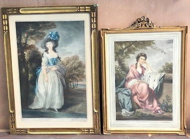
2 PIECES 19C ENGLISH COLORED ENGRAVINGS SIGNED WITH ORIGINAL HANCARVED FRAMESBidhaus4.3(747)See Sold PriceFeb 28, 2024
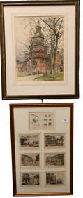
Two Hand-Colored 19th Century Maps of New Orleans and Louisiana, Larger- H.- 12 1/2 in., W.- 15 1/2Crescent City Auction Gallery4.3(229)See Sold PriceMar 08, 2024
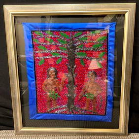
Jean Baptiste Jean Joseph Voodoo Flag Adam & EveRapid Estate Liquidators and Auction Gallery4.5(1.1k)See Sold PriceFeb 24, 2024
1849 Orr & Co. Hand Colored Southern Germany MapMatthew Bullock Auctioneers4.7(1.8k)See Sold PriceMar 02, 2024
Hand Painted Navajo Native American Sand Wedding VaseRapid Estate Liquidators and Auction Gallery4.5(1.1k)See Sold PriceFeb 26, 2024