SoldLarge detailed map of Forida seat of war 1839Title: Map of the Seat of War in Florida Compiled by Order of Bvt. Brigr. Gen. Z. Taylor...By Capt. John Mackay and Lieut. J. E. Blake, U.S. Topographical Engineers Author: U.S. War Department DescripSee Sold Price
SoldLarge detailed map of Forida seat of war 1839Title: Map of the Seat of War in Florida Compiled by Order of Bvt. Brigr. Gen. Z. Taylor...By Capt. John Mackay and Lieut. J. E. Blake, U.S. Topographical Engineers Author: U.S. War Department DescripSee Sold Price
SoldLarge detailed map of Forida seat of war 1839Title: Map of the Seat of War in Florida Compiled by Order of Bvt. Brigr. Gen. Z. Taylor...By Capt. John Mackay and Lieut. J. E. Blake, U.S. Topographical Engineers Author: U.S. War Department DescripSee Sold Price
***WITHDRAWN***Large map of Florida seat of war 1839Heading: Author: U.S. War Department Title: Map of the Seat of War in Florida Compiled by Order of Bvt. Brigr. Gen. Z. Taylor...By Capt. John Mackay and Lieut. J. E. Blake, U.S. Topographical EngineeSee Sold Price
SoldLarge and Detailed French & Indian War Engraved MapThis attractive horn features a large and detailed map starting in "PoiNt LEVy" and ending at the "FAll OF Niagara" and Fort "NiAgARA". Other noted locations recorded on this horn include: "Crudre", "See Sold Price
Sold1946 Map of War Damaged Tokyo and Bombed-out Areas --Title/Content of Map: 1946 Map of War Damaged Tokyo and Bombed-out Areas -- [Tokyo] Date: 1946 Cartographer: US Army? Size: 28.8 x 40.8 in. A large, detailed map of Tokyo from the Showa era. It showsSee Sold Price
1946 Map of War Damaged Tokyo and Bombed-out AreasTitle/Content of Map: 1946 Map of War Damaged Tokyo and Bombed-out Areas -- [Tokyo] Date Printed: 1946 Cartographer: US Army? Size: 28.8 x 40.8 in. A large, detailed map of Tokyo from the Showa era. ISee Sold Price
Vintage Map of War Damaged Tokyo, 1946Title/Content of Map: 1946 Map of War Damaged Tokyo -- [Tokyo] Date Printed: 1946 Cartographer: Size: 28.8 x 40.8 in. A large, detailed map of Tokyo from the Showa era. It shows by red color coding daSee Sold Price
1946 Map of War Damaged Tokyo and Bombed-out Areas --Title: 1946 Map of War Damaged Tokyo and Bombed-out Areas -- [Tokyo] Date: 1946 Cartographer: US Army? Size: 28.8 x 40.8 in. Additional Information: A large, detailed map of Tokyo from the Showa era.See Sold Price
1946 Map of War Damaged Tokyo and Bombed-out Areas --Title/Content of Map: 1946 Map of War Damaged Tokyo and Bombed-out Areas -- [Tokyo] Date: 1946 Cartographer: US Army? Size: 28.8 x 40.8 in. A large, detailed map of Tokyo from the Showa era. It showsSee Sold Price
1946 Map of War Damaged Tokyo and Bombed-out Areas --Title/Content of Map: 1946 Map of War Damaged Tokyo and Bombed-out Areas -- [Tokyo] Date: 1946 Cartographer: US Army? Size: 28.8 x 40.8 in. A large, detailed map of Tokyo from the Showa era. It showsSee Sold Price
1946 Map of War Damaged Tokyo and Bombed-out Areas --Title/Content of Map: 1946 Map of War Damaged Tokyo and Bombed-out Areas -- [Tokyo] Date: 1946 Cartographer: US Army? Size: 28.8 x 40.8 in. A large, detailed map of Tokyo from the Showa era. It showsSee Sold Price
Vintage WWII Map of War Damaged Tokyo, 1946Title/Content of Map: 1946 Map of War Damaged Tokyo and Bombed-out Areas -- [Tokyo] Date Printed: 1946 Cartographer: US Army? Size: 28.8 x 40.8 in. A large, detailed map of Tokyo from the Showa era. ISee Sold Price
Vintage Map of War Damaged Tokyo Japan, 1946Title/Content of Map: 1946 Map of War Damaged Tokyo -- [Tokyo] Date Printed: 1,946 Cartographer: Anonymous Size: 28.8 x 40.8 in. A large, detailed map of Tokyo from the Showa era. It shows by red coloSee Sold Price
1946 Map of War Damaged Tokyo and Bombed-out Areas --Title: 1946 Map of War Damaged Tokyo and Bombed-out Areas -- [Tokyo] Date: 1946 Cartographer: US Army? Size: 28.8 x 40.8 in. Additional Information: A large, detailed map of Tokyo from the Showa era.ISee Sold Price
1946 Map of War Damaged Tokyo and Bombed-out Areas --Title/Content of Map: 1946 Map of War Damaged Tokyo and Bombed-out Areas -- [Tokyo] Date: 1946 Cartographer: US Army? Size: 28.8 x 40.8 in. A large, detailed map of Tokyo from the Showa era. It showsSee Sold Price
1946 Map of War Damaged Tokyo and Bombed-out Areas --Reserve Reduced! Title/Content of Map: 1946 Map of War Damaged Tokyo and Bombed-out Areas -- [Tokyo] Date: 1946 Cartographer: US Army? Size: 28.8 x 40.8 in. A large, detailed map of Tokyo from the ShoSee Sold Price
A GRAPHIC AND DETAILED PRO-LINCOLN BROADSIDE12" x 19". Published by theNational Union Executive Committee, Astor House, New York. Large detailed map displaying the regions of the south which the Confederates held at the beginning of the war witSee Sold Price
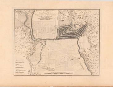
US CIVIL WAR Seat of War in Virginia & Maryland. DCTITLE/CONTENT OF MAP: 'Seat of War in Virginia and Maryland' A detailed map of Washington DC, Eastern Maryland and Virginia, showing the region from the Chesapeake to Faquier, Prince Loudon and WashinSee Sold Price
US CIVIL WAR Seat of War in Virginia sheet 2.TITLE/CONTENT OF MAP: 'Seat of War in Virginia &c. sheet 2' A detailed map of what is now north-eastern West Virginia and northern Virginia, and part of the Western Maryland panhandle DATE PRINTED: 18See Sold Price
US CIVIL WAR Seat of War in Virginia sheet 3 RichmondTITLE/CONTENT OF MAP: 'Seat of War in Virginia sheet 3' This detailed map covers part of Civil War Virginia between Richmond and Lynchburg, bounded by Augusta, Amherst and Campbell Counties in the WesSee Sold Price
SoldJohnson’s 1862 map of TexasA. J. Johnson's highly desirable map of Texas. Large and detailed map based on J. de Cordova's map of 1849, by way of Colton's map of 1855, Produced at the height of the American Civil War, this beautSee Sold Price
Johnson’s 1862 map of TexasA. J. Johnson's highly desirable map of Texas. Large and detailed map based on J. de Cordova's map of 1849, by way of Colton's map of 1855, Produced at the height of the American Civil War, this beautSee Sold Price
Sold1775 Map of Boarder wars of CanadaCa 1775 " A Map of the Present Seat of War on the Boarders of Canada". Originally from Pennsylvania Magazine ca 1775 , probably engraved by Robert Aitken. Highly detailed map fo the lake route from TiSee Sold Price
18TH C. ANTIQUE MAP: FRENCH & INDIAN WAR, FRAMEDThomaston Place Auction Galleries4.4(386)See Sold PriceFeb 24, 2024
Large lot of assorted prints. 18th-20th century. To include: North American and other maps, CivilTremont Auctions4.6(293)See Sold PriceFeb 25, 2024
Cram's Global War Atlas 1939 Maps WWIINorth American Artifact Auctions4.6(182)See Sold PriceApr 20, 2024
William Simpson's Sketches at the Seat of War - Two Volumes with 81 Hand-colored LithographsTrillium Antique Prints & Rare Books4.5(30)See Sold PriceFeb 24, 2024
First World War.- Petre (F.Loraine), Wilfrid Ewart & Major General Lowther. The Scots Guards in theForum Auctions4.3(52)See Sold PriceFeb 29, 2024
Pre-SECOND WORLD WAR AFRICA. European colonies & German mandates 1942 old mapJasper524.5(9.8k)See Sold PriceFeb 28, 2024
World War 2 Europe Battle of the Atlantic 1939-43 Axis Expansion limits 1959 mapJasper524.5(9.8k)See Sold PriceFeb 28, 2024