Map of New South Wales Australia c.1850
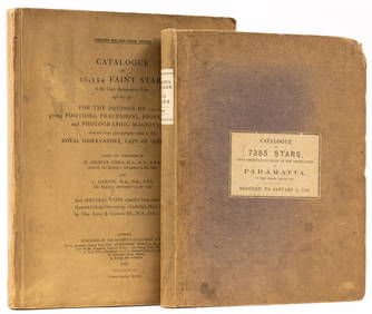
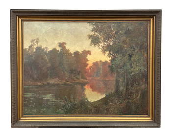
ASSOCIATED MOTORWAYS "LONDON TO NEW SOUTH WALES" BOOKING OFFICE TIN FLANGE SIGN.Feb 24, 2024LARGE LATE 17TH C. DUTCH CHART OF CANADA, GREAT LAKES, NEW FRANCE, LABRADOR, HUDSON BAY, BY PIERREFeb 24, 2024LARGE EARLY 18TH C. DUTCH CHART OF UPPER NORTH AMERICA, PIERRE MORTIER (1661-1711), FRAMEDFeb 24, 2024World Coins - British Empire - Mixed Pennies Group [6]Mar 09, 2024Portfolio of 15 County Maps by Robert Morden (English 1650-1703)Feb 24, 2024Richard Haley Lever American 1876 - 1958 Watercolor Gouache Painting on PaperMar 03, 2024Nostalgia #401 New South Wales Mounted RiflesMar 15, 2024Nostalgia #254 New South Wales Irish RiflesMar 15, 2024Nostalgia #291 New South Wales Lancers 1900Mar 15, 2024D'Entrecasteaux - Map of Australia (New Holland), New Zealand, and southern Asia and surroundingFeb 24, 2024Astronomy.- Richardson (William) A Catalogue of 7385 Stars, chiefly in the Southern Hemisphere,Feb 29, 2024Sermon on extraordinary doings of GodMar 07, 2024Philips' Atlas of Counties of EnglandMar 07, 2024Large map of the Americas 1794Mar 07, 2024Ernest William Christmas (1863 - 1918) Australia - Extra Large Oil PaintingFeb 28, 2024Framed New South Wales 6th Hole Golf PhotographFeb 29, 2024Vintage Australia Airplane Ashtray [Kangaroo]Mar 06, 2024MAP, World, FerMar 12, 2024MAP, World, BankesMar 12, 2024MAP, Game, England, DartonMar 12, 2024MAP, New York, HaywardMar 12, 2024MAP, South America, AaMar 12, 2024MAP, Asia, VisscherMar 12, 2024MAP, Australia, CookMar 12, 2024 


![Mineralogy. [MAP - AUSTRALIA - NEW SOUTH WALES]. (1 of 1)](https://p1.liveauctioneers.com/3336/142282/72020217_1_x.jpg?height=282&quality=70&version=1558025914)


![World Coins - British Empire - Mixed Pennies Group [6] (1 of 1)](https://p1.liveauctioneers.com/1191/317894/170617541_1_x.jpg?height=282&quality=70&version=1706620797)


![Vintage Australia Airplane Ashtray [Kangaroo] (1 of 7)](https://p1.liveauctioneers.com/5755/320282/172113950_1_x.jpg?height=282&quality=70&version=1708463029)


