1952 ROBERT F. KENNEDY HANDWRITTEN LETTERJohn McInnis Auctioneers,LLC4.6(502)See Sold PriceFeb 25, 2024
CASED PRESENTATION HALF HULL MODEL OF THE BARQUE "HAWTHORNBANK" Last Quarter of the 19th CenturyEldred's4.7(409)See Sold PriceFeb 27, 2024
Lot Of 14 Jack Daniels And Country Club Glass Spirit BottlesRbfinearts4.4(571)See Sold PriceFeb 24, 2024
PR OF 17TH C. SPANISH BRASS CANDLESTICKSThomaston Place Auction Galleries4.4(386)See Sold PriceFeb 24, 2024
Lake Shore and Michigan Southern RR Special Excursions Timetable-July 7-13, 1892JM Hobby Supply and Railroad Artifact Auctions4.4(126)See Sold PriceFeb 24, 2024
Tiffany & Co. Sterling Silver Corkscrew Bottle OpenerSJ Auctioneers4.5(165)See Sold PriceMar 03, 2024
Rolls Royce Landau c1950s Gin/ Scotch TantalusPasadena Antique Auctions4.3(6)See Sold PriceMar 10, 2024
SoldOrdnance Survey.- JamesOrdnance Survey.- James (Sir Henry) and A. Ross Clarke Ordnance Trigonometrical Survey of Great Britain and Ireland, plate vol. only (of 2 vol), presentation copy from the Secretary of State fSee Sold Price
Ordnance Survey.- JamesOrdnance Survey.- James (Sir Henry) and A. Ross Clarke Ordnance Trigonometrical Survey of Great Britain and Ireland, plate vol. only (of 2 vol), presentation copy from the Secretary of State fSee Sold Price
SoldMcDonald (Sgt James) Ordnance Survey of JerusalemMcDonald (Sgt James) Ordnance Survey of Jerusalema group of ten photographs from the series, comprising Eastern View of the Platform from the Golden Gate, a 3-part panorama, overall 17 x 67 cmSee Sold Price
SoldMcDonald (Sgt. James, R.E.) SinaiMcDonald (Sgt. James, R.E.) [Ordnance Survey of the Peninsula of Sinai],20 albumen prints including two 3-part and one 2-part panoramas, each single image c.175 x 210mm., arched tops, on origiSee Sold Price
Sgt. James M. McDonald (1822-1885)Sgt. James M. McDonald (1822-1885) ORDNANCE SURVEY OF JERUSALEM, UNDER THE DIRECTION OF COLONEL SIR HENRY JAMES. Charles W. Wilson, London: Her Majesty's Treasury 1865, The Photographic 2nd Volume, FoSee Sold Price
SoldJames McDonald (1822-1885)James McDonald (1822-1885) THE ORDNANCE SURVEY OF THE PENINSULA OF SINAI TITLE PAGE, c.1869. Albumen print, image size, 165 x 115mm, on original paper support, mount size, 475 x 350mm.See Sold Price
SoldJames, Sir Henry Facsimiles of National ManuscripJames, Sir Henry Facsimiles of National Manuscripts of Scotland selected by Sir William Gibson-Craig. Southampton: Ordnance Survey Office, 1868-72, large folio, 3 volumes, additional titles with hand-See Sold Price
SoldJames, Sir Henry Facsimiles of National ManuscripJames, Sir Henry Facsimiles of National Manuscripts of Scotland selected by Sir William Gibson-Craig. Southampton: Ordnance Survey Office, 1868-72, 3 volumes, additional titles with hand-coloured vignSee Sold Price
SoldAtlases.- Wilson (Capt. Charles W.) and H. S. Palmer.Atlases.- Wilson (Capt. Charles W.) and H. S. Palmer. Ordnance Survey of the Peninsula of Sinai ... under the Direction of Colonel Sir Henry James, part 1 only (of 3), 2 folding linen-backed maps andSee Sold Price
SoldJames and Clarke Principal Triangulation.James (Lt. Colonel Henry) and Captain Alexander Ross Clarke. Ordnance Trigonometrical Survey of Great Britain and Ireland. Account of the Observations and Calculations of the Principal TriangulationSee Sold Price
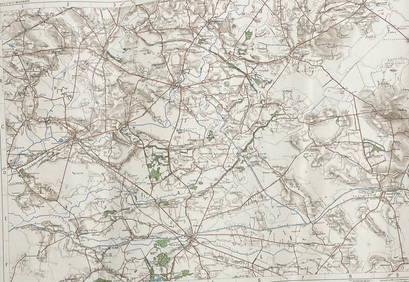
SoldOrdnance Survey maps,South West England and Wales, late 19th century, double page coastal maps/charts, including Falmouth Harbour, Menai Strait 1464, Newquay to Holyhead 1411, Milford Haven, Bristol Channel 1179, TrevoseSee Sold Price
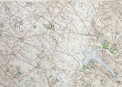
SoldEngland.- A group of 16 Ordnance Survey maps, mainlyEngland.- A group of 16 Ordnance Survey maps, including a Col. Mudge map of Kent showing Whitstable, Ramsgate and Dover, 4 Col. Colby maps sold by Letts, Son & Co. of Essex, Kent, Berkshire, and HampsSee Sold Price
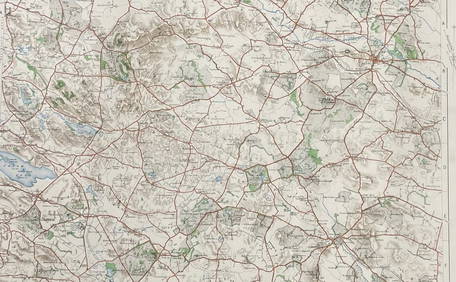
SoldOrdnance Survey maps,West Coast of Scotland, late 19th century with some revisions, approx 60 sheets, some with vignettes, including Lochs, Western Isles, Skye, Harris, Hebrides etc, condition varies (c.60)See Sold Price
SoldOrdnance Survey coastal maps/charts, late 19th century,mostly Ireland, engraved by J & C Walker, Davies et al., sheets 2046 (Waterford Harbour), 1787 (Wexford and Wicklow), 45 & 46 (Larne to Bloody Foreland), 1825B Irish Channel, 44 Dundalk Bay, 1468 (DubSee Sold Price
SoldMaps from the Ordnance Survey of Palestine by Wilson,A portfolio of maps, being the second part of the "Ordnance Survey of Palestine" conducted by Captain Charles William Wilson (1836-1905), in 1864. Contains five folding, cloth-backed maps, including tSee Sold Price
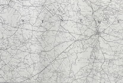
SoldLondon.- Ordnance Survey.- Mudge (Lt. Col. William)London.- Mudge (Lt. Col. William) Four Ordnance Survey maps covering the environs of London, numbered I, VI, VII, and VIII, showing from Great Marlow to the mouth of the River Medway, and East GrinsteSee Sold Price
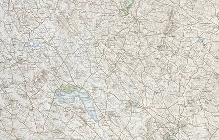
SoldOrdnance Survey.- A group of 70 folding mapsOrdnance Survey.- A group of 70 folding maps,with various counties and areas of the British Isles, lithographed maps, many printed in colour, v.s., all folding into contemporary paper covers,See Sold Price
SoldA quantity of books including Ordnance Survey, Atlas ofA quantity of books including Ordnance Survey, Atlas of England and Wales, Phillips Student Atlas, Phillips Handy General Atlas of the World, two bound volumes of The London Illustrated News and JohnsSee Sold Price
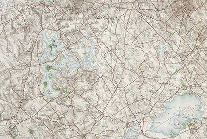
Geological Survey of Scotland Ordnance Survey ofReserve Reduced! Title: Geological Survey of Scotland Ordnance Survey of Scotland Inveraray Sheet 37 Publication Date: 1908 Cartographer: PEACH, B. N. et al. Publisher: ORDNANCE SURVEY Size: 18.75X26.See Sold Price
SoldCruchley's Reduced Ordnance Survey Map of DevonshireTitle/Content of Map: Cruchley's Reduced Ordnance Survey Map of Devonshire and adjoining areas Date Printed: 1840 ca. Cartographer: CRUCHLEY, C.F. Material/Medium: C.F. CRUCHLEY, mapseller and globe mSee Sold Price
SoldWilson. Ordnance Survey of JerusalemWilson (Capt. Charles W.) Ordnance Survey of Jerusalem,the portfolio of plans only, five folding plans, dissected and linen-backed, in original roan-backed portfolio, general title pasted insiSee Sold Price
SoldOrdnance Survey. South East EnglandOrdnance Survey. South East England,index map of England and Wales, and sheets 1-16, covering S. Essex, Kent, E. and W. Sussex, Middlesex, Surrey, S. Buckingham, Hampshire, Berkshire, S. WiltsSee Sold Price
SoldOrdnance Survey.- - [The Ordnance Survey of England andindex map in 2 sheets and 111 maps, numbered 1 to 110, lacking sheet 100, the Isle of Man, but with sheet 68 in 2 parts and sheet 110 supplied in 2 states, 113 engraved map sheets, the index maps withSee Sold Price
SoldOrdnance Survey.- the British IslesOrdnance Survey.- a bound collection of the British Isles,the complete set of 40 sheets for England and Wales, each in 2 editions (except the Isle of Man in the earlier edition only) for 1906-See Sold Price
David James Gilhooly "Frog Burger" Ceramic, 1977Auctions at Showplace4.5(726)See Sold PriceMar 03, 2024
1877 Gallery of Great Artists Raphael da Vinci Michelangelo Durer Holbein TitianSchilb Antiquarian Rare Books4.8(421)See Sold PriceMar 31, 2024
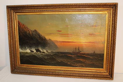
Wonderful Oil On Canvas Painting Of Ship At Sea Signed James HamiltonRalph Fontaine Heritage Auctions Inc.4.7(235)See Sold PriceFeb 25, 2024
Nottingham.- Ordnance Survey Office (publisher) Collection 8 geological maps on the environs ofForum Auctions4.3(52)See Sold PriceFeb 29, 2024
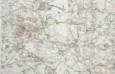
ORDNANCE SURVEY OF IRELAND/ Sheet No. 79/ CAVAN, LEITRIM, LONGFORD, MEATH & WESTMEATH Revised 1899Churchill Galleries3.7(213)See Sold PriceFeb 26, 2024
ORDNANCE SURVEY OF IRELAND/ Sheet No. 80/ CAVAN, MEATH & MONAGHAN/ Surveyed 1837 - 39. Printed inChurchill Galleries3.7(213)See Sold PriceFeb 26, 2024
ORDNANCE SURVEY OF IRELAND/ Sheet No. 89/ LONGFORD, MEATH & WESTMEATH/ Published in 1903Churchill Galleries3.7(213)See Sold PriceFeb 26, 2024
ORDNANCE SURVEY OF IRELAND/ Sheet No. 89/ LONGFORD, MEATH & WESTMEATH/ Published in 1903Churchill Galleries3.7(213)See Sold PriceFeb 26, 2024
ORDNANCE SURVEY OF IRELAND/ Sheet No. 89/ LONGFORD, MEATH & WESTMEATH/ Published in 1903Churchill Galleries3.7(213)See Sold PriceFeb 26, 2024
ORDNANCE SURVEY OF IRELAND/ Sheet No. 89/ LONGFORD, MEATH & WESTMEATH/ Published in 1903Churchill Galleries3.7(213)See Sold PriceFeb 26, 2024
ORDNANCE SURVEY OF IRELAND/ Sheet No.90/ MEATH & WESTMEATH/ Published in 1903Churchill Galleries3.7(213)See Sold PriceFeb 26, 2024
ORDNANCE SURVEY OF IRELAND/ Sheet No.90/ MEATH & WESTMEATH/ Published in 1903Churchill Galleries3.7(213)See Sold PriceFeb 26, 2024
ORDNANCE SURVEY OF IRELAND/ Sheet No.90/ MEATH & WESTMEATH/ Published in 1903Churchill Galleries3.7(213)See Sold PriceFeb 26, 2024
ORDNANCE SURVEY OF IRELAND/ Sheet No.90/ MEATH & WESTMEATH/ Published in 1903Churchill Galleries3.7(213)See Sold PriceFeb 26, 2024
ORDNANCE SURVEY OF IRELAND/ Sheet No.90/ MEATH & WESTMEATH/ Published in 1903Churchill Galleries3.7(213)See Sold PriceFeb 26, 2024
ORDNANCE SURVEY OF IRELAND/ Sheet No.99/ KILDARE, MEATH, KINGS & WESTMEATH/ Published in 1902Churchill Galleries3.7(213)See Sold PriceFeb 26, 2024
ORDNANCE SURVEY OF IRELAND/ Sheet No.100/ KILDARE, MEATH & WESTMEATH/ Published in 1903Churchill Galleries3.7(213)See Sold PriceFeb 26, 2024
ORDNANCE SURVEY OF IRELAND/ Sheet No.100/ KILDARE, MEATH & WESTMEATH/ Published in 1903Churchill Galleries3.7(213)See Sold PriceFeb 26, 2024
ORDNANCE SURVEY OF IRELAND/ Sheet No.100/ KILDARE, MEATH & WESTMEATH/ Published in 1903Churchill Galleries3.7(213)See Sold PriceFeb 26, 2024
ORDNANCE SURVEY OF IRELAND/ Sheet No.100/ KILDARE, MEATH & WESTMEATH/ Published in 1903Churchill Galleries3.7(213)See Sold PriceFeb 26, 2024
ORDNANCE SURVEY OF IRELAND/ Sheet No.100/ KILDARE, MEATH & WESTMEATH/ Published in 1903Churchill Galleries3.7(213)See Sold PriceFeb 26, 2024
ORDNANCE SURVEY OF IRELAND/ SHEET NO.109/ KING CO. & CO. WESTMEATH. / PUBLISHED IN 1900Churchill Galleries3.7(213)See Sold PriceFeb 26, 2024