SoldNaval Map Plotting Tools,Naval Map Plotting Tools, brass map roller in mahogany case, by G.Lee of Portsmouth, another unnamed in pine case, and a set of cased nickel & bone marine plotting instruments (13) by J.HaldSee Sold Price
SoldNaval Map Plotting Tools,Naval Map Plotting Tools, brass map roller in mahogany case, by G.Lee of Portsmouth, another unnamed in pine case, and a set of cased nickel & bone marine plotting instruments (13) by J.HaldeSee Sold Price
SoldNAVAL AVIATOR'S CERTIFICATE, PLOTTING TOOLSNAVAL AVIATOR'S CERTIFICATE, PLOTTING TOOLS War-date naval aviator's certificate, Dept. of the Navy, Oct. 10, 1944, issued to Ens. Arthur C. Haymen and issued at the air station in Pensacola. In leathSee Sold Price
SoldAntique Explorers CaneAntique Explorers Cane, this phenomenal cane consists of a compass, a telescope, large dagger, plotting tools, working brass compass, measuring instruments, pens and parchment papers, field maps. AlsoSee Sold Price
Sold18th Century British Naval Map of Port Royal, SC18th Century British Naval Map of Port Royal, SCDes Barres, Joseph F. Wallet, PORT ROYAL IN SOUTH CAROLINA TAKEN FROM SURVEYS DEPOSITED AT THE PLANTATION OFFICE, disbound from THE ATLANTIC NEPTUNE (LoSee Sold Price
Sold1868-1869 NAVAL MAP OF THE NORTH PACIFIC OCEANMade up of Sheets I, II and III. (18) 13 x 13 inch sheets backed with cloth. 38 1/2 x 79 1/2 inches (to end of margins (overall))See Sold Price
Sold1720 HENRI CHATELAINE FRENCH NAVAL MAP MILITARY FORTIFICATIONHand colored some faded. frame 20" by 23 1/4". this is an original from either 1719 or 1720. Land and sea fortifications FrenchSee Sold Price
SoldAn English Naval Map of the Southern AtlanticAn English Naval Map of the Southern Atlantic, A Reduced Chart of the Ethiopic or Southern Atlantic Ocean..., 1850, by Isaac Purdy, published by R.H. Laurie, London,sight 37 1/2 in. x 49 in., framedSee Sold Price
Military and Naval Map of WWIILOW BUYERS PREMIUM (10%) NO RESERVE AUCTION! BIDDING STARTS AT $10! This map was copyrighted by Rand McNally & Co. date of printing unknown is in color and decent condition. Contains a Western HemisphSee Sold Price
SoldPaint Decorated Naval Tool Box"The Oline, 1917" on the lid and "Edward Benson, Bristol, RI" on front panel 21" x 12 3/4", 11 1/2" high SHIPPING: Buyer is responsible for arranging 3rd party shipping.See Sold Price
Sold28 Navigation Maps & Plotting ChartsDESCRIPTION: Twenty-eight navigations maps and plotting charts/sheets. Dated 1920-1945. U.S. Navy charts includes West Coast of Central America No.1017, Magellan Strait No. 443, Amami O Shima to KumeSee Sold Price
SoldPre-Civil War Map ToolHard to find pre-Civil War metal map navigating tool. All original with pole directons and degrees Northwest and Southeast etc. This item was placed on natucial maps by the Captain or ship's navigatorSee Sold Price
SoldCASED WORLD WAR II JAPANESE MAP MAKERS KIT.An interesting set of tools for making maps in a Japanese softwood (cedar?) box with Kanji on lid that identifies it as a map tools box. Black leatherette case with kanji on lid indicating that it holSee Sold Price
SoldGERMAN WW II ARTILLERY FIELD PLOTTING KITGERMAN WW II ARTILLERY OBSERVER FIELD PLOTTING KIT HAVING TRAJECTORY PLOTTING TOOLS:Folding drafting lap table, wood aluminum board, artillery plotting tools. Hallmarked; Wichman hallmarked Berlin M.BSee Sold Price
SoldMiniatute Model T Ford Tool Kitwonderful tool roll-up marked "Good For A Breakdown" with 9 die-cast tools and an oiling can together with a Gulf Philadelphia to Wilminton Road Map tools 1.5" t. ecSee Sold Price
H‚risson (E.) Mappe Monde en deux h‚misphŠresH‚risson (Eustache) Mappe Monde en deux h‚misphŠres,double-hemisphere world map plotting the courses of Captain Cook's 3 voyages, ornately lettered title above, engraved map, 450 x 675mm., oldSee Sold Price
GERMAN MILITARY MAP WITH LETTERED QUADRANTSGERMAN MILITARY MAP WITH LETTERED QUADRANTS War-date printed German naval map, 31" x 23", Paris, 1943, showing the area of Brest and the immediate waters offshore broken into quadrants, reminiscent ofSee Sold Price
SoldVintage Brass Fireplace Tools, Naval MotifVintage brass fireplace tools, naval motif, classical ship, tripod base, includes 5-tools including shovels, brush, etc 47"h x 15"w x 15"d Provenance: Charlott's Antiques, San Antonio, TX State-wide dSee Sold Price
SoldWWII 1944 BOUGAINVILLE TO ADMIRALTY PLOTTING MAPFolded 2 sided pilot plotting map, pocket size or knee board use size, when folded 3 3/4 x 4 1/4 opened 15 3/4 inches, has one small hole, very good otherwise, dated 1944,considered scarce.See Sold Price
LATE 17TH C. FRENCH MAP OF THE NEW WORLD BY ALEXIS-HUBERT JAILLOT (1632-1712)Thomaston Place Auction Galleries4.4(394)See Sold PriceFeb 24, 2024
18TH C. ANTIQUE MAP: FRENCH & INDIAN WAR, FRAMEDThomaston Place Auction Galleries4.4(394)See Sold PriceFeb 24, 2024
Collection of Assorted Watch Maker and Repair ToolsPremier Auction Galleries4.3(338)See Sold PriceMar 09, 2024
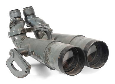
PAIR OF WORLD WAR II JAPANESE NAVAL BINOCULARS CAPTURED BY H.M.S. "EURYALUS" 1943-1945 Case heightEldred's4.7(423)See Sold PriceFeb 27, 2024
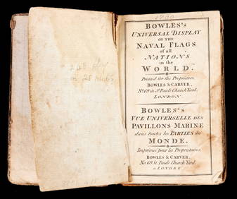
BOWLES'S UNIVERSAL DISPLAY of NAVAL FLAGS c1790John McInnis Auctioneers,LLC4.5(505)See Sold PriceFeb 24, 2024
Keith Haring - Ink on New York Map, Best Buddies, Inscribed, Signed, and DatedSapphire Auction Gallery4.1(67)See Sold PriceMar 02, 2024
Collection of Allied Military Silk Printed Maps, WWII Era and LaterMaterial Culture4.6(780)See Sold PriceFeb 29, 2024
Rand McNally Railroad Map Cabinet w/ 21 Railroad MapsRail & Road Auctions4.6(165)See Sold PriceMar 08, 2024
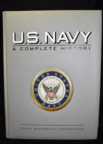
U.S. NAVY - A Complete History by Goodspeed, M. Hill 2003 MintNorth American Artifact Auctions4.7(201)See Sold PriceApr 20, 2024
Putnam - First Map of the State of Ohio by Rufus PutnamTrillium Antique Prints & Rare Books4.5(33)See Sold PriceFeb 24, 2024
Vaillant - Hawaii: Stranding in the Sandwich Islands (Echouage aux Iles Sandwich). 43Trillium Antique Prints & Rare Books4.5(33)See Sold PriceFeb 24, 2024
Vaillant - Kealakekua Bay, Hawaii (Village de Kearakekoua, Iles Sandwich). 44Trillium Antique Prints & Rare Books4.5(33)See Sold PriceFeb 24, 2024
Vaillant - Honolulu, Hawaii (Vue de Honolulu, Iles Sandwich). 45Trillium Antique Prints & Rare Books4.5(33)See Sold PriceFeb 24, 2024
Vaillant - Hawaiian Dance (Scene de Danse aux Iles Sandwich). 42Trillium Antique Prints & Rare Books4.5(33)See Sold PriceFeb 24, 2024
Fielding (Henry) The Works, with An Essay on His Life and Genius by Arthur Murphy, 10 vol., newForum Auctions4.4(54)See Sold PriceFeb 29, 2024
Operation Torch Nov 1942-May 1943. World War 2. Western Mediterranean 1966 mapJasper524.5(9.9k)See Sold PriceFeb 28, 2024
6 pcs Vintage Paper Maps. Vancouver Island, British Columbia. Upper Elk Creek Sheet. See pics.Crawford Family Auctions LLC4.5(128)See Sold PriceMay 25, 2024