SoldFramed Map of the World Print & Map of KY & OHDepicting two hemispheres map of The New World, 34" W x 23" H sight, 40" W x 29" H gilt frame, circa 20th century, along with a map by Tunison's 1888 of Ohio on one side and Kentucky on reverse, printSee Sold Price
SoldVintage Gold Framed Old World Map PrintVintage Gold Framed Old World Map Print. Measures 13.5 x 21 inches.See Sold Price
SoldVintage World MapVintage world map, print, framed 21.5"h x 19"w Provenance: The Estate of Nancye Miller, Alamo Heights, TXSee Sold Price
CUSTOM FRAMED MODERN DECORATIVE WORLD MAP PRINTCUSTOM FRAMED MODERN DECORATIVE WORLD MAP PRINT FROM A FORMER NFL PLAYERS ESATE IN NC 18 X 32" 18 X 32"See Sold Price
SoldCUSTOM FRAMED MODERN DECORATIVE WORLD MAP PRINTCUSTOM FRAMED MODERN DECORATIVE WORLD MAP PRINT FROM A FORMER NFL PLAYERS ESATE IN NC 18 X 32"See Sold Price
CUSTOM FRAMED MODERN DECORATIVE WORLD MAP PRINTCUSTOM FRAMED MODERN DECORATIVE WORLD MAP PRINT FROM A FORMER NFL PLAYERS ESATE IN NC 18 X 32"See Sold Price
CUSTOM FRAMED MODERN DECORATIVE WORLD MAP PRINTCUSTOM FRAMED MODERN DECORATIVE WORLD MAP PRINT FROM A FORMER NFL PLAYERS ESATE IN NC 18 X 32"See Sold Price
SoldCoaching Scene Print and World MapCoaching scene print, 'Down Hill, The Skid', published London May 20, 1867, 18" x 25" (view), 26 3/4" x 33 3/4" (framed), together with map of the world print published 1791, 17 1/2" x 13 1/2" (framedSee Sold Price
SoldFramed World MapFramed World map, Blaeu wall map, color print with areas of silvered paper, double matted in mahogany finish 25" x 29" frame. Condition; very goodSee Sold Price
SoldWorld Map Print "Nova Totius Terrarum Orbis" by Willem Blaeu - Dutch circa 1606World Map Print "Nova Totius Terrarum Orbis" by Willem Blaeu - Dutch circa 1606. Matted and framed Old World brought forward in the piece both colorful and detailed. Measures H 29" x W 35" and weightSee Sold Price
SoldLG FRAMED PRINT - FLAT MAP OF THE WORLDLARGE FRAMED PRINT - MAPPE MONDE OU DESCRIPTION DU GLOBE - FLAT MAP OF THE WORLD - PROFESSIONALLY FRAMED AND MATTED - MINOR SCRATCH ON FRAME - 34''x 40'' FRAMED - BUYER RESPONSIBLE FOR MAKING SHIPPINGSee Sold Price
SoldFramed Antique Map Orbis Vetus, Robert De VaugondyItem/Description: Old print. Map of the world by Robert de Vaugondy from 1752. Orbis vetus in utraque continente : In both the old continent / world map / Vaugondy 1752. Material: Print framed under gSee Sold Price
(3) FRAMED WORLD & COUNTRY MAPS(lot of 3) Framed geographic map prints, 20th c., comprising: (1) "Around The World With American President Lines," includes twelve small prints of ocean liners and airplanes, sight: approx 31.25"h, 4See Sold Price
SoldOversized Framed Poster, Nat Geo’s World AtlasFramed poster print of the world map by National Geographic. Copyright 2000. Poster is set behind plexiglass in black tone metal frame. Measures approx 48.25 inches in height by 69.5 inches in width wSee Sold Price
SoldSet 2 Art Prints of Vintage MapsSet of two gold toned framed Art Prints of Vintage Maps. One world map and one map of the northern section of South America. Both pieces labeled in print as being ‘Appendix 10 - Coast and Geodetic SSee Sold Price
2 World War II maps2 World War II maps. Pacific and European Theater. Title: 2 World War II map. Framed. Medium: Print. Size: 9.5 X 7.5See Sold Price
Vintage Estate World Maps II Signed & Framed Art PrintFOR SALE IS THIS VINTAGE ESTATE WORLD MAPS II SIGNED & FRAMED ART PRINT. THE FRAME MEASURES 30 3/4" BY 38 3/4". PIECE IS SIGNED BY ARTIST BUT UNABLE TO MAKE OUT THE NAME. ANY QUESTIONS PLEASE DONT HESSee Sold Price
Vintage Estate World Maps II Signed & Framed Art PrintFOR SALE IS THIS VINTAGE ESTATE WORLD MAPS II SIGNED & FRAMED ART PRINT. THE FRAME MEASURES 30 3/4" BY 38 3/4". PIECE IS SIGNED BY ARTIST BUT UNABLE TO MAKE OUT THE NAME. ANY QUESTIONS PLEASE DONT HESSee Sold Price
Vintage Estate World Maps II Signed & Framed Art PrintFOR SALE IS THIS VINTAGE ESTATE WORLD MAPS II SIGNED & FRAMED ART PRINT. THE FRAME MEASURES 30 3/4" BY 38 3/4". PIECE IS SIGNED BY ARTIST BUT UNABLE TO MAKE OUT THE NAME. ANY QUESTIONS PLEASE DONT HESSee Sold Price
The Oldest Known Map of the New World PrintPrint reproduction of "The Oldest Map of the New World" by 15th century cartographer Juan de la Casa, framed under glass. Frame measures 19-1/2" in height by 24-3/4" in width by 3/4" in depth with theSee Sold Price
SoldThe Oldest Known Map of the New World PrintPrint reproduction of "The Oldest Map of the New World" by 15th century cartographer Juan de la Casa, framed under glass. Frame measures 19-1/2" in height by 24-3/4" in width by 3/4" in depth with theSee Sold Price
SoldThe Oldest Known Map of the New World PrintPrint reproduction of "The Oldest Map of the New World" by 15th century cartographer Juan de la Casa, framed under glass. Frame measures 19-1/2" in height by 24-3/4" in width by 3/4" in depth with theSee Sold Price
Vintage Estate World Maps II Signed & Framed Art PrintMannys Jewelry4.6(335)See Sold PriceMar 03, 2024
PAUL SANDBY Copperplate Mezzotint Landscape 1738 Framed & SuperbLuis Porretta Fine Arts4.3(10)See Sold PriceMar 02, 2024
THOMAS MOULE 1837 Colored Map of Warwickshire Framed vgcLuis Porretta Fine Arts4.3(10)See Sold PriceMar 02, 2024
Vintage Full Color World Map LithographThe Benefit Shop Foundation Inc.4.3(2.9k)See Sold PriceFeb 28, 2024
Nova Totius Full Color Geographical World MapThe Benefit Shop Foundation Inc.4.3(2.9k)See Sold PriceFeb 28, 2024
Group of Ten Railroad Photographs, Maps, and Prints - New Jersey, Long Island, and New YorkRail & Road Auctions4.6(165)See Sold PriceMar 07, 2024
A 1987 Walt Disney World Magic Kingdom Souvenir Map.Van Eaton Galleries4.6(99)See Sold PriceMar 02, 2024
Chatelain - Map of the Americas and Details and Insets of Government CounselsTrillium Antique Prints & Rare Books4.5(32)See Sold PriceFeb 24, 2024
Arrowsmith & Lewis - Map of the World on Mercator's ProjectionTrillium Antique Prints & Rare Books4.5(32)See Sold PriceFeb 24, 2024
Carey, pub. 1796 - A Chart of the West IndiesTrillium Antique Prints & Rare Books4.5(32)See Sold PriceFeb 24, 2024
Carey, pub. 1796 - Map of the State of MarylandTrillium Antique Prints & Rare Books4.5(32)See Sold PriceFeb 24, 2024
Carey, pub. 1796 - Map of GeorgiaTrillium Antique Prints & Rare Books4.5(32)See Sold PriceFeb 24, 2024
Carey, pub. 1796 - Map of The State of South CarolinaTrillium Antique Prints & Rare Books4.5(32)See Sold PriceFeb 24, 2024
Carey, pub. 1796 - Map of KentuckyTrillium Antique Prints & Rare Books4.5(32)See Sold PriceFeb 24, 2024
Carey, pub. 1796 - Map of the Tennassee State formerly part of North Carolina (Tennessee)Trillium Antique Prints & Rare Books4.5(32)See Sold PriceFeb 24, 2024
De Jode, Rare, pub. 1593 - Map of Africa (Africae Vera Forma, et Situs)Trillium Antique Prints & Rare Books4.5(32)See Sold PriceFeb 24, 2024
Vintage Framed Cat Island Nautical Map PrintRapid Estate Liquidators and Auction Gallery4.5(1.1k)See Sold PriceFeb 25, 2024
Framed Tropical West Indies Map PrintRapid Estate Liquidators and Auction Gallery4.5(1.1k)See Sold PriceFeb 26, 2024
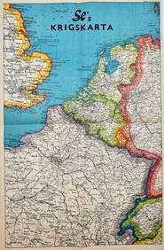
Vintage Map - Krigskarta - War Map - Second World War, published 1940Proverde Auctions4.3(3)See Sold PriceFeb 28, 2024
Framed Vintage Style Visscher Commander Repro MapRapid Estate Liquidators and Auction Gallery4.5(1.1k)See Sold PriceMar 01, 2024