SoldPrint map of OPERATIONS IN KOREAS-12 Print of a map of "OPERATIONS IN KOREA" (January 1951). Ink signed by Gen. "M. Ridgeway - Canada US 8TH Army - & RDK Army". 10" x 13". Also with an 8 1/2" x 12" photo of Ridgeway in a jeep with GSee Sold Price
Korean War. General Map - The Far East 1959 old vintage plan chartTITLE/CONTENT OF MAP: 'Operations in Korea - General Map - The Far East' DATE PRINTED: 1959 IMAGE SIZE: Approx 25.0 x 33.0cm, 10 x 13 inches (Large) TYPE: Antique colour military map CONDITION: Good;See Sold Price
Map of Korea[Map of Korea], chromo or color cerograph, ca. 1900s, 20.5 x 29.5 20.5 x 29.5See Sold Price
Original Antique Map - China - Korea - Japan - 19th Century - East Asia - LapieA fine first edition example of M. Lapie's 1832 map of the Chinese empire and Japan. The map covers all of China, Korea, and Japan from Asiatic Russia to India and the Sea of China and from IndependenSee Sold Price
SoldWWI - WWII WORLD BOOK, MANUAL, MAP & POSTCARD LOTWWI - WWII WORLD BOOK, MANUAL, MAP & POSTCARD LOT WWI collection of military operation maps in Egypt & Palestine, and France & Belgium. Some photos & postcard prints of world sites, in photo album.See Sold Price
UNITED STATES WAR DEPARTMENT - CIVIL WAR MAP SHOWINGUnited States War Department - Civil War Map Showing The Operations Of The Armies Against Richmond And Petersburg, 1865 - 29 3/4 X 40 In. - This Giclée Print Is Gallery Stretched And Ready To Hang OrSee Sold Price
United States War Department - Civil War Map ShowingUnited States War Department - Civil War Map Showing The Operations Of The Armies Against Richmond And Petersburg, 1865 Size: 32 3/4 X 44 In. - This Is A Gallery Stretched Giclee Print On Canvas. TheSee Sold Price
UNITED STATES WAR DEPARTMENT - CIVIL WAR MAP SHOWINGUnited States War Department - Civil War Map Showing The Operations Of The Armies Against Richmond And Petersburg, 1865 - 32 3/4 X 44 In. - Giclée Print - Gallery Stretched - Ready to hang.See Sold Price
UNITED STATES WAR DEPARTMENT - CIVIL WAR MAP SHOWINGUnited States War Department - Civil War Map Showing The Operations Of The Armies Against Richmond And Petersburg, 1865 - 22 3/8 X 30 In. - This Giclée Print Is Gallery Stretched And Ready To Hang OrSee Sold Price
UNITED STATES WAR DEPARTMENT - CIVIL WAR MAP SHOWINGUnited States War Department - Civil War Map Showing The Operations Of The Armies Against Richmond And Petersburg, 1865 - 26 7/8 X 36 In. - This Giclée Print Is Gallery Stretched And Ready To Hang OrSee Sold Price
United States War Department - Civil War Map ShowingUnited States War Department - Civil War Map Showing The Operations Of The Armies Against Richmond And Petersburg, 1865 Size: 26 7/8 X 36 In. - This Is A Gallery Stretched Giclee Print On Canvas. TheSee Sold Price
UNITED STATES WAR DEPARTMENT - CIVIL WAR MAP SHOWINGUnited States War Department - Civil War Map Showing The Operations Of The Armies Against Richmond And Petersburg, 1865 - 26 7/8 X 36 In. - This Giclée Print Is Gallery Stretched And Ready To Hang OrSee Sold Price
UNITED STATES WAR DEPARTMENT - CIVIL WAR MAP SHOWINGUnited States War Department - Civil War Map Showing The Operations Of The Armies Against Richmond And Petersburg, 1865 - 32 3/4 X 44 In. - This Giclée Print Is Gallery Stretched And Ready To Hang OrSee Sold Price
UNITED STATES WAR DEPARTMENT - CIVIL WAR MAP SHOWINGUnited States War Department - Civil War Map Showing The Operations Of The Armies Against Richmond And Petersburg, 1865 - 26 7/8 X 36 In. - This Giclée Print Is Gallery Stretched And Ready To Hang OrSee Sold Price
SoldP.R.R. Maps and Blue Prints lotP.R.R System 1964 Map 12 1/2" x 26" P.R.R. Co. Map of Phila, PA "1936" Blue Print 16" x 17" P.R.R. Co. and B & O.R.R. Key Joint Operation Interlocked switches Blue Print 13" x 20 1/2" Phila. RegionSee Sold Price
Antique Map - Japan - Asia - Sanson - Korea - Hokkaido - Japanese ArchipelagoThis detailed map of Japan by Nicolas Sanson originates ftom "Description de tout l’Univers...L'usage des globes celestes et terrestres et des spheres" (Description of the whole Universe...TheSee Sold Price
SoldBeauclerk. Canada 1840Beauclerk (Captain Lord Charles) Lithographic Views of Military Operations in Canada,map, 6 coloured lithograph plates, tissue guards, very slight marking, mostly marginal, original printed wrSee Sold Price
SoldMap of U. S. Army operations during Mexican WarHeading: Author: Turnbull, Charles Nesbit & Edmund Lafayette Hardcastle Title: Survey of the Line of Operations of the U.S. Army, under the Command of Major General Winfield Scott. on the 19th & 20thSee Sold Price
Map of U. S. Army operations during Mexican WarHeading: Author: Turnbull, Charles Nesbit & Edmund Lafayette Hardcastle Title: Survey of the Line of Operations of the U.S. Army, under the Command of Major General Winfield Scott. on the 19th & 20thSee Sold Price
Original Antique Map of Asia - China - Japan - 19th Century - East Asia - LapieA fine first edition example of M. Lapie's 1832 map of the Chinese empire and Japan. The map covers all of China, Korea, and Japan from Asiatic Russia to India and the Sea of China and from IndependenSee Sold Price
Antique Map of East Asia - China - Japan - 19th Century - Korea - Central AsiaA fine first edition example of M. Lapie's 1832 map of the Chinese empire and Japan. The map covers all of China, Korea, and Japan from Asiatic Russia to India and the Sea of China and from IndependenSee Sold Price
SoldFACTUAL CHART WORLD WAR II PACIFIC printsL-028 "FACTUAL CHART OF WORLD WAR II ASIATIC - PACIFIC OPERATIONS". 14" x 15" hard cover with color insignia. Large 38" x 57" fold out poster with maps, photos of leaders, history of operations and coSee Sold Price
SoldOPERATION OF FIRST UNITED STATES ARMY FRAMED PRINTFramed print titled "Operations of First United States Army in Europe June 6, 1944 to May 9, 1945" Has map with emblems surrounding. Printed by 654th Engineer BN May, 1945. Measures 19.5 inches by 18.See Sold Price
Sold"Map of the Mississippi from Haine's Bluff to Below"Map of the Mississippi from Haine's Bluff to Below Grand Gulf, Showing the Theatre of Gen. Grant's and Admiral Farragut's Operations, etc.," May 23, 1863, colored Harper's Weekly print; together withSee Sold Price
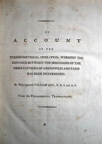
WILLIAM ROY Rare Navigation Book c1797 Trigonometry Between Paris & GreenwichLuis Porretta Fine Arts4.3(10)See Sold PriceMar 02, 2024
AMBROISE TARDIEU c1822 Napoleonic War Map GermanyLuis Porretta Fine Arts4.3(10)See Sold PriceMar 02, 2024
Operation Torch Nov 1942-May 1943. World War 2. Western Mediterranean 1966 mapJasper524.5(9.9k)See Sold PriceFeb 28, 2024
Anatomical Lithograph Print - Man's skeleton and musculature, back sideProverde Auctions4.3(3)See Sold PriceFeb 28, 2024
Henri-Joseph Redouté - Large Folio Botanical Print - Plants in Egypt - Fagonia latifoliaProverde Auctions4.3(3)See Sold PriceFeb 28, 2024
Jules de Liron d’Airoles (1802 - 1882) - Antique Fruit Print of Pond's Seedling PlumProverde Auctions4.3(3)See Sold PriceFeb 28, 2024
Von Wright brothers - Set of 8 Bird Prints - Surnia Ulula - Accipiter Nisus - Falco AesalonProverde Auctions4.3(3)See Sold PriceFeb 28, 2024
Von Wright brothers - Set of 12 Bird Prints - Gallinule Chloropus - Tringa Alpina - PorzanaProverde Auctions4.3(3)See Sold PriceFeb 28, 2024
Von Wright brothers - Set of 12 Bird Prints - Aria Grylle - Harelda Hyemalis - AnasProverde Auctions4.3(3)See Sold PriceFeb 28, 2024
Von Wright brothers - Set of 12 Bird Prints - Lanius Collurio - Sturnus Vulgaris - Ampelis GarrulusProverde Auctions4.3(3)See Sold PriceFeb 28, 2024
Von Wright brothers - Set of 9 Bird Prints - Sterna Paradisaea - Larus Canus - Larus ArgentatusProverde Auctions4.3(3)See Sold PriceFeb 28, 2024
K.A. Andersson - Set av 30 Fish Prints - Torbay sole - Common Dragonet - TroutProverde Auctions4.3(3)See Sold PriceFeb 28, 2024
K.A. Andersson - Set av 30 Fish Prints - Red gurnard - Shorthorn sculpin -Tench - IchthyologyProverde Auctions4.3(3)See Sold PriceFeb 28, 2024
James Cook - Map of the Friendly Isles - Tonga IslandsProverde Auctions4.3(3)See Sold PriceFeb 28, 2024
Robert de Vaugondy - Map of Canada - Mer de l' Ouest or Sea of the West and a Northwest PassageProverde Auctions4.3(3)See Sold PriceFeb 28, 2024
Francis McNally - Antique Map of California & MinnesotaProverde Auctions4.3(3)See Sold PriceFeb 28, 2024
Francis McNally - Antique Map of Ohio, Indiana & KentuckyProverde Auctions4.3(3)See Sold PriceFeb 28, 2024
Francis McNally - Antique Map of Washington, Oregon, Idaho, Nevada, Utah & ArizonaProverde Auctions4.3(3)See Sold PriceFeb 28, 2024
Vintage Street Map of Pittsburgh, Pennsylvania - Rand McNallyProverde Auctions4.3(3)See Sold PriceFeb 28, 2024
Vintage Map of Roman Forum - Vatican City - Versailles parkProverde Auctions4.3(3)See Sold PriceFeb 28, 2024
Colorful Illustrated Map - 1938 Southern California TourismProverde Auctions4.3(3)See Sold PriceFeb 28, 2024
Poster "Les jardins de Paris", illustrated map and plan of Paris with its parcs, gardens, monuments,Proverde Auctions4.3(3)See Sold PriceFeb 28, 2024
Mary Jane Thomas Stokes - Map of Lighthouses of the Chesapeake Bay. Past and PresentProverde Auctions4.3(3)See Sold PriceFeb 28, 2024