SoldNeed for new State Map of California 1855Title: Report of the Committee on Public Lands, in relation to a New State Map. Author: Description: Heading: Place Published: Publisher: Date Published:See Sold Price
SoldReport on New State Map of California 1855Heading: (California State Map) Author: Title: Report of the Committee on Public Lands, in relation to a New State Map. Submitted, March 21, 1855 Place Published: Sacramento Publisher:B.B. Redding, sSee Sold Price
SoldReport on New State Map of California 1855Title: Report of the Committee on Public Lands, in relation to a New State Map. Submitted, March 21, 1855 Author: ** Description: 6 pp. 22.2x14.5 cm. (8¾x5¾"), removed from larger volume.Scarce repoSee Sold Price
SoldUSA 1903 Lot of 6 State Maps. California, Utah, NevadaPlus Washington, Colorada and Arizona/New Mexico. Lithograph Maps Published 1903 by Adam & Charles Black, Edinburgh & London for "Encyclopaedia Brittannica" Tenth Edition. Centre fold as published. PaSee Sold Price
1855 Colton Map of California -- CaliforniaTitle/Content of Map: 1855 Colton Map of California -- California Date: 1855, New YorkCartographer: J Colton Size: 14.7 X 12 in. This is a very nice map of California with inset of San Francisco. ThisSee Sold Price
1855 Colton Map of California -- CaliforniaTitle/Content of Map: 1855 Colton Map of California -- California Date: 1855, New York Cartographer: J Colton Size: 14.7 X 12 in. This is a very nice map of California with inset of San Francisco.ThisSee Sold Price
America.- A group of maps of AmericaAmerica.- A group of maps of America,including city plans of New York and Philadelphia, several state maps, including Texas, Massachusetts, California, Louisiana, Virginia and other, mostly laSee Sold Price
Colton: Map of California, 1855Map: California Cartographer: J. H. Colton Illustrator: J. H. Colton Publisher: J. H. Colton, Co. Published: New York, 1855 Size: 12.75 x 15.5 inches Extremely nice example of one of the best mid-nineSee Sold Price
SoldColton's Map of California 1855Title: Colton's Map of California, Nevada, Utah, New Mexico, Colorado, Arizona & New Mexico Author: Colton, J.H. Description: Lithographed map, hand-colored. 38.2x62.2 cm. (15x24½") plus decorative bSee Sold Price
1855 Colton Map of New York -- New YorkReserve Reduced! Title/Content of Map: 1855 Colton Map of New York -- New York Date: 1855, New York Cartographer: J Colton Size: 11.8 X 14.7 in. This is a very nice map of New York state with the inseSee Sold Price
1855 Colton Map of New York -- New YorkTitle/Content of Map: 1855 Colton Map of New York -- New York Date: 1855, New York Cartographer: J Colton Size: 11.8 X 14.7 in. This is a very nice map of New York state with the insets of New York CiSee Sold Price
SoldSeven vintage 1855 maps of states: Mississippi, ASeven vintage 1855 maps of states: Mississippi, Alabama, Georgia, Arkansas, New York and cities: St. Louis, Chicago, New Orleans, Louisville; some rips and stains, 16" x 14"See Sold Price
SoldUSA 1911 Lot of 12 State Maps incl Texas & CaliforniaIncl Utah, New Jersey, Nebraska, Washington, Arkansas, Oregon, Texas, California and Nevada, Maine, Maryland and Delaware, Massachusetts, and South Eastern Pennsylvania. Lithograph Maps Published 1911See Sold Price
SoldDistrunell: Antique Township Map of New York, 1855Map: 1855 Distrunell Township Map of New York -- Map of the State of New York Showing the Boundaries of Counties & Townships, the Location of Cities, Towns and Villages: and the Courses of Rail Roads,See Sold Price
1855 Colton Map of California -- CaliforniaTitle: 1855 Colton Map of California -- California Date: 1855, New York Cartographer: J Colton Size: 14.7 X 12 in. Additional Information: This is a very nice map of California with inset of San FrancSee Sold Price
SoldPrinter's proof of Cal. State Geology map 1873Heading: Author: California, State Geological Survey Title: State Geological Survey of California, J.D. Whitney, State Geologist. Map of California and Nevada Place Published: New York Publisher:J. BSee Sold Price
SoldS.A. Mitchell: New Map of the State of California, 1854Map: A New Map of the State of California, the Territories of Oregon, Washington, Utah and New Mexico Cartographer: S. Augustus Mitchell Illustrator: J.H. Young Publisher: Thomas, Cowperthwait & Co. PSee Sold Price
new map of the State of California, the territoriesMap: new map of the State of California, the territories Oregon, Washington, Utah & New Mexico. Date: 1855 Cartographer: S. Augustus Mitchell Publisher: Thomas Cowperthwait & Co Size (inches): 15.5x12See Sold Price
SoldCowperthwait, State Of California Map.MAP. Thomas Cowperthwait & Co., A New Map Of The State Of California, The Territories Of Oregon, Washington, Utah & New Mexico. Philadelphia, 1853, plate 37, hand colored, 15.5" x 12.5", good conditioSee Sold Price
SoldMorse Map of Illinois, 1855Morse's Map of Illinois. Charles Walkter Morse (1823-1887). New York: Rufus Blanchard, 1855. - COLBY Charles. Hand-Book of Illinois, Accompanying Morse's New Map of the State. New York: Rufus BlancharSee Sold Price
Sold1855 Colton Map of New York -- New YorkTitle: 1855 Colton Map of New York -- New York Date: 1855, New York Cartographer: J Colton Size: 11.8 X 14.7 in. Additional Information: This is a very nice map of New York state with the insets of NeSee Sold Price
NEW MAP OF THE STATE OF CALIFORNIA AND NEVADALeander Ransom - New Map Of The State Of California And Nevada Territory, 1863 - 31 7/8 X 40 In. - This Giclée On Canvas Is Gallery Stretched And Ready To HangSee Sold Price
NEW MAP OF THE STATE OF CALIFORNIA AND NEVADALeander Ransom - New Map Of The State Of California And Nevada Territory, 1863 - 31 7/8 X 40 In. - This Giclée Print Is Gallery Stretched And Ready To Hang Or Lean Against A Wall, Or Display On An EaSee Sold Price
LEANDER RANSOM - NEW MAP OF THE STATE OF CALIFORNIA ANDLeander Ransom - New Map Of The State Of California And Nevada Territory, 1863 - 28 5/8 X 36 In. - This Giclée Print Is Gallery Stretched And Ready To Hang Or Lean Against A Wall, Or Display On An EaSee Sold Price
1892 Adams and Bowles New Road Map of the State of New YorkJM Hobby Supply and Railroad Artifact Auctions4.4(126)See Sold PriceFeb 24, 2024
Crams Railroad Map of New York-1881JM Hobby Supply and Railroad Artifact Auctions4.4(126)See Sold PriceFeb 24, 2024
EARLY 18TH C. DUTCH CHART OF PACIFIC OCEAN BY FREDERIK DE WIT (1629-1706) WITH CALIFORNIA AS ANThomaston Place Auction Galleries4.4(389)See Sold PriceFeb 24, 2024
Vintage County Map Of NY State Plate EngravingThe Benefit Shop Foundation Inc.4.3(2.9k)See Sold PriceFeb 28, 2024
1855 Map of New York & Erie Railroad and 1917 Trespassing On Railway Property Is A MisdemeanorRail & Road Auctions4.6(165)See Sold PriceMar 07, 2024
1867 Map of the Railroads of The State of New YorkRail & Road Auctions4.6(165)See Sold PriceMar 08, 2024
Rand McNally & Co's New Ideal State and County Survey and Atlas 1911North American Artifact Auctions4.6(184)See Sold PriceApr 20, 2024
Chinese Enameled Copper Snuff Box w/ Ivory FiguresArtemis Fine Arts4.8(1.4k)See Sold PriceFeb 26, 2024
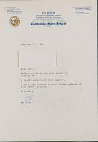
Signed California State Senate Ed Davis LetterRapid Estate Liquidators and Auction Gallery4.5(1.1k)See Sold PriceFeb 26, 2024
Robert de Vaugondy - Map of Canada - Mer de l' Ouest or Sea of the West and a Northwest PassageProverde Auctions4.3(3)See Sold PriceFeb 28, 2024
2020 1oz Silver Treasures of the U.S.California GoAffinity Antique Auction4.6(249)See Sold PriceMar 03, 2024
Vintage Estate 14K Yellow & White Gold Jewish Judaica Star of David PendantMannys Jewelry4.6(333)See Sold PriceMar 21, 2024