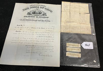
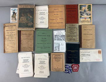
Timetable, Paper and Ephemera Lot-Eastern USA RailroadsJM Hobby Supply and Railroad Artifact Auctions4.4(126)See Sold PriceFeb 24, 2024
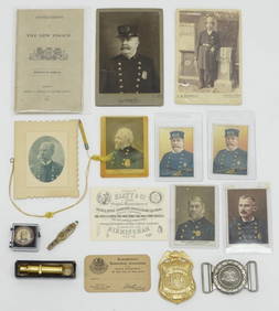
[BASEBALL]. Group of Varied Ephemera, including: Sporting L...Potter & Potter Auctions4.6(544)See Sold PriceMar 07, 2024
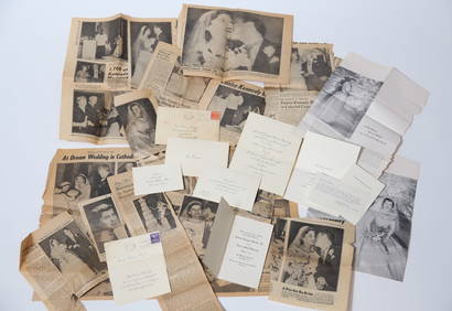
EPHEMERA from the MARRIAGE of MS. EUNICE KENNEDYJohn McInnis Auctioneers,LLC4.6(504)See Sold PriceFeb 25, 2024
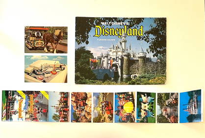
Rare Lot of 1965 and 1977 Walt Disneyland Collectible EphemeraSouth Florida Auction & Estate Sale Services Inc4.5(522)See Sold PriceMar 08, 2024
[CIGARETTE CARDS AND TOBACCO EPHEMERA]. A Group of Six Coll...Potter & Potter Auctions4.6(544)See Sold PriceMar 07, 2024
Group of MLB Ticket and Passes, Other Ephemera: American League Annual PassDana J. Tharp Auctions4.7(268)See Sold PriceFeb 24, 2024
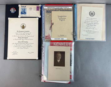
Group of US Presidents inauguration souvenirs, and EphemeraMatthew Bullock Auctioneers4.7(1.8k)See Sold PriceFeb 24, 2024
SoldCalifornia Central Sierra Region Outing Maps (2)1) Inyo-Sierra Region Outing Map, published by the Automobile Club of Southern California, C1920 [x=#8211/] Covers area Between Yosemite N.P on the North & Sequoia N.P on the South [x=#8211/] Index onSee Sold Price
SoldDerby map of California Gold RegionDerby, George Horatio Description:Lithographed map. 53.7x49.5 cm. (21x19½"). Central California including San Francisco, Monterey, east to the Sierra foothills and the Diggings, with the various miniSee Sold Price
SoldGold Rush Discovery Maps ~ 1848 Government ReportCA - Lot of 2 showing the gold and quicksilver districts of California, dated July 20 & 25, 1848, six months after Marshall's discovery at Coloma. Regions shown stretch from the Sierra to the PaciSee Sold Price
SoldRare tourist map of California gold country c.1935Heading: (California - Gold Region) Author: Title: Map of the Old Mining Regions of Central California - showing principal places of interest for the student of early California history and for the vSee Sold Price
SoldMAP - Central California, Yosemite. LeConteCentral California, Yosemite. Joseph LeConte, Map of the Sierra Nevada Mountains of Central California. Publication No. 12 of the Sierra Club, 1896 (dated). Black & White. This impressive, large-scaleSee Sold Price
SoldSanson (Nicolas) Comté de NamurSanson (Nicolas) Comté de Namur,central region of Belgium with the river Meuse and environs, large decorative cartouche (uncoloured), engraved map on 2 sheets joined, with original outline hanSee Sold Price
SoldSanson (Nicolas) Comté de NamurSanson (Nicolas) Comté de Namur,central region of Belgium with the river Meuse and environs, large decorative cartouche (uncoloured), engraved map on 2 sheets joined, with original outline hanSee Sold Price
SoldGeologic atlases of California Gold RegionTitle: Geologic Atlas of the United States - seven folios Author: ** Description: Includes: Geologic Atlas of the United States: Folio 3, Placerville. 3 maps. 1894. * Folio 5, Sacramento. 2 maps. 1894See Sold Price
SoldMason maps of California Gold Region 1848Title: Upper Mines. Nos. 1 & 8 [on same sheet as] Lower Mines or Mormon Diggings. No. 3 Author: Mason, Richard B. Description: Together, 2 lithographed maps on 1 sheet. Overall 22.5x16 cm. (9x6½") plSee Sold Price
Mason maps of California Gold Region 1848Title: Upper Mines. Nos. 1 & 8 [on same sheet as] Lower Mines or Mormon Diggings. No. 3 Author: Mason, Richard B. Description: Together, 2 lithographed maps on 1 sheet. Overall 22.5x16 cm. (9x6½") plSee Sold Price
A.L. BANCROFT - NEW MAP OF CENTRAL CALIFORNIA, 1871A.l. Bancroft - New Map Of Central California, 1871 - 16 X 13 1/2 In. - Gallery Stretched The Piece Of Art Is Ready To Hang Or Lean Against A Wall, Or Display On An Easel. - A Giclée Print Is The HigSee Sold Price
A.L. BANCROFT - NEW MAP OF CENTRAL CALIFORNIA, 1871A.l. Bancroft - New Map Of Central California, 1871 - 16 X 13 1/2 In. - Gallery Stretched The Piece Of Art Is Ready To Hang Or Lean Against A Wall, Or Display On An Easel. - A Giclée Print Is The HigSee Sold Price
Guide to Mother Lode with map & text 1939Heading: (California - Mother Lode) Author: Ramsey, R. S. Title: Guide through the Old Mining Regions of Central California Place Published: No place Publisher: Date Published: 1939 DeSee Sold Price
SoldGuide to Mother Lode with map & text 1939Heading: (California - Mother Lode) Author: Ramsey, R. S. Title: Guide through the Old Mining Regions of Central California Place Published: No place Publisher: Date Published: 1939 DeSee Sold Price
Guide to Mother Lode with map & text 1939Heading: (California - Mother Lode) Author: Ramsey, R. S. Title: Guide through the Old Mining Regions of Central California Place Published: No place Publisher: Date Published: 1939 DeSee Sold Price
SoldTwo maps(lot of 2) Unframed maps, ''Britannia Saxonica'' and ''Central American (Texas and California), 20th century, largest overall: 19.5''h x 16.25''wSee Sold Price
SoldRoad map of California's central Sierra, 1915Heading: (California & Nevada) Author: Title: Automobile road map of the east central section of California and a portion of Nevada: Showing routes between Los Angeles, Sacramento, Lake Tahoe and RenSee Sold Price
SoldSurvey map of Yosemite regionTitle: Parts of Central California. Atlas Sheet No. 56(D) Author: U.S. Wheeler Surveys Description: Duotone lithographed map. 38x49.4 cm. (14¾x19½").The mountains and river valleys of the central SiSee Sold Price
SoldCALIFORNIA GOLD MINING MAP19th century map from Sierra County, California. Ware. 14 1/2''See Sold Price
SoldDerby map of California Gold RegionTitle: Sketch of General Riley's Route through the Mining Districts July and Aug. 1849 Author: Derby, George Horatio Description: Lithographed map. 53.7x49.5 cm. (21x19½").Central California includinSee Sold Price
Derby map of California Gold RegionTitle: Sketch of General Riley's Route through the Mining Districts July and Aug. 1849 Author: Derby, George Horatio Description: Lithographed map. 53.7x49.5 cm. (21x19½").Central California includinSee Sold Price
Central Asian Stone Spindle Whorl with Rosette DesignThousandPlanet4.3(130)See Sold PriceFeb 27, 2024
A near pair of Chinese blue and white 'landscape' rectangular plates, 19th centuryOakridge Auction Gallery4.5(192)See Sold PriceMar 15, 2024
Angel Eusebio Rivero Sierra Abstract Monotypes, 2Auctions at Showplace4.6(731)See Sold PriceFeb 13, 2025


![[BASEBALL]. Group of Varied Ephemera, including: Sporting L... (1 of 2)](https://p1.liveauctioneers.com/928/318880/171361366_1_x.jpg?height=282&quality=70&version=1707501302)
![[CIGARETTE CARDS AND TOBACCO EPHEMERA]. A Group of Six Coll... (1 of 1)](https://p1.liveauctioneers.com/928/318880/171361529_1_x.jpg?height=282&quality=70&version=1707501302)