SoldFRY, Joshua (1699-1754) and Peter JEFFERSON. A MapFRY, Joshua (1699-1754) and Peter JEFFERSON. A Map of the Most Inhabited Part of Virginia Containing the Whole Province of Maryland. Joshua Fry and Peter Jefferson, "A Map of the most Inhabited part oSee Sold Price
Fry and Jefferson, A Map of the most Inhabited part ofFRY, Joshua (1699-1754) and Peter JEFFERSON (1708-1757). A Map of the most Inhabited part of Virginia containing the whole province of Maryland with Part of Pensilvania, New Jersey and North Carolina.See Sold Price
SoldJefferson and Fry Map of Virgina, 1776A Map of the Most Inhabited part of Virginia... Joshua Fry (1699-1754) & Peter Jefferson (1708-1757). Engraved map in four sheets. London: R. Sayer & J. Bennett, 1775. 16 3/4 x 24 1/2 inches sheet, 41See Sold Price
Fry & Jefferson 1775 Map of VirginiaA Map of the most Inhabited Part of Virginia. Joshua Fry (1699-1754) and Peter Jefferson (1708-1757). Engraved Map on 4 Sheets, joined. London: for Robert Sayer & Thomas Jefferys, 1775. 32 x 50 inchesSee Sold Price
SoldFry & Jefferson Map of Virginia, 1775FRY, Joshua (1699-1754) and JEFFERSON, Peter (1708-1757). A Map of the most Inhabited Part of Virginia. Engraved Map on 4 Sheets, joined. London: for Robert Sayer & Thomas Jefferys, 1751 (1775). 32 xSee Sold Price
SoldFry & Jefferson Map of Virginia, 1775FRY, Joshua (1699-1754), and JEFFERSON, Peter (1708-1757). A map of the most inhabited part of Virginia containing the whole province of Maryland with part of Pensilvania, New Jersey and North CarolinSee Sold Price
Fry & Jefferson Map of Virginia 1775FRY, Joshua (1699-1754) and JEFFERSON, Peter (1708-1757). A Map of the most Inhabited Part of Virginia. Engraved Map on 4 Sheets, joined.London: for Robert Sayer & Thomas Jefferys, 1751 (1775). 32 x 5See Sold Price
SoldFry & Jefferson Map of Virginia, Bottom Half OnlyFRY, Joshua (1699-1754), and JEFFERSON, Peter (1708-1757). A map of the most inhabited part of Virginia containing the whole province of Maryland with part of Pensilvania, New Jersey and North CarolinSee Sold Price
SoldFry and Jefferson First Edition Map of VirginiaA Map of the Inhabited Part of Virginia, containing the whole of the Province of Maryland with Part of Pennsylvania, New Jersey and North Carolina. Joshua Fry (1699-1754) and Peter Jefferson (1708-175See Sold Price
SoldFry and Jefferson - VirginiaJoshua Fry (1700-1754) and Peter Jefferson (1708-1757) A Map of the most Inhabited part of Virginia containing the whole Province of Maryland with Part of Pensilvania, New Jersey and North Carolina DrSee Sold Price
SoldFry & Jefferson Map of VirginiaJoshua Fry (circa 1700-1754) and Peter Jefferson (1708-1757), A Map of the most inhabited part of Virginia/containing the whole province of/Maryland/with part of Pensilvania, New Jersey and North CaroSee Sold Price
Fry & Jefferson Map of VirginiaJoshua Fry (circa 1700-1754) and Peter Jefferson (1708-1757), A Map of the most inhabited part of Virginia/containing the whole province of/Maryland/with part of Pensilvania, New Jersey and North CaroSee Sold Price
SoldFry & Jefferson Map of VirginiaJoshua Fry (circa 1700-1754) and Peter Jefferson (1708-1757), [A Map of the most inhabited part of Virginia / containing the whole province of / Maryland / with part of Pensilvania, New Jersey and NorSee Sold Price
SoldFry and Jefferson Engraved Map of VirginiaA map of the most inhabited part of Virginia containing the whole province of Maryland with part of Pensilvania, New Jersey and North Carolina. Joshua Fry (c.1700-1754) & Peter Jefferson (1708-1757).See Sold Price
Le Rouge - Virginie, MarylandGeorge Louis Le Rouge (fl. 1740-1780), after work by Joshua Fry (1700-1754) and Peter Jefferson (1708 - 1757) Virginie, Maryland en 2 feuilles par Fry et Jefferson Traduit, Corrigé, augmenté a ParisSee Sold Price
SoldJoshua Fry and Peter Jefferson, "A Map ofJoshua Fry and Peter Jefferson, "A Map of the most Inhabited part of Virginia containing the whole Province of Maryland with part of Pennsylvania, New Jersey and North Carolina, Drawn by Joshua Fry &See Sold Price
SoldFRY, JOSHUA; and JEFFERSON, PETER. A Map of the MostFRY, JOSHUA; and JEFFERSON, PETER. A Map of the Most Inhabited Part of Virginia Containing the Whole Province of Maryland with Part of Pensilvania, New Jersey and North Carolina. Large engraved map ofSee Sold Price
Sold(North America, Middle Atlantic States), Fry, Josh(North America, Middle Atlantic States), Fry, Joshua and Jefferson, Peter, A Map of the Most Inhabited part of Virginia containing the Whole Province of Maryland with Part of Pensilvania, New Jersey aSee Sold Price
SoldMAP - Carte de la Virginie et du Maryland. 1755.MAP - FRY, Joshua; and Peter JEFFERSON; after. Carte de la Virginie et du Maryland.[Paris]: 1755. Hand-colored double-page engraved map (502x665 mm, overall). Condition: trimmed to or justSee Sold Price
SoldFry/Jefferson map of Virginia & Maryland ...dated 1775; " A Map of the most Inhabited part of Virginia containing the whole Province of Maryland with part of Pennsylvania, New Jersey and North Carolina Drawn by Joshua Fry & Peter Jefferson in 1See Sold Price
SoldWonderful Engraved Maps from Jefferys' American AtlasA Map of the most Inhabited Part of Virginia containing the whole Province of Maryland...Drawn by Joshua Fry & Peter Jefferson in 1775. Thomas Jefferys (c. 1719 – 1771). Engraved map with original hSee Sold Price
SoldFry & Jefferson. Maryland and Virginia mapdated 1755; "Carte de la Virginie et de Maryland," (sic) by Robert de Vaugondy based on a map by Joshua Fry and Peter Jefferson, 21 x 26 in., in ebonized giltwood eglomise frameSee Sold Price
Sold18th c. de Vaugondy Map of Virginia and MarylandDouble-page hand-colored engraved folio, titled "Carte de la Virginie et du Maryland", Robert de Vaugondy, Paris, circa 1755. Based on a map by Joshua Fry and Peter Jefferson, sight size: 21 1/8 x 31See Sold Price
EARLY 18TH C. MAP OF ITALY, FRAMEDThomaston Place Auction Galleries4.4(393)See Sold PriceFeb 24, 2024
Peter Stoyan (Stoyanoff) (1900-1979) Canadian Listed Engraving 1940 PortraitLuis Porretta Fine Arts4.3(10)See Sold PriceMar 02, 2024
PETER MAX Original Serigraph Figural Woman In Pink 245/300 Signed 1989Luis Porretta Fine Arts4.3(10)See Sold PriceMar 02, 2024
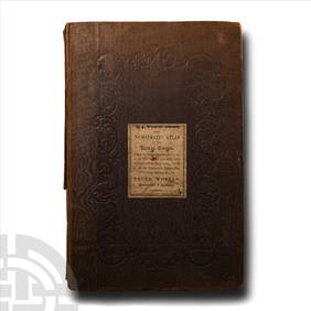
Numismatic Books - Whelan - The Numismatic Atlas of the Roman EmpireTimeLine Auctions Ltd.4.6(183)See Sold PriceMar 09, 2024
Group of 15 Printed or Lithographed Items, including: litho...Potter & Potter Auctions4.6(545)See Sold PriceMar 07, 2024
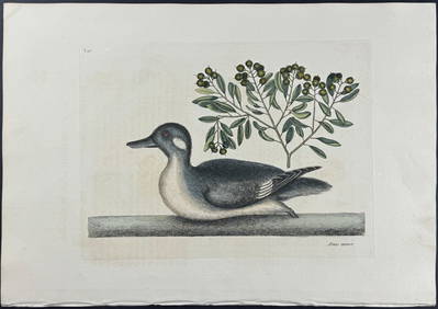
Catesby, Folio - Little Brown Duck with Soap-Wood. 1-98Trillium Antique Prints & Rare Books4.5(32)See Sold PriceFeb 24, 2024
Catesby, Folio - Red Bellied Woodpecker & Hairy Woodpecker with Black Oak. 1-19Trillium Antique Prints & Rare Books4.5(32)See Sold PriceFeb 24, 2024
1772 GREEK BIBLE NEW TESTAMENT antique BIBLIA LATIN text MAP NOVUM TESTAMENTUMJasper524.5(9.9k)See Sold PriceFeb 27, 2024
1730 BIBLE in DUTCH ILLUSTRATED w/ MAPS antique MASSIVE FOLIO BIBLIAJasper524.5(9.9k)See Sold PriceFeb 27, 2024
Disney Art Prints and Old Epcot Discovery GuideRapid Estate Liquidators and Auction Gallery4.5(1.1k)See Sold PriceFeb 25, 2024
Elias Fries (1794 - 1878) - Set of 4 Mushroom Prints - Cantarellus Aurantiacus - Merulius LacrymansProverde Auctions4.3(3)See Sold PriceFeb 28, 2024
Elias Fries (1794 - 1878) - Set of 4 Mushroom Prints - Agaricus Rubescens - Polyporus FomentariusProverde Auctions4.3(3)See Sold PriceFeb 28, 2024
Antique Map - Views on the coast of Asia. J. Webber del. Engraved after J. Webber and W. Bligh.Proverde Auctions4.3(3)See Sold PriceFeb 28, 2024
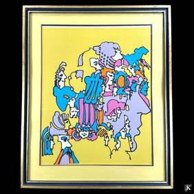
Peter Max (GERMAN / AMERICAN, Born 1937) limited edition color lithograph titled "Past Incarnations"Joshua Kodner4.2(394)See Sold PriceMar 09, 2024
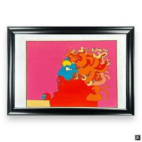
Peter Finkelstein Max (AMERICAN / / NEW YORK / GERMANY, Born 1937) serigraph on arches paperJoshua Kodner4.2(394)See Sold PriceMar 09, 2024
Peter Max Mixed Media Liberty. Artwork measures 11 1/2 inches high x 8 1/2 inches wide. approx.Joshua Kodner4.2(394)See Sold PriceMar 09, 2024
Peter Max (GERMAN / AMERICAN / NEW YORK, Born 1937) Hors Commerce serigraph titled "Zero In Love".Joshua Kodner4.2(394)See Sold PriceMar 09, 2024