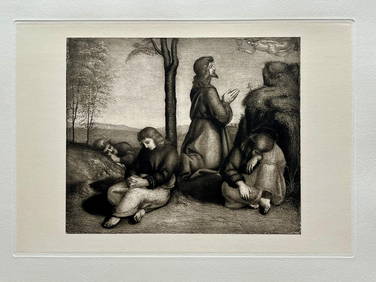
ETCHING PRINT AFTER RAPHAEL "AGONY IN THE GARDEN"Marnie Collection Auction4.5(70)See Sold PriceMar 10, 2024
ETCHING PRINT AFTER PISANELLO "PORTRAIT OF A LADY"Marnie Collection Auction4.5(70)See Sold PriceMar 10, 2024
Le Corbusier Lithograph Print. (Little Confidences)Estate Collection Auctioneer4.1(115)See Sold PriceMar 02, 2024
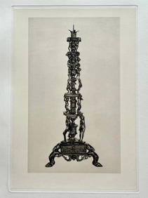
ETCHING PRINT AFTER ANDREA BRIOSCO RICCIO "A SATYR CANDLESTICK"Marnie Collection Auction4.5(70)See Sold PriceMar 10, 2024
ANTIQUE NEOCLASSICAL ENGRAVING ATHENA STATUE BY CHRISTIAN F STOLZELMarnie Collection Auction4.5(70)See Sold PriceMar 10, 2024
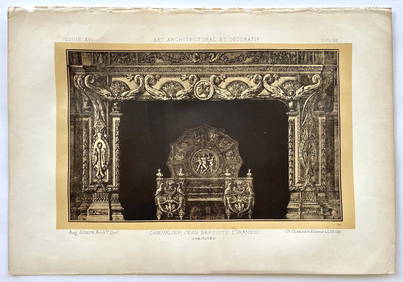
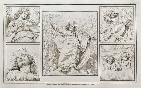
LOT OF 3 ANTIQUE PIRANESI PRINTS CHIMNEY DESIGNSMarnie Collection Auction4.5(70)See Sold PriceMar 10, 2024
ENGRAVING AFTER OLD MASTER MELOZZO DA FORLI JESUS VATICAN FRESCOESMarnie Collection Auction4.5(70)See Sold PriceMar 10, 2024
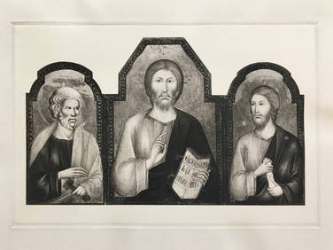
SET OF 3 RELIGIOUS ETCHINGS AFTER CIMABUE GIOTTO FRA FILIPPO LIPPIMarnie Collection Auction4.5(70)See Sold PriceMar 10, 2024
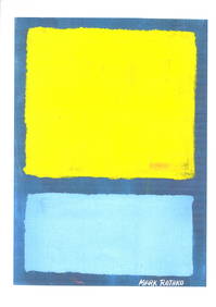
Fine Art Mark Rothko Print on High Quality Paper.Estate Collection Auctioneer4.1(115)See Sold PriceMar 02, 2024
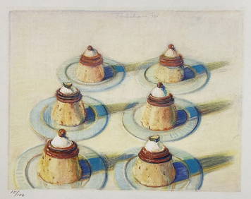
ETCHING PRINT OF AN ANTIQUE BRONZE CANDLESTICKMarnie Collection Auction4.5(70)See Sold PriceMar 10, 2024
ANTIQUE ITALIAN ENGRAVING STATUE OF SABINA WIFE OF EMPEROR ADRIANOMarnie Collection Auction4.5(70)See Sold PriceMar 10, 2024
Antique Map ITALIA ANTIQUA PARS MERIDIONALISSize: 11 X 8.5 inches approx. Unframed. Printed 1826.See Sold Price
Antique Map ITALIA ANTIQUA PARS MERIDIONALISSize: 11 X 8.5 inches approx. Unframed. Printed 1826.See Sold Price
Antique Map ITALIA ANTIQUA PARS MERIDIONALISSize: 11 X 8.5 inches approx. Unframed. Printed 1826.See Sold Price
Antique Map ITALIA ANTIQUA PARS MERIDIONALISSize: 11 X 8.5 inches approx. Unframed. Printed 1826.See Sold Price
Antique Map ITALIA ANTIQUA PARS MERIDIONALISSize: 11 X 8.5 inches approx. Unframed. Printed 1826.See Sold Price
Antique Map ITALIA ANTIQUA PARS MERIDIONALISSize: 11 X 8.5 inches approx. Unframed. Printed 1826.See Sold Price
1734 antique MAP OF SAXONY GERMANY Saxoniae Pars Meridionalissize 20 by 23.5" Wear, damages, repairs visible on the photos = Reserve: $70.00 Shipping: Domestic: Flat-rate of $25.00 to anywhere within the contiguous U.S. International: Foreign shipping rates areSee Sold Price
1734 antique MAP OF SAXONY GERMANY Saxoniae Pars Meridionalissize 20 by 23.5" Wear, damages, repairs visible on the photos Reserve: $70.00 Shipping: Domestic: Flat-rate of $25.00 to anywhere within the contiguous U.S. International: Foreign shipping rates are dSee Sold Price
1734 antique MAP OF SAXONY GERMANY Saxoniae Pars Meridionalissize 20 by 23.5" Wear, damages, repairs visible on the photos Reserve: $70.00 Shipping: Domestic: Flat-rate of $25.00 to anywhere within the contiguous U.S. International: Foreign shipping ratesSee Sold Price
1734 antique MAP OF SAXONY GERMANY Saxoniae Pars Meridionalissize 20 by 23.5" Wear, damages, repairs visible on the photos Reserve: $70.00 Shipping: Domestic: Flat-rate of $25.00 to anywhere within the contiguous U.S. International: Foreign shipping rates are dSee Sold Price
1734 antique MAP OF SAXONY GERMANY Saxoniae Pars Meridionalissize 20 by 23.5" Wear, damages, repairs visible on the photos = Reserve: $70.00 Shipping: Domestic: Flat-rate of $25.00 to anywhere within the contiguous U.S. International: Foreign shipping rates areSee Sold Price
Sold18TH CENTURY MAPS OF SICILY & VENICE, ITALYTwo antique hand-colored lithograph maps. The first reads, "Italia Antiqua cum Insulis Sicilia, Sardinia, et Corscia in suas marjores partes et populor divisa, Venetiis, 1785, Apud Antonium Zatta et FSee Sold Price
SoldAntique map, south America, Peruvia id est, Novi OrbisAntique map, south America, Peruvia id est, Novi Orbis pars Meridionalis a Praestantissima eius in Occidentem Regione sic Appellata. 1598, engraved in Cologne by Johann Bussemacher, framed, map size iSee Sold Price
SoldAntique map, south America, 1598, Johann BussemacherAntique map, south America, Peruvia id est, Novi Orbis pars Meridionalis a Praestantissima eius in Occidentem Regione sic Appellata. 1598, engraved in Cologne by Johann Bussemacher, framed, map size iSee Sold Price
SoldMap of Italy (Italia Antiqua of Oud Italje), 1704 HandElant, H., Engraved by, Map of Italy (Italia Antiqua of Oud Italje), 1704, Antique map of Italy and the islands Corsica, Sicily and Sardinia after N. Sanson, Published by Francois Halma, Engraving witSee Sold Price
Three antique hand coloured maps comprising a map ofThree antique hand coloured maps comprising a map of the Hundred of Middleton alias Milton and of Tenham, Italia Antiqua and Cambridgeshire engraved by John Cary, mounted and glazed, two mounted, theSee Sold Price
Three antique hand coloured maps compris...Three antique hand coloured maps comprising a map of the Hundred of Middleton alias Milton and of Tenham, Italia Antiqua and Cambridgeshire engraved by John Cary, mounted and glazed, two mounted, theSee Sold Price
SoldJan Jansson Hand Colored Old Map of South AmericaJan Jansson (Johannes Janssonius; Dutch, 1588-1664). Framed antique etching print of South America. Titled AMERICAE PARS MERIDIONALIS. Hand colored. Unknown printing date in two sheets joined in the mSee Sold Price
SoldHomann map, Magnae Britanniae. c.1720[Britain]. Johann Baptiste Homann, after Visscher. Magnae Britanniae Pars Meridionalis, In Qua Regnum Angliae Tam In Septem Antiqua Anglo-Saxonum Regna Quam In Omnes Hodiernas Regiones Accurate DivisuSee Sold Price
1720 MAP BY JOHANN BAPTIST HOMANN1720 -Magnae Britanniae Pars Meridionalis in qua Regnum Angliae tam in Septem Antiqua Anglo-Saxonum Regna Color engraving on paper Dimensions: Framed H 28.5" x W 24.5",sight H 22" x W 19" Condition: sSee Sold Price
SoldMap: An 18thC hand coloured engraved map of England andMap: An 18thC hand coloured engraved map of England and Wales by Johann Baptist Homann titled Magnae Britanniae Pars Meridionalis in qua Regnum Angliae tam in Septem Antiqua Anglo-Saxonum Regna in a dSee Sold Price
Sold1730 MAP BY JOHANN BAPTISTE HOMANNMagnae Britanniae Pars Meridionalis, in qua Regnum Angliae tam in Septm Antiqua Angl-Saxonum Regna… Hand Colored engraving on paper. Dimensions: Framed H28.5" x W 24.5", sight H 22"x W 19" CondiSee Sold Price
SoldHomann - Magnae BritanniaeJohann Baptist Homann (1663-1724), Magnæ Britanniæ Pars Meridionalis in qua Regnum Angliæ Tam In Septem Antiqua Anglo-Saxonum Regna quam in omnes Hodiernas Regiones accurate division hie oftendituSee Sold Price
SoldFramed Antique Map, ItaliaFramed antique map of Italia. Plate marks visible. hand-colored. Hand-written information along verso Of frame. Map is set behind glass in wood frame in two-tone wood style frame. Measures approximateSee Sold Price
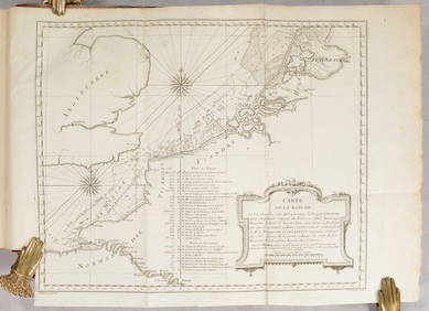
D'Entrecasteaux - Australia: Coasts of Van Diemen's Land (New Holland). 9Trillium Antique Prints & Rare Books4.5(28)See Sold PriceFeb 24, 2024
D'Entrecasteaux - Tasmania, Australia: Map of the Northern Portion of Recherche Bay. 5Trillium Antique Prints & Rare Books4.5(28)See Sold PriceFeb 24, 2024
D'Entrecasteaux - Australia: Chart of Van Diemen's Land (New Holland). 3Trillium Antique Prints & Rare Books4.5(28)See Sold PriceFeb 24, 2024
D'Entrecasteaux - Map of Australia (New Holland), New Zealand, and southern Asia and surroundingTrillium Antique Prints & Rare Books4.5(28)See Sold PriceFeb 24, 2024
AFRICA. Antiqua; Rome Carthage, start Punic War 1908 old antique map chartJasper524.5(9.7k)See Sold PriceFeb 28, 2024
Plan de la Baye & Isle d'Arguim'. Mauritania. Arguin island. BELLIN 1746 mapJasper524.5(9.7k)See Sold PriceFeb 28, 2024
Afrique…Nord-Ouest' & 'Inde' by Meissas. N Africa India Singapore 1861 old mapJasper524.5(9.7k)See Sold PriceFeb 28, 2024
Bakka, Dakha or Bangua plant. Bukhu plant or Spiraea. Kolben 1748 old printJasper524.5(9.7k)See Sold PriceFeb 28, 2024
Plan de Fort d'Arguim'. Mauritania. Arguin fort. BELLIN 1746 old antique mapJasper524.5(9.7k)See Sold PriceFeb 28, 2024