![Philips' Atlas of Counties of England: Heading: (England) Author: Title: Philips' Atlas of the Counties of England, Including Maps of North & South Wales, the Channel Islands, and the Isle of Man Place Published: London Publisher:George P](https://p1.liveauctioneers.com/642/319971/171838576_1_x.jpg?height=310&quality=70&version=1708735483)
Popular Searches
Popular Searches
“speed OR map OR of OR farne OR and OR channel OR islands”
1,234 Results
Categories
Location & Shipping
Payment Method
Auction House
Current Bid
Est. Price Range
Origin
Material / Technique
Style / Period
Creator
![Philips' Atlas of Counties of England: Heading: (England) Author: Title: Philips' Atlas of the Counties of England, Including Maps of North & South Wales, the Channel Islands, and the Isle of Man Place Published: London Publisher:George P](https://p1.liveauctioneers.com/642/319971/171838576_1_x.jpg?height=310&quality=70&version=1708735483)
![Le Canal de Mosambique, l'Isle de Madagascar… Mozambique. Africa. BONNE 1788 map: TITLE/CONTENT OF MAP: Le Canal de Mosambique, l'Isle de Madagascar, les Etats du Monomotapa, et les Royaumes voisins [The Mozambique Channel, the island of Madagascar, and the States of Monomotapa wit](https://p1.liveauctioneers.com/5584/319994/171846266_1_x.jpg?height=310&quality=70&version=1708466739)
![Le Canal de Mosambique, l'Isle de Madagascar… Mozambique. Africa. BONNE 1790 map: TITLE/CONTENT OF MAP: Le Canal de Mosambique, l'Isle de Madagascar, les Etats du Monomotapa, et les Royaumes voisins [The Mozambique Channel, the island of Madagascar, and the States of Monomotapa wit](https://p1.liveauctioneers.com/5584/319994/171846348_1_x.jpg?height=310&quality=70&version=1708466739)
![MAP, Asia, Speed: Northern Asia. John Speed, A Newe Mape of Tartary, from A Prospect of the Most Famous Parts of the World…, 1676 (circa). Hand Color. This splendid carte-a-figures map covers the region from Lake Bai](https://p1.liveauctioneers.com/6576/320593/172252601_1_x.jpg?height=310&quality=70&version=1708729193)
![1942 Guernsey Channel Islands Occupation England Cover #N4 Blue Paper Locally: 1942 Guernsey Channel Islands Occupation England Cover #N4 Blue Paper Locally Type: Event Cover Place Of Origin: Great Britain Color: Blue Cancellation Type: First Day of Issue Pre-Owned The MYNT Guar](https://p1.liveauctioneers.com/7804/318986/171311204_1_x.jpg?height=310&quality=70&version=1707945039)
![1946 Guernsey Channel Islands England Reg Cover To New Zealand #N4 Blue Paper: 1946 Guernsey Channel Islands England Reg Cover To New Zealand #N4 Blue Paper Type: Event Cover Place Of Origin: Great Britain Color: Blue Pre-Owned The MYNT Guarantee: All items in this auction are g](https://p1.liveauctioneers.com/7804/318983/171306676_1_x.jpg?height=310&quality=70&version=1707944061)
![A silver cream jug formed as a Jersey / Channel Island creamer, hallmarked Birmingham 1908, stamped: A silver cream jug formed as a Jersey / Channel Island creamer, hallmarked Birmingham 1908, stamped under London Jewellers & Silversmiths Jersey. Approx. 3 1/2" highPlease Note - we do not make refere](https://p1.liveauctioneers.com/1605/319174/171619786_1_x.jpg?height=310&quality=70&version=1707988777)
![MAP, English Channel, Danckerts: English Channel. Theodorus Danckerts, Novissima et Accuratissima Canalis Inter Angliae et Galliae Tabula cum Omnibus suis Portibus, Arenis et Profundis, 1695 (circa). Hand Color. Magnificent chart of](https://p1.liveauctioneers.com/6576/320593/172252453_1_x.jpg?height=310&quality=70&version=1708729193)
![MAP, Atlantic Islands, Tallis: Atlantic Islands. John Tallis, Islands in the Atlantic, from Illustrated Atlas and Modern History of the World, 1851 (circa). Hand Color. A beautiful steel engraving consisting of four maps with six v](https://p1.liveauctioneers.com/6576/320593/172252421_1_x.jpg?height=310&quality=70&version=1708729193)
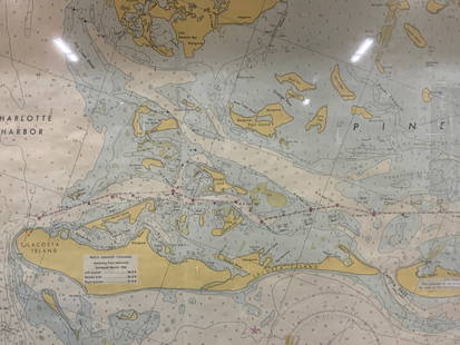
![Vintage Framed Pine Island & Lacoste Island Map: Vintage full color paper map, marked on top Pine island, Charlotte harbor and Lacosta island. Showing waterways and directions. Framed in a wooden frame. Approx 14 x 18 inches window measures 11.5 x 1](https://p1.liveauctioneers.com/3283/318532/171088975_1_x.jpg?height=310&quality=70&version=1707256623)
![Modern Long Island map: Modern Long Island map titled A View of the World poster est. value $50.00-$65.00](https://p1.liveauctioneers.com/2863/320099/171978983_1_x.jpg?height=310&quality=70&version=1708283420)
Lot Closed
0238: 6 pcs Vintage Paper Maps. Vancouver Island, British Columbia. Upper Elk Creek Sheet. See pics.Est. —
Lot Passed
![MAP, England, Speed: Southern England. John Speed, Barkshire Described, from The Theatre of the Empire of Great Britaine, 1616 (circa). Hand Color. Speed's elaborate map of the Berkshire region features a large vignette o](https://p1.liveauctioneers.com/6576/320593/172252439_1_x.jpg?height=310&quality=70&version=1708729193)
![Map of Mexico, Central America, and the West Indies: Publication Date: 1860 Title: Map of Mexico, Central America, and the West Indies Cartographer: WILLIAMS, W. Publisher: MITCHELL, S.A. Height: 11.8 Width: 19.8 Map showing lower U.S., Mexico, West Ind](https://p1.liveauctioneers.com/5584/319958/171812103_1_x.jpg?height=310&quality=70&version=1708466739)
![1822 MAP of LEEWARD ISLANDS GEOGRAPHICAL STATISTICAL HISTORICAL antique 17.5x22": 1822 MAP of LEEWARD ISLANDS GEOGRAPHICAL STATISTICAL HISTORICAL # 45 from Carey & Lea’s Complete Historical, Chronological, and Geographical American Atlas. Overall size 17 1/2 by 21 3/4" Very g](https://p1.liveauctioneers.com/5584/319637/171623104_1_x.jpg?height=310&quality=70&version=1708466739)
![Blackie (Pub) 1882 Folio Map. West India Islands & Central America: Lithograph Map Published 1882 by Blackie & Son, London for "The Comprehensive Atlas & Geography of the World" by W. G. Blackie. Centre fold as published. Paper Size: 22 x 15 inch (56 x 38cm) Good cond](https://p1.liveauctioneers.com/3952/320085/171971860_1_x.jpg?height=310&quality=70&version=1708266709)
![MAP, England, Speed: Central England. John Speed, Stafford Countie and Towne with the Ancient Citie Lichfeild Described, from The Theatre of the Empire of Great Britaine..., 1616 (circa). Hand Color. An attractive map of](https://p1.liveauctioneers.com/6576/320593/172252435_1_x.jpg?height=310&quality=70&version=1708729193)
![MAP, England, Speed: Western England. John Speed, Worcester Shire Described, from The Theatre of the Empire of Great Britaine, 1610 (dated). Hand Color. This handsome decorative map of Worcestershire is from John Speed’](https://p1.liveauctioneers.com/6576/320593/172252433_1_x.jpg?height=310&quality=70&version=1708729193)
![MAP, England, Speed: Western England. John Speed, Hereford-shire Described with the True Plot of the Citie Hereford, as Alsoe the Armes of Thos Nobles That Have Bene Intituled with That Dignitye, from The Theatre of the E](https://p1.liveauctioneers.com/6576/320593/172252434_1_x.jpg?height=310&quality=70&version=1708729193)
![MAP, Wales, Speed: Southeastern Wales. John Speed, The Countye of Monmouth with the Sittuation of the Shire-towe Described Ann 1610, from The Theatre of the Empire of Great Britaine..., 1616 (circa). Hand Color. This fi](https://p1.liveauctioneers.com/6576/320593/172252449_1_x.jpg?height=310&quality=70&version=1708729193)
![MAP, Wales, Speed: Northwestern Wales. John Speed, Caernarvon Both Shyre and Shire-Towne with the Ancient Citie Bangor Described, from The Theatre of the Empire of Great Britaine, 1610 (dated). Hand Color. The inset of](https://p1.liveauctioneers.com/6576/320593/172252448_1_x.jpg?height=310&quality=70&version=1708729193)
![MAP, England, Speed: Northern England. John Speed, The North and East Ridins of Yorkshire, from The Theatre of the Empire of Great Britaine..., 1713 (circa). Hand Color. This stunning and uncommon map of North and East Yo](https://p1.liveauctioneers.com/6576/320593/172252432_1_x.jpg?height=310&quality=70&version=1708729193)
![Vintage Framed Cat Island Nautical Map Print: Vintage Framed Cat Island Nautical Map Print. The signature "Stubbings" and year "77" can be seen near the bottom middle of the print. The framed print is approx 21 1/2" x 1" x](https://p1.liveauctioneers.com/6056/319966/171980576_1_x.jpg?height=310&quality=70&version=1708288936)
![1750 Bowen Map of Bermuda and St. Kitts -- A New & Accurate Map of Bermudas or Sommer's Islands...: Title: 1750 Bowen Map of Bermuda and St. Kitts -- A New & Accurate Map of Bermudas or Sommer's Islands... [on sheet with] An Accurate Map of the Island of St. Christopher… Cartographer: E Bowen](https://p1.liveauctioneers.com/5584/319958/171812096_1_x.jpg?height=310&quality=70&version=1708466739)
TOP