![MAP, North Pole, Bowen: North Pole. Emanuel Bowen, A New & Accurate Map of the North Pole, with All the Countries Hitherto Discovered Situated Near or Adjacent to It as Well as Some Others More Remote..., from A Complete Sys](https://p1.liveauctioneers.com/6576/320593/172252337_1_x.jpg?height=310&quality=70&version=1708729193)
Popular Searches
Popular Searches
“johannes OR blaeu OR new OR and OR accurate OR map OR of OR the OR world”
1,616 Results
Categories
Location & Shipping
Payment Method
Auction House
Current Bid
Est. Price Range
Origin
Material / Technique
Style / Period
Creator
![MAP, North Pole, Bowen: North Pole. Emanuel Bowen, A New & Accurate Map of the North Pole, with All the Countries Hitherto Discovered Situated Near or Adjacent to It as Well as Some Others More Remote..., from A Complete Sys](https://p1.liveauctioneers.com/6576/320593/172252337_1_x.jpg?height=310&quality=70&version=1708729193)
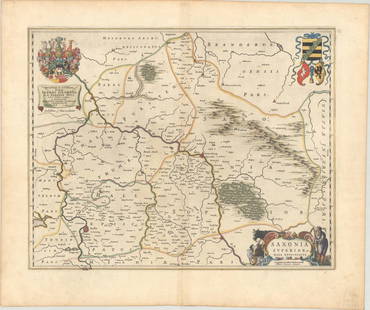
![MAP, Germany, Blaeu: Central Germany. Johannes Blaeu, Saxonia Superior, & Hall Episcopatus, 1659 (circa). Hand Color. This exquisitely engraved map of central Germany features the fortified cities of Wittenberg and Halle,](https://p1.liveauctioneers.com/6576/320593/172252517_1_x.jpg?height=310&quality=70&version=1708729193)
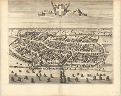
![MAP, Italy, Blaeu: Riva Presso Chieri, Italy. Johannes Blaeu, Ripae Oppidum, 1685 (circa). Black & White. This superb bird's-eye view of the town of Riva Presso Chieri, just outside of Turin, was published in Blaeu's to](https://p1.liveauctioneers.com/6576/320593/172252571_1_x.jpg?height=310&quality=70&version=1708729193)
![MAP, Germany, Blaeu: Eastern Germany. Johannes Blaeu, Principatus Anhaltinus, 1659 (circa). Hand Color. This map depicts part of Saxony-Anhalt between the cities of Magdeburg, Halberstadt, Mansfeld and Wittenberg. The map](https://p1.liveauctioneers.com/6576/320593/172252518_1_x.jpg?height=310&quality=70&version=1708729193)
![MAP, Germany, Blaeu: Western Germany. Johannes Blaeu, Comitatus Marchia et Ravensberg, 1659 (circa). Hand Color. This map depicts two historical counties of the Holy Roman Empire: Marks and Ravensberg. Major cities, towns](https://p1.liveauctioneers.com/6576/320593/172252515_1_x.jpg?height=310&quality=70&version=1708729193)
![MAP, Germany, Blaeu: Northern Germany. Johannes Blaeu, Praefecturae Trittow, Reinbeeck, Tremsbuttel et Steinhorst, 1662 (circa). Hand Color. This decorative map focuses on the region between Hamburg and Lubeck, identifyin](https://p1.liveauctioneers.com/6576/320593/172252513_1_x.jpg?height=310&quality=70&version=1708729193)
![MAP, Netherlands, Blaeu: Enkhuizen, Netherlands. Johannes Blaeu, Topographia Enchusae Delineata a Cornelio Biens Senatore Enchusano, from Toonneel der Steden van de ... Nederlanden, 1652 (published). Black & White. This super](https://p1.liveauctioneers.com/6576/320593/172252465_1_x.jpg?height=310&quality=70&version=1708729193)
![MAP, Scotland, Blaeu: Southern Scotland. Johannes Blaeu, Lidalia vel Lidisdalia Regio, Lidisdail. Auct. Timotheo Pont, from Sixieme Volume de la Geographie Blaviane, 1663 (circa). Hand Color. This beautifully engraved map](https://p1.liveauctioneers.com/6576/320593/172252451_1_x.jpg?height=310&quality=70&version=1708729193)
![MAP, Scotland, Blaeu: Northern Scotland. Johannes Blaeu, Cathenesia. Caithness, from Geographiae Blavianae Volumen Sextum, 1662 (published). Hand Color. This beautifully engraved map covers the northern tip of Scotland. Th](https://p1.liveauctioneers.com/6576/320593/172252450_1_x.jpg?height=310&quality=70&version=1708729193)
![MAP, England, Blaeu: Eastern England. Johannes Blaeu, Cantabrigiensis Comitatus; Cambridge Shire, from Cinquieme Volume de la Geographie Blaviane..., 1663 (circa). Hand Color. This is an excellent example of the height of](https://p1.liveauctioneers.com/6576/320593/172252436_1_x.jpg?height=310&quality=70&version=1708729193)
![MAP, Baltic, Blaeu: Baltic. Johannes Blaeu, Livonia, Vulgo Lyfeland, 1642 (circa). Hand Color. This handsome map covers the area of present-day Estonia, Latvia and Lithuania, with the Baltic Sea, as well as the neighbori](https://p1.liveauctioneers.com/6576/320593/172252460_1_x.jpg?height=310&quality=70&version=1708729193)
![MAP, Wales, Blaeu: Wales. Johannes Blaeu, Wallia Principatus Vulgo Wales, from Cinquieme Volume de la Geographie Blaviane, 1663 (circa). Hand Color. This handsome map of Wales is filled with detail and decorative elemen](https://p1.liveauctioneers.com/6576/320593/172252447_1_x.jpg?height=310&quality=70&version=1708729193)
![MAP, England, Blaeu: Northern England. Johannes Blaeu, Ducatus Eboracensis Pars Borealis / The Northriding of York Shire, from Le Theatre du Monde ou Nouvel Atlas, 1645 (circa). Hand Color. This map of North Yorkshire has](https://p1.liveauctioneers.com/6576/320593/172252430_1_x.jpg?height=310&quality=70&version=1708729193)
![MAP, US & Canada, Gavit: New England & Southeastern Canada. John Gavit, A Chorographical Map of the Northern Department of North America Drawn from the Latest and Most Accurate Observations, 1850 (circa). Black & White. This](https://p1.liveauctioneers.com/6576/320593/172252351_1_x.jpg?height=310&quality=70&version=1708729193)
![[ARCTIC]. BOWEN, Emanuel. A New & Accurate Map of the North...: [ARCTIC]. BOWEN, Emanuel. A New & Accurate Map of the North Pole. London, [ca. 1746]. Copper-plate map, hand-colored, of the regions north of 50 degrees. The western side of North America is marked Pa](https://p1.liveauctioneers.com/928/318880/171360917_1_x.jpg?height=310&quality=70&version=1707501302)
![1750 Bowen Map of Bermuda and St. Kitts -- A New & Accurate Map of Bermudas or Sommer's Islands...: Title: 1750 Bowen Map of Bermuda and St. Kitts -- A New & Accurate Map of Bermudas or Sommer's Islands... [on sheet with] An Accurate Map of the Island of St. Christopher… Cartographer: E Bowen](https://p1.liveauctioneers.com/5584/319958/171812096_1_x.jpg?height=310&quality=70&version=1708466739)
![1764 MAP OF COUNTRIES THIRTY MILES ROUND LONDON antique 12.5 by 15": A NEW AND ACCURATE MAP OF THE COUNTRIES THIRTY MILES ROUND LONDON 1764 Very good condition, folds, cut out portion of right margin Reserve: $48.00 Shipping: Domestic: Flat-rate of $25.00 to anywhere w](https://p1.liveauctioneers.com/5584/319637/171623095_1_x.jpg?height=310&quality=70&version=1708466739)
![LATE 17TH C. FRENCH MAP OF THE NEW WORLD BY ALEXIS-HUBERT JAILLOT (1632-1712): "L'Amerique Septentrionale divisee en ses Principale Partieas ou sont distingues les villes des autres, Les Etats suivant quils appartiement presenteme Francois, Castillans, Anglois, Suedois, Danois,](https://p1.liveauctioneers.com/957/316681/169967484_1_x.jpg?height=310&quality=70&version=1706130831)
![NICOLAES VISSCHER (NETHERLANDS, 1618-1709) MAP OF THE NEW WORLD: "Novi Belgii Novaeque Angliae nec non Partis Virginie Tabula multis in locis emendata", 1656. Handcolored copperplate engraving on two joined sheets of wove paper as issued. Features cartouche panoram](https://p1.liveauctioneers.com/957/316681/169967505_1_x.jpg?height=310&quality=70&version=1706130831)
![MAP, England, Bowen: Eastern England. Emanuel Bowen, An Accurate Map of the County of Suffolk Divided into Its Hundreds. Drawn from Surveys, with Various Additional Improvements..., 1752 (circa). Hand Color. This attracti](https://p1.liveauctioneers.com/6576/320593/172252438_1_x.jpg?height=310&quality=70&version=1708729193)
![MAP, Jamaica, Moll: Jamaica. Herman Moll, A New Map of the Island of Jamaica, from Atlas Geographus..., 1717 (published). Hand Color. A detailed map of the island locating scores of towns and coastal place names, roads,](https://p1.liveauctioneers.com/6576/320593/172252396_1_x.jpg?height=310&quality=70&version=1708729193)
![MAP, England, Bowen: Southeast England. Emanuel Bowen, An Accurate Map of the County of Kent Divided Into Its Lathes, and Subdivided Into Hundreds, Drawn from the Best Authorities and Adorned with Views of the Cathedral C](https://p1.liveauctioneers.com/6576/320593/172252440_1_x.jpg?height=310&quality=70&version=1708729193)
![MAP IN BOOK, US, Martyn: First Printed Map to Name Georgia. Colonial Southern United States. Benjamin Martyn, [Map in Book] [New Map of Georgia] [in] Reasons for Establishing the Colony of Georgia, with Regard to the Trade of](https://p1.liveauctioneers.com/6576/320593/172252361_1_x.jpg?height=310&quality=70&version=1708729193)
![MAP, World, Fer: World. Nicholas de Fer, Carte Generale du Globe Terrestre, from Methode pour Apprendre Facilement la Geographie..., 1746 (published). Black & White. This double hemisphere map of the world shows the i](https://p1.liveauctioneers.com/6576/320593/172252331_1_x.jpg?height=310&quality=70&version=1708729193)
TOP