![WORLD ILLUSTRATED HISTORICAL CHRONIC VOLUMES 2 FOLIO EDITION 1979: Year/Century: 20th century Language: German Subject: Illustrated Binding: Leather Description: The title of this historical chronicle is "Historical chronicle or description of the strangest story so](https://p1.liveauctioneers.com/6177/320166/172025009_1_x.jpg?height=310&quality=70&version=1708361366)
Popular Searches
Popular Searches
“historical OR atlas OR of OR the OR world OR illustrated OR 1876”
1,527 Results
Categories
Location & Shipping
Payment Method
Auction House
Current Bid
Est. Price Range
Origin
Material / Technique
Style / Period
Creator
![WORLD ILLUSTRATED HISTORICAL CHRONIC VOLUMES 2 FOLIO EDITION 1979: Year/Century: 20th century Language: German Subject: Illustrated Binding: Leather Description: The title of this historical chronicle is "Historical chronicle or description of the strangest story so](https://p1.liveauctioneers.com/6177/320166/172025009_1_x.jpg?height=310&quality=70&version=1708361366)
![Illustrated World-Atlas and Gaszetteer by Hammond-Doubleday 1954: Illustrated World-Atlas and Gaszetteer by Hammond-Doubleday. Published by Nelson Doubleday, 1954. Fine or near fine hardback with its original dust cover.](https://p1.liveauctioneers.com/7983/318753/171113388_1_x.jpg?height=310&quality=70&version=1707443215)
![Illustrated Historical Register 1876: 17"x22" framed paper advertising sign of Frank Leslie's Illustrated Historical Register 1876 Centennial Exposition - Very good * * WILL NOT SHIP](https://p1.liveauctioneers.com/6535/319935/171797465_1_x.jpg?height=310&quality=70&version=1708098331)
![Books on American Interest, 8: Eight Books on American Interest, including: an autographed copy of "The Constitution of the United States of America" inscribed and illustrated by Sam Fink, "Self-Portrait: U.S.A." by David Douglas D](https://p1.liveauctioneers.com/5649/320533/172227745_1_x.jpg?height=310&quality=70&version=1708708602)
![1876 Antique Atlas of York County, PA (2): Two York County, Pennsylvania atlases, the first copy complete with "Atlas of York Co. Pennsylvania Illustrated from Actual Surveys" dated 1876 by and under the direction of Beach Nichols and publishe](https://p1.liveauctioneers.com/1060/320044/171928551_1_x.jpg?height=310&quality=70&version=1708147156)
![1918 FRENCH L ILLUSTRATION MAGAZINE WWI ARMISTICE: L Illustration magazine, issued 16-23 November 1918, no. 3950-3951. Published in Paris, France. The issue is dedicated to the end of the First World War. L Illustration was the first weekly illustrate](https://p1.liveauctioneers.com/6975/320306/172133567_1_x.jpg?height=310&quality=70&version=1708514188)
![MAP, Atlantic Islands, Tallis: Atlantic Islands. John Tallis, Islands in the Atlantic, from Illustrated Atlas and Modern History of the World, 1851 (circa). Hand Color. A beautiful steel engraving consisting of four maps with six v](https://p1.liveauctioneers.com/6576/320593/172252421_1_x.jpg?height=310&quality=70&version=1708729193)
![MAPS IN BOOK, Atlases, Arbuckle Bros.: Atlases. Arbuckle Bros. Coffee Company, Arbuckles' Illustrated Atlas of Fifty Principal Nations of the World, 1889 (dated). Printed Color. A nice example of this unusual atlas that was designed to adv](https://p1.liveauctioneers.com/6576/320593/172252663_1_x.jpg?height=310&quality=70&version=1708729193)
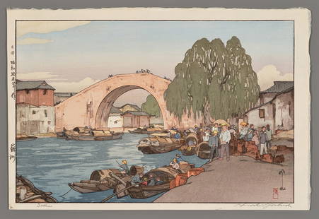
![Hiroshi Yoshida Woodblock - Small Town in Chugoku: Artist: Yoshida, Hiroshi, 1876-1950 Title: Small Town in Chugoku Series: Kansai District Date: 1933 Medium: Japanese woodblock print Image Size: 9 5/8 x 14 5/8 inches](https://p1.liveauctioneers.com/692/319694/171636847_1_x.jpg?height=310&quality=70&version=1708033106)
![Hiroshi Yoshida Woodblock - Soshu: Artist: Yoshida, Hiroshi, 1876-1950 Title: Soshu Date: 1940 Medium: Japanese woodblock print Image Size: 9 3/4 x 14 7/8 inches Illustrated: Abe, pl. 236 Note](https://p1.liveauctioneers.com/692/319694/171636849_1_x.jpg?height=310&quality=70&version=1708033106)
![MAP, Boston, Bellin: Boston, Massachusetts. Jacques Nicolas Bellin, Carte de la Baye de Baston Situee dans la Nouvelle Angleterre, from Le Petit Atlas Maritime…, 1764 (circa). Hand Color. The complex nature of the islan](https://p1.liveauctioneers.com/6576/320593/172252380_1_x.jpg?height=310&quality=70&version=1708729193)
![MAP, Brazil, Leti: Paraiba, Brazil. Gregorio Leti, Afbeeldinghe van Pariba ende Forten, from Teatro Belgico, 1690 (published). Hand Color. This bird's-eye map shows the region of Paraiba and Portuguese fortifications at](https://p1.liveauctioneers.com/6576/320593/172252413_1_x.jpg?height=310&quality=70&version=1708729193)
![1792 OLD INDIA HISTORY ANTIQUE ILLUSTRATED WITH MAPS OF THE EIGHTEENTH CENTURY IN FRENCH: Year/Century: 18th century Language: French Subject: Illustrated Binding: Hardcover Description: Historical research on the awareness that the ancients had of the outside world and the commercial deve](https://p1.liveauctioneers.com/6177/320166/172025072_1_x.jpg?height=310&quality=70&version=1708361366)
![GERMAN ANTIQUE 1780S ILLUSTRATED UNIVERSAL HISTORY FROM 1776 TO 1780: Year/Century: 18th century Language: German Subject: Illustrated Binding: Leather Description: The newly established historical picture gallery is this: a concise, clear, and dispassionate account of](https://p1.liveauctioneers.com/6177/320166/172025237_1_x.jpg?height=310&quality=70&version=1708361366)
![[WORLD’S FAIRS]. A Group of Nearly 40 Postcards, Brochures,...: [WORLD’S FAIRS]. A Group of Nearly 40 Postcards, Brochures, Trade Cards and More from World’s Fairs. [V.p., ca. 1876-1984]. Original ephemera from the 1876 Continental Exposition (one trad](https://p1.liveauctioneers.com/928/318880/171361564_1_x.jpg?height=310&quality=70&version=1707501302)
![[JAPANESE BASEBALL]. “Baseball World” (Translated from the ...: [JAPANESE BASEBALL]. “Baseball World” (Translated from the Japanese) Magazine, Vol. 4, No. 6. [June 5, 1914]. 4to. Illustrated. Original pictorial front wrapper (rear wrapper lacking). Str](https://p1.liveauctioneers.com/928/318880/171361457_1_x.jpg?height=310&quality=70&version=1707501302)
![[LITHOGRAPHY]. A Collection of 19th c. Masked Ball and Masq...: [LITHOGRAPHY]. A Collection of 19th c. Masked Ball and Masquerade Tickets and Invitations [V.p., 1824-1890’s]. Lovely and uncommon collection of primarily full color lithographed items. Grouping](https://p1.liveauctioneers.com/928/318880/171361123_1_x.jpg?height=310&quality=70&version=1707501302)
![HISTORICAL ILLUSTRATED ANTIQUE 37 ENGRAVINGS FROM THE NETHERLANDS, 1744: Year/Century: 18th century Language: Dutch Subject: Illustrated Binding: Leather Description: Smids, Leonard. Short life stories and sayings of the Dutch Graaven, from Dirk the first to Koning Filip t](https://p1.liveauctioneers.com/6177/320166/172024887_1_x.jpg?height=310&quality=70&version=1708361366)
![HAMMOND'S READY REFERENCE HISTORICAL ATLAS 1920: HAMMOND'S READY REFERENCE HISTORICAL ATLAS [A NEW SERIES OF 29 PLATES CONTAINING 67 COLORED MAPS] by Hammond, C.S.. Published by C.S. Hammond & Co, NY, circa 1920. Very good condition paperback.](https://p1.liveauctioneers.com/7983/318753/171113465_1_x.jpg?height=310&quality=70&version=1707443215)
![Robert H Labberton - Map of The Territory of the Present United States - The territory of the: The Territory of the Thirteen Original States in 1783; The Territory of the Present United States after 1 February 1801. Illustration for the New Historical Atlas and General History by Robert H Labbe](https://p1.liveauctioneers.com/8353/320221/172083438_1_x.jpg?height=310&quality=70&version=1708436667)
![Universal World History Illustrated Bks 8, 1929: Wise & Co. NY 8 volume UNIVERSAL WORLD HISTORY books, hardcover , 8.5 x 5.75 in. 1st page colored illustrations, and black and white illustrations, photographs, and maps. Property of Greenwich Connect](https://p1.liveauctioneers.com/3283/318532/171088950_1_x.jpg?height=310&quality=70&version=1707256619)
![WORLD RELIGIONS ILLUSTRATED: ASIA, AFRICA, AMAZON, 1663 VINTAGE VELLUM BINDING: Year/Century: 17th century Language: Dutch Subject: Illustrated Binding: Vellum Description: "The World's Religions," or "A discourse of all the religions and heresies in Asia, Africa, America, and Eu](https://p1.liveauctioneers.com/6177/320166/172024910_1_x.jpg?height=310&quality=70&version=1708361366)
![Rand McNally Cosmopolitan World Atlas by Rand McNally 1949: Rand McNally Cosmopolitan World Atlas by Rand McNally Published by Rand McNally, 1949. Near Mint condition hardback with its original dust cover. Folio size book full of maps from back in its era. Boo](https://p1.liveauctioneers.com/7983/318753/171113384_1_x.jpg?height=310&quality=70&version=1707443215)
![1691 APPLICATION OF COMPASS ILLUSTRATED HISTORICAL APPLICATION OF THE PROPORTION COMPANY: Year/Century: 17th century Language: French Subject: Illustrated Binding: Leather Description: L'utilisation de la proportion, l'explication et le montrage d'une manière concise et simple, et l'ampli](https://p1.liveauctioneers.com/6177/320166/172024891_1_x.jpg?height=310&quality=70&version=1708361366)
TOP