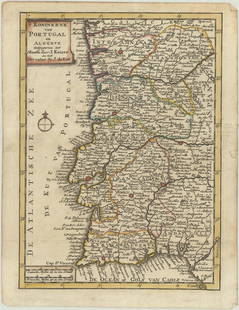
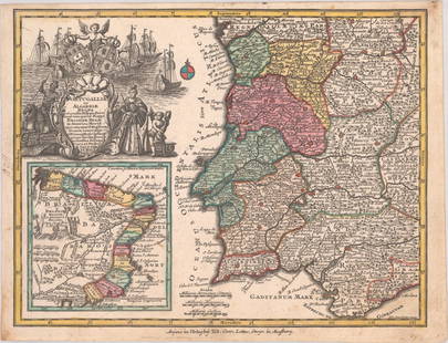
![Guthrie, William 1812 Antique Map. Spain and Portugal: Copper Engraved Map Published 1812, London for "A New Geographical, Historical and Commercial Grammar..." by William Guthrie. The maps are by John Senex, Thomas Kitchin and others. Folds as issued. Pa](https://p1.liveauctioneers.com/3952/320085/171971893_1_x.jpg?height=310&quality=70&version=1708266709)
Popular Searches
Popular Searches
“hall OR antique OR map OR of OR spain OR and OR portugal OR 1856”
1,443 Results
Categories
Location & Shipping
Payment Method
Auction House
Current Bid
Est. Price Range
Origin
Material / Technique
Style / Period
Creator
![Guthrie, William 1812 Antique Map. Spain and Portugal: Copper Engraved Map Published 1812, London for "A New Geographical, Historical and Commercial Grammar..." by William Guthrie. The maps are by John Senex, Thomas Kitchin and others. Folds as issued. Pa](https://p1.liveauctioneers.com/3952/320085/171971893_1_x.jpg?height=310&quality=70&version=1708266709)
![Early colonial Africa. Inset Madeira & Aden. SIDNEY HALL 1856 old antique map: CAPTION PRINTED BELOW PICTURE: Africa [inset: Madeira, port of Aden] DATE PRINTED: 1856 IMAGE SIZE: Approx 40.5 x 29.5cm, 16 x 11.75 inches (Large) TYPE: Antique atlas map with original hand colouring](https://p1.liveauctioneers.com/5584/319994/171846293_1_x.jpg?height=310&quality=70&version=1708466739)
![MAP, Spain & Portugal, Gravius: Spain & Portugal. N.T. Gravius, Nouvelle Carte du Royaume d'Espagne, Dressee sur les Observations de Messieurs de l'Academie Royale des Sciences, from Nieuwe Natuur-Geschieden Handelkundige Zak-En Rei](https://p1.liveauctioneers.com/6576/320593/172252498_1_x.jpg?height=310&quality=70&version=1708729193)
![MAP, Spain & Portugal, Heredero: Spain & Portugal. M. Heredero, Espana, 1957 (circa). Printed Color. This superb pictorial map of Spain was created by M. Heredero. The map shows the history, culture, and natural resources in Spain, a](https://p1.liveauctioneers.com/6576/320593/172252499_1_x.jpg?height=310&quality=70&version=1708729193)
![Northern & Southern Africa. Maghreb. Orange River Sovereignty. HALL 1856 map: CAPTION PRINTED BELOW PICTURE: 'Africa, north part / Africa, south part' DATE PRINTED: 1856 IMAGE SIZE: Approx 41.5 x 29.5cm, 16.25 x 11.5 inches (Large) TYPE: Antique atlas map with original hand col](https://p1.liveauctioneers.com/5584/319994/171846321_1_x.jpg?height=310&quality=70&version=1708466739)
![Early colonial Africa. Inset Madeira & Aden. SIDNEY HALL 1854 old antique map: CAPTION PRINTED BELOW PICTURE: Africa [inset: Madeira, port of Aden] DATE PRINTED: 1854 IMAGE SIZE: Approx 40.5 x 29.5cm, 16 x 11.75 inches (Large) TYPE: Antique atlas map with original hand colouring](https://p1.liveauctioneers.com/5584/319994/171846420_1_x.jpg?height=310&quality=70&version=1708466739)
![Antique Map of The Kingdom of Spain, 1701 Print: Antique Map of The Kingdom of Spain, 1701 Print. 28 x 34 1/2 in with frame. 18 x 24 1/2 in without frame. Local Pick up call one day before to make an appointment. TO SHIP THIS ITEM IN USA OR INTERNAT](https://p1.liveauctioneers.com/6103/320331/172143571_1_x.jpg?height=310&quality=70&version=1708532982)
![Perry, Matthew C. 1856 Large Map. Shah Bay, Lew Chew I. Japan: Large Folio Lithograph Map Published 1856, Washington for "Narrative of the Expedition of an American Squadron to the China Seas and Japan, performed in the years 1852, 1853, and 1854" by Commodore Ma](https://p1.liveauctioneers.com/3952/320085/171971896_1_x.jpg?height=310&quality=70&version=1708266709)
![Northern & Southern Africa. Maghreb. Orange River Sovereignty. HALL 1854 map: CAPTION PRINTED BELOW PICTURE: 'Africa, north part / Africa, south part' DATE PRINTED: 1854 IMAGE SIZE: Approx 41.5 x 29.5cm, 16.25 x 11.5 inches (Large) TYPE: Antique atlas map with original hand col](https://p1.liveauctioneers.com/5584/319994/171846201_1_x.jpg?height=310&quality=70&version=1708466739)
![COLONIAL AFRICA. British French German Italian Portugal Spain.STANFORD 1906 map: TITLE/CONTENT OF MAP: 'Africa' DATE PRINTED: 1906 IMAGE SIZE: Approx 33.0 x 27.5cm, 13 x 10.75 inches (Large); Please note that this is a folding map. TYPE: Colour antique map. Scale 1: 30,096,000 CON](https://p1.liveauctioneers.com/5584/319994/171846383_1_x.jpg?height=310&quality=70&version=1708466739)
![COLONIES FRANÇAISES AFRIQUE. Africa Sénégambie Madagascar. LEVASSEUR 1856 map: CAPTION PRINTED BELOW PICTURE: 'Colonies Françaises (en Afrique)' DATE PRINTED: 1856 IMAGE SIZE: Approx 31.0 x 43.0cm, 12 x 16.75 inches (Large) TYPE: Antique steel engraved map with outline hand](https://p1.liveauctioneers.com/5584/319994/171846199_1_x.jpg?height=310&quality=70&version=1708466739)
![AFRIQUE. Africa. Decorative antique map/carte by Victor LEVASSEUR 1856 old: CAPTION PRINTED BELOW PICTURE: 'Afrique' DATE PRINTED: 1856 IMAGE SIZE: Approx 31.0 x 44.0cm, 12.25 x 17.25 inches (Large) TYPE: Antique steel engraved map with outline hand colour (color) applied at](https://p1.liveauctioneers.com/5584/319994/171846247_1_x.jpg?height=310&quality=70&version=1708466739)
![MAP, Portugal, Keizer: Portugal. Jocob Keizer & Jan De Lat, T Koninkryk van Portugal en Algerve..., 1747 (circa). Hand Color. This small map is densely engraved with tiny towns, political boundaries, and river systems. Ador](https://p1.liveauctioneers.com/6576/320593/172252506_1_x.jpg?height=310&quality=70&version=1708729193)
![MAP, Portugal, Seutter: Portugal & Brazil. Seutter/Lotter, Portugalliae et Algarbiae Regna cu Confin: Hispan: Prov: Simul Vero Pecul: Mappa Brasiliae Regn:..., from Atlas Minor, 1740 (circa). Hand Color. This great small map](https://p1.liveauctioneers.com/6576/320593/172252505_1_x.jpg?height=310&quality=70&version=1708729193)
![MAP, Spain, Jansson: Northern Spain. Jansson/Valck & Schenk, Biscaia et Guipuscoa Cantabriae Veteris Pars, 1700 (circa). Hand Color. This handsome copper engraved map shows the coastal Basque country in northern Spain. It](https://p1.liveauctioneers.com/6576/320593/172252500_1_x.jpg?height=310&quality=70&version=1708729193)
![MAP, Spain, Valck: Eastern Spain. Valck and Schenk, Episcopatus Tervelae, et Albarrasin, 1700 (circa). Hand Color. Beautifully decorated map of the southern portion of the Aragon region, based on the cartography of the](https://p1.liveauctioneers.com/6576/320593/172252504_1_x.jpg?height=310&quality=70&version=1708729193)
![MAP, Spain, Valck: Northeastern Spain. Valck and Schenk, Episcopatus Balbastrensis et Comitatus Ribagorcae, 1700 (circa). Hand Color. Beautifully decorated map of the region along the border with France, based on the ca](https://p1.liveauctioneers.com/6576/320593/172252502_1_x.jpg?height=310&quality=70&version=1708729193)
![MAP, Spain, Mercator: Eastern Spain. Mercator/Hondius, Regni Valentiae Typus, 1628 (circa). Hand Color. This handsome map of Valencia covers the coastline from Cartagena to Benicarlo with north oriented to the right. It is](https://p1.liveauctioneers.com/6576/320593/172252503_1_x.jpg?height=310&quality=70&version=1708729193)
![MAP, Spain, Lopez: Northern Spain. D. Tomas Lopez, Mapa del Reyno de Navarra Comprehende las Merindades de Pamplona, Estella, Tudela, Sanguessa, Olite, Cuidades, Villas, Valles, y Cendeas &c..., 1772 (dated). Hand Color](https://p1.liveauctioneers.com/6576/320593/172252501_1_x.jpg?height=310&quality=70&version=1708729193)
![Mckenney & Hall - Two Octavo Volumes of Text with Rare Plate of Billy Bowlegs: These are the two text volumes issued with the rare second edition folio work of Thomas L. McKenney & James Hall's History of the Indian tribes of North America. The work was published in Philadelphia](https://p1.liveauctioneers.com/6581/319571/171593358_1_x.jpg?height=310&quality=70&version=1707853304)
![McKenney & Hall, Folio, Rare - Hunting the Buffaloe: This folio lithograph is from extremely rare second edition of Thomas L. McKenney & James Hall's History of the Indian tribes of North America. The work was published in Philadelphia by D. Rice & Co i](https://p1.liveauctioneers.com/6581/319571/171593363_1_x.jpg?height=310&quality=70&version=1707853304)
![McKenney & Hall, Folio, Rare - Se-Quo-Yah: This folio lithograph is from extremely rare second edition of Thomas L. McKenney & James Hall's History of the Indian tribes of North America. The work was published in Philadelphia by D. Rice & Co i](https://p1.liveauctioneers.com/6581/319571/171593361_1_x.jpg?height=310&quality=70&version=1707853304)
![McKenney & Hall, Folio, Rare - 5 Native American Lithographs: This folio lithograph is from extremely rare second edition of Thomas L. McKenney & James Hall's History of the Indian tribes of North America. The work was published in Philadelphia by D. Rice & Co i](https://p1.liveauctioneers.com/6581/319571/171593359_1_x.jpg?height=310&quality=70&version=1707853304)
![McKenney & Hall, Folio, Rare - Chono-Ca-Pe, An Ottoe Chief: This folio lithograph is from extremely rare second edition of Thomas L. McKenney & James Hall's History of the Indian tribes of North America. The work was published in Philadelphia by D. Rice & Co i](https://p1.liveauctioneers.com/6581/319571/171593360_1_x.jpg?height=310&quality=70&version=1707853304)
TOP