![Vintage Estate World Maps II Signed & Framed Art Print: FOR SALE IS THIS VINTAGE ESTATE WORLD MAPS II SIGNED & FRAMED ART PRINT. THE FRAME MEASURES 30 3/4" BY 38 3/4". PIECE IS SIGNED BY ARTIST BUT UNABLE TO MAKE OUT THE NAME. ANY QUESTIONS PLEASE DONT HES](https://p1.liveauctioneers.com/1846/315507/169170802_1_x.jpg?height=310&quality=70&version=1704826207)
Popular Searches
Popular Searches
“framed OR continental OR maps”
6,208 Results
Categories
Advertisements & Signs
Banks, Registers & Vending Machines
Books, Magazines & Papers
Breweriana & Beer Collectibles
Cameras & Photo Equipment
Coins, Currency & Stamps
Comic Books
Entertainment Memorabilia
Historical Memorabilia
Militaria & War Memorabilia
Musical Instruments
Pens & Writing Instruments
Radios, Phones & Electronics
Religious & Spiritual Objects
Rocks, Minerals & Fossils
Scientific & Medical Objects
Sewing, Weaving & Knitting
Sports Equipment
Sports Memorabilia
Tobacciana
Toys & Hobbies
Transportation & Travel Collectibles
Weapons & Armor
Wine & Spirits
Location & Shipping
Payment Method
Auction House
Current Bid
Est. Price Range
Origin
Material / Technique
Style / Period
Creator
![Vintage Estate World Maps II Signed & Framed Art Print: FOR SALE IS THIS VINTAGE ESTATE WORLD MAPS II SIGNED & FRAMED ART PRINT. THE FRAME MEASURES 30 3/4" BY 38 3/4". PIECE IS SIGNED BY ARTIST BUT UNABLE TO MAKE OUT THE NAME. ANY QUESTIONS PLEASE DONT HES](https://p1.liveauctioneers.com/1846/315507/169170802_1_x.jpg?height=310&quality=70&version=1704826207)
![Two (2) Antique 18th C. Copper Engraved Framed Maps - America & Europe: Two (2) antique 18th C. copper engraved framed maps. One of Amerique and other titled Carte d'Europe. Both framed under glass. Frame Size: 13.5H x 14.5W (each)](https://p1.liveauctioneers.com/8122/319505/171536430_1_x.jpg?height=310&quality=70&version=1708121271)
![Antique Style Framed Map of New Jersey: Antique style framed map of New Jersey. OD approx. 27? x 35.?](https://p1.liveauctioneers.com/1060/320044/171928642_1_x.jpg?height=310&quality=70&version=1708147156)
![Kilburg Geochron Lighted Scrolling Framed Map: Kilburg Geochron Lighted Scrolling Framed Map with original paperwork](https://p1.liveauctioneers.com/5779/318058/170774005_1_x.jpg?height=310&quality=70&version=1706800127)
![BRAM STOKER'S DRACULA (1992) - Framed Map of Central Europe: BRAM STOKER'S DRACULA (1992) - Framed Map of Central Europe - A framed map of central Europe from Francis Ford Coppola's Bram Stoker's Dracula. Jonathan Harker (Keanu Reeves) looked over a map of cent](https://p1.liveauctioneers.com/8944/319704/171641864_1_x.jpg?height=310&quality=70&version=1708116612)
![1867 Map of the Railroads of The State of New York: 1867 Map of the Railroads of The State of New YorkA large framed Map of the Railroads of The State of New York dated 1867 and Prepared Under the Direction of J. Matt Goodsell, State Engineer and Surve](https://p1.liveauctioneers.com/7489/316856/171048583_1_x.jpg?height=310&quality=70&version=1707229759)
![1855 Map of New York & Erie Railroad and 1917 Trespassing On Railway Property Is A Misdemeanor: 1855 Map of New York & Erie Railroad and 1917 Trespassing On Railway Property Is A Misdemeanor Poster SignA pair of New York railroad items including a map of New York & Erie Railroad with its Connexi](https://p1.liveauctioneers.com/7489/315696/170879993_1_x.jpg?height=310&quality=70&version=1707225973)
![Vintage 1920s Rand McNally Auto Trails Map: Marked on upper corner Rand McNally Official Auto Trails Map of The United States, copyright by Rand McNally & Company. Depicts the whole of the United States with Trails and marked roads in red along](https://p1.liveauctioneers.com/3283/320322/172161288_1_x.jpg?height=310&quality=70&version=1708550514)
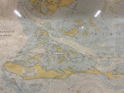
![Vintage Framed Pine Island & Lacoste Island Map: Vintage full color paper map, marked on top Pine island, Charlotte harbor and Lacosta island. Showing waterways and directions. Framed in a wooden frame. Approx 14 x 18 inches window measures 11.5 x 1](https://p1.liveauctioneers.com/3283/318532/171088975_1_x.jpg?height=310&quality=70&version=1707256623)
![Framed AMI Continental II Jukebox Advertisement: Framed AMI Continental II jukebox advertisement. The glass has cracked in two pieces. Dimensions (H x W x D): 34 x 25 x 3 cm. Condition: Fair. Location: The Netherlands, Tilburg.](https://p1.liveauctioneers.com/7809/313197/167708306_1_x.jpg?height=310&quality=70&version=1703146616)
![Framed African Map, 22 x 25: Framed African Map, 22 x 25](https://p1.liveauctioneers.com/3882/319823/171702836_1_x.jpg?height=310&quality=70&version=1708044387)
![Framed Vintage Map Of Le Port Au Prince In The Island Of Santo Domingo: This lot contains a framed vintage map of "Le port Au Prince" in the island of Santo Domingo. The frame is approx 12 1/4" x 10" while the map itself is approx 8 1/2" x 6 1/2".](https://p1.liveauctioneers.com/6056/320272/172138223_1_x.jpg?height=310&quality=70&version=1708534806)
![Modern framed 'Silver Map of Great Britain'](https://p1.liveauctioneers.com/62/320172/172027100_1_x.jpg?height=310&quality=70&version=1708363691)
![A 1987 Walt Disney World Magic Kingdom Souvenir Map.: (Walt Disney World, 1987) An early "A Guide to the Magic Kingdom of Walt Disney World" souvenir map, framed by Disney characters and introduced by Walt Disney World Magic Kingdom Guided Tour Hostess M](https://p1.liveauctioneers.com/4633/319010/171391252_1_x.jpg?height=310&quality=70&version=1707593851)
![FRAMED WARREN COUNTY MAP: WARREN CO., NEW JERSEY. MATTED AND FRAMED UNDER GLASS. 29 1/4" X 21 3/4". PLEASE READ CAREFULLY - Terms for Purchasing and Shipping of Auction Items. Please read carefully before bidding. All payments](https://p1.liveauctioneers.com/942/318628/170985382_1_x.jpg?height=310&quality=70&version=1707234904)
![1937 Holland, Michigan, Tulip Time Map Guide, Framed: 1937 Tulip Time Map Guide (Holland, Michigan), M.E. Bertsch. Framed and matted. Measures approx. 18 1/2" x 23 1/2" OA; 16 1/4" x 21 1/4" SS.](https://p1.liveauctioneers.com/7853/314996/170659156_1_x.jpg?height=310&quality=70&version=1708357295)
![Pair of Early Railroad Maps - 1874 Delaware, Lackawanna & Western and 1876 Pennsylvania Railroad: Pair of Early Railroad Maps - 1874 Delaware, Lackawanna & Western and 1876 Pennsylvania RailroadA pair of framed early railroad maps including an 1874 map of Delaware, Lackawanna & Western Railroad an](https://p1.liveauctioneers.com/7489/315696/170880010_1_x.jpg?height=310&quality=70&version=1707225973)
![Pair of Early Railroad Maps - 1862 Pittsburgh, Ft. Wayne & Chicago Railway and 1873 Pennsylvania: Pair of Early Railroad Maps - 1862 Pittsburgh, Ft. Wayne & Chicago Railway and 1873 Pennsylvania State Auditor General's ReportA pair of framed early railroad maps including a large 1862 Map Showing t](https://p1.liveauctioneers.com/7489/315696/170880022_1_x.jpg?height=310&quality=70&version=1707225973)
![THOMAS MOULE 1837 Colored Map of Warwickshire Framed vgc: THOMAS MOULE 1837 Colored Map of Warwickshire Framed vgcTHOMAS MOULE - Map of WarwickshireThis map was engraved by James Bingley and published in English Counties Delineated (London: G. Virtue, 1837),](https://p1.liveauctioneers.com/1494/316361/170121387_1_x.jpg?height=310&quality=70&version=1707067309)
![Framed Space Age Rand McNally Map of Planets Poster, 1958: Framed Rand McNally Map of Outer Space Astronomy Poster, 1958. This large print of the planets and stars, with astronomical science and math facts, may have been used in a classroom school setting for](https://p1.liveauctioneers.com/7417/319960/171812333_1_x.jpg?height=310&quality=70&version=1708113502)
![Framed Collection Engravings & A Map From The Excursions In The County Of Sussex Published In 1822: This lot contains a Framed Collection Engravings & A Map From The Excursions In The County Of Sussex Published In 1822. It is approx 28" x 35 3/4" and it weigh about 11lbs. Overall the fra](https://p1.liveauctioneers.com/6056/320272/172139185_1_x.jpg?height=310&quality=70&version=1708534806)
![RARE 1638 HONDIUS MAP OF BERMUDA, FRAMED: Henricus Hondius (1597-1651): "Mappa Aestivarum Insularum, alias Barmudas." First atlas issue, two joined sheets as issued, copperplate engraving on wove paper with original contemporary color, printe](https://p1.liveauctioneers.com/957/316681/169967486_1_x.jpg?height=310&quality=70&version=1706130831)
![17TH C. ENGLISH LINEAR MAP BY OGILBY, FRAMED: "The Road from London to the Lands End, Commencing at the Standard in Cornhill and Extending to Senan in Cornwall" by John Ogilby,1675. Handcolored copperplate engraving, on wove paper, with center fo](https://p1.liveauctioneers.com/957/316681/169967501_1_x.jpg?height=310&quality=70&version=1706130831)
![EARLY 18TH C. MAP OF ITALY, FRAMED: "Italia iam Tota Principes in suas Partes accuratius distincta hisee, praeter caeteras adjunximus Majerum ejus Insularum Siciliam . . .", by Peter Schenk, Amsterdam, ca 1700, handcolored copperplate e](https://p1.liveauctioneers.com/957/316681/169967494_1_x.jpg?height=310&quality=70&version=1706130831)
TOP