![MAP, England, Blaeu: Northern England. Johannes Blaeu, Ducatus Eboracensis Pars Borealis / The Northriding of York Shire, from Le Theatre du Monde ou Nouvel Atlas, 1645 (circa). Hand Color. This map of North Yorkshire has](https://p1.liveauctioneers.com/6576/320593/172252430_1_x.jpg?height=310&quality=70&version=1708729193)
“blaeu OR map OR of OR the OR world OR 1606”
817 Results
Categories
Advertisements & Signs
Banks, Registers & Vending Machines
Books, Magazines & Papers
Breweriana & Beer Collectibles
Cameras & Photo Equipment
Coins, Currency & Stamps
Comic Books
Entertainment Memorabilia
Historical Memorabilia
Militaria & War Memorabilia
Musical Instruments
Religious & Spiritual Objects
Rocks, Minerals & Fossils
Scientific & Medical Objects
Sewing, Weaving & Knitting
Sports Equipment
Sports Memorabilia
Tobacciana
Toys & Hobbies
Transportation & Travel Collectibles
Weapons & Armor
Wine & Spirits
Location & Shipping
Payment Method
Auction House
Current Bid
Est. Price Range
Origin
Material / Technique
Style / Period
Creator
![MAP, England, Blaeu: Northern England. Johannes Blaeu, Ducatus Eboracensis Pars Borealis / The Northriding of York Shire, from Le Theatre du Monde ou Nouvel Atlas, 1645 (circa). Hand Color. This map of North Yorkshire has](https://p1.liveauctioneers.com/6576/320593/172252430_1_x.jpg?height=310&quality=70&version=1708729193)
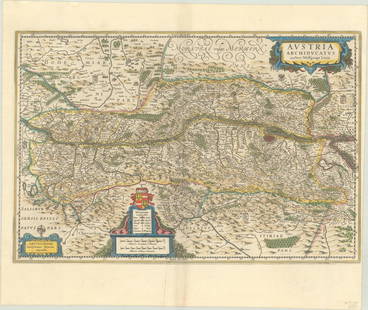
![MAP, Austria, Blaeu: Northwestern Austria. Willem Blaeu, Austria Archiducatus Auctore Wolfgango Lazio, from Theatre du Monde ou Nouvel Atlas, 1643 (circa). Hand Color. This striking, large map of the Danube River valley i](https://p1.liveauctioneers.com/6576/320593/172252533_1_x.jpg?height=310&quality=70&version=1708729193)
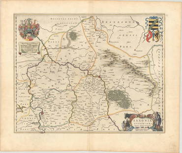
![MAP, Germany, Blaeu: Central Germany. Johannes Blaeu, Saxonia Superior, & Hall Episcopatus, 1659 (circa). Hand Color. This exquisitely engraved map of central Germany features the fortified cities of Wittenberg and Halle,](https://p1.liveauctioneers.com/6576/320593/172252517_1_x.jpg?height=310&quality=70&version=1708729193)
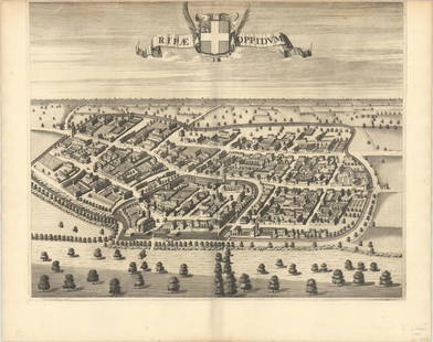
![MAP, Italy, Blaeu: Riva Presso Chieri, Italy. Johannes Blaeu, Ripae Oppidum, 1685 (circa). Black & White. This superb bird's-eye view of the town of Riva Presso Chieri, just outside of Turin, was published in Blaeu's to](https://p1.liveauctioneers.com/6576/320593/172252571_1_x.jpg?height=310&quality=70&version=1708729193)
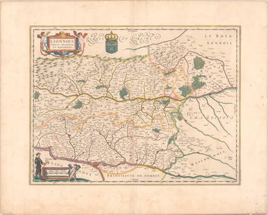
![MAP, France, Blaeu: Eastern France. Willem Blaeu, Lionnois, Forest, Beavliolois et Masconnois, 1641 (circa). Hand Color. A beautifully engraved map of the Rhone and Loire valleys showing Vienne, Lyon, and Macon. It is fu](https://p1.liveauctioneers.com/6576/320593/172252489_1_x.jpg?height=310&quality=70&version=1708729193)
![MAP, Germany, Blaeu: Eastern Germany. Johannes Blaeu, Principatus Anhaltinus, 1659 (circa). Hand Color. This map depicts part of Saxony-Anhalt between the cities of Magdeburg, Halberstadt, Mansfeld and Wittenberg. The map](https://p1.liveauctioneers.com/6576/320593/172252518_1_x.jpg?height=310&quality=70&version=1708729193)
![MAP, Germany, Blaeu: Western Germany. Johannes Blaeu, Comitatus Marchia et Ravensberg, 1659 (circa). Hand Color. This map depicts two historical counties of the Holy Roman Empire: Marks and Ravensberg. Major cities, towns](https://p1.liveauctioneers.com/6576/320593/172252515_1_x.jpg?height=310&quality=70&version=1708729193)
![MAP, Germany, Blaeu: Northern Germany. Johannes Blaeu, Praefecturae Trittow, Reinbeeck, Tremsbuttel et Steinhorst, 1662 (circa). Hand Color. This decorative map focuses on the region between Hamburg and Lubeck, identifyin](https://p1.liveauctioneers.com/6576/320593/172252513_1_x.jpg?height=310&quality=70&version=1708729193)
![MAP, Germany, Blaeu: Northern Germany. Willem Blaeu, Oldenburg Comitatus, 1659 (circa). Hand Color. This highly decorative and very attractive map of the vicinity of Oldenburg and Bremen shows the Jadebusen and the estuar](https://p1.liveauctioneers.com/6576/320593/172252512_1_x.jpg?height=310&quality=70&version=1708729193)
![MAP, Belgium, Blaeu: Southern Belgium. Blaeu Family, Comitatuum Hannoniae et Namurci Descriptio, from Theatre du Monde ou Nouvel Atlas, 1643 (circa). Hand Color. Finely engraved and detailed chart of the region of Hainaut](https://p1.liveauctioneers.com/6576/320593/172252469_1_x.jpg?height=310&quality=70&version=1708729193)
![MAP, Germany, Blaeu: Western Germany. Willem Blaeu, Westphalia Ducatus Auctore Ioh. Gigante Medico et Mathematico, from Theatrum Orbis Terrarum, 1640 (circa). Hand Color. This elegantly engraved map of Westphalia, includi](https://p1.liveauctioneers.com/6576/320593/172252514_1_x.jpg?height=310&quality=70&version=1708729193)
![MAP, Poland, Blaeu: Western Poland. Blaeu Family, Ducatus Silesiae Glogani Vera Delineatio Secunda Cura ac Labore Confecta a Iona Sculteto Sprotta Silesio, 1659 (circa). Hand Color. This fine decorative map shows the Odr](https://p1.liveauctioneers.com/6576/320593/172252526_1_x.jpg?height=310&quality=70&version=1708729193)
![MAP, Netherlands, Blaeu: Enkhuizen, Netherlands. Johannes Blaeu, Topographia Enchusae Delineata a Cornelio Biens Senatore Enchusano, from Toonneel der Steden van de ... Nederlanden, 1652 (published). Black & White. This super](https://p1.liveauctioneers.com/6576/320593/172252465_1_x.jpg?height=310&quality=70&version=1708729193)
![MAP, Scotland, Blaeu: Southern Scotland. Johannes Blaeu, Lidalia vel Lidisdalia Regio, Lidisdail. Auct. Timotheo Pont, from Sixieme Volume de la Geographie Blaviane, 1663 (circa). Hand Color. This beautifully engraved map](https://p1.liveauctioneers.com/6576/320593/172252451_1_x.jpg?height=310&quality=70&version=1708729193)
![MAP, Scotland, Blaeu: Northern Scotland. Johannes Blaeu, Cathenesia. Caithness, from Geographiae Blavianae Volumen Sextum, 1662 (published). Hand Color. This beautifully engraved map covers the northern tip of Scotland. Th](https://p1.liveauctioneers.com/6576/320593/172252450_1_x.jpg?height=310&quality=70&version=1708729193)
![MAP, England, Blaeu: Eastern England. Johannes Blaeu, Cantabrigiensis Comitatus; Cambridge Shire, from Cinquieme Volume de la Geographie Blaviane..., 1663 (circa). Hand Color. This is an excellent example of the height of](https://p1.liveauctioneers.com/6576/320593/172252436_1_x.jpg?height=310&quality=70&version=1708729193)
![MAP, Baltic, Blaeu: Baltic. Johannes Blaeu, Livonia, Vulgo Lyfeland, 1642 (circa). Hand Color. This handsome map covers the area of present-day Estonia, Latvia and Lithuania, with the Baltic Sea, as well as the neighbori](https://p1.liveauctioneers.com/6576/320593/172252460_1_x.jpg?height=310&quality=70&version=1708729193)
![MAP, Africa, Blaeu: Southern Africa & Madagascar. Willem Blaeu, Aethiopia Inferior, vel Exterior. Partes Magis Septentrionales, quae hic Desiderantur, Vide in Tabula Aethiopiae Superioris, from Theatre du Monde ou Nouvel](https://p1.liveauctioneers.com/6576/320593/172252644_1_x.jpg?height=310&quality=70&version=1708729193)
![MAP, Wales, Blaeu: Wales. Johannes Blaeu, Wallia Principatus Vulgo Wales, from Cinquieme Volume de la Geographie Blaviane, 1663 (circa). Hand Color. This handsome map of Wales is filled with detail and decorative elemen](https://p1.liveauctioneers.com/6576/320593/172252447_1_x.jpg?height=310&quality=70&version=1708729193)
![MAP, Low Countries, Blaeu: Northwestern France & Southwestern Belgium. Blaeu Family, Pars Flandriae Teutonicae Occidentalior, from Atlas Maior, 1662 (circa). Hand Color. Fine map of Flanders covering the coast from Calais to Oo](https://p1.liveauctioneers.com/6576/320593/172252475_1_x.jpg?height=310&quality=70&version=1708729193)
![MAP, Tierra del Fuego, Blaeu: Tierra del Fuego. Willem Blaeu, Tabula Magellanica, qua Tierrae del Fuego, cum Celeberrimis Fretis a F. Magellano et I. Le Maire Detectis Novissima et Accuratissima Descriptio Exhibetur, 1635 (circa).](https://p1.liveauctioneers.com/6576/320593/172252419_1_x.jpg?height=310&quality=70&version=1708729193)
![MAPS IN BOOK, Atlases, Blaeu: Blaeu's Atlas of Germany and the Netherlands with 107 maps in Full Contemporary Color. Atlases. Blaeu Family, Toonneel des Aerdrycx, oft Nieuwe Atlas ... Eerste Deels, 1650 (published). Hand Color. Th](https://p1.liveauctioneers.com/6576/320593/172252662_1_x.jpg?height=310&quality=70&version=1708729193)
![Blackie (Pub) 1882 Folio Map. World on Mercators Projection: Lithograph Map Published 1882 by Blackie & Son, London for "The Comprehensive Atlas & Geography of the World" by W. G. Blackie. Centre fold as published. Paper Size: 22 x 15 inch (56 x 38cm) Two botto](https://p1.liveauctioneers.com/3952/320085/171971861_1_x.jpg?height=310&quality=70&version=1708266709)
![MAP, World, Fer: World. Nicholas de Fer, Carte Generale du Globe Terrestre, from Methode pour Apprendre Facilement la Geographie..., 1746 (published). Black & White. This double hemisphere map of the world shows the i](https://p1.liveauctioneers.com/6576/320593/172252331_1_x.jpg?height=310&quality=70&version=1708729193)
TOP