MAP - PIETER SCHENK / VALK / JANSSEN Hand Colored superb Map Central Italy c1702Luis Porretta Fine Arts4.3(10)See Sold PriceMar 02, 2024
CHARLES ROLLIN c1828 Ceasar Hand Colored Africa Military MapLuis Porretta Fine Arts4.3(10)See Sold PriceMar 02, 2024
MAP - Dufour, A. H. ( Malte / Brun ) :MAP - ESPAGNE PARTIE SUD DIVISEE EN PROVINCES ANCIENNES ( MAPLuis Porretta Fine Arts4.3(10)See Sold PriceMar 02, 2024
RIGOBERT BONNE c1787 Original Colored Map Germany & Region 15" x 12"Luis Porretta Fine Arts4.3(10)See Sold PriceMar 02, 2024
AMBROISE TARDIEU c1822 Napoleonic War Map GermanyLuis Porretta Fine Arts4.3(10)See Sold PriceMar 02, 2024
MAP - AMBROISE TARDIEU c1822 Napoleonic Miltary Map GermanyLuis Porretta Fine Arts4.3(10)See Sold PriceMar 02, 2024
1822 Rare Map by Ambroise Tardieu Napoleon Caldiero Battle of Vento 17" x 11Luis Porretta Fine Arts4.3(10)See Sold PriceMar 02, 2024
PIETER SCHENK / VALK / JANSSEN Hand Colored Map of Rhodes Greece ca1702 vgcLuis Porretta Fine Arts4.3(10)See Sold PriceMar 02, 2024
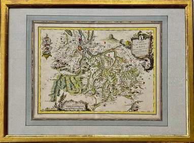
Map: Carte du Canton de Bale, Jacques Clermont, Paris, 1788Kensington Estate Auction4.6(216)See Sold PriceFeb 26, 2024
SoldV. Levasseur: Map of Asia, 1850Map: Asie Maker: V. Levasseur Date: 1850 Origin Paris Date: 11 x 16.5 inches A highly decorative nineteenth century map of Asia, dominated by Russian, Chinese Empires and British India and French IndoSee Sold Price
SoldLevasseur: Map of Asia, 1850Map: Map of Asia - Asie Cartographer: V. Levasseur Date: 1850 Origin: Paris Size: 11 x 16.5 inches A highly decorative nineteenth century map of Asia, dominated by Russian, Chinese Empires and BritishSee Sold Price
SoldLevasseur Map of Asia, 1850Map: 1850 Levasseur Map of Asia -- Asie Cartographer: V. Levasseur Year / Place: 1850 Paris Map Dimension: 11 x 16.5 in. A highly decorative nineteenth century map of Asia, dominated by Russian, ChineSee Sold Price
SoldLevasseur: Map of Oceania, 18501850 Levasseur Map of Oceania -- Oceanie. V. Levasseur. 1850 Paris. 11 x 16.5 in. A highly decorative nineteenth century map of Oceania including Australia colored to show the colonial possessions. ThSee Sold Price
SoldLevasseur: Antique Map of Asia, 1852Title/Content of Map: 1852 Levasseur Map of Asia -- Asie Date Printed: 1852, Paris Cartographer: V. Levasseur Size: 11 x 16.5 in. A highly decorative nineteenth century map of Asia, dominated by RussiSee Sold Price
Sold1850 Levasseur Map of Algeria -- Algerie, ColonieTitle/Content of Map: 1850 Levasseur Map of Algeria -- Algerie, Colonie Francaise Date: 1850, Paris Cartographer: V Levasseur Size: 11.4 X 16.8 in. This is a rather lovely map of the French colony ofSee Sold Price
SoldMap, V. Levasseur, Il de la ReunionV. Levasseur (French, 19th century), "Il de la Reunion," 1850, copper engraved map with hand-coloring, overall; (framed): 16"h x 21"w; Provenance: Property from the Christian de Guigne' IV Estate, HilSee Sold Price
1850 Levasseur Map of Algeria -- Algerie, ColonieTitle/Content of Map: 1850 Levasseur Map of Algeria -- Algerie, Colonie Francaise Date Printed: 1850, Paris Cartographer: V Levasseur Size: 11.4 X 16.8 in. This is a rather lovely map of the French coSee Sold Price
1850 Levasseur Map of Algeria -- Algerie, ColonieReserve Reduced! Title/Content of Map: 1850 Levasseur Map of Algeria -- Algerie, Colonie Francaise Date: 1850, Paris Cartographer: V Levasseur Size: 11.4 X 16.8 in. This is a rather lovely map of theSee Sold Price
1850 Levasseur Map of France -- France en 1850 AtlasReserve Reduced! Title/Content of Map: 1850 Levasseur Map of France -- France en 1850 Atlas National Illustre Date: 1850 Paris Cartographer: V. Levasseur Size: 11.5 x 17 in. This handsome map of FrancSee Sold Price
1850 Levasseur Map of France -- France en 1850 AtlasTitle/Content of Map: 1850 Levasseur Map of France -- France en 1850 Atlas National Illustre Date: 1850 Paris Cartographer: V. Levasseur Size: 11.5 x 17 in. This handsome map of France shows the boundSee Sold Price
1850 Levasseur Map of France -- France en 1850 AtlasTitle/Content of Map: 1850 Levasseur Map of France -- France en 1850 Atlas National Illustre Cartographer: V. Levasseur Year/Place: 1850 Paris Size: 11.5 x 17 in. This handsome map of France shows theSee Sold Price
1850 Levasseur Map of France -- France en 1850 AtlasTitle: 1850 Levasseur Map of France -- France en 1850 Atlas National Illustre Cartographer: V. Levasseur Year / Place: 1850 Paris Map Dimension (in.): 11.5 x 17 in. This handsome map of France shows tSee Sold Price
SoldLevasseur: Antique Map of Oceania & Australia, 1850Title/Content of Map: 1850 Levasseur Map of Oceania and Australia -- Oceanie Date Printed: 1850, Paris Cartographer: V Levasseur Size: 11.3 x 16.8 in. Condition: Excellent. Very light edge toning; sliSee Sold Price
SoldLevasseur: Antique Map of South America, 1850Title/Content of Map: 1850 Levasseur Map of South America -- Amerique Meridionale Date Printed: 1850, Paris Cartographer: V Levasseur Size: 11 x 16.5 in. Condition: Very Good - Excellent. Very light tSee Sold Price
Levasseur: Antique Map of France, 1850Title: 1850 Levasseur Map of France -- France en 1850 Atlas National Illustre Cartographer: V. Levasseur Year / Place: 1850 Paris Map Dimensions: 11.5 x 17 in. Condition: Very good, slight age toningSee Sold Price
Levasseur: Map of South America, 1850Map: 1850 Levasseur Map of South America -- Amerique Meridionale Cartographer: V Levasseur Year / Place: 1850, Paris Map Dimensions: 11 x 16.5 Condition: Very Good - Excellent. Very light toning alongSee Sold Price
Levasseur: Antique Map of France, 1850Title/Content of Map: 1850 Levasseur Map of France -- France en 1850 Atlas National Illustre Date Printed: 1850 Paris Cartographer: V. Levasseur Size: 11.5 x 17 in. This handsome map of France shows tSee Sold Price
Levasseur: Antique Map of South America, 1850Map: 1850 Levasseur Map of South America -- Amerique Meridionale Cartographer: V Levasseur Year / Place: 1850, Paris Dimensions: 11 x 16.5 Condition: Very Good - Excellent. Very light toning along theSee Sold Price
Levasseur: Antique Map of Oceania & Australia, 1850Map: 1850 Levasseur Map of Oceania and Australia -- Oceanie Cartographer: V Levasseur Year / Place: 1850, Paris Dimensions: 11.3 x 16.8 in. Condition: Excellent. Very light edge toning; slight soilingSee Sold Price
Levasseur: Antique Map of Oceania & Australia, 1850Map: 1850 Levasseur Map of Oceania and Australia -- Oceanie Cartographer: V Levasseur Year / Place: 1850, Paris Map Dimensions: 11.3 x 16.8 in. Condition: Excellent. Very light edge toning; slight soiSee Sold Price
Levasseur: Antique Map of France, 1850Title/Content of Map: 1850 Levasseur Map of France -- France en 1850 Atlas National Illustre Date Printed: 1850 Paris Cartographer: V. Levasseur Size: 11.5 x 17 in. Condition: Very good, slight age toSee Sold Price
Levasseur: Map of Turkey in Asia, 18431843 map of Turkey in Asia by V. Levasseur. 8.625 x 12. Hand-colored steel engraved map. Bottom edge has been extended with white paper beyond the border. Two small holes in the area of the Arabian SeSee Sold Price
Sold''Asie,'' map w/ illustrated border, [ca mid-1800[Asia]. Asie. Double-page engraved map, with elaborate engraved border. Map engraved by Laguillerme after V. Levasseur, border after Raimond Bonbeur. Paris: A. Combette, c.mid-1800s. ''Atlas UniversalSee Sold Price
COLONIES FRANÇAISES AFRIQUE. Africa Sénégambie Madagascar. LEVASSEUR 1856 mapJasper524.5(9.8k)See Sold PriceFeb 28, 2024
COLONIES FRANÇAISES en AFRIQUE. Africa Sénégal Madagascar. LEVASSEUR c1850 mapJasper524.5(9.8k)See Sold PriceFeb 28, 2024
Carte de L'Algérie et de la Régence de Tunis' ANDRIVEAU-GOUJON Algeria 1850 mapJasper524.5(9.8k)See Sold PriceFeb 28, 2024