Chaim Soutine (Belarusian/French, 1893-1943) - La Petite Fille dans la VerdureFreeman's | Hindman4.5(158)See Sold PriceFeb 27, 2024
Elisabeth Frink (British, 1930-1993) - Harbinger Bird IFreeman's | Hindman4.5(158)See Sold PriceFeb 27, 2024
AMERICAN SEASCAPE PAINTING BY ROSS EMBROSE MOFFETTAntique Arena Inc.4.5(866)See Sold PriceMar 02, 2024
CHARLES HENRY GIFFORD (Massachusetts, 1839-1904), Luminist view of three sailboats in a quietEldred's4.7(418)See Sold PriceFeb 28, 2024
RARE MANHATTAN PROJECT GLASS LEADED FROM THE MANHATTAN PROJECT WORLD WAR II WW2 724 GRAMSCol. Christie Hatman Auctioneers4.5(323)See Sold PriceFeb 26, 2024
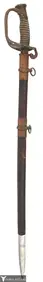
Estate Fresh Civil War Cavalry C. Roby 1863 With ScabbardRalph Fontaine Heritage Auctions Inc.4.7(234)See Sold PriceFeb 25, 2024
ABSTRACT ARAB LEBANESE OIL PAINTING BY ETEL ADNANAntique Arena Inc.4.5(866)See Sold PriceMar 02, 2024
SoldTwo Civil War Era Mitchell MapsMap of North America Showing Its Political Divisions and county maps of North Carolina, South Carolina, and Florida on one sheet (Philadelphia: S. Augustus Mitchell, 1860). Not framed. 15.25 x 12.25 iSee Sold Price
SoldTwo Fine Civil War Era MapsTwo Fine Civil War Era Maps by Samuel Augustus Mitchell, Jr., including "Plan of New Orleans" and "County Map of Louisiana, Mississippi and Arkansas", each hand-colored engraving published PhiladelphiSee Sold Price
SoldLot of 8 Civil War era School AtlasesTitle: Lot of 8 Civil War era School Atlases Author: ** Description: Comprises: Mitchell's School Atlas. 5 copies, each with 18 maps (5 double page). Revised Eds. One 1862, two are 1863, one 1864 andSee Sold Price
Civil War era map case coffee potK-082 Two Civil War era items: (1) Tin map case. 16 1/4" cylinder with a removable cap. (2) Copper coffee pot. 9 7/8" tall. 7 1/4" diameter at the base. Large "open" ear. IISee Sold Price
Civil War map case and coffee potK-037 Two Civil War era items: (1) Tin map case. 16 1/4" cylinder with a removable cap. (2) Copper coffee pot. 9 7/8" tall. 7 1/4" diameter at the base. Large "open" ear. IISee Sold Price
SoldPopular Civil War Era Map of the Capital of theOne Hundred Fifty Miles around Richmond-Battleground of the Wilderness. Julius Bien (1826-1909). Two color lithograph. New York & Washington, c. 1869. 26 x 30 inches, 40 1/4 x 35 1/2 inches framed. ThSee Sold Price
Sold2 Colton Civil War Maps, Military Stations & Forts, 3Two (2) Colton Civil War maps, 3 items total. 1st item: J.H. Colton, Civil War era map of the United States showing Military Stations and Forts, prepared for The Rebellion Record, New York: G.P. PutnaSee Sold Price
SoldCivil War-era map of Washington, DC by MitchellNice map of the nation’s capital as it looked during the second year of the Civil War. Notice the vulnerability of the “President’s House.” Also of note are the U. S. Arsenal, U. S. Navy YardSee Sold Price
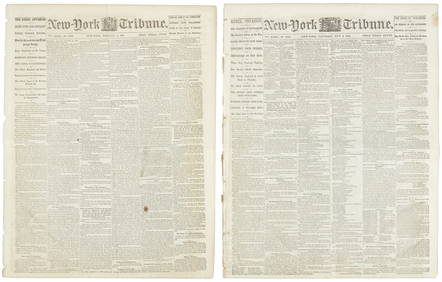
SoldLot of 8 Civil War era newspapers with front page MAPSLot of 8 issues (7 of The New York Herald and 1 of N.Y. World), various dates in 1861, 1862 ad 1864, featuring FRONT PAGE MAPS from Civil War battle locations. Oct. 13, 1861: Two maps: Locations at ChSee Sold Price
Civil War era map of the U. S. with unsettled western bordersS. A. Mitchell, Jr’s excellent and collectible map of the United States during a time of changing border configurations. Shows considerable detail including railroads, mail routes (Pony Express)See Sold Price
SoldCivil War Era County Map of Kentucky & Tennessee, 1860Civil War Era Hand Colored County Map of Kentucky & Tennessee | Map no. 28 from Mitchell's New General Atlas. Philadelphia: S. Augustus Mitchell, Jr., 1860 | Inscribed in the lower left margin: "EnterSee Sold Price
CIVIL WAR ERA JOHNSON'S NORTH, SOUTH CAROLINA MAPFramed "Johnson's North and South Carolina Map", by Johnson & Ward (Alvin Jewett Johnson,1827-1884), c. 1862, the two states shown in colors with vignettes of Chimney Rocks and French Broad River, TabSee Sold Price
SoldCivil War County Map of Virginia & West Virginia, 1863Civil War Era Hand Colored Engraving of a County Map of Virginia and West Virginia | Rare Map No. 30 from Mitchell's New General Atlas. Philadelphia: S. Augustus Mitchell, Jr., 1863 | Inscribed in theSee Sold Price
Civil War era handbook “Infantry Tactics”, 1830Civil War era handbook “Infantry Tactics”, with 2 maps, signed, 1830Antique 1830 \"Infantry Tactics\" Civil War Handbook w/Two, Fold-out Maps. Signed.Infantry Tactics:Exercises & Maneuvers of LighSee Sold Price
SoldCounty Map of California, Mitchell 1860Lovely handcolored map of California during era of the Civil War. Published in the 1864 Mitchell General Atlas by S. Augustus Mitchell. Nice impression. Tiny water stain at lower left corner paper edgSee Sold Price
County Map of California, Mitchell 1860Reserve Reduced! Lovely handcolored map of California during era of the Civil War. Published in the 1864 Mitchell General Atlas by S. Augustus Mitchell. Nice impression. Tiny water stain at lower leftSee Sold Price
SoldCivil War Era County Map of Kentucky & Tennessee, 18601860 Hand-Colored Engraved Civil War Era County Map of Kentucky & Tennessee by Samuel Augustus Mitchell, Jr., Philadelphia, 1860, From Mitchell's Atlas, Plate 31, Steel engraved floral border | A detaSee Sold Price
Civil War era RR Johnson’s Minnesota and Dakota, 1862Very nice example of this steel engraved map of Minnesota and Dakota Territory. Depicts the new State of Minnesota (admitted 1858) and Dakota Territory (admitted as two states in 1889). TopographicalSee Sold Price
Civil War era county map of Georgia & AlabamaS. Augustus Mitchell published some of the nicer atlases during the mid-19th century in America. Maps from these atlases are desirable documents showing what the different states looked like at the tiSee Sold Price
SoldTIN SOLDIER CIVIL WAR ERA BATTLEFIELD COLLECTIONTwenty Four pieces Military Tin Soldiers Blue Coats, Red Trousers, (6) soldiers and two horsed seriously wounded in action but perhaps not fatally. Set upon a topographical map of the Lake Miccosuci rSee Sold Price
SoldCIVIL WAR ERA MAP OF PHILADELPHIACIVIL WAR ERA MAP OF PHILADELPHIA A nicely hand-colored printed ca. 1860 map, entitled "Plan of Philadelphia", printed and published by S. Augustine Mitchell, Jr., measuring approx. 12" x 14". The citSee Sold Price
Strong ink impression on 1862 map of N. Hampshire and VermontVery clean, sound map of these two northern states during the early time of the Civil War. From Mitchell’s 1864 New General Atlas. Shows topography, lakes, towns, rivers, etc. Full, original hanSee Sold Price
SoldS. AUGUSTUS MITCHELL 1846 AMERICAN REPUBLIC MAP1846 S. Augustus Mitchell American Republic Pre-Civil War map. Wooden scroll bars to two ends for rolling or hanging for display. Measures approx. 50" width x 40" height (127cm x 102cm).See Sold Price
SoldS. AUGUSTUS MITCHELL 1846 AMERICAN REPUBLIC MAP1846 S. Augustus Mitchell American Republic Pre-Civil War map. Wooden scroll bars to two ends for rolling or hanging for display. Measures approx. 50" width x 40" height (127cm x 102cm).See Sold Price
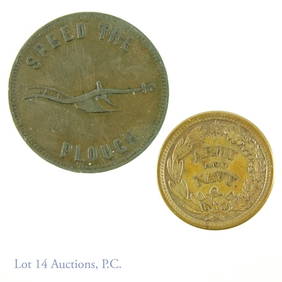
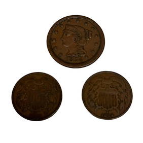
Two US 2 Cent Coins and 1854 Large One CentPremier Auction Galleries4.3(329)See Sold PriceMar 09, 2024
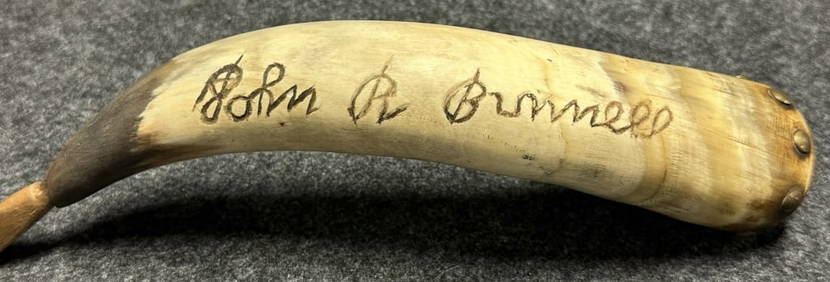
Antique John R Bunnell 189th New York Infantry Carved Civil War Era Powder HornHoller and Hammer4.5(57)See Sold PriceFeb 24, 2024
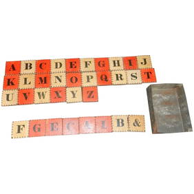
Antique Civil War Era Alphabet Block Set with Two Color Letter and Number BlocksJasper524.5(9.8k)See Sold PriceMar 07, 2024


![[Tintype] Massive Bowie knife (1 of 1)](https://p1.liveauctioneers.com/7226/317626/170485482_1_x.jpg?height=282&quality=70&version=1706368022)
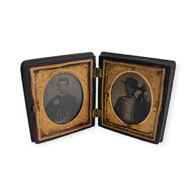
![[Ambrotype] Magnificent Portrait (1 of 1)](https://p1.liveauctioneers.com/7226/317626/170485477_1_x.jpg?height=282&quality=70&version=1706368022)


![[Tintype] Native American Man w/ Knife (1 of 2)](https://p1.liveauctioneers.com/7226/317626/170485453_1_x.jpg?height=282&quality=70&version=1706368022)
![[REES, Charles] Enlistedman w/ Bowie Knife (1 of 1)](https://p1.liveauctioneers.com/7226/317626/170485489_1_x.jpg?height=282&quality=70&version=1706368022)
![[Ambrotype] Wounded at Gettysburg (1 of 1)](https://p1.liveauctioneers.com/7226/317626/170485471_1_x.jpg?height=282&quality=70&version=1706368022)


![[Ambrotype] Young Soldier w/ Bowie Knife (1 of 1)](https://p1.liveauctioneers.com/7226/317626/170485459_1_x.jpg?height=282&quality=70&version=1706368022)

![[Daguerreotype] Soldier w/ Bowie Knife (1 of 2)](https://p1.liveauctioneers.com/7226/317626/170485458_1_x.jpg?height=282&quality=70&version=1706368022)
![[Tintype] Soldier w/ Flowers (1 of 1)](https://p1.liveauctioneers.com/7226/317626/170485495_1_x.jpg?height=282&quality=70&version=1706368022)
![[Tintype] Identified North Carolina Infantryman (1 of 2)](https://p1.liveauctioneers.com/7226/317626/170485474_1_x.jpg?height=282&quality=70&version=1706368022)


![[Daguerreotype] c. 1855 Militia Officer (1 of 2)](https://p1.liveauctioneers.com/7226/317626/170485455_1_x.jpg?height=282&quality=70&version=1706368022)